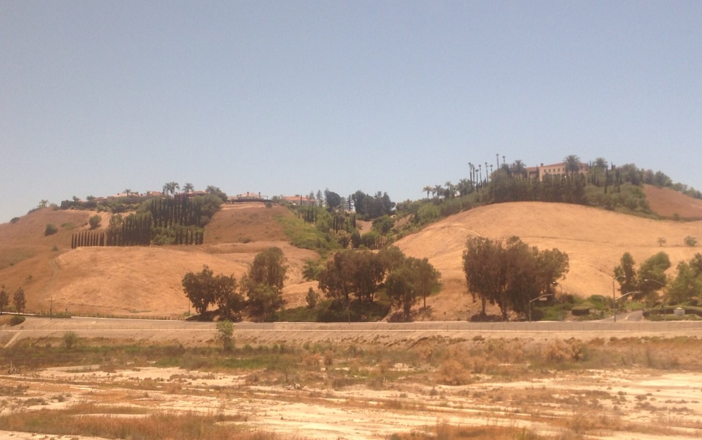
We have had an amazing three days in Bend, Oregon for what was to be a prelude to our Grants Pass, Oregon house sit. As you may recall from a prior post, however, that house sit was cancelled due to a critical family medical issue with the home owners. We had already purchased out tickets to Bend, however, so here we are. We are thrilled to be here before heading into the oven that is Arizona for the remainder of June and the first half of July.
Bend is the county seat of Deschutes County in central Oregon. Bend is a city of about 80,000 –the largest city in central Oregon. It is gorgeous, active, and vibrant. It has it all — lovely rivers and canals, beautiful trees and flowers, and nearby mountains. It is the best shades of green and blue and very active. We hope to return.
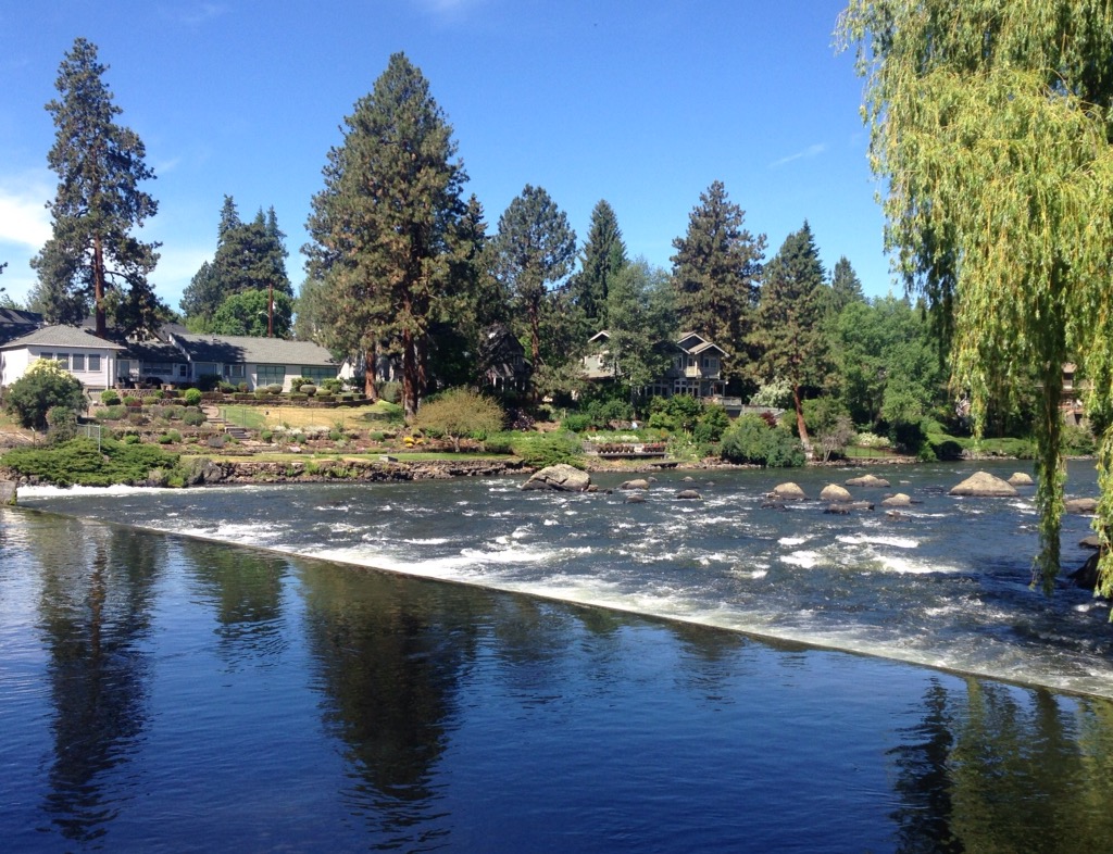
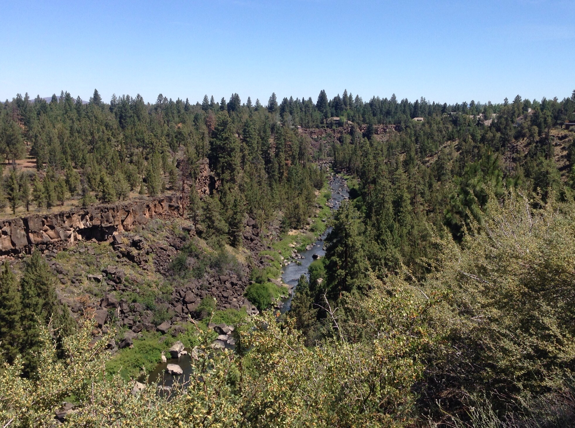
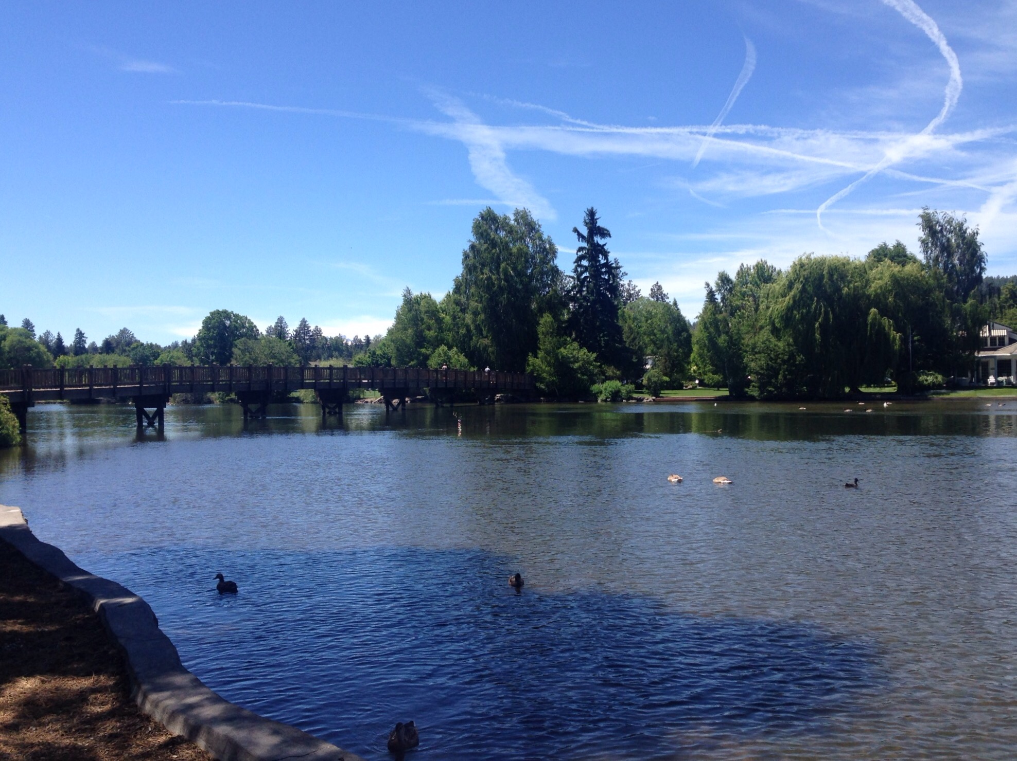
Our first full day here on Wednesday we spent hiking along the Deschutes River which is a major tributary to the Columbia River. While it is a popular river for water sports, we were on the quieter end on Wednesday.
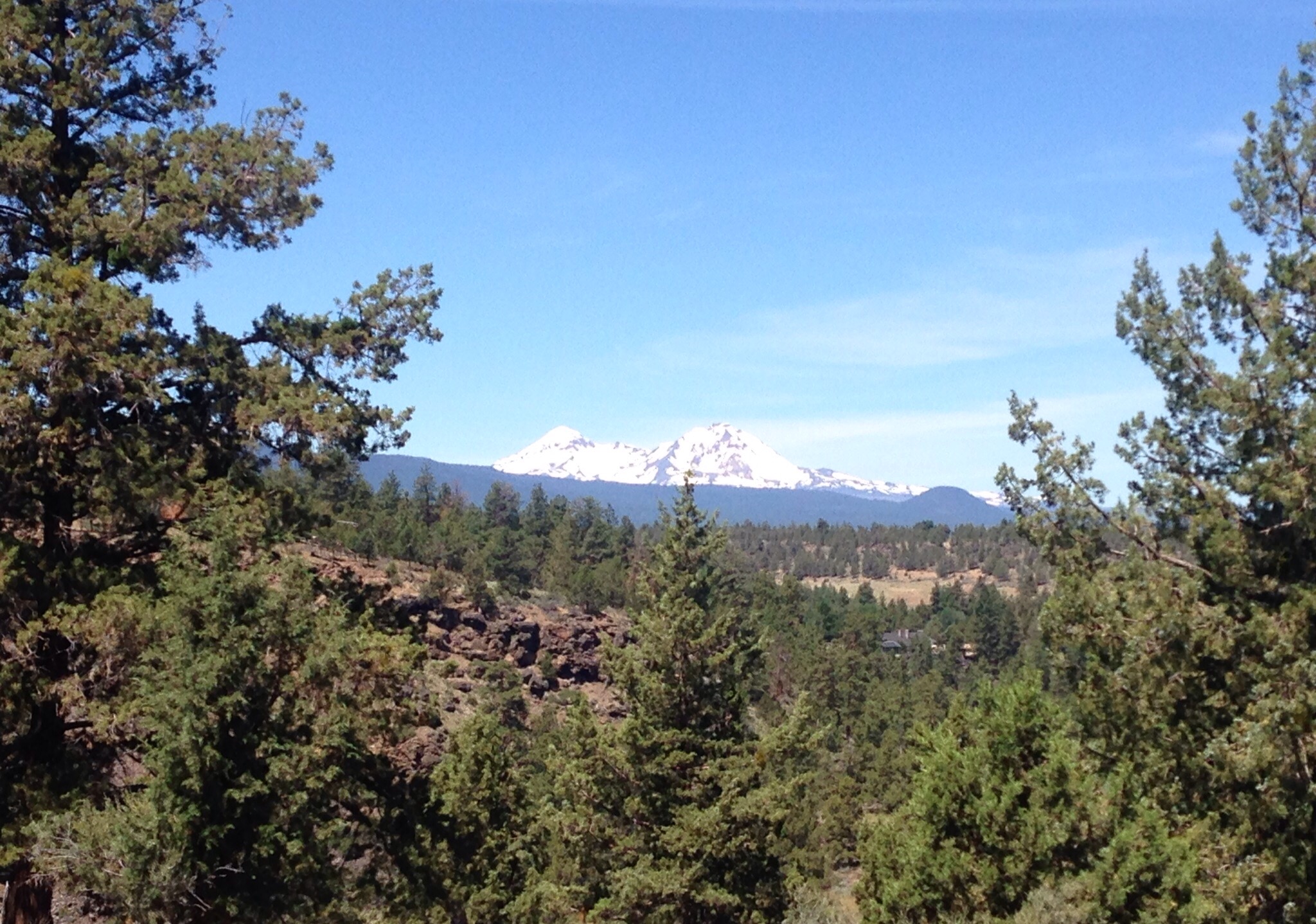
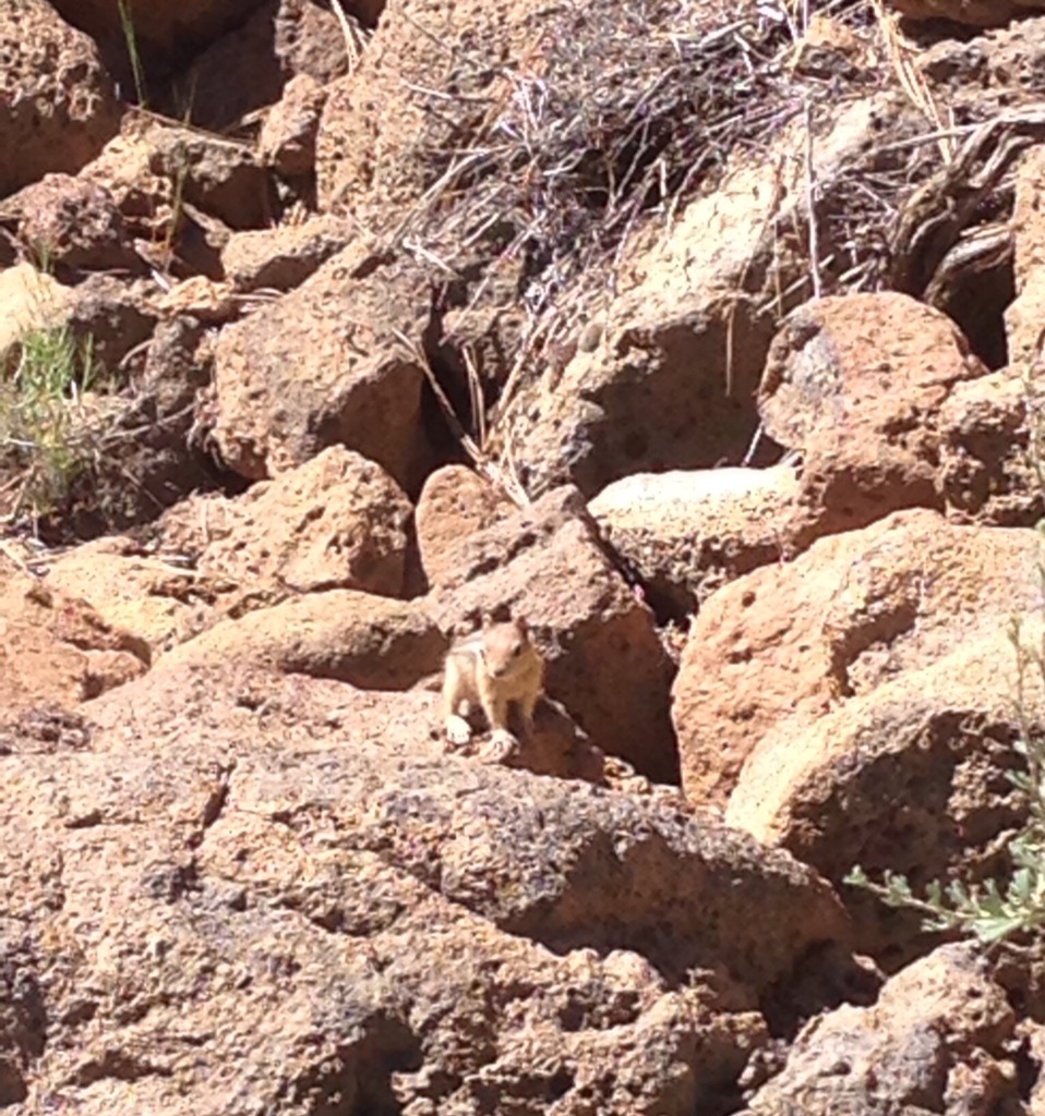
Starting the Deschutes River Trail near Newport AvenueThis river moves!A room (or many, many rooms) with a viewLooking towards the Cascade MountainsLooking down the gorge back towards the River Bob captured a well-camouflaged critter
The Deschutes River Trail took us up a gorge and into neighborhoods on top of hills/buttes out of the city center. We left that trail to follow a North Rim path to the Sylvan and Summit city parks (where we thought ther might be a good view but no — just the satisfaction of having summitted). We then walked back into town where we reconnected with the Deschutes River at a different point.
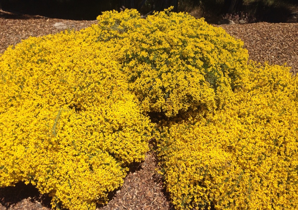
Striking yellow flowersOur view of Bend as we walked back into townReconnecting with the Deschutes River in Drake Park on the outskirts of downtown
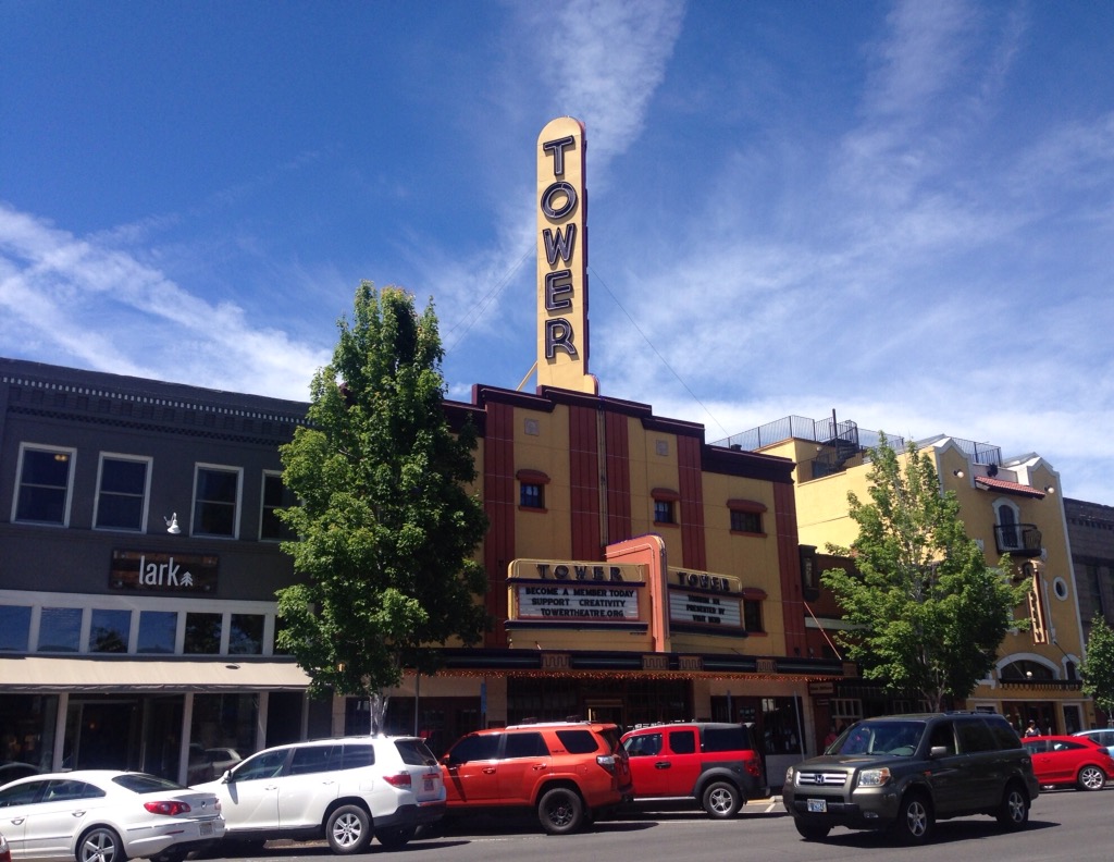
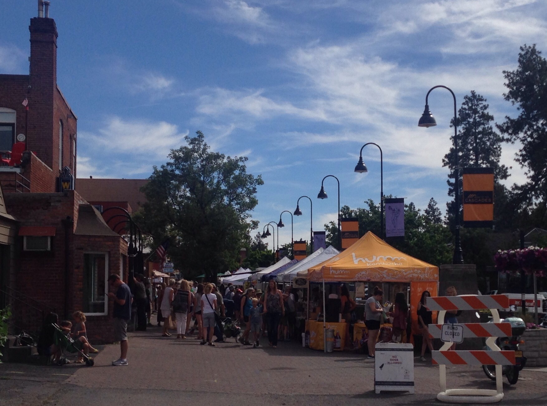
We then spent some time exploring the downtown area, including their Wednesday afternoon farmers market.
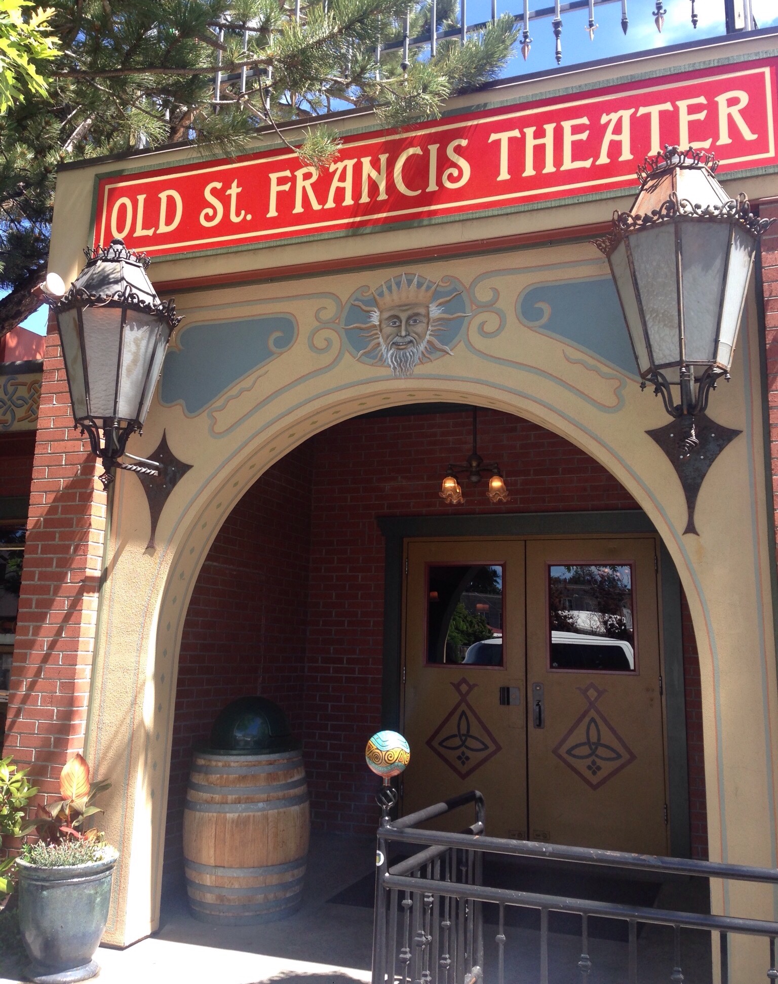
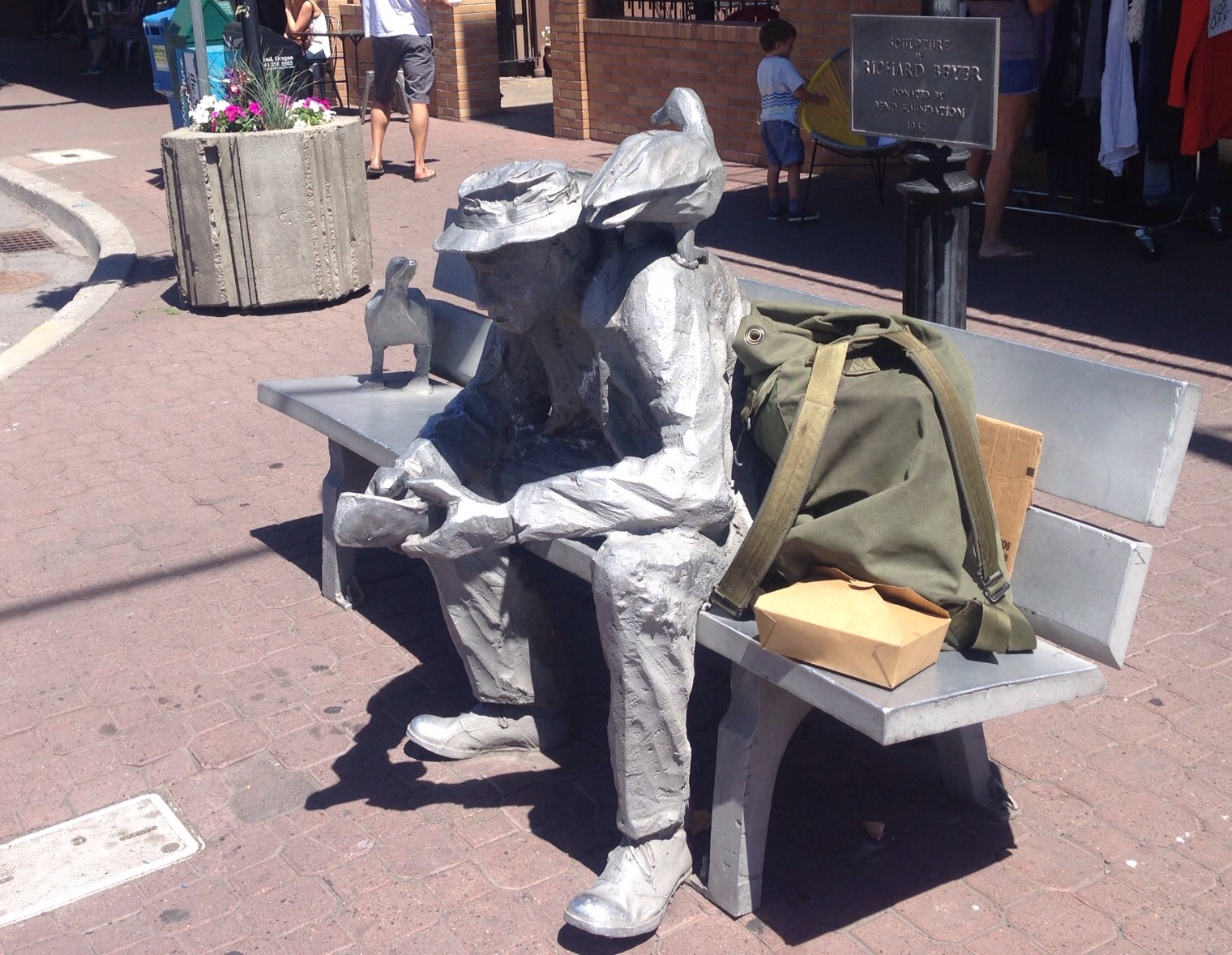
Some downtown buildings on Wall Street, one of the two main downtown thoroughfaresPart of what is now McMenamins — a hotel, pub, and theatre, in a former schoolhouseLots of public art in Bend — this is at a corner in downtownThis is one of many similar-sized pieces of art along a downtown building’s wallOur view of the farmer’s market as we headed towards it
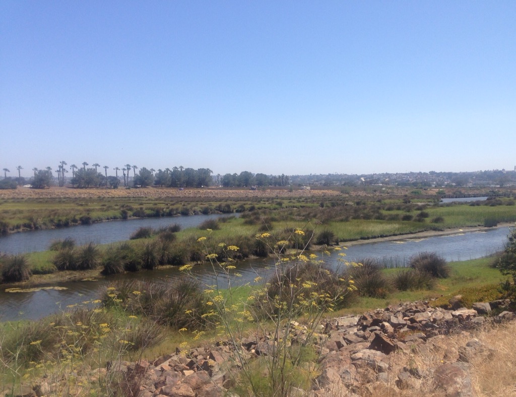
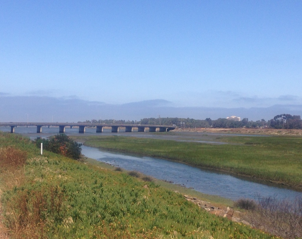
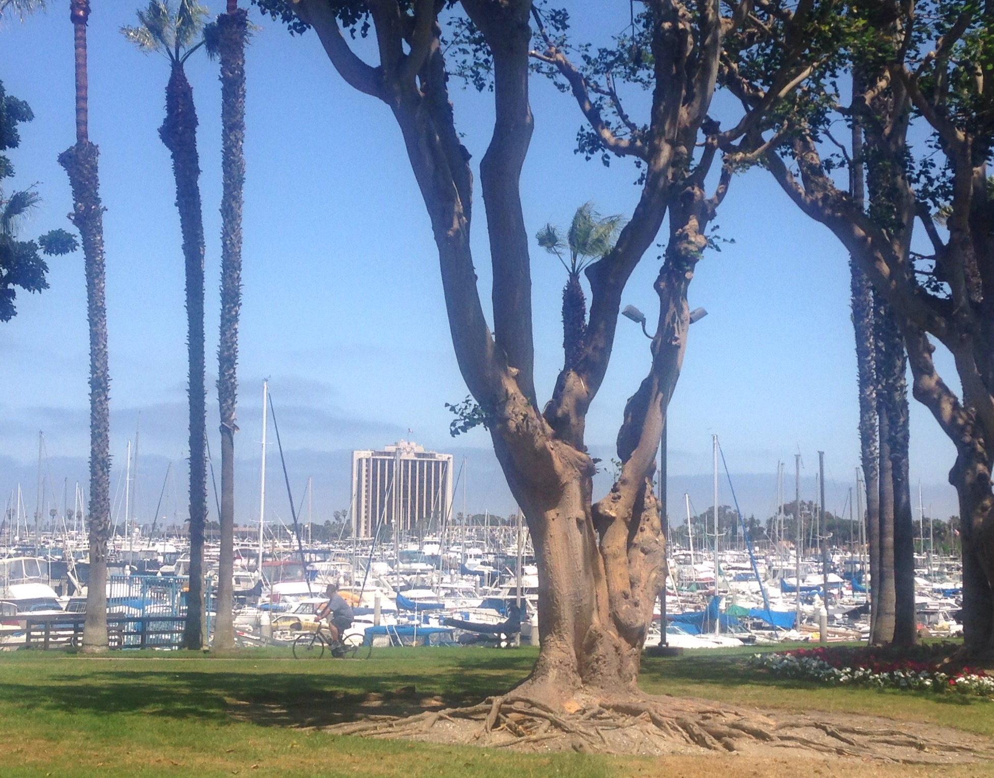
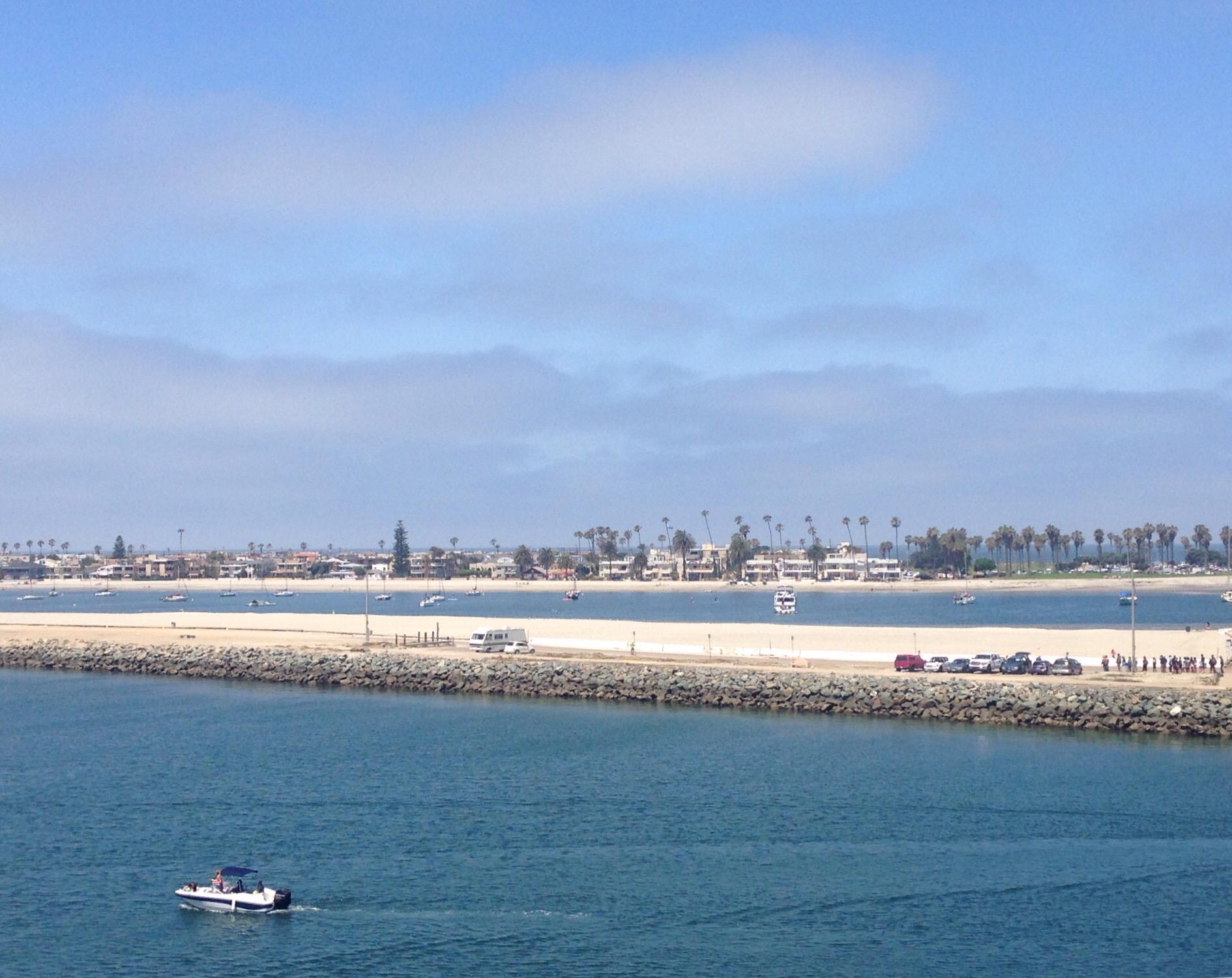
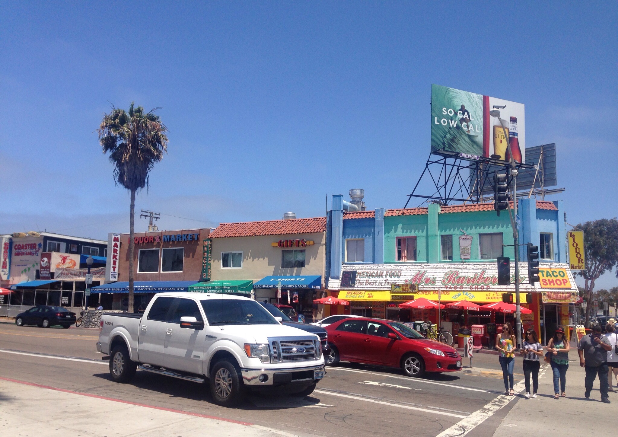
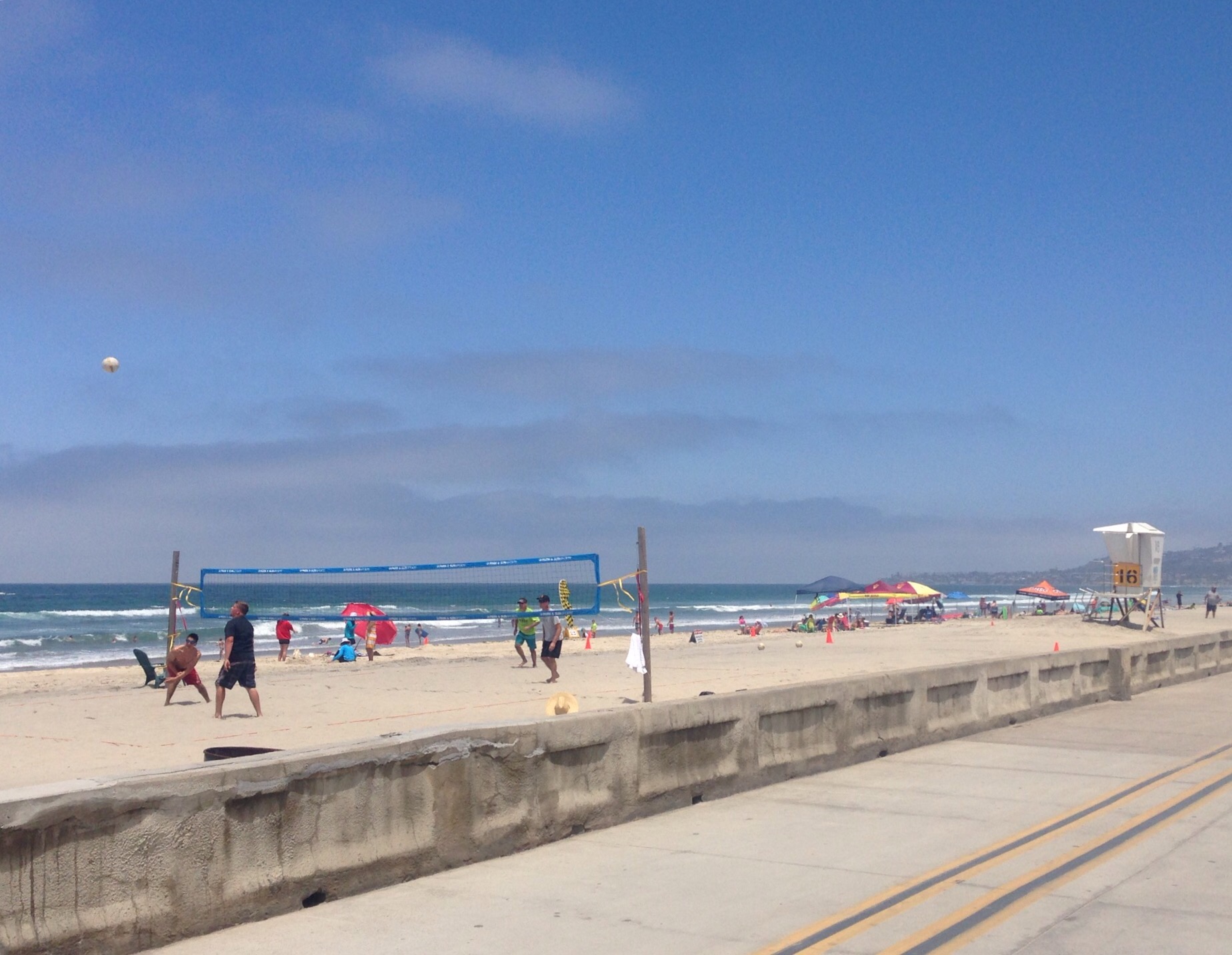
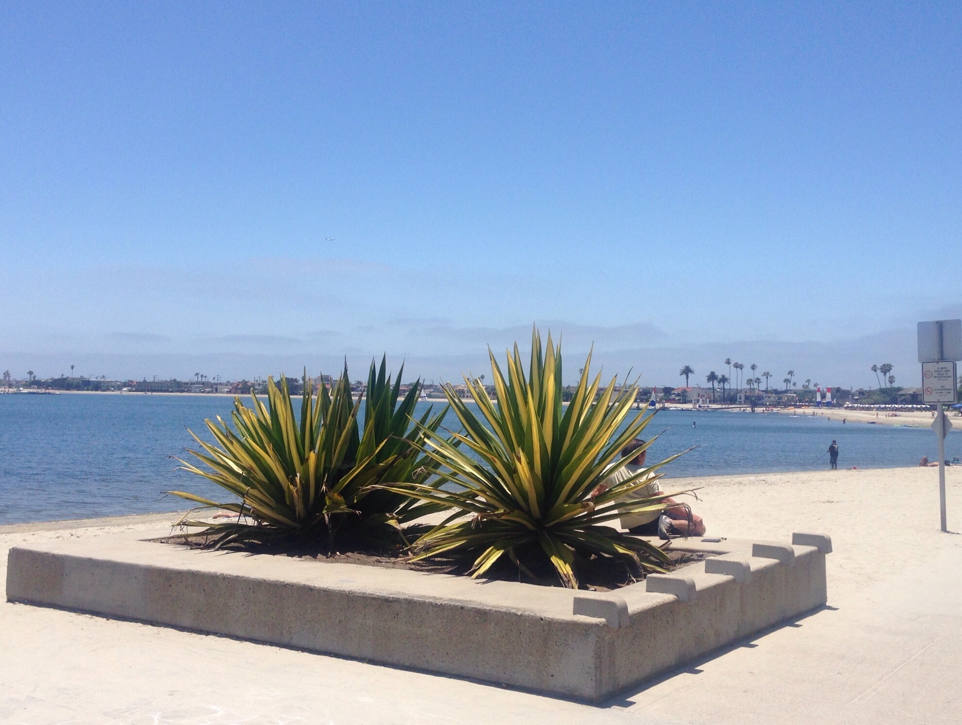
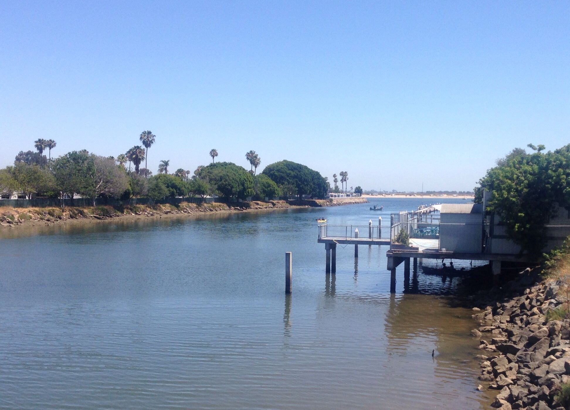
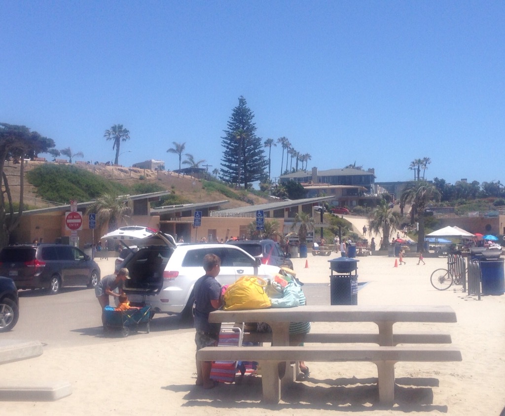
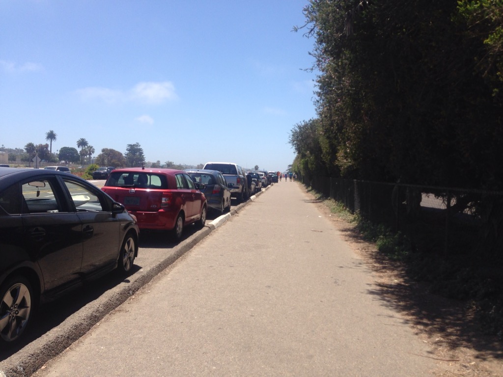
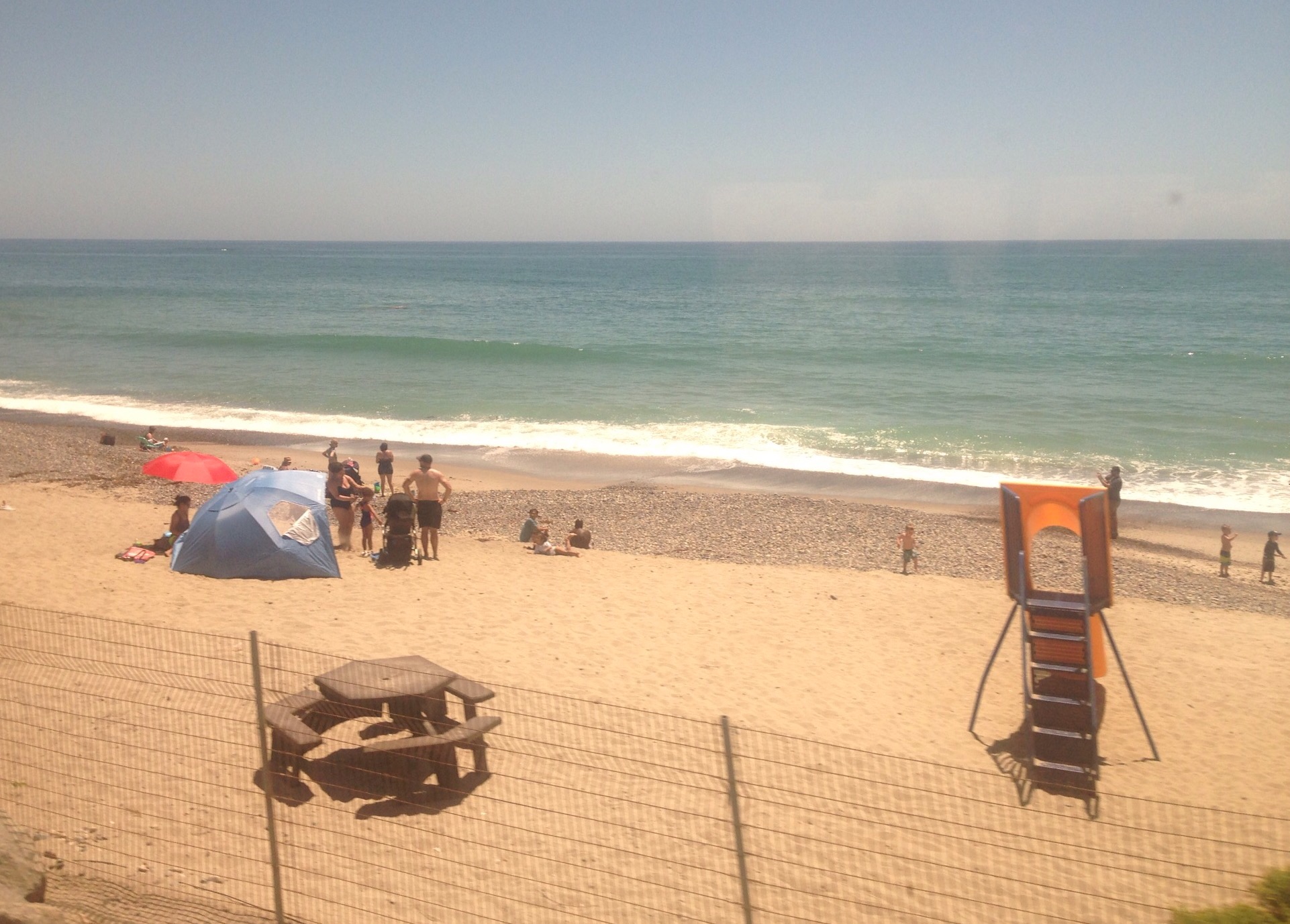
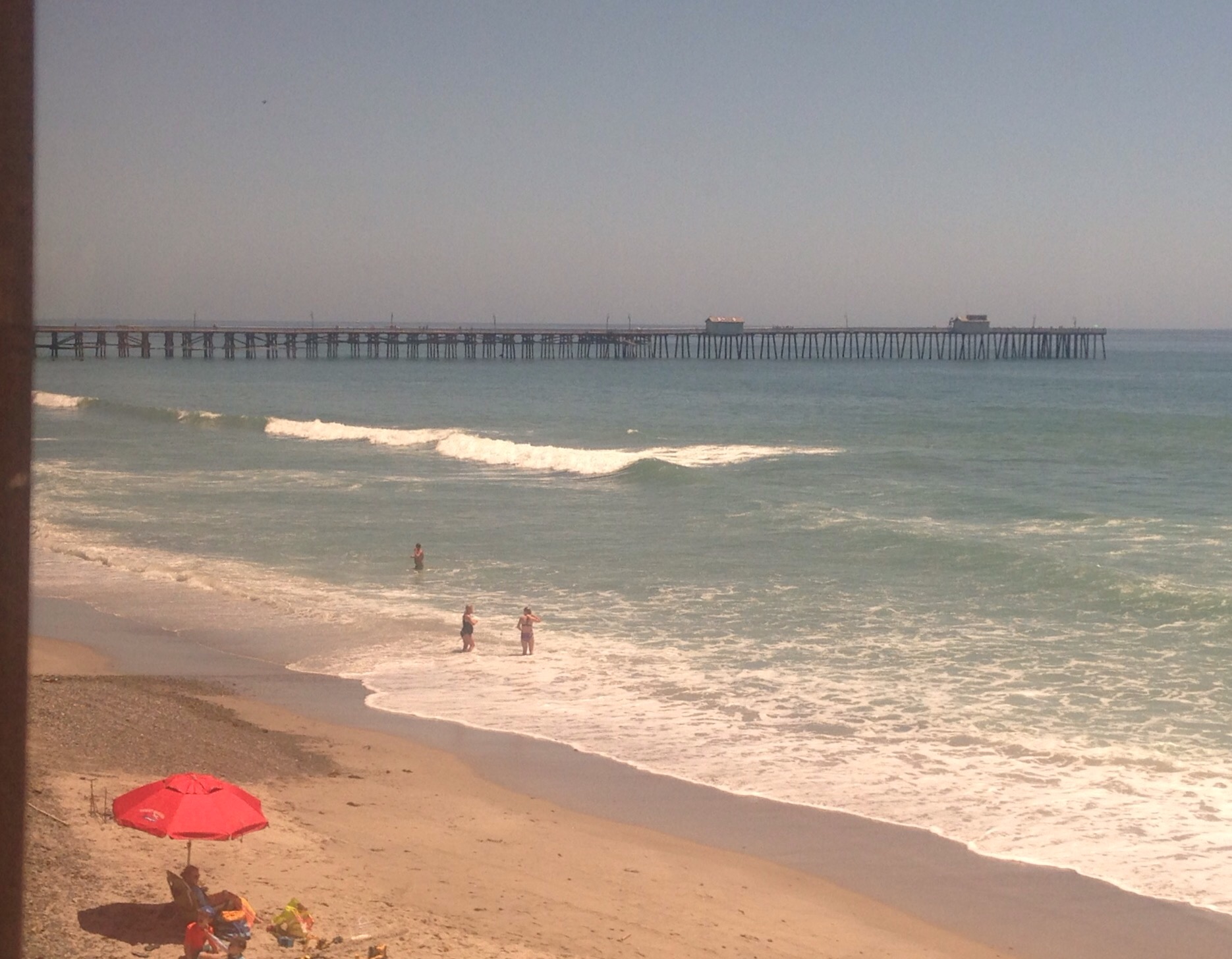
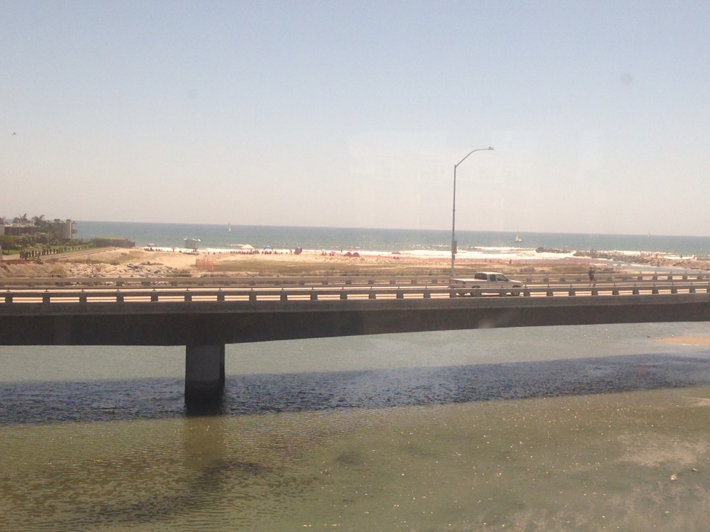
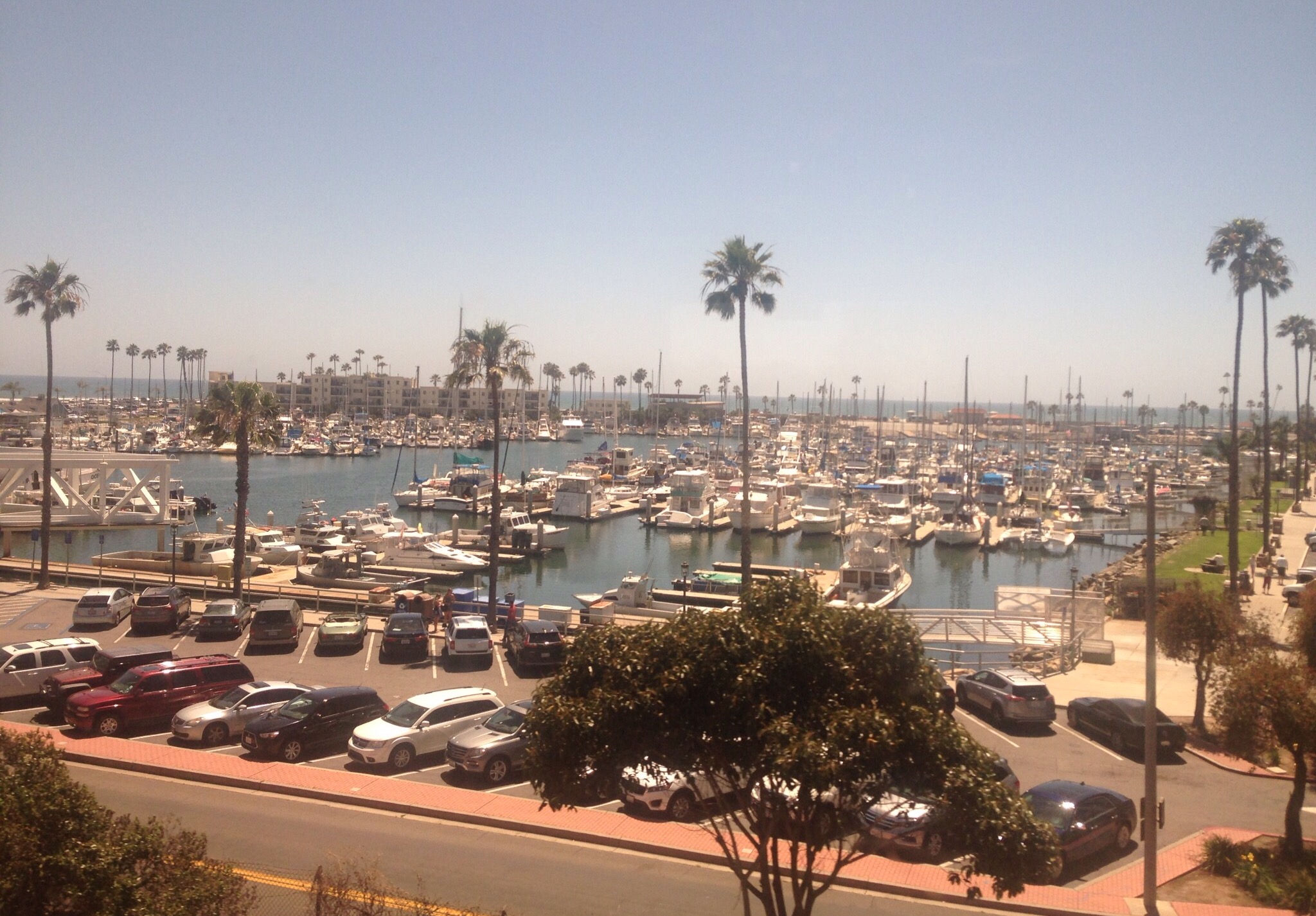
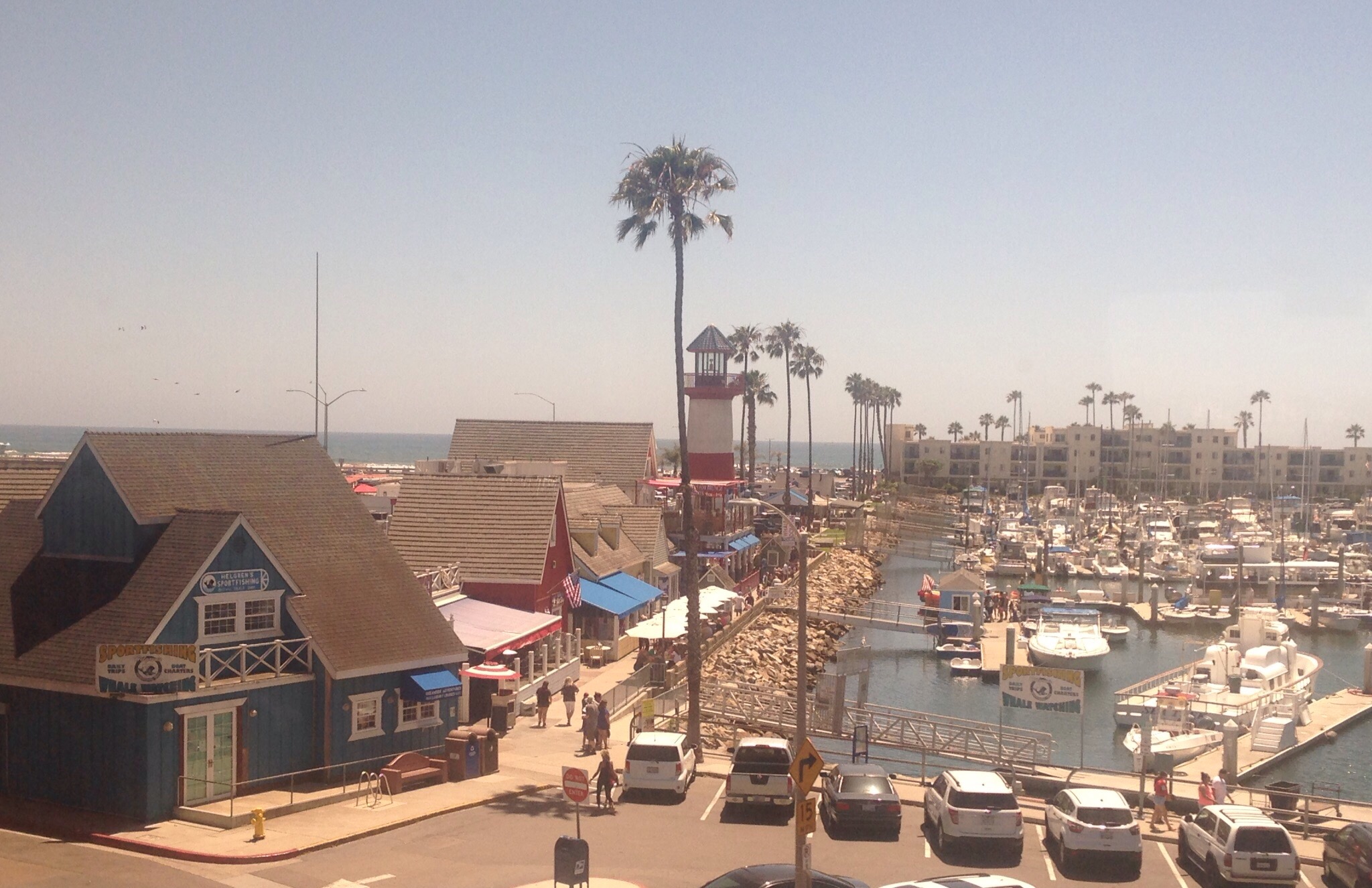
Bob and I had one full day ( Monday, June 19) in San Diego before flying up to Oregon. We stayed near Old Town but spent the day walking to and around Mission Bay, Mission Beach, and Pacific Beach. It was a full-day hike, and for us land-locked folks, it provided another opportunity to view the beautiful coast.
Photos below–
We started off along a wetland preserve — part of our initial route on our bike across the US a few years ago.More of the reserveA popular boat harborDowntown Mission BeachFun on the beachInland waterways are just as lovely
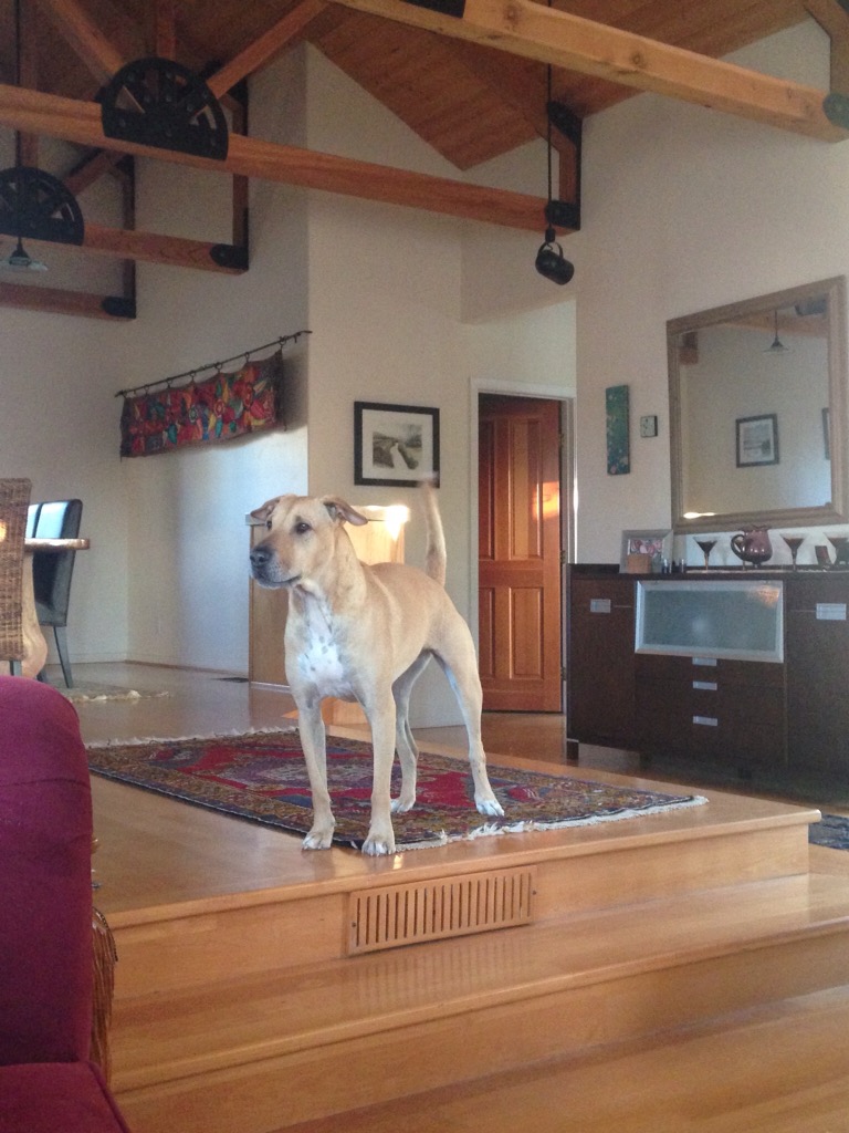
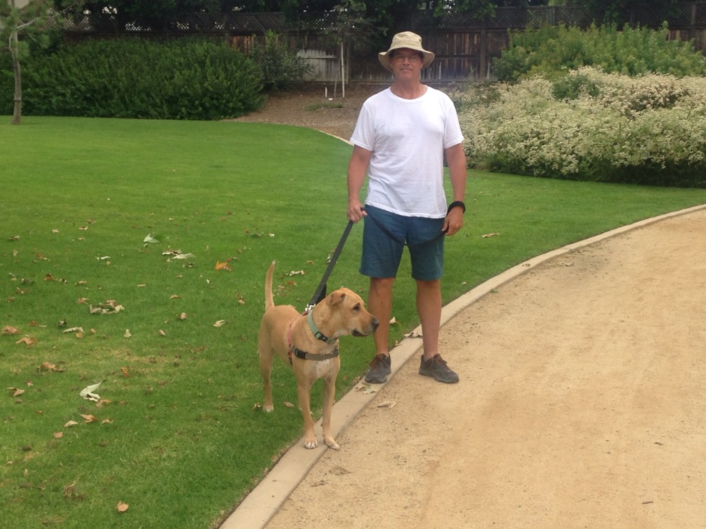
While our house sit in Encinitas was short, it left a big impression. We loved the beautiful community, the climate, and the walk-ability of the area. We also really bonded with “our” dog, Sadie. She is a rescue from Hawaii. There is apparently a lot of animals left homeless there when their owners leave the island. She couldn’t have been sweeter and kept us very close company in bed.
Sadie checking out a noise out frontBob and Sadie walking in the nearby park
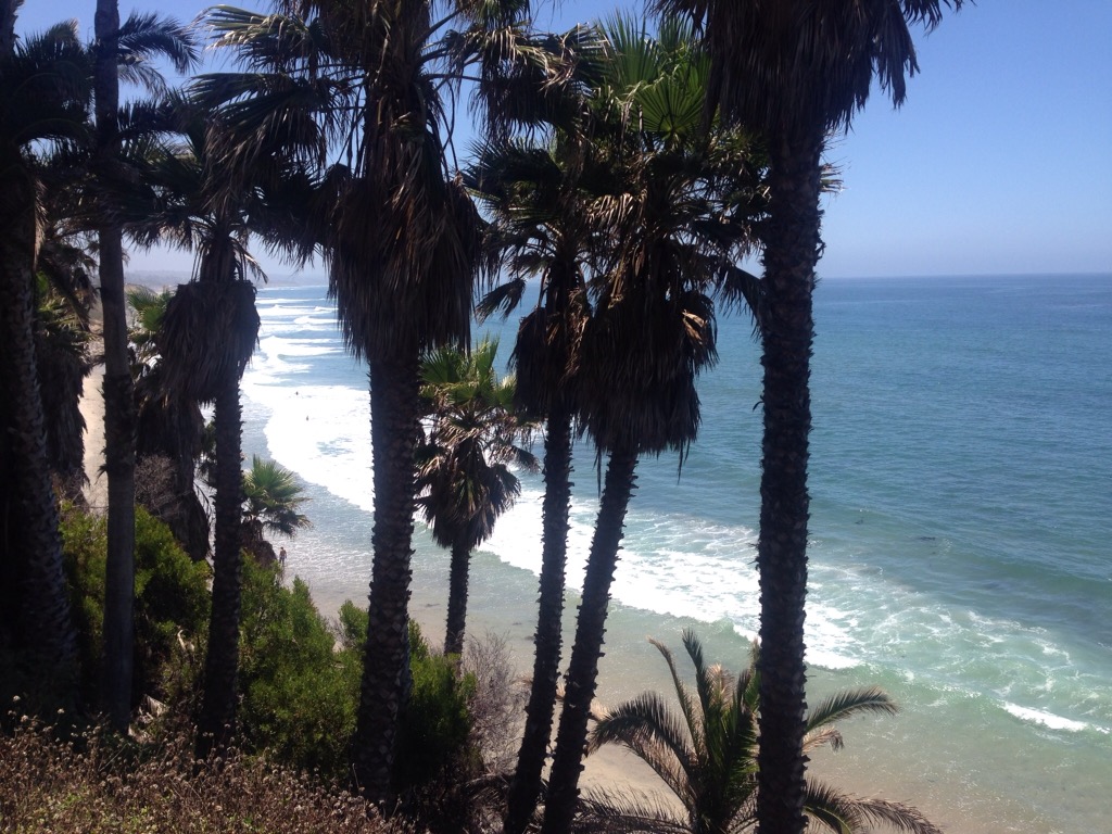
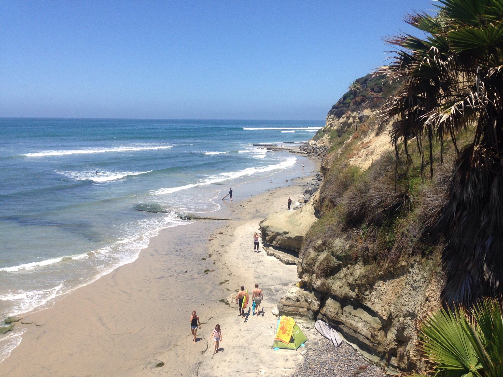
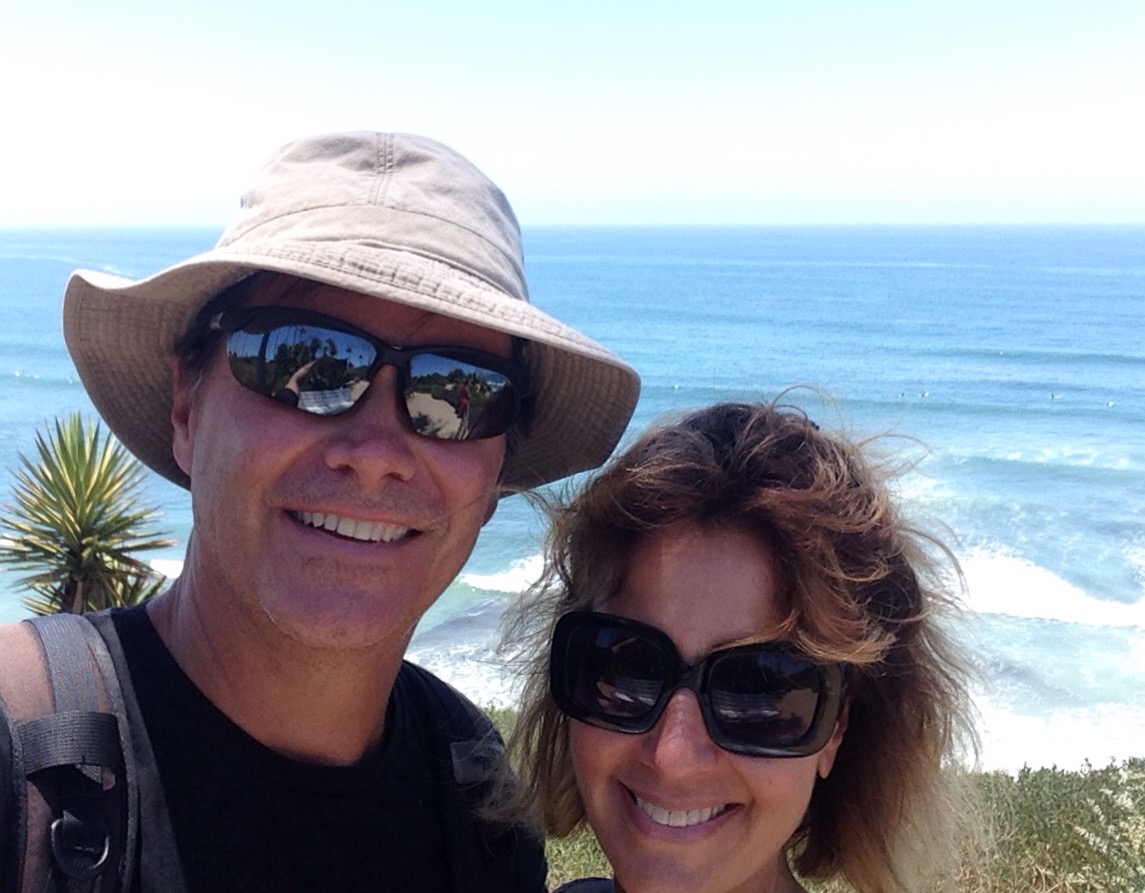
The beaches and coastline are gorgeous —
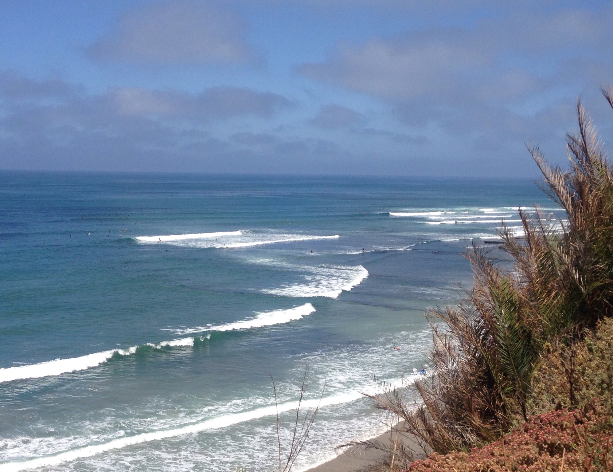
Moonlight Beach — about 2 blocks from the Main Street area of EncinitasView of the beach from the H street viewpoint and beach accessWe walked this trail along hwy 101 from Encinitas to Cardiff. There were runners, bikers, and lots of people changing at their cars to go surfing or swimmingBlue is such a happy color!People out on the beachMore beach/coastline between Encinitas and CardiffIt was hard to get anywhere — cuz we kept stopping to take photos! This is looking back towards Encinitas.
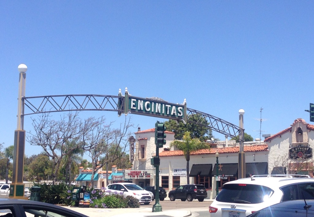
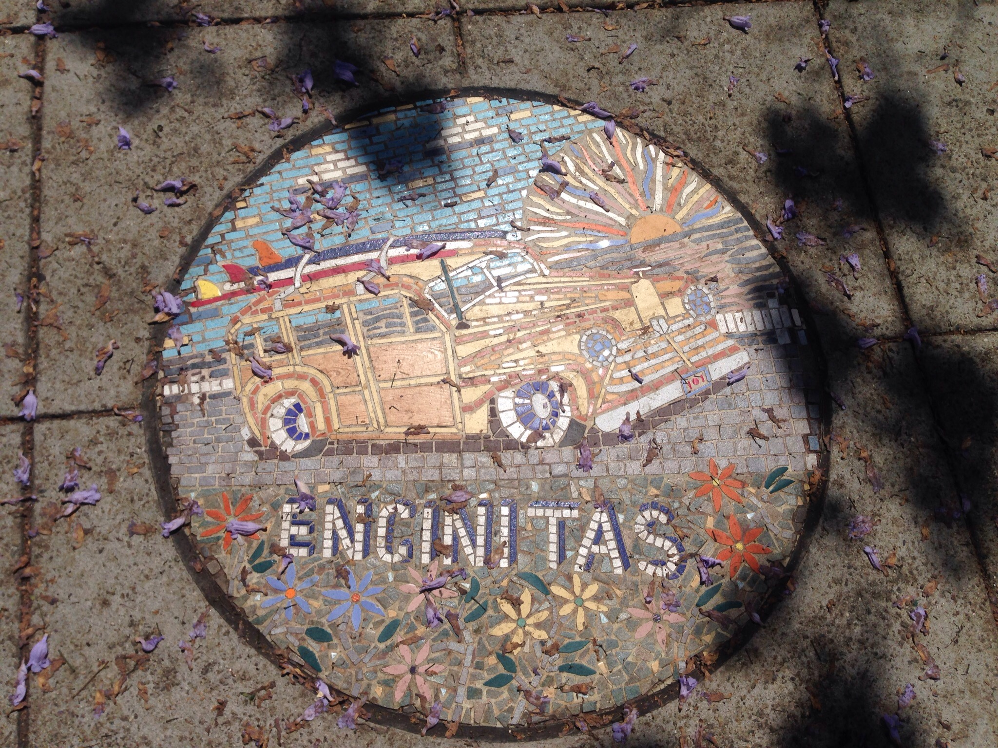
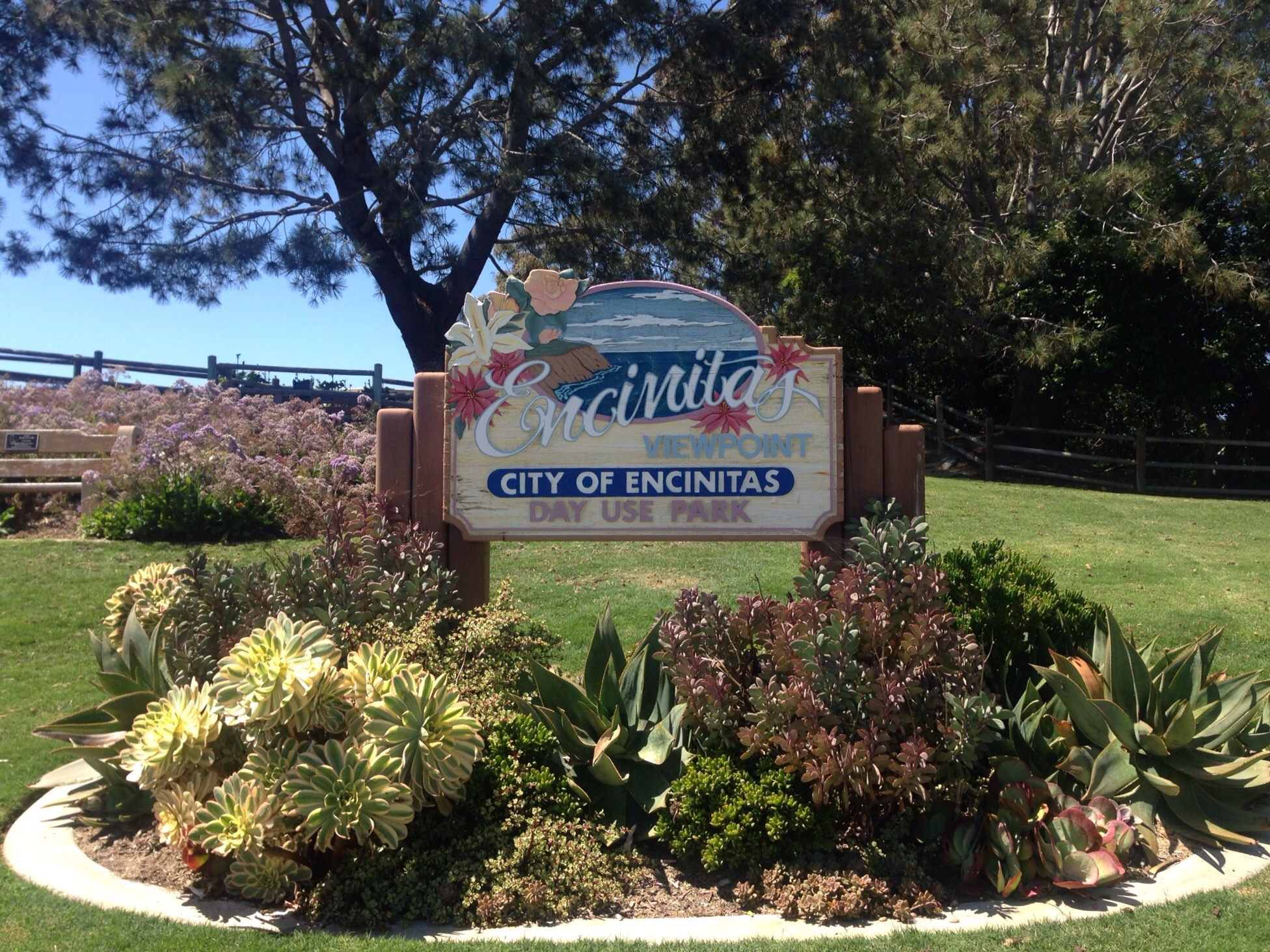
The downtown area was cute with lots of retail and dining options —
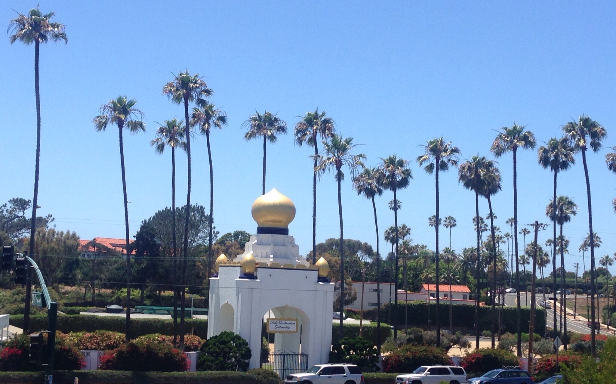
The Encinitas sign over the Main Street areaOne of several mosaic circles in downtown EncinitasThe Self Realization Fellowship founded in 1920 by Paramahansa Yogananda
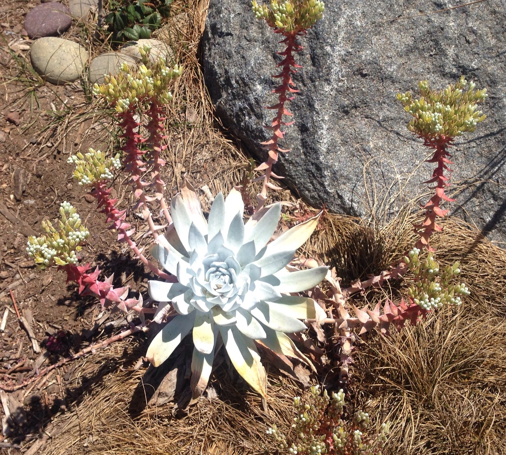
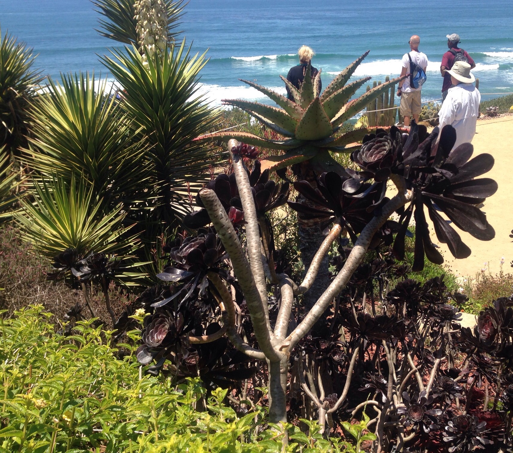
We also loved the variety of flowers and plants in the parks, gardens, and yards —
A local yard in our neighborhoodBeautiful cactus flowerOne of many local parksPart of the Meditation Garden at the Self Realization FellowshipMore of the (free!) Meditation GardenShameless selfie at the Meditation Garden
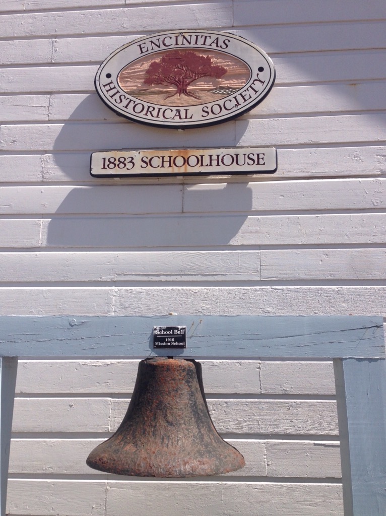
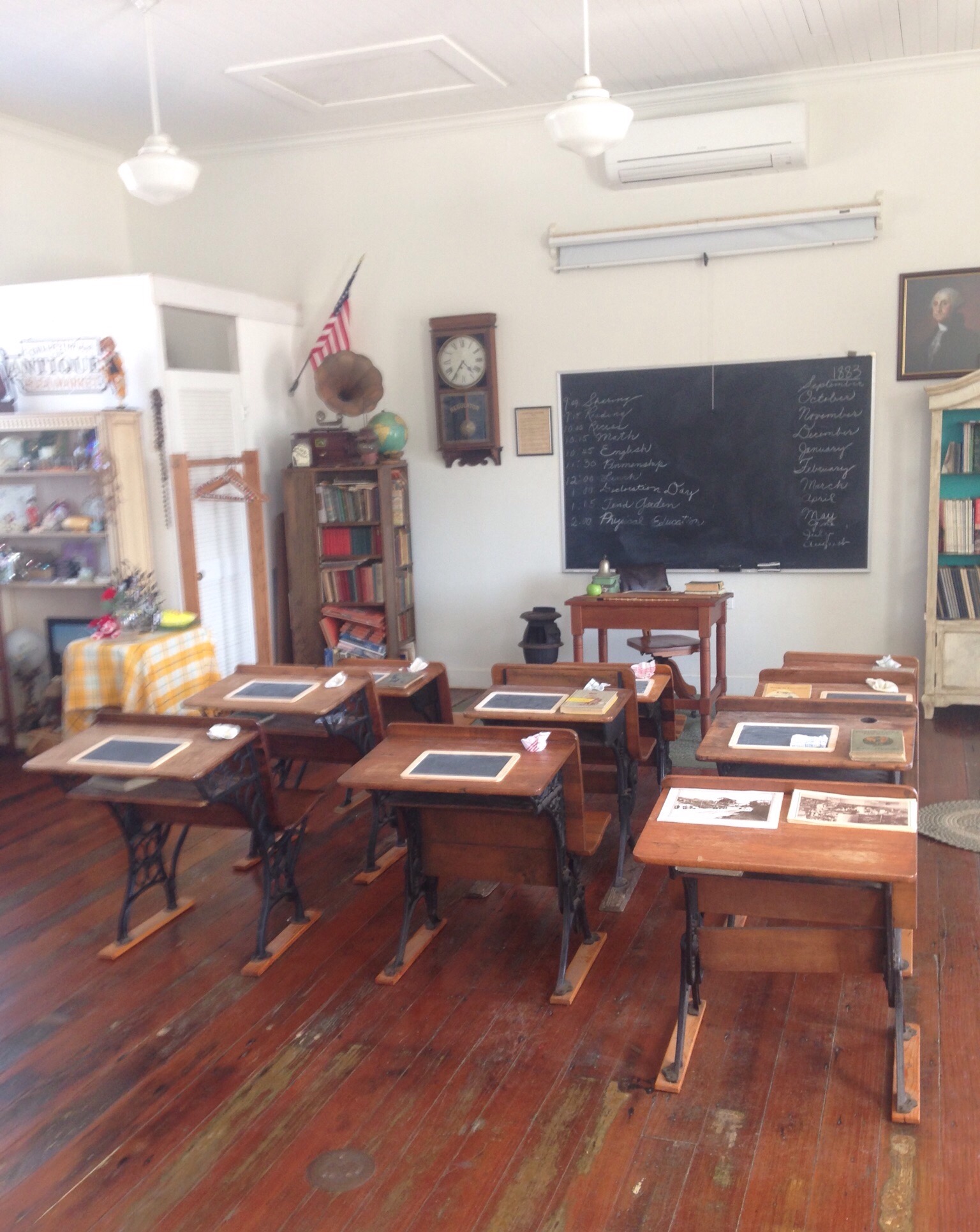
We even spent a couple of hours on Saturday on a free historical walking tour. It was interesting to learn more about the community — including the fact that Encinitas was the first town established between San Diego and LA due to its role in the development of the railroad.
The outside of the original schoolhouseThe recreated inside of the original school houseTwo original boat houses that were built for on-land housing. They are currently affordable housing rentals, but the one on the left will be turned into a museum.
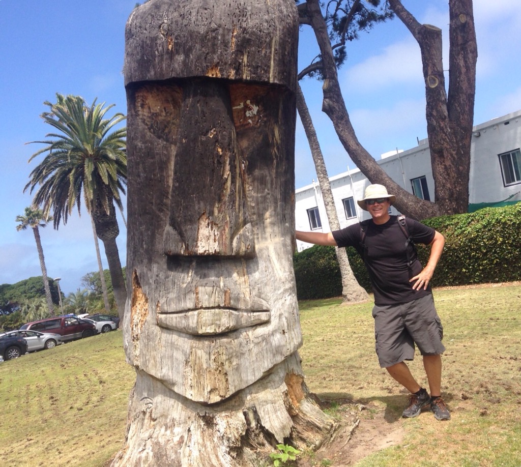
Oh, and we scored Bob another Big Head photo.
Actually, we only needed one of each of the above-mentioned modes of transportation (with the exception of buses) to get us from Mexico City to Encinitas, California, for our current housesit, but then I couldn’t riff on the John Candy movie, so please excuse the poetic license.
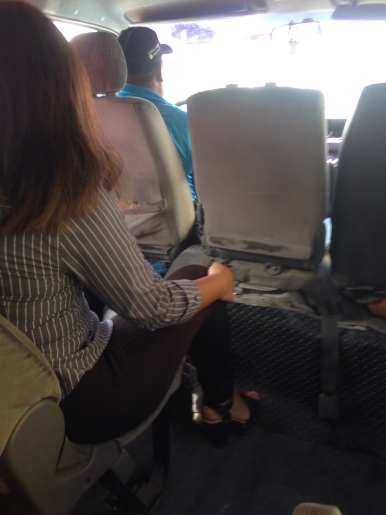
Planes — Bob and I had a 6:55 am American Airlines flight on Wednesday, June 14, from Mexico City to LAX, which entailed a 4:00 am alarm to catch the free shuttle from our hotel. The airport must never sleep, as it was already going strong at that time of day. Our flight was uneventful, and we landed at LAX ahead of schedule. This rarely seems to be a good thing as the arrival gate is seldom ready. We stopped and started towards a gate and then were finally informed that we would be going down stairs at the back of the plane to be bussed to the terminal. After that, however, it was the most efficient airport departure ever. Customs and Immigration was super fast with our Global Entry status, and we were very close to our baggage claim carousel. Our baggage was unloaded pretty quickly, and we were off to make our way to Union Station in LA to catch a 3:00 pm Amtrak train to Solano Beach (near Encinitas).
Metros — It was barely after 10 am, so since we had lots of time we decided to take the metro to Union Station instead of the more direct (and expensive) bus. To get to the metro we had to wait in the designated area outside of the terminal for the free Airport “G” bus to take us to the airport metro station. At the airport metro station, we purchased a metro card for $1.00 each and then paid the $1.75 one-day fare. We then took the green line to the Rosa Parks Station, switched to the blue line to the Metro Center station, and then switched to the red line to Union Station. The entire trip from leaving the baggage claim area at the airport to Union Station was about 2 hours and 10 minutes.
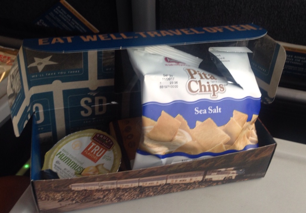
Trains — Once at Union Station, we found the Amtrak Customer Service window and were able to exchange our 3:00 pm tickets for the 12:30 departure. We hightailed it to the platform and were soon boarding the business class! coach. We had splurged on the upgrade over general seating in economy. We thought there might be more room for our luggage in Business Class, and we had heard about the great views from this route and wanted to be sure we could take advantage. It was a difference of paying $90 for the two of us instead of $60. To our pleasant surprise (as we hadn’t eaten since very early on our flight), we were provided with a free snack box and one free drink — water, juice, soda, or alcohol.
Our snack box — hummus & pita chips, trail mix, and cookieAnaheim Angels stadium on our way out of LA
Landscape view from trainOcean view 1 from trainOcean view 2 from trainOcean view 3 from trainOceanside, CAOceanside, CA The Solano Beach station where we ended our Amtrak journey
Buses — Amtrak was the gift that kept giving. Once we arrived in Solana Beach, we walked across the street to wait for the Breeze Bus to take us back up to Encinitas (about a 15 minute ride). We were able to show our Amtrak tickets for a free ride on the bus.
NOTE: Bob is the logistics guru. He researched all of this before we left Mexico and knew the transportation options out of LAX, where we needed to catch each one, and the costs. He is also the chief chef. Not sure of my value-add on this adventure, but I picked my partner wisely!
Automobiles — After we arrived in Encinitas, we found a cafe with wifi to communicate with our homeowner. She collected us and our bags and brought us to the house where we met Sadie and settled in while she and her husband finished their work for the day. We had a lovely meal with them prior to their departure early the following morning.
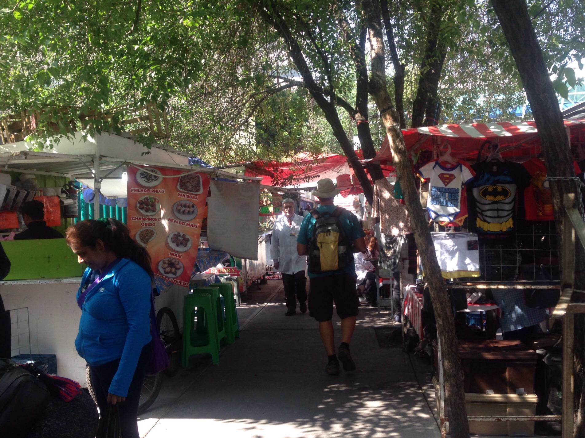
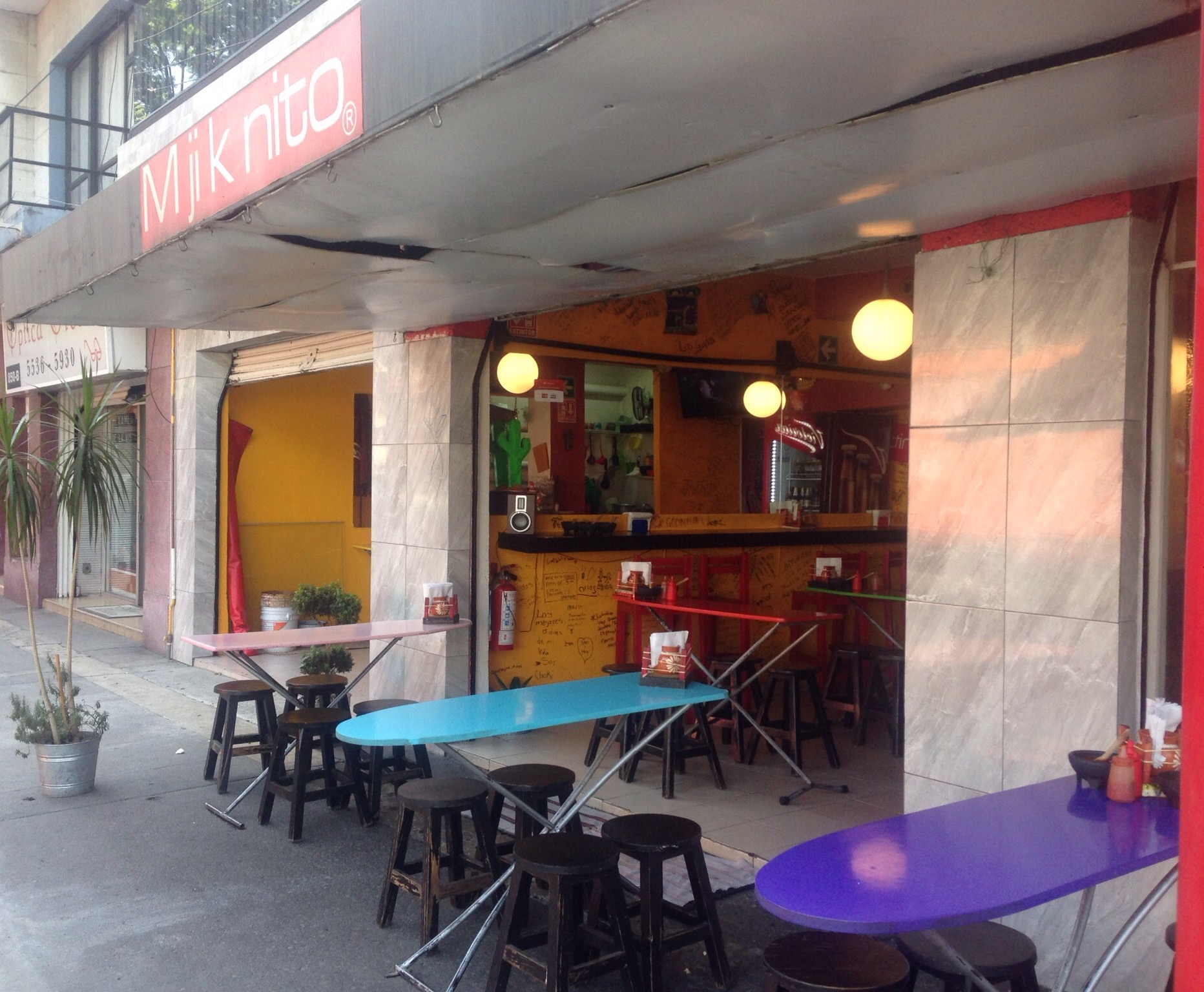
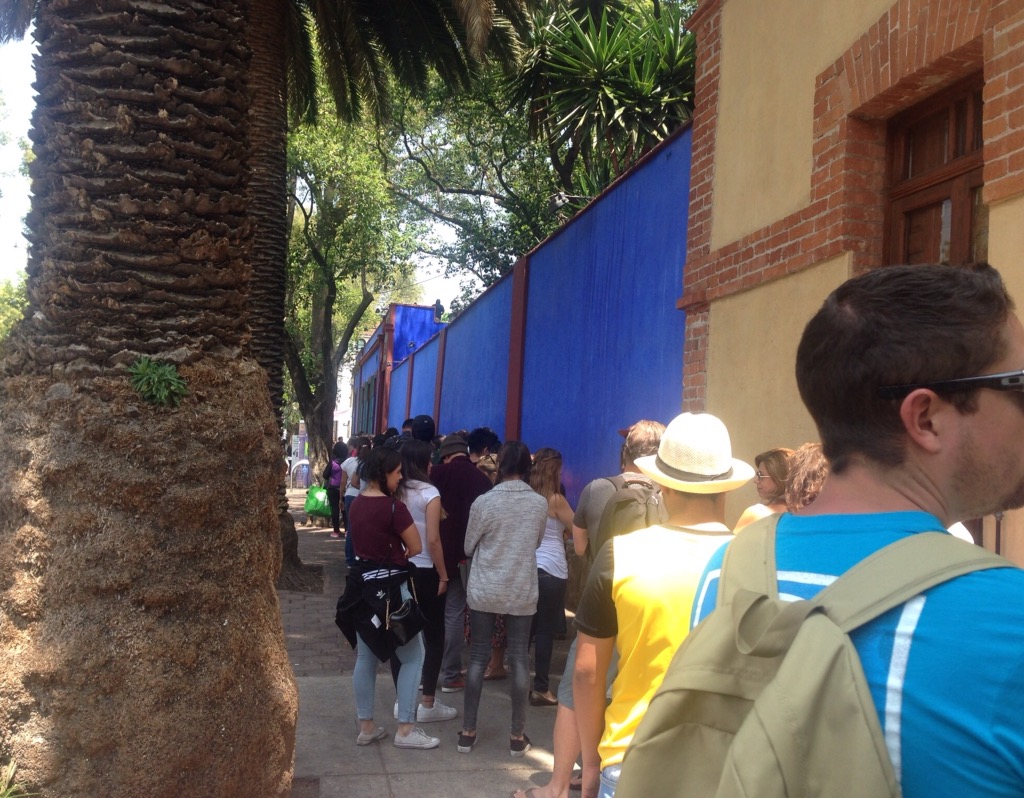
Our last day in Mexico City was pretty much focused on Frida Kahlo. We both really wanted to get to her museum, locally known as La Casa Azul or the Blue House. We decided to walk there and then bus or metro it back to our hotel. It was about a two-hour walk to the museum which allowed us to see a lot of neighborhoods that we hadn’t seen before.The walk was pretty much a straight shot, with a little excitement along the way.
There are all kinds of food cooking on almost every corner of the cityAnd markets galore — these were some that we passed on our way to the museumAlong with being a book and crossword puzzle nerd, I also love to iron so this cafe caught my eyeWe were on a pedestrian walkway to cross this very wide roadA little later we came across this — all ended well (except for the car)
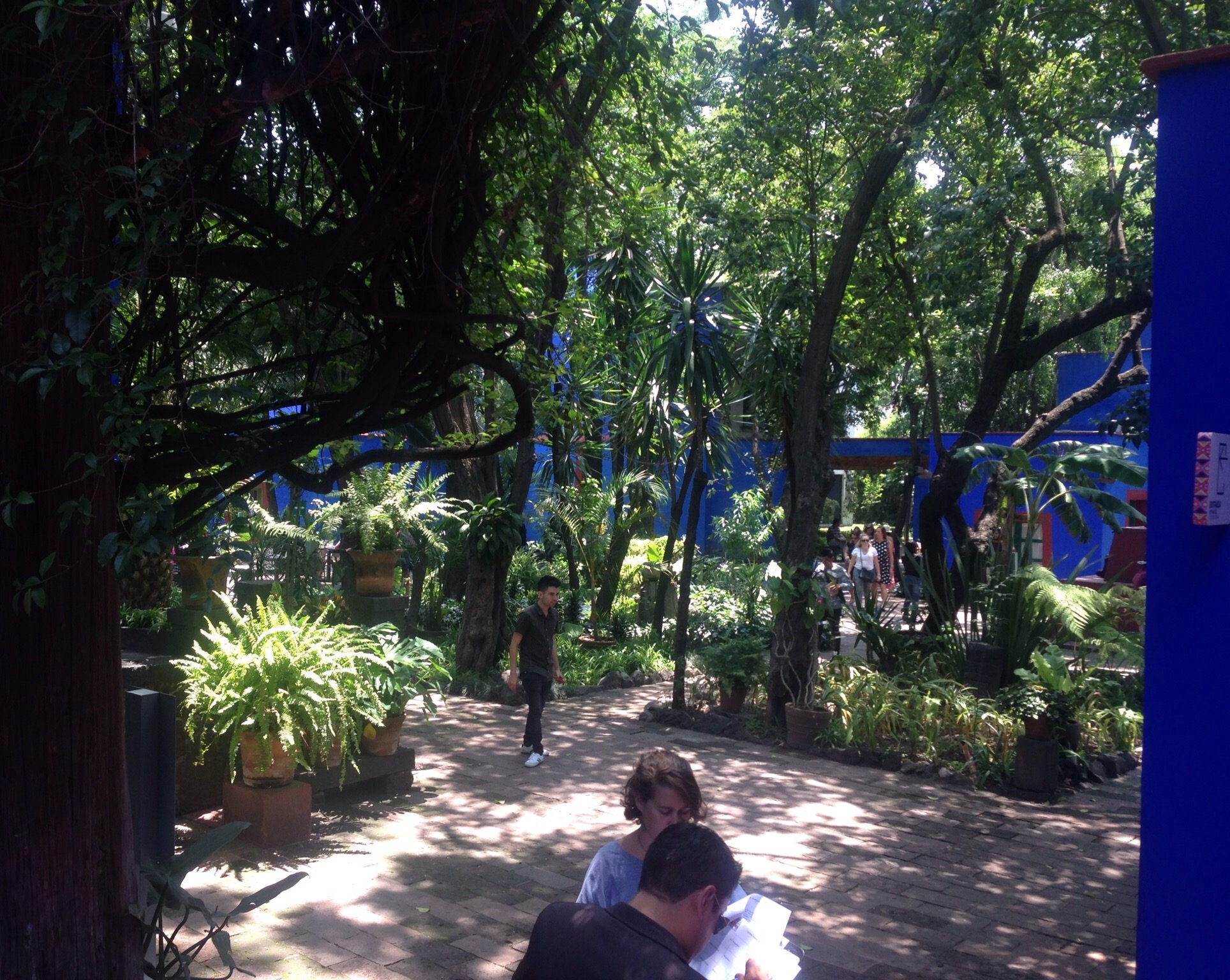
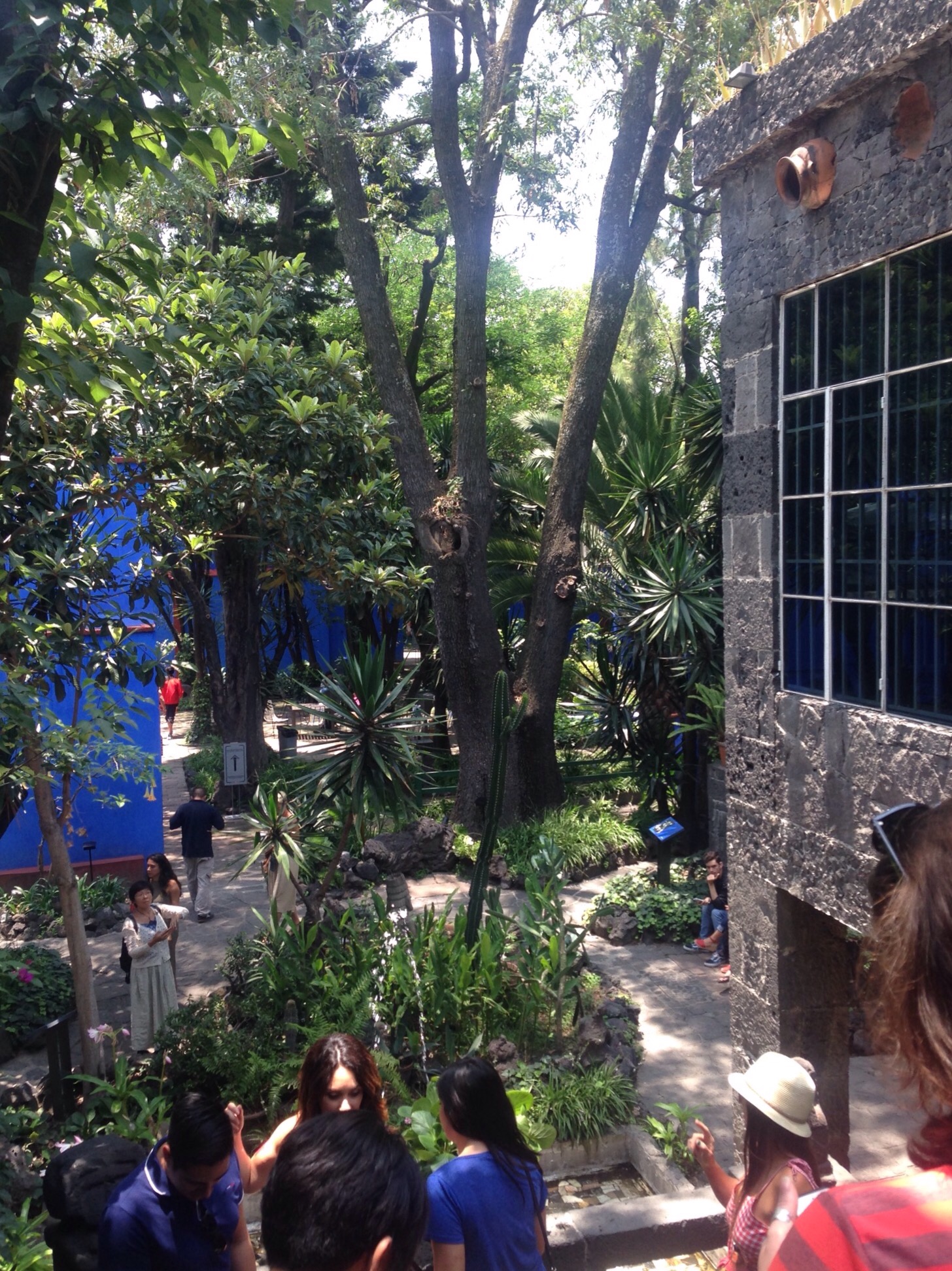
Once at the museum, we waited for about an hour in line to enter the museum and then had a good hour to 90 minutes inside the house and very lovely grounds. The museum provided a good overview of Frida’s life, including her childhood bout with polio that caused one leg to be shorter than the other, the traffic accident at age 18 that would create health issues for the rest of her life, her relationship/marriage to Diego Rivera, their relationship with Leon Trotsky, as well as her career. We loved it!
NOTE: In a related aside — If you have not yet seen the movie Frida with Salma Hayek and Alfred Molina, we highly recommend a viewing.
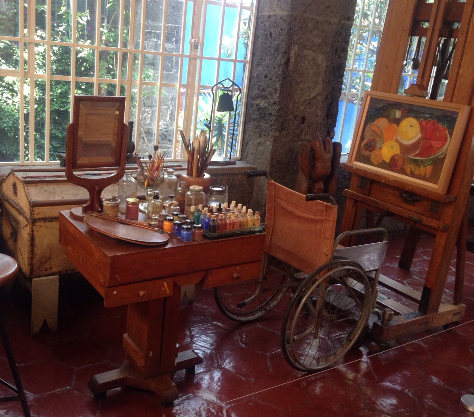
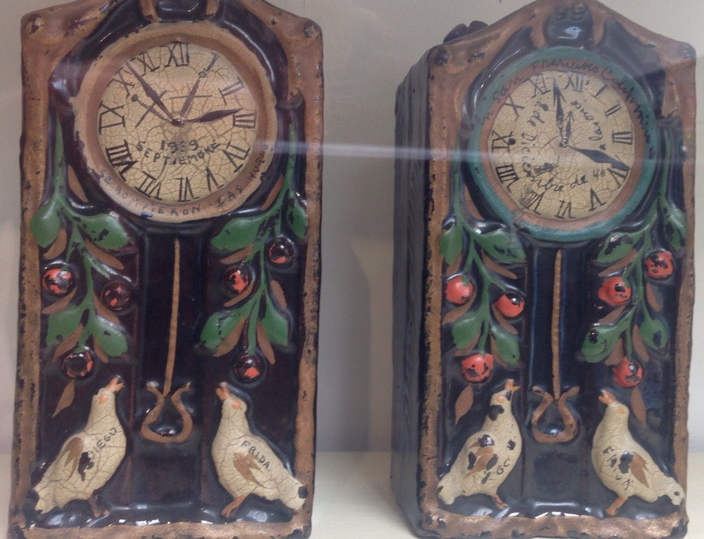
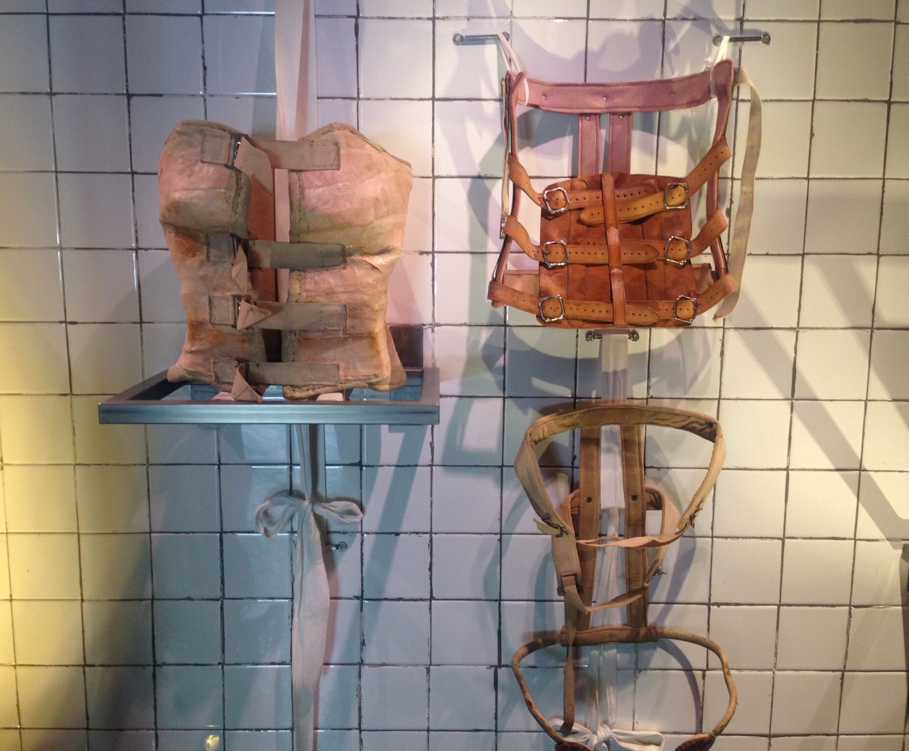
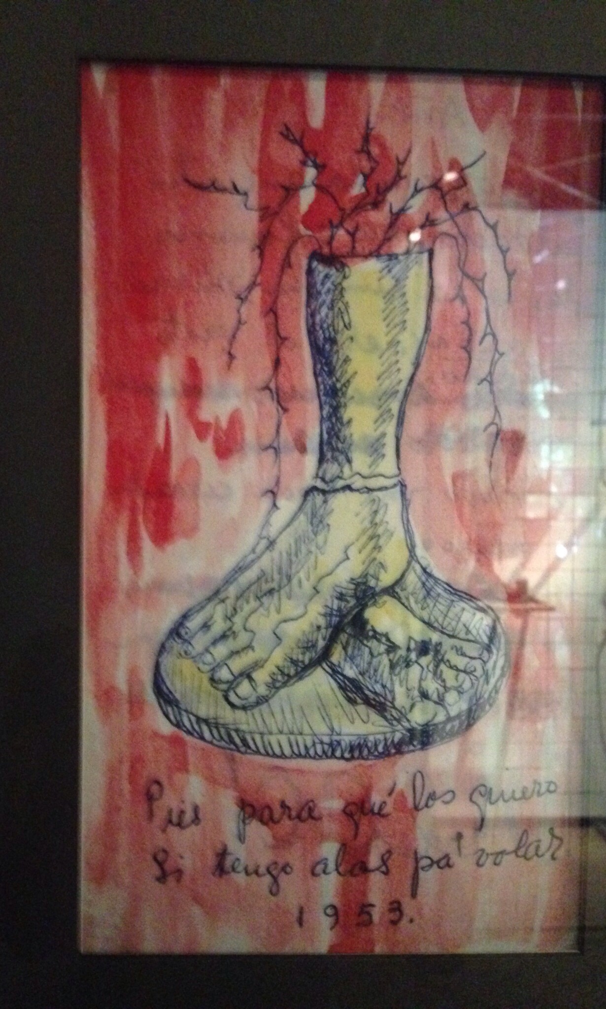
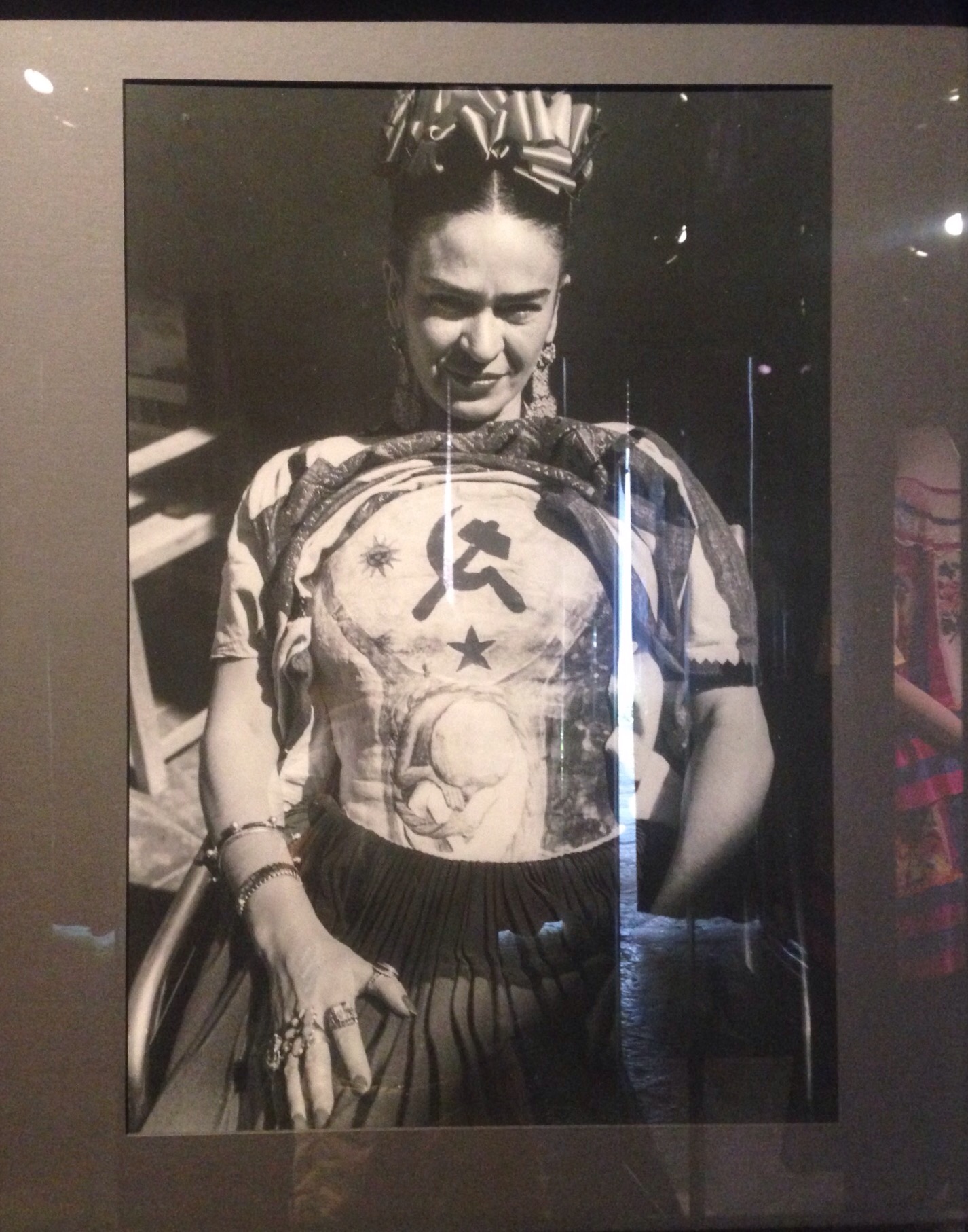
The long line for the Frida Kahlo Musem, the blue house where she and Diego livedThe initial courtyard as we entered the propertyThe kitchen — Frida and Diego preferred traditional ways of preparing food rather than using ovensA display of her paints plus her wheelchair from which she would paint Two clocks that Frida painted. The one on the left has the September 1939 date when she decided to divorce Diego for sleeping with her sister. The one on the right has the December 1940 date when they remarried.A second courtyard on the propertySome of the corsets that Frida had to wear following her accidentA painting by Frida after she had to have part of a leg amputated due to gangrene. The quote is “who needs feet, when I have wings to fly.”This is Frida in an upper body cast that she has decided to make into art
We ended up taking the metro back to our hotel. That was a very warm, crowded experience. Of course, when you are paying $.50 each, you don’t really complain too much. Once at the hotel, we got an Uber to take us to a hotel closer to the airport as we had a very early flight to the States on Wednesday.
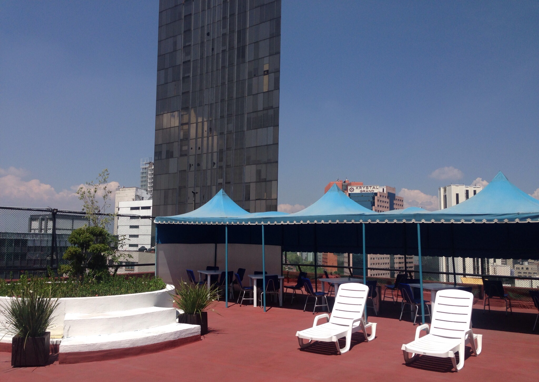
The atrium of the Grand Prix Hotel where we spent our last night in Mexico
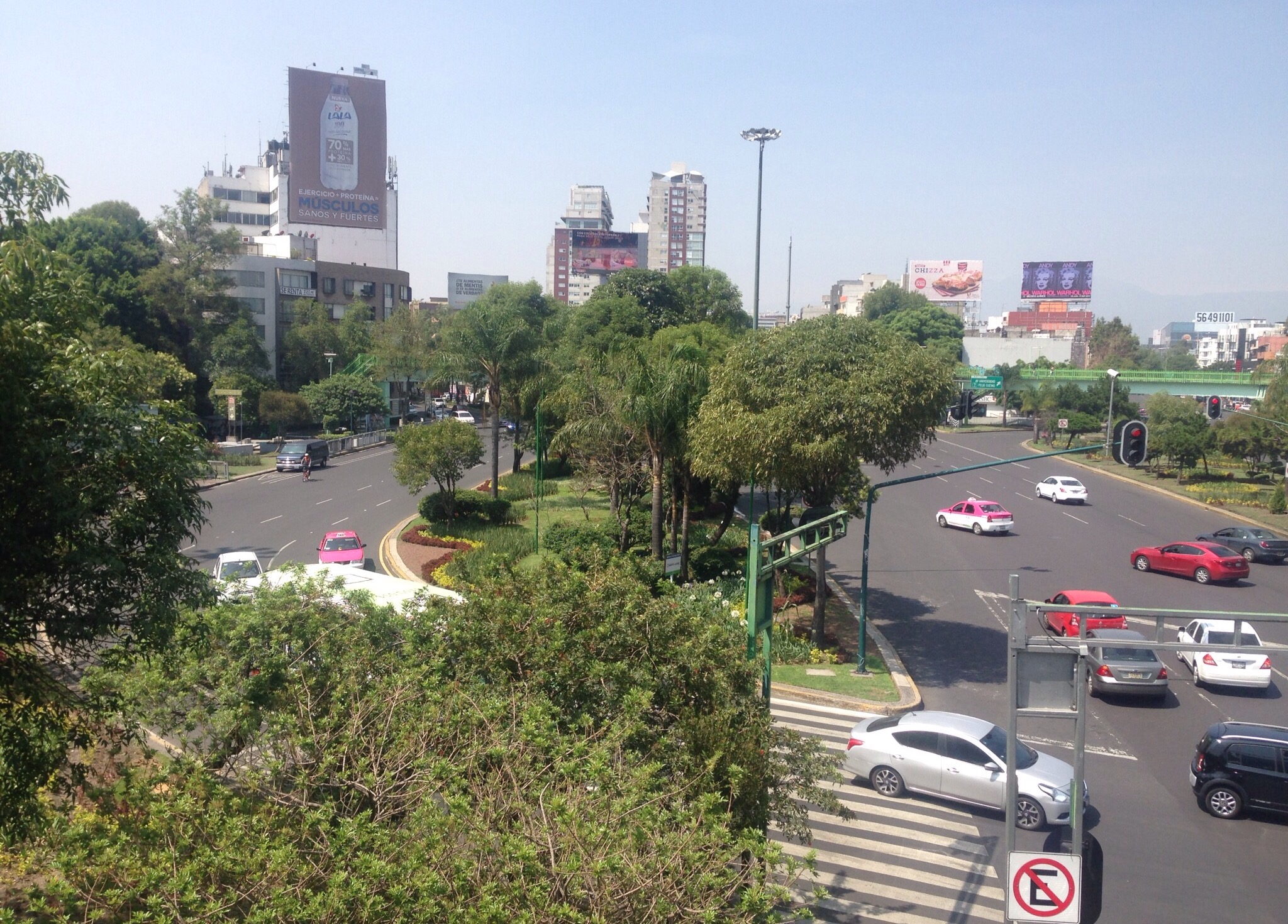
Our second day in Mexico City was Monday — as in ALL museums are closed Monday. Not to be stymied in our efforts to see and learn more about Mexico City (or so we thought), we headed to Chapultepec Park. This is a top rated thing to do in the city as the vast park holds not only a number of museums but also has man-made lakes, walking trails, fountains, and statues. We thought it would make for a lovely half-day of walking and would also allow us to see the broad and beautiful Paseo de la Reforma, one of the main streets in the city, as we would need to walk that to get to the park.
We aren’t as smart as we thought. Unbeknownst to us, Mexico City closes the entire park to visitors on Mondays. It is twice the size of Central Park — closed! There is an iron fence surrounding the park, and on Mondays all gates are locked. We spoke with the nice security people who told us that “yes, the whole park is closed on Mondays” as if the closing of vast stretches of public park space is an obvious thing to do.
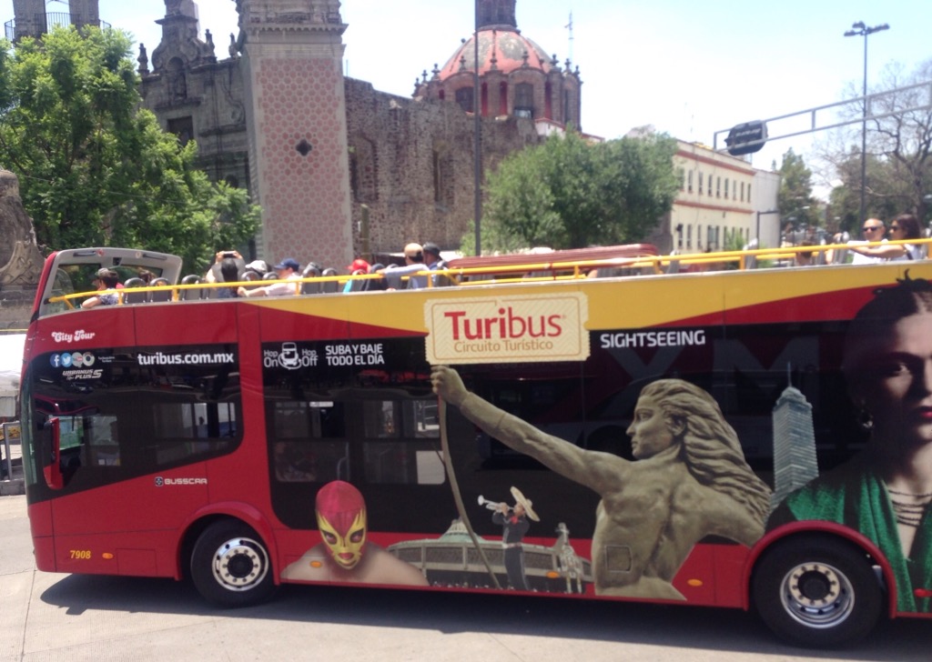
We decided that Plan B would be to pay to be driven around in a tourist bus to learn some facts about the sites we were seeing as well as to see additional sites. After about a 90 minute walk to the Zocalo Square from the park, we paid the equivalent of $8 for a 3 hour tour. The bus drivers, who are able to successfully negotiate the madness that is Mexico City traffic (including 2-way traffic around round-about some), ought perhaps to be given some gubernatorial authority as well cuz they are good.
Some photos of our day —
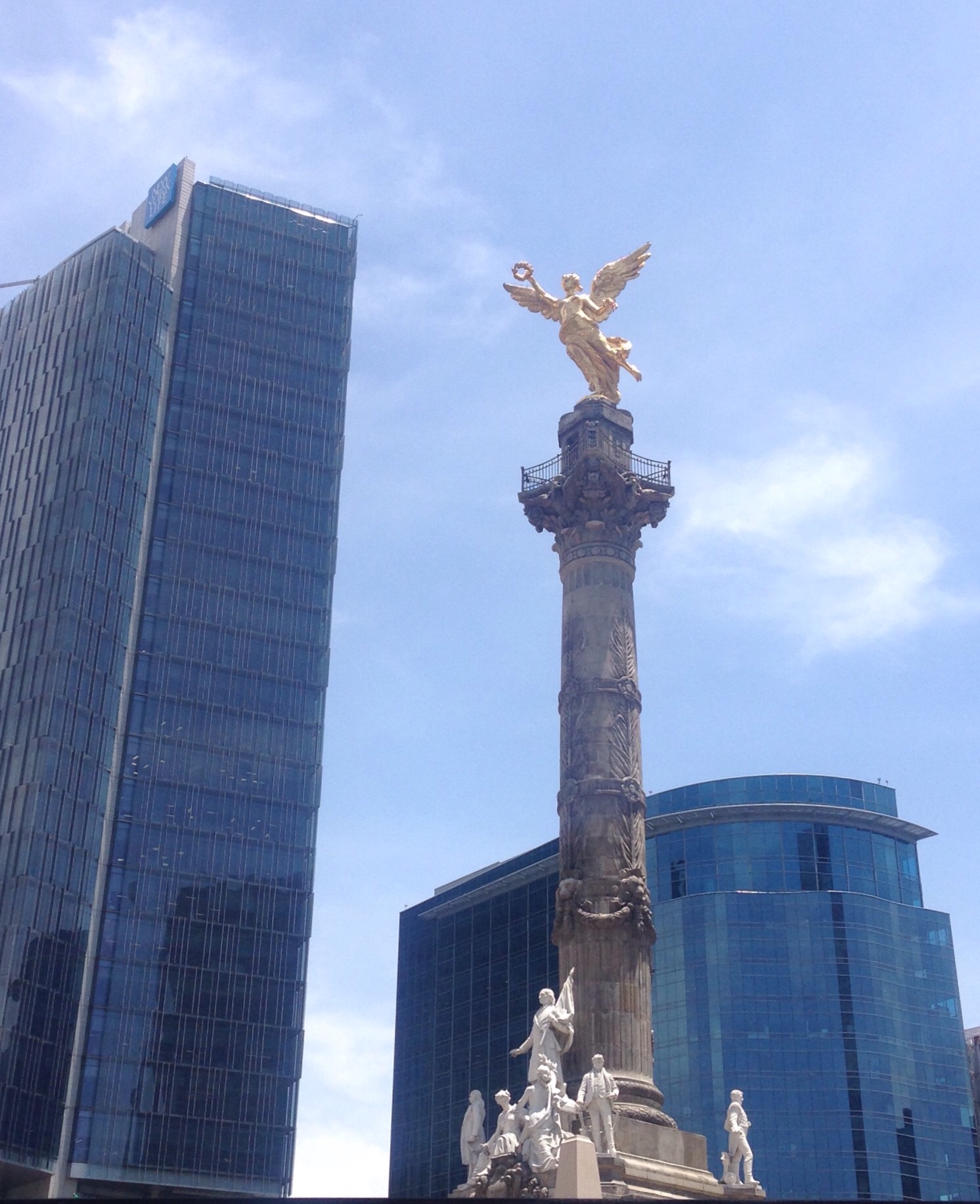
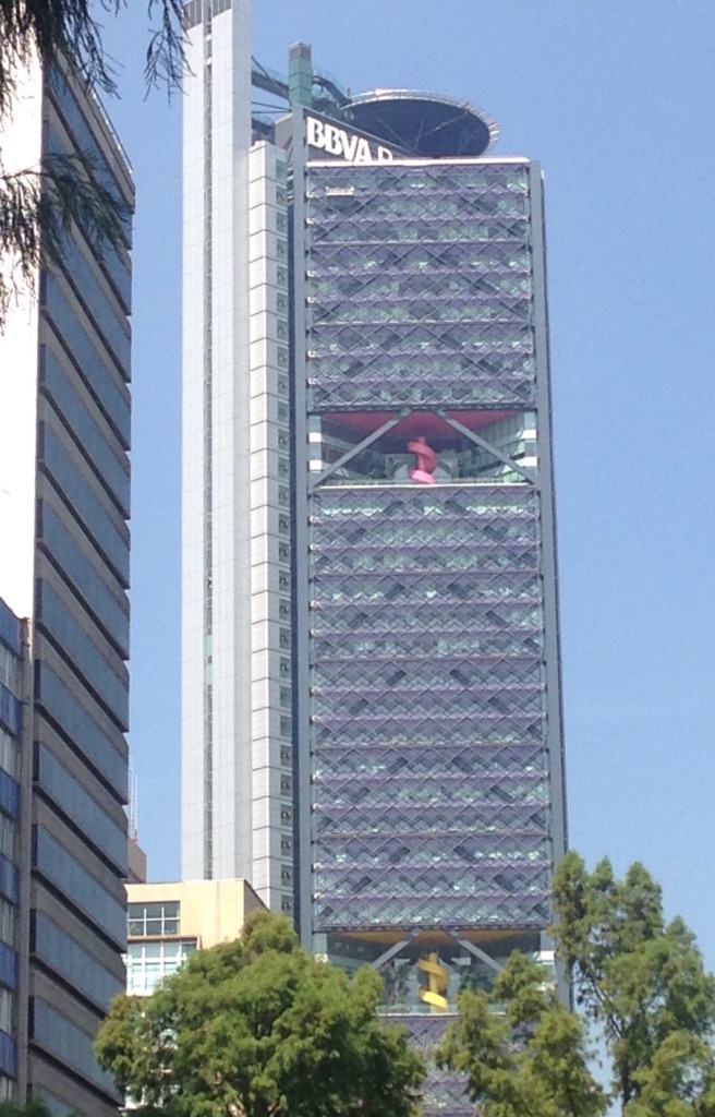
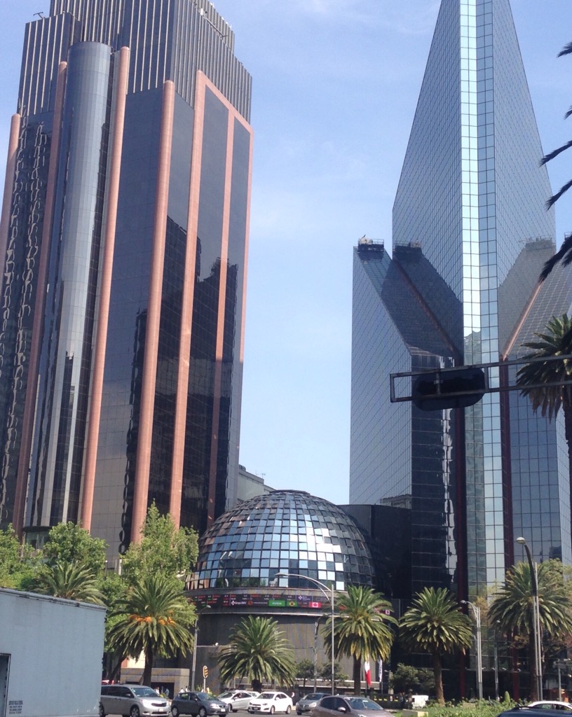
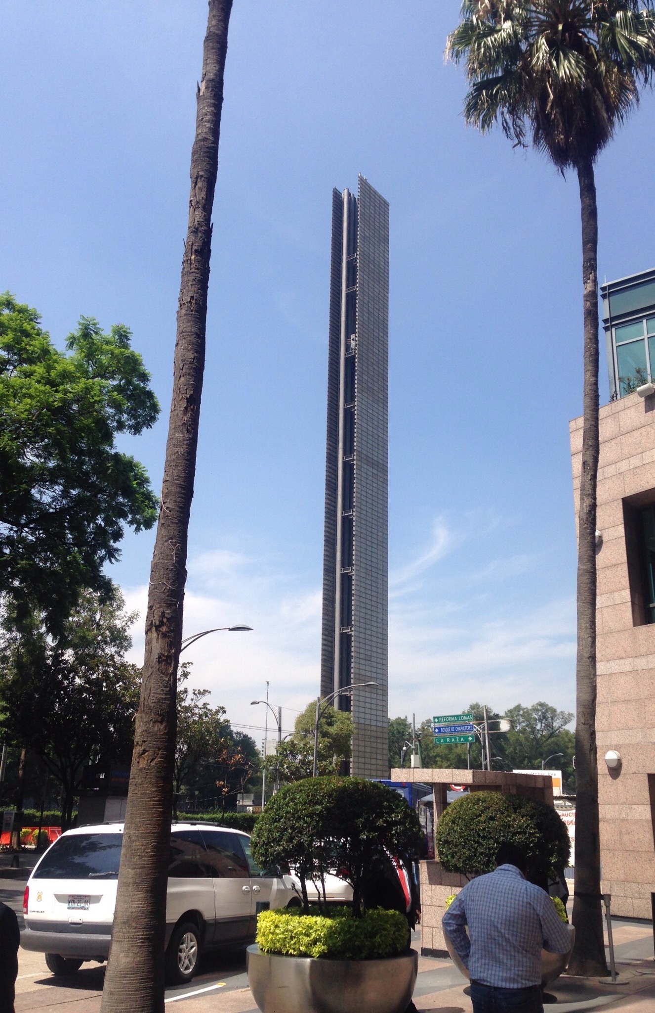
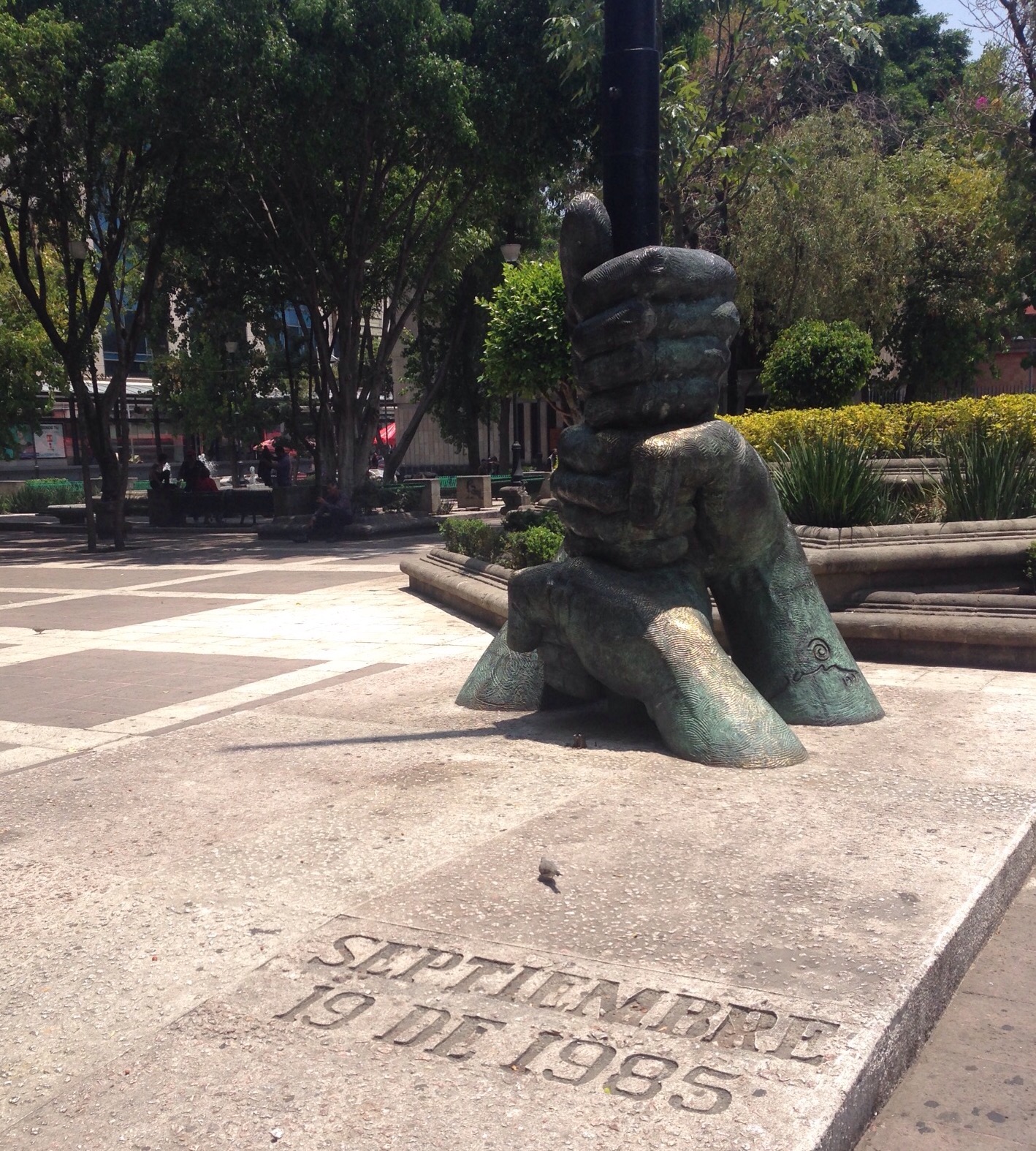
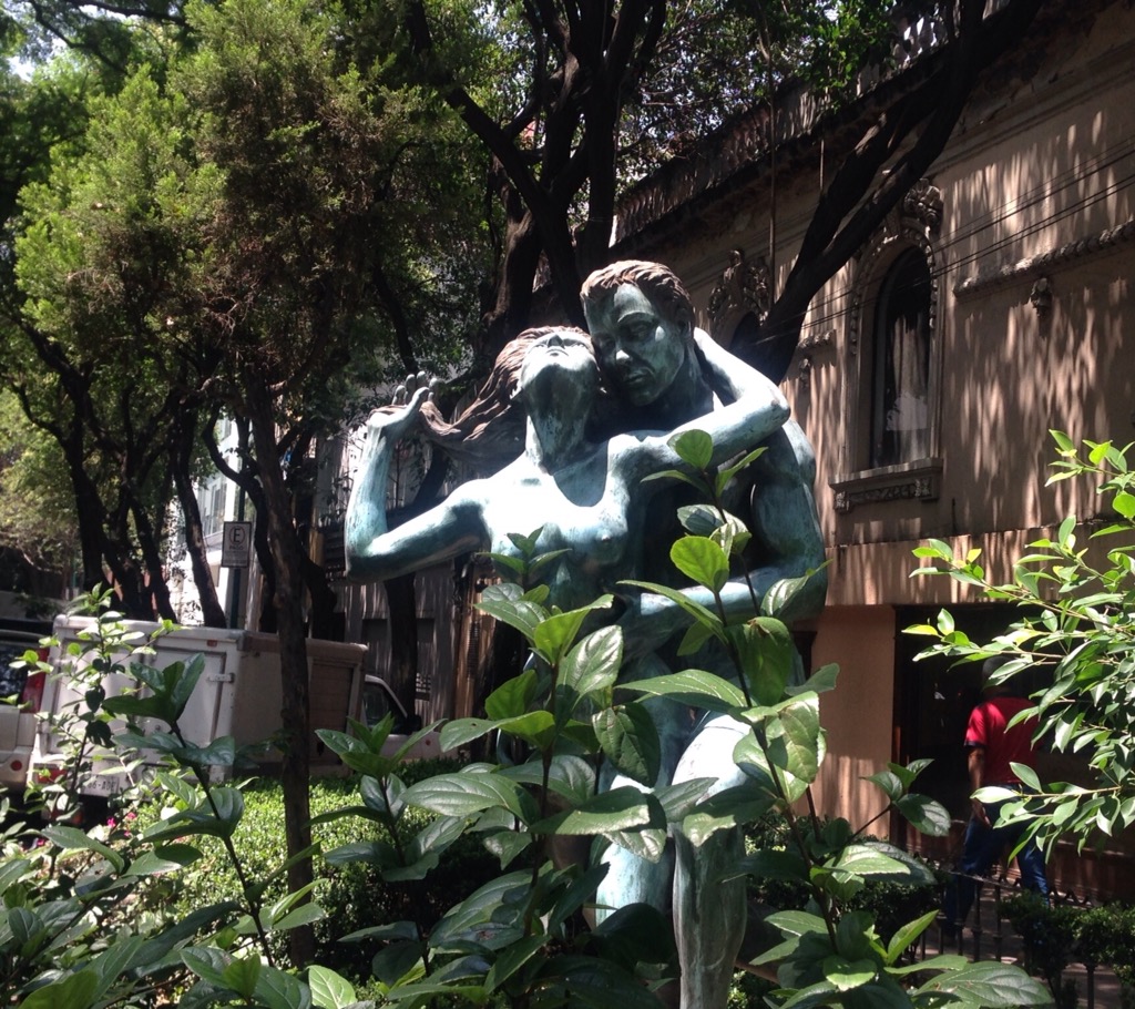
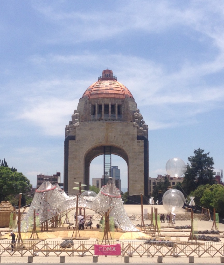
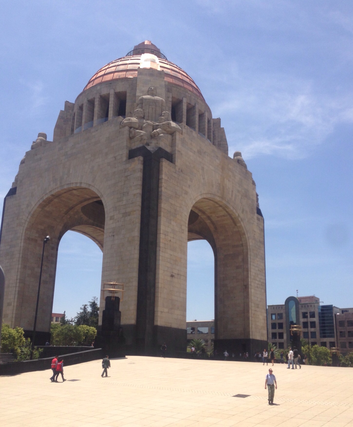
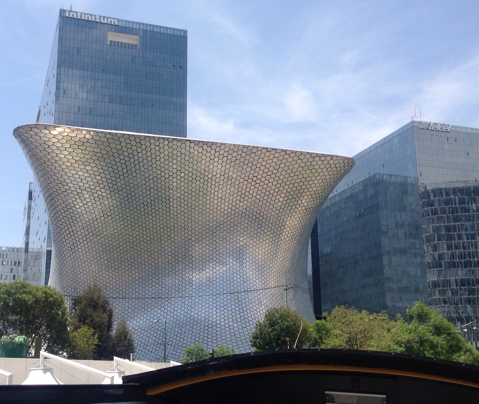
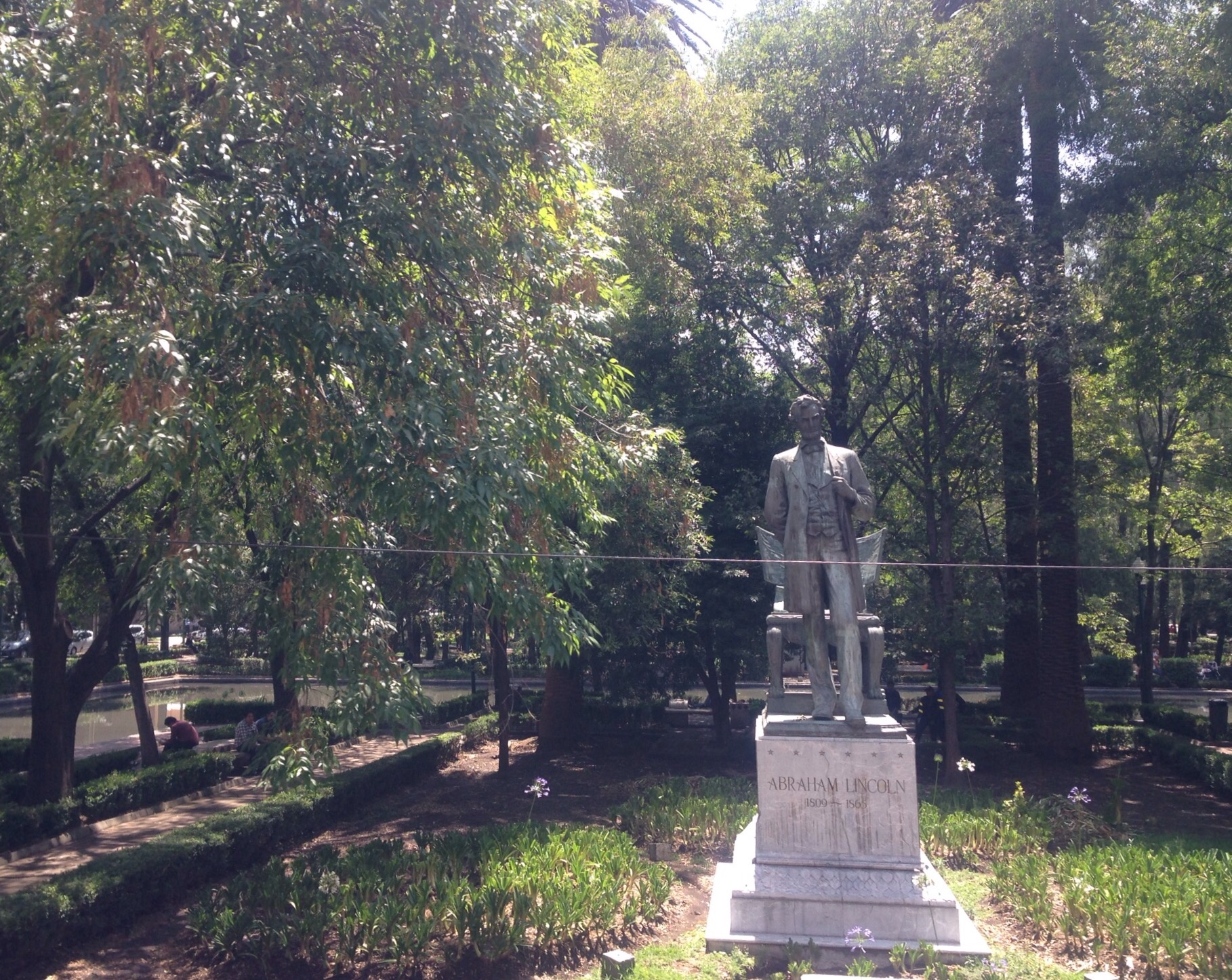
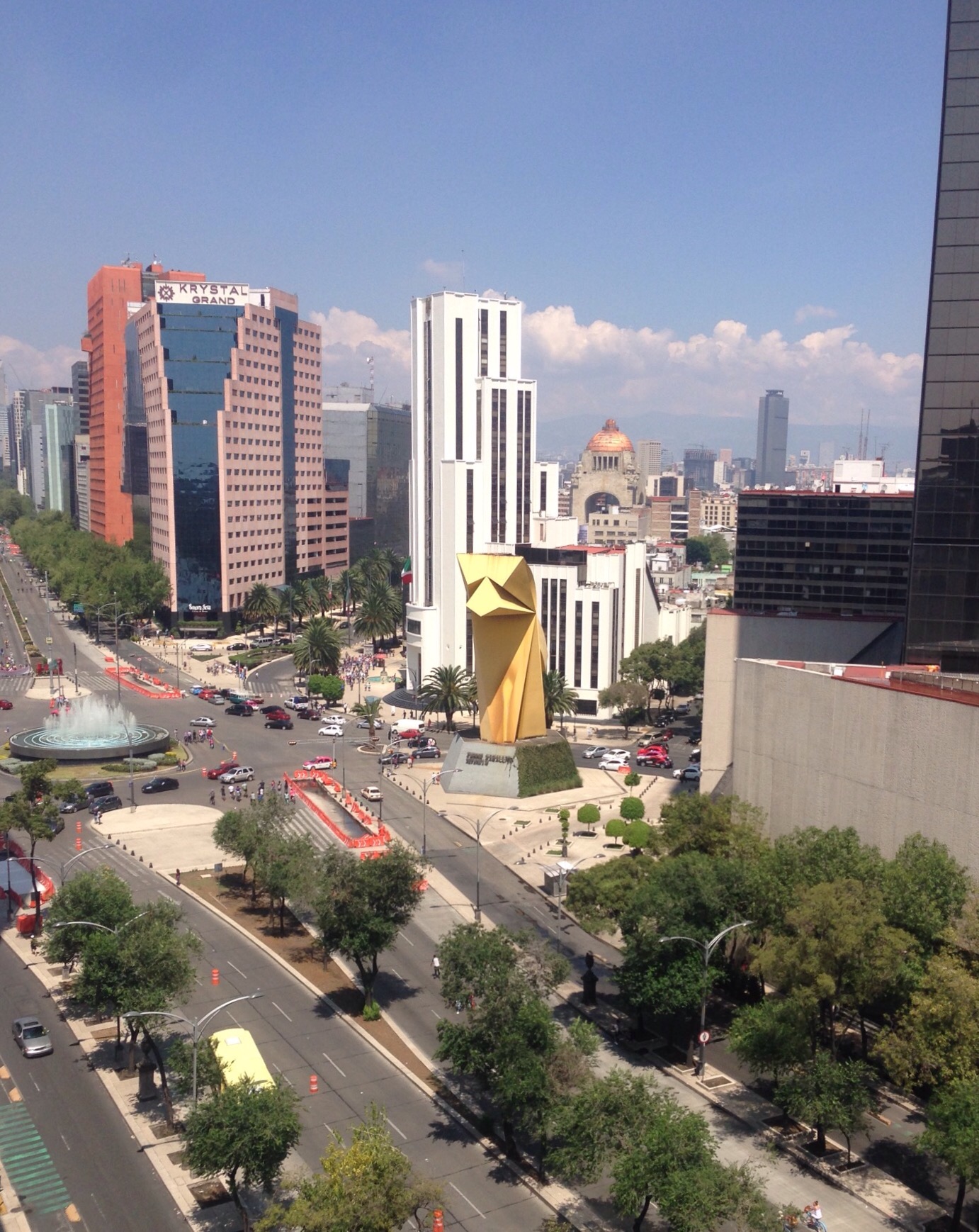
A view of the Paseo de la Reforma from our hotelLooking down the Paseo de la Reforma as we were walkingThe Paseo is lined with memorial, public art, and modern buildings. This is a statue to the 10th Aztec ruler who rebelled against the Spanish occupiers.This is the Diana the Huntress fountainOne of many public art works along the PaseoThe Angel of Independence statue on the Paseo was built in 1910 to commemorate the centennial of the beginning of Mexico’s War of IndependenceAnother view of the statue — groups of up to 6 people at a time who have requested permission from the borough are allowed to enter for 15 minutes. They can also climb the 200 steps to the top.We thought this building along the Paseo was cool looking and it has a helipadWe also liked the Mexico Stock Exchange buildingThis is a digital light tower that lies just outside of Chapultepec Park. It is actually a cultural complex dedicated to activities of digital artWe took this photo from a bridge that took us to one of the many closed gates into Chapultepec Park. We were having bridge envy as the pedestrian bridge in the photo is much more attractive than the one we were on. Of course, neither bridge to the park is of much use on a Monday. . .On our walk back from the park to catch a tour bus, we ate our picnic lunch in the Alameda Central Park near this statue which commemorates the magnitude 8.0 earthquake which struck Mexico City on the date sitedAnother piece of public art that we passed going to the tourbusThis was a different tour company than the one we took, but our bus was very similar. We sat on top and had headphones for the English translation of the Spanish commentary.Monument to the Revolution — View 1Monument to the Revolution — View 2Soumaya Museum — an art museum named for the wife of Carlos Slim, once the richest person in the worldStatue of Abraham Lincoln in one of the neighborhood parks — the same park also has a statue of MLKA military field that we saw on the tourWe stumbled on a little Chinatown area on our walk back towards our hotel from the bus tourMore of the Chinatown area
After leaving the Yucatan via Volaris Airlines from Merida, we arrived to beautiful weather in Mexico City. Instead of dealing with the aggressive taxi drivers, we took the Metro Bus (Line 4) into the historic center of the city — very easy, cheap, and not crowded. We were in early (still in the am) but were able to check-in to our hotel where we ended up having a great stay with beautiful views from the top two floors and free breakfast buffets.
We had a fun 3 days in this bustling, cultural metropolis, but I’ll let the photos do most of the talking.
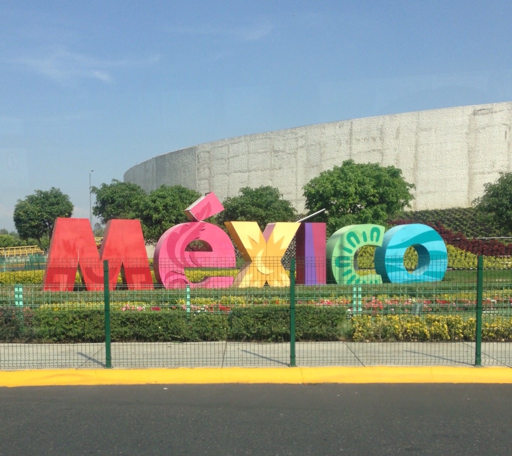
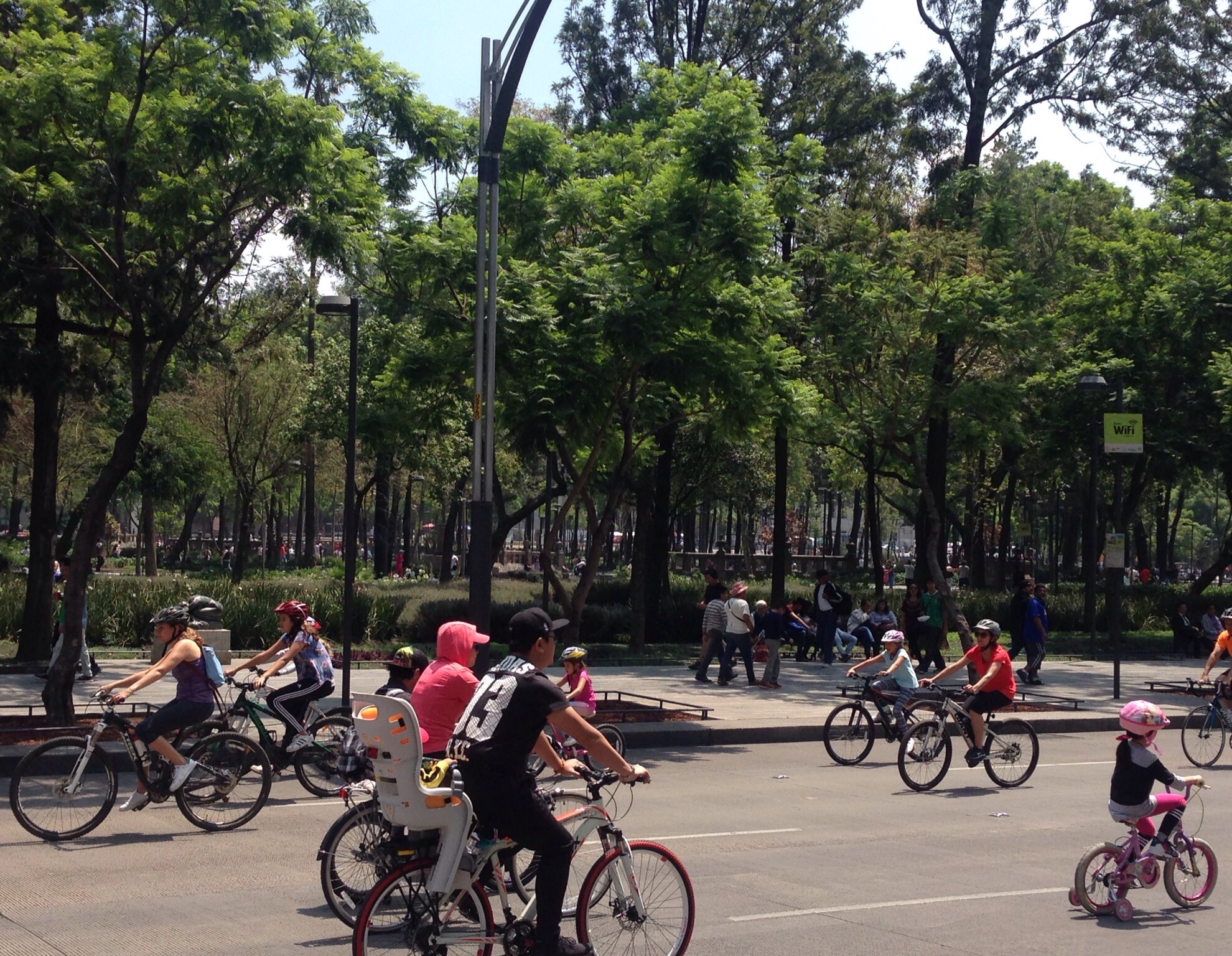
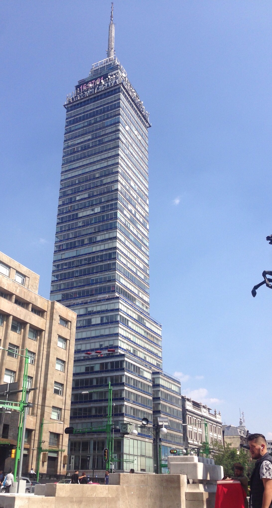
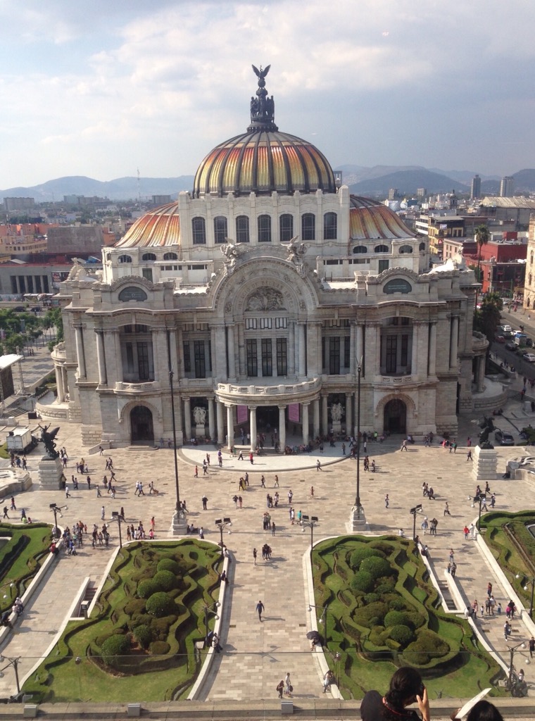
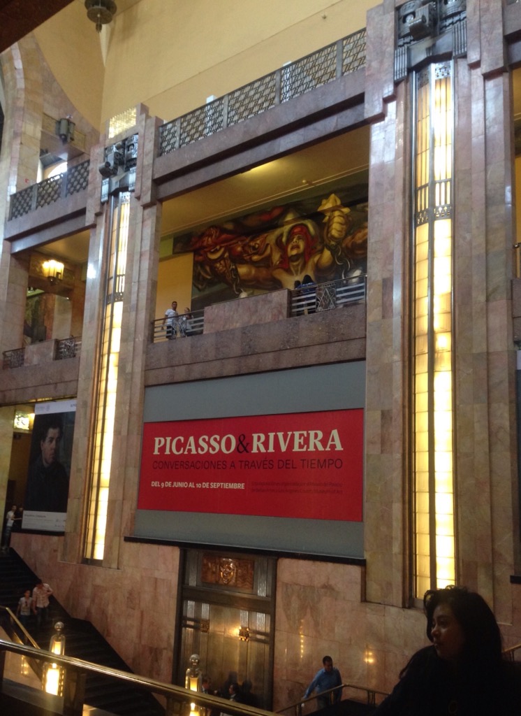
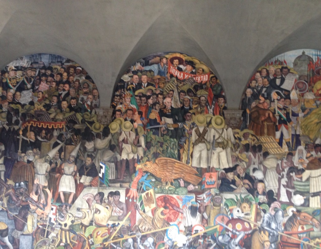
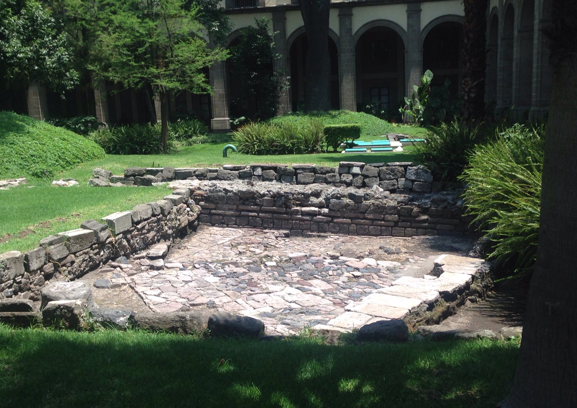
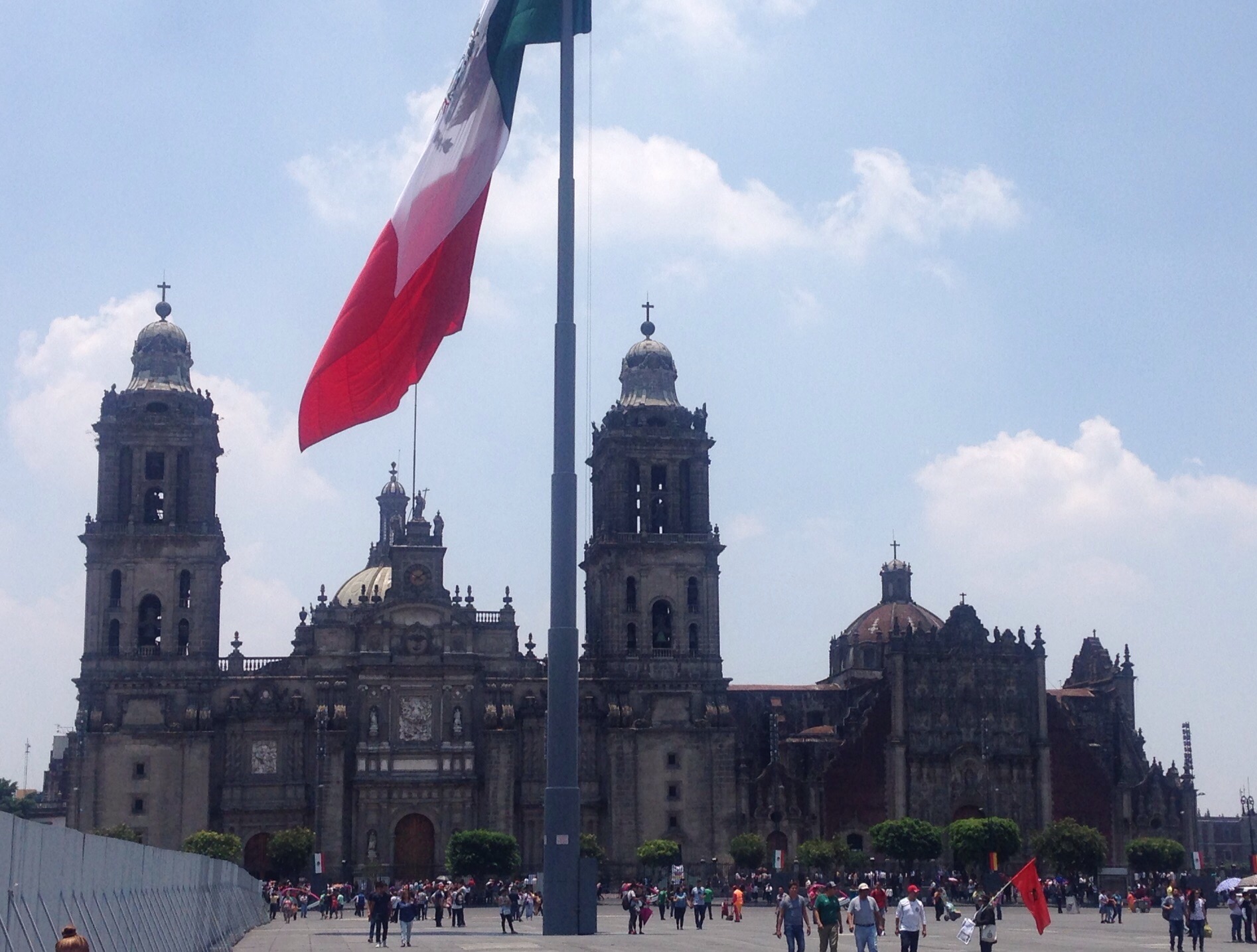
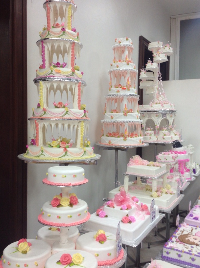
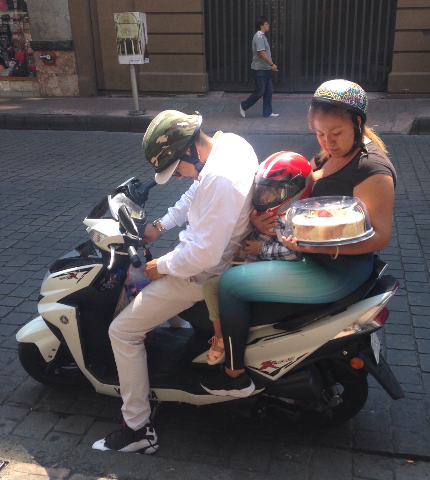
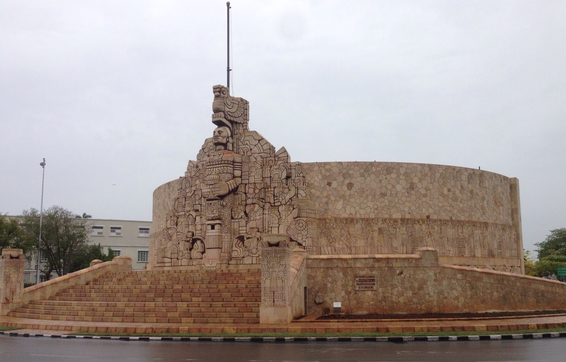
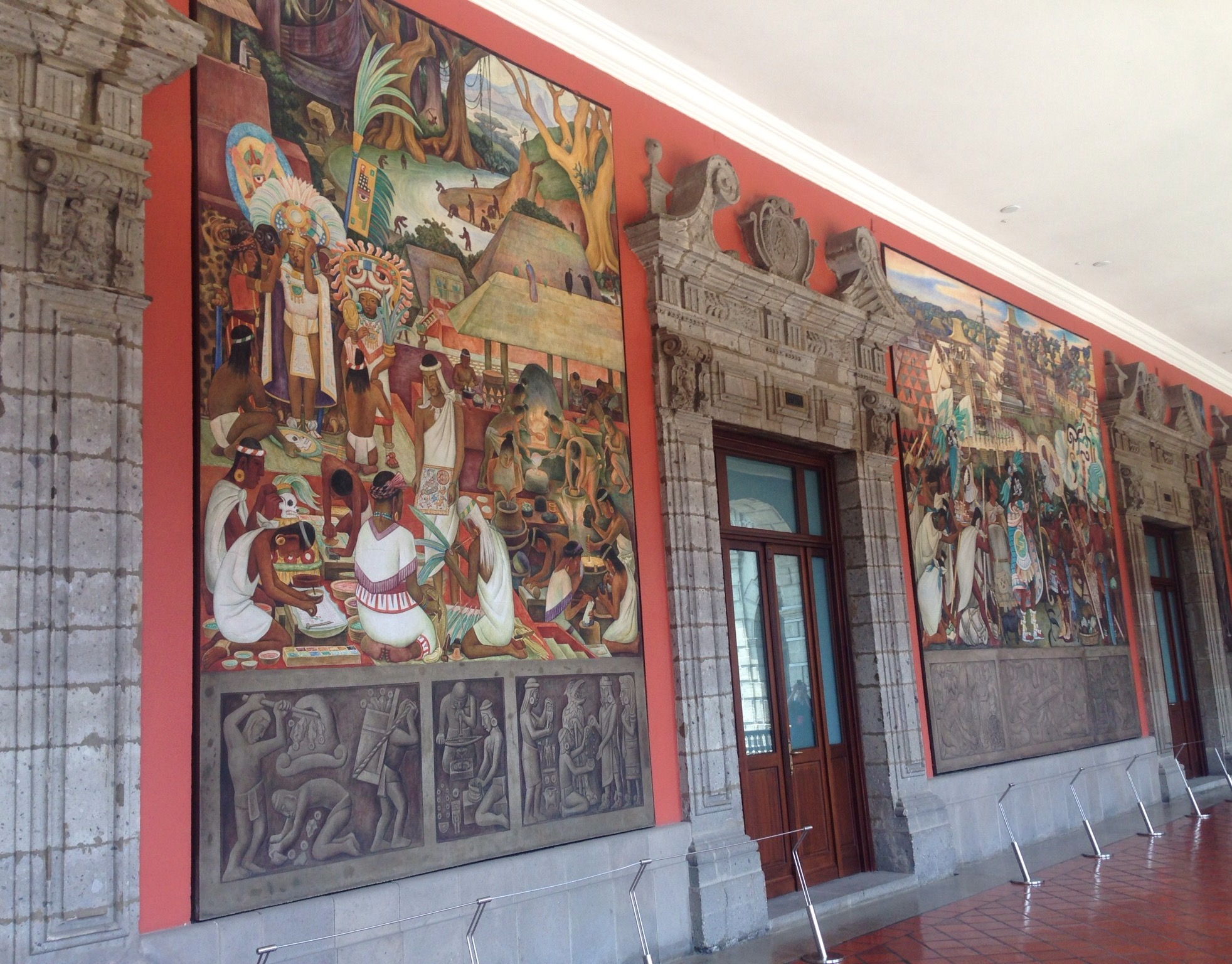
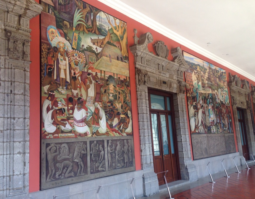
The colorful Mexico sign at the airportThe top floor of our hotel — the Fortran ReformaA view of the Paseo de Reforma (street on left) from our hotelThe old and the newWe arrived on Sunday — or Bike Sunday as it is known in the big city — cars give way to cyclists, runners, and pedestrians. Awesome!A group of USA compatriots getting fired up for the big Mexico v USA football (soccer) match in Mexico City that night. It ended in a 1-1 tie which is like a win for the US.The Latin American Tower which use to be the tallest in the city. You can pay to go up for views of the city, but we settled for the free views from our hotel and a Sears store.The beautiful Palace of Belles Arts as seen from the top floor of the Sears store across the street. It has a performance center, art museum, and concert hall. It was also free museum Sunday so along with lots of other people we went into the Palace of Belles Arts to see the Diego Rivera murals that are there but got to take in the Picasso & Rivera exhibition that was there as well. Very, very cool!3 of the Diego Rivera murals in the Palace of Belle ArtsThe National Palace located on Mexico City’s main square (El Zocalo). It has been the site of the ruling class in Mexico since the Aztec empire!The inner courtyard of the National Palace A Diego Rivera mural in the National Palace. It is a replica of the one that he had created for Rockefeller Center in New York but which was destroyed after being determined by the Rockefellers to be too anti-capitalistRuins uncovered on the grounds of the National Palace — there are lots more being unearthed in the cityRuins uncovered on the grounds of the National Palace. There are lots more . . .The Metropolitan Cathedral is the largest cathedral in the Americas and was built between 1573 to 1813 — note the different architectural stylesOn a completely different note — we stumbled upon a pastry shop that had a cake exhibition on the 2nd floor to show the types of cakes that they can make — icing, icing, babyThe ever muti-tasking, and group-traveling Mexicans
We are wrapping up our Chelem house sit today. We will spend a night in Merida before heading to Mexico City for a couple of days before heading back to the States for some house sits there. (More on that later as our plans have changed, but we will hit both coasts and the southwest before heading to our nephew’s wedding in Illinois in early September.)
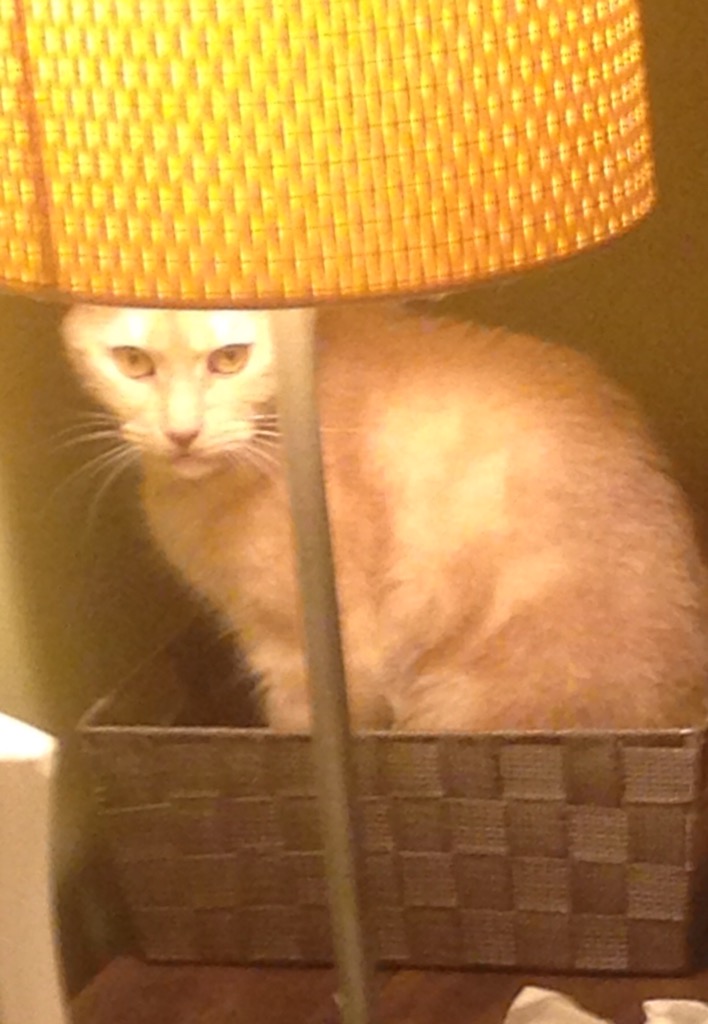
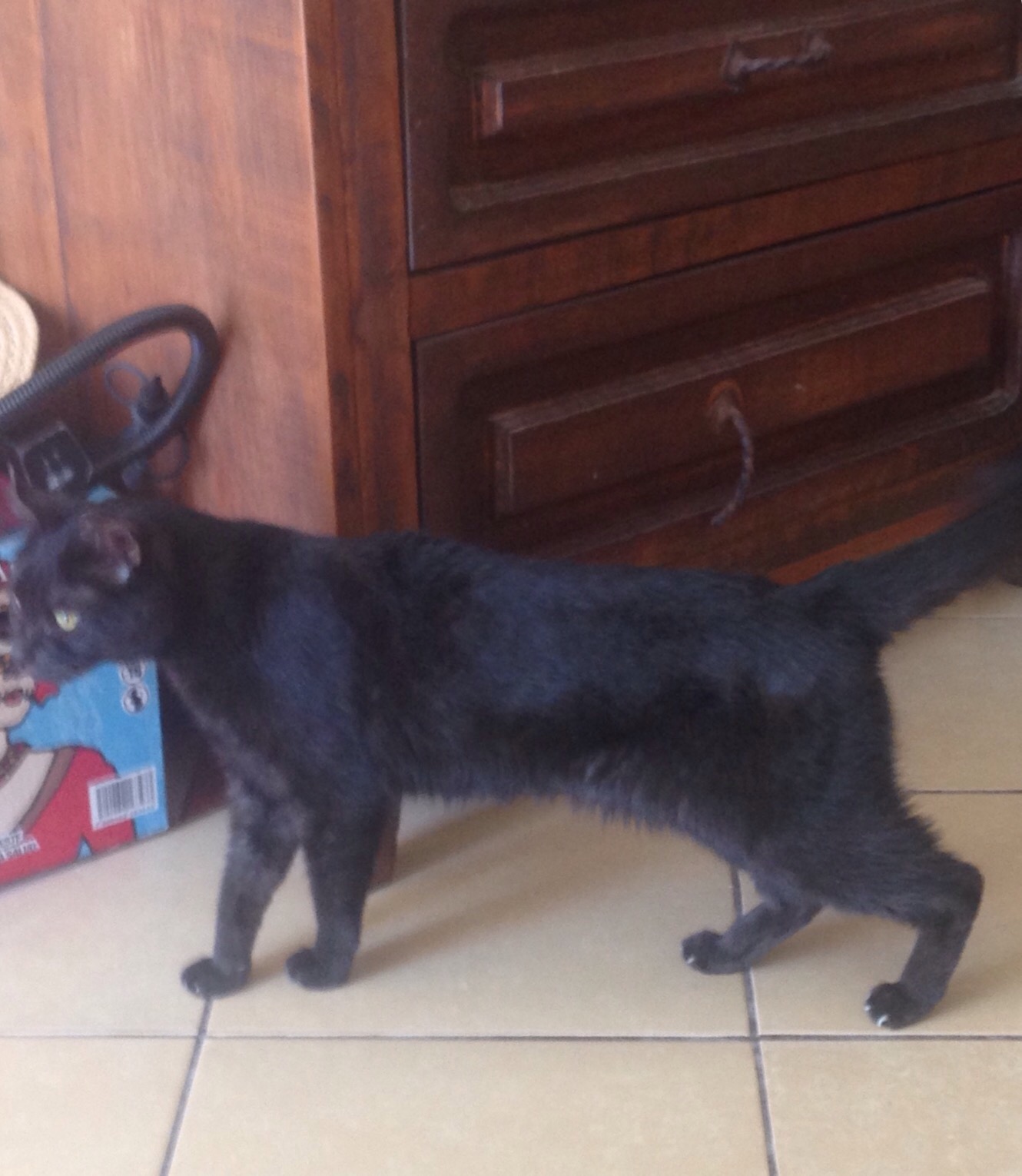
Today we will have to say good-bye to two of the cutest cats ever. Purrcy, the male, is gregarious, curious and loving. He is with us in the house wherever we are either to watch, cuddle, lick our water bottles or glasses (he likes cold!), or take our seats when we get up. He has also slept with us every night.
Cute sleep poseCleaning time!Getting comfy in a basket on the nightstand
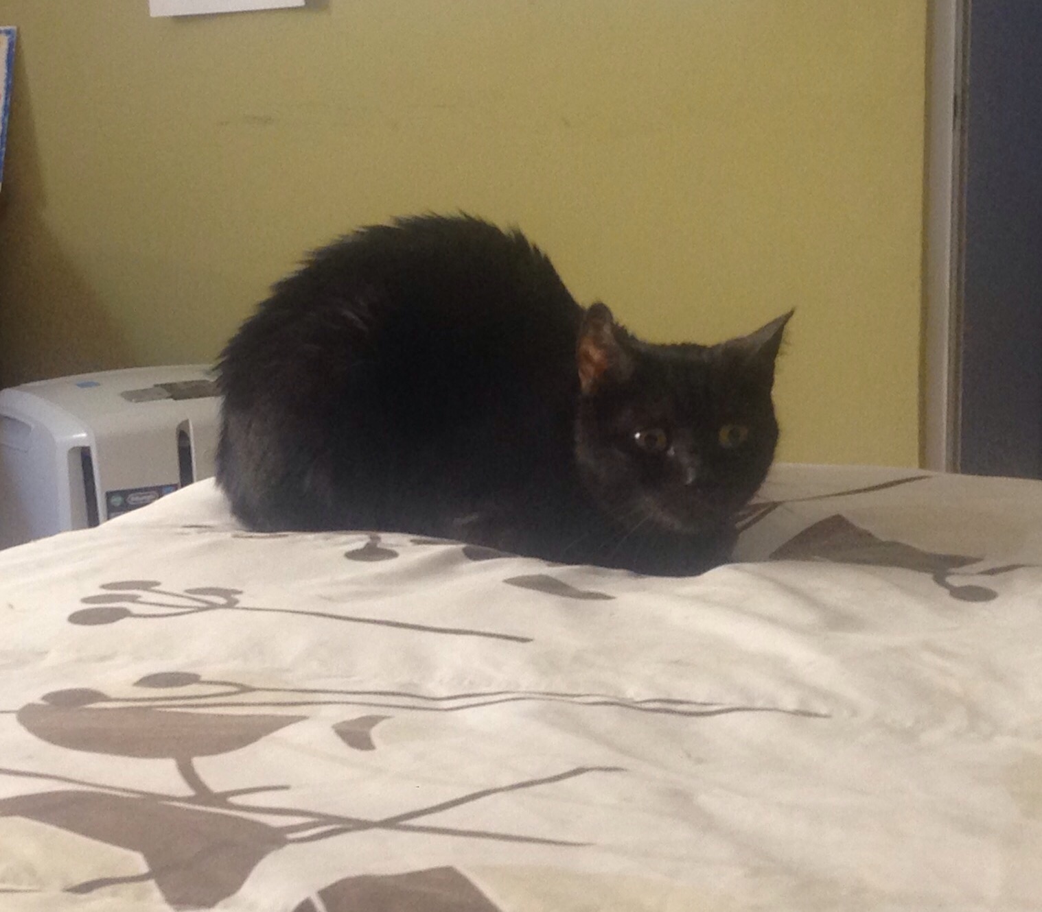
Squeak is a bit more selective with her affections. She kept mostly to the 2nd bedroom, “her” room, but occasionally comes out to see what’s up, maybe let us pet her a bit, before heading back. However, the last few days, she has come out more — even getting up on the bed with us for a few minutes while Purrcy was there. I have also been granted some cuddle time with her which is awesome cuz she does this cute reach thing with her paw for your attention. However, she always heard Bob when he would try to get a photo so no evidence this go round.
The ever-on-alert SqueakOn the prowlHer normal “post” in her room
We never did venture too far afield, but we had a great meal out in Progreso and returned to Merida for a hair appointment for me. Mostly we’ve hit doc appointments in Progreso, wandered into Chelem, or hung by the pool.
For our night out in Progreso, we tried an Uber ride which worked well. We had a patch of wet weather last week, as you’ll see from the window of our restaurant.
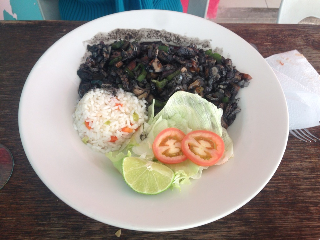
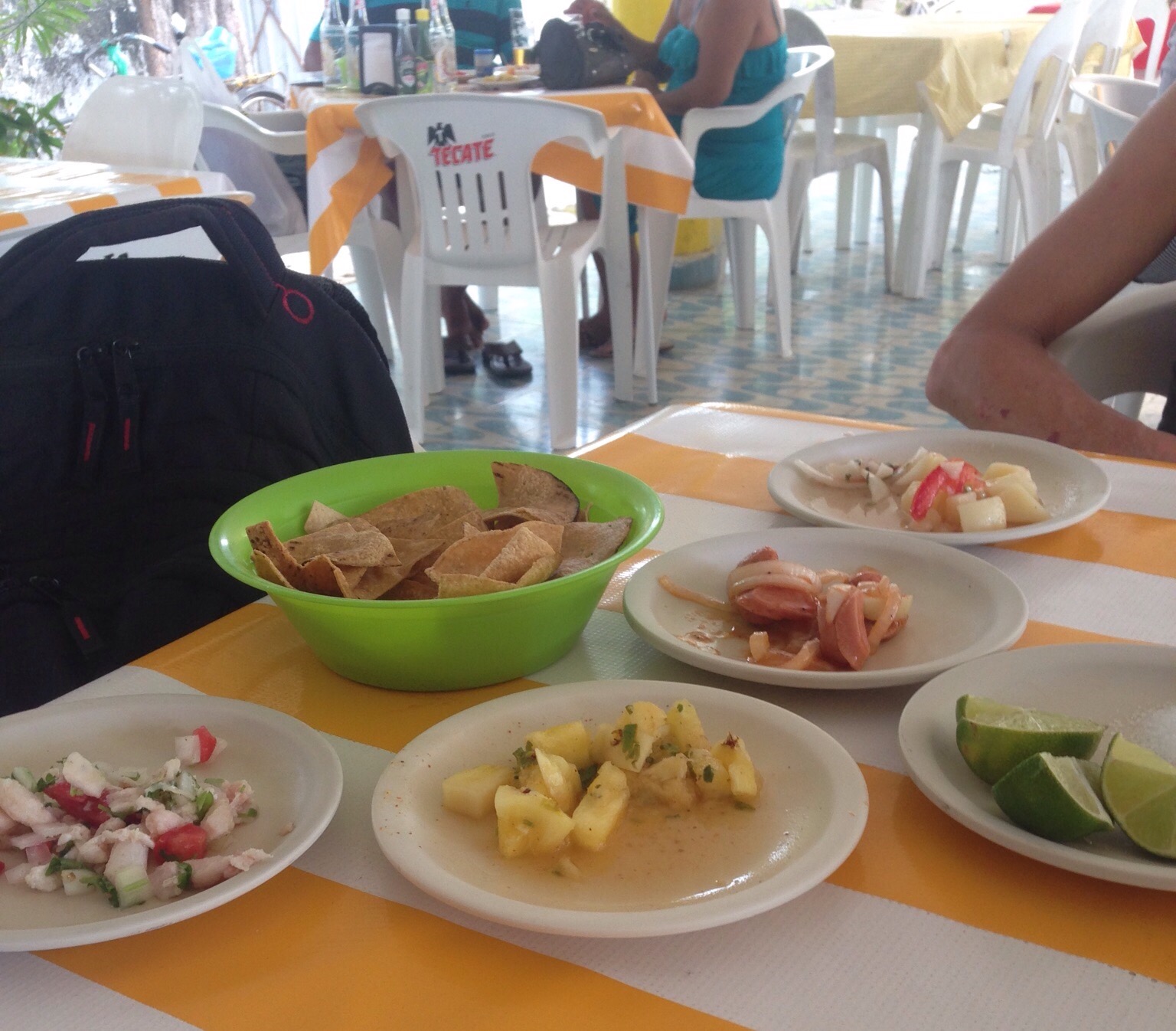
The Lena y Mar Restaurant — we split a great octopus ceviche and then an anchovy pizza
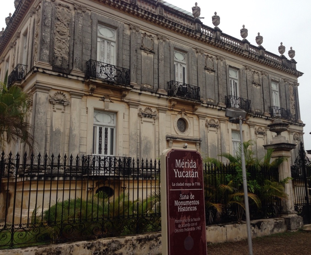
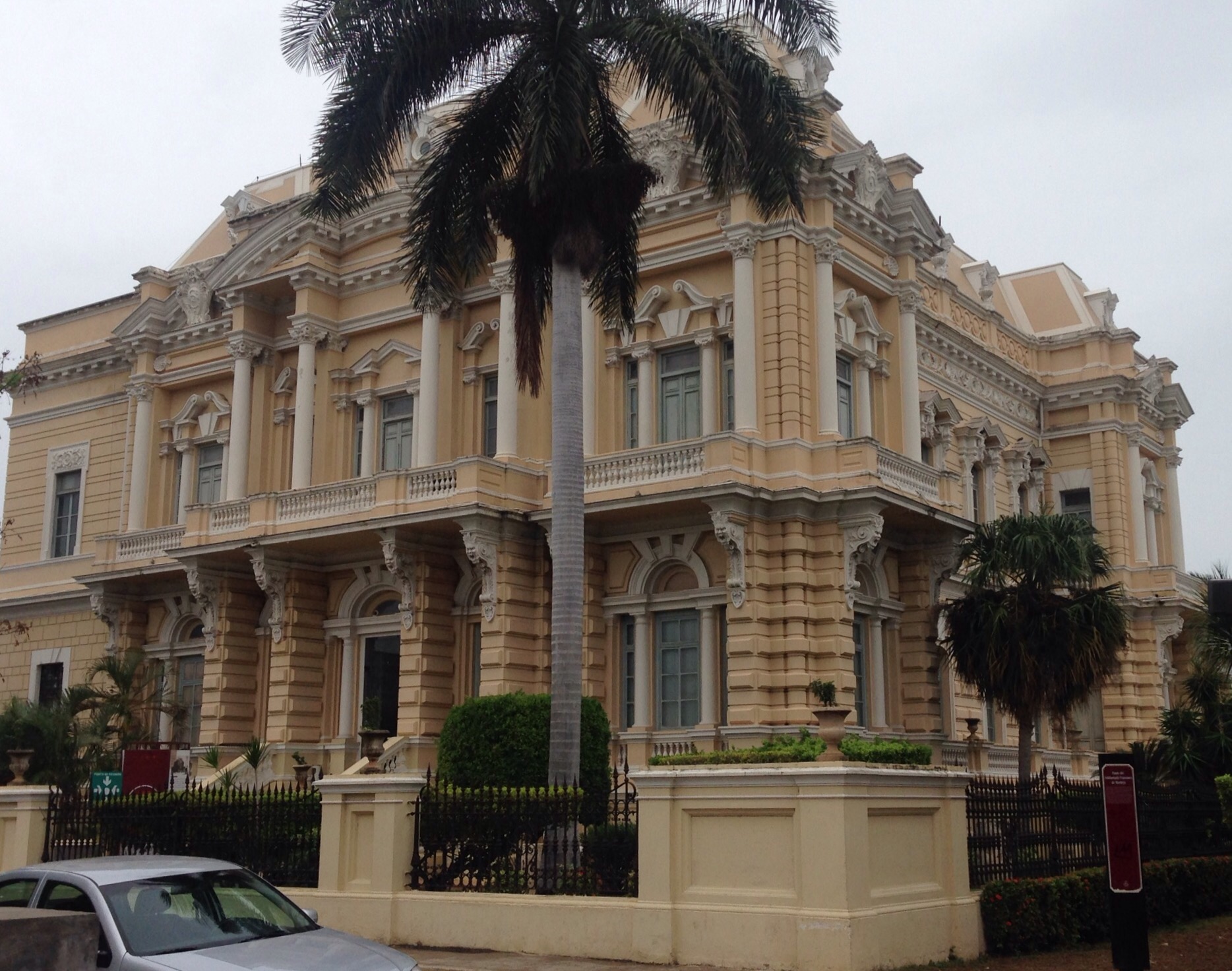
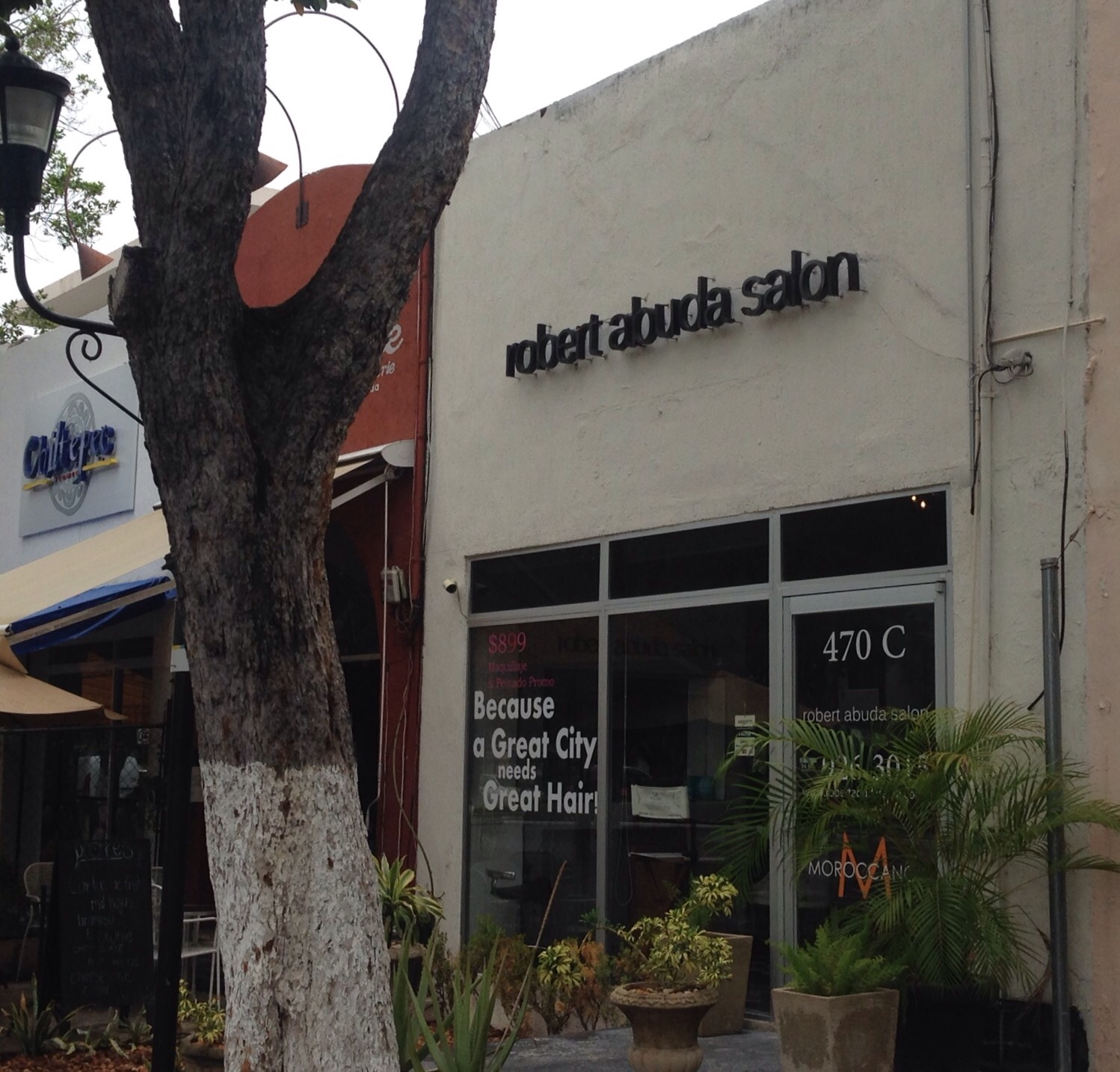
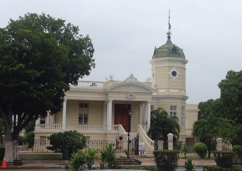
We got to see a little different area of Merida for my hair appointment — mostly along Calle 60 which took us from the bus station to the Avenida Paseo Montejo where the salon was located. The Paseo Montejo is a lovely, broad avenue which is lined with lovely home so/buildings as well as monuments at either end and along the meridian.
An old hotel in Merida that is being renovatedA cute park along the walk with oversize Yucatan (our term) seatsLooking down the Paseo MontejoThe start of the historic zone along the PasejoOne of the historic homes along the PasejoThe salon that was recommended to me. I would also recommend it!Another beautiful building along the PaseoMonument to the Homeland at one end of the PaseoThe hotel in Merida where we will spend the night
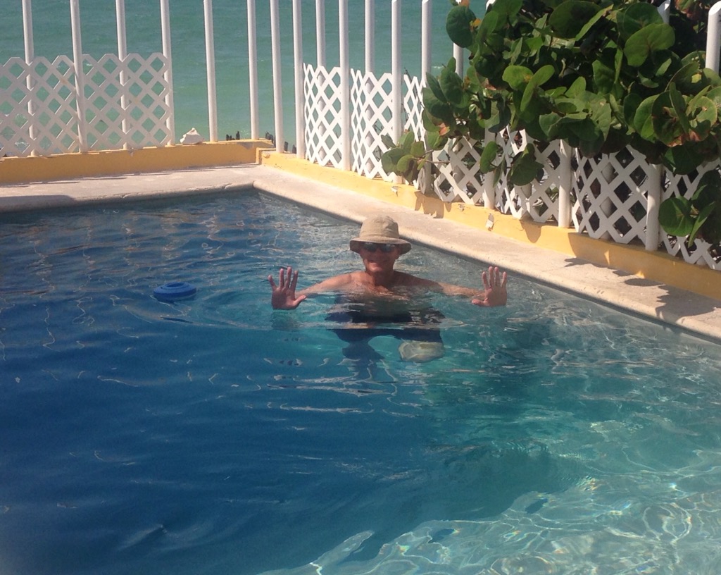
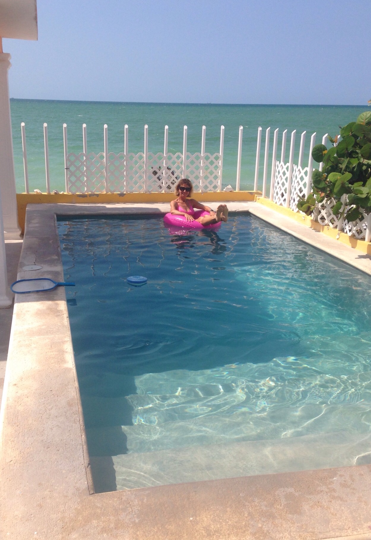
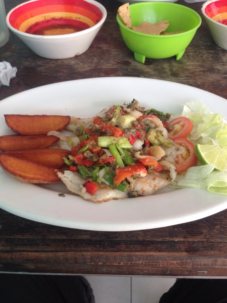
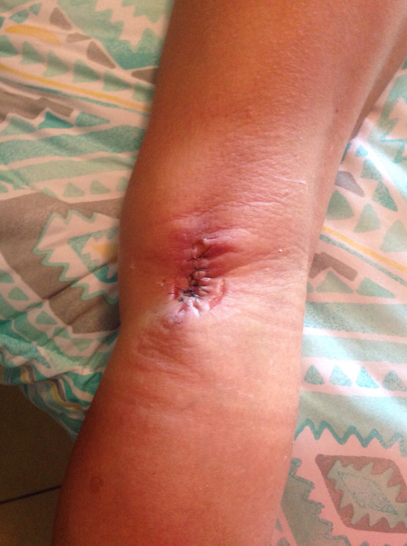
While it has been a less active than usual house sit, we have enjoyed our stay. The house and pool made it feel like we were suppose to be on vacation, and all of the locals we met were very nice.Bob taking his daily dipUsing the floaty to help keep my leg from getting too wetLast meal at La Playa — chef’s grilled filet specialOctopus in its inkIn the last installment of Beth’s Dog Bite saga, I had my stitches removed on Wednesday. While the wound doesn’t look pretty yet, it looks much better. I have been impressed with the kindness and attention to a foreigner. Everything has been easy to access and stress-free. I don’t know that this would have been the case for me in the US, and I’m sure that it would not be the case for a foreign visitor. I hope I’m wrong.
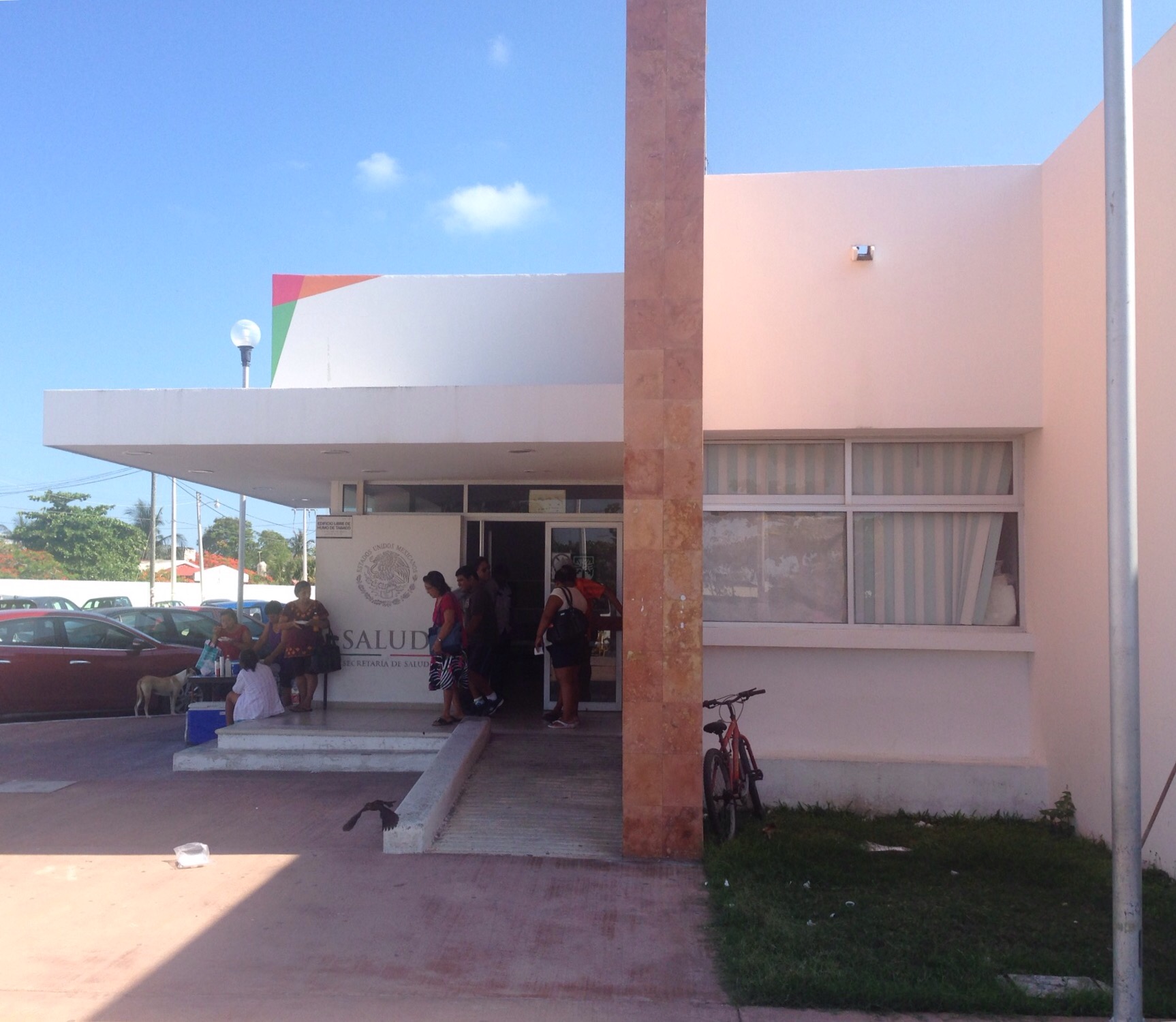
The health center in Progreso where the doctor cared for the wound, including the stitchesThe public health clinic where I received the rabies shotsAll sewn up
In terms of our usual activity level, Bob and I have been pretty “chill” here in Mexico. We have gotten out a few times in Chelem and have continued to visit Progreso regularly, usually in association with doc appointments related to my dog bite. More on all of that a bit later.
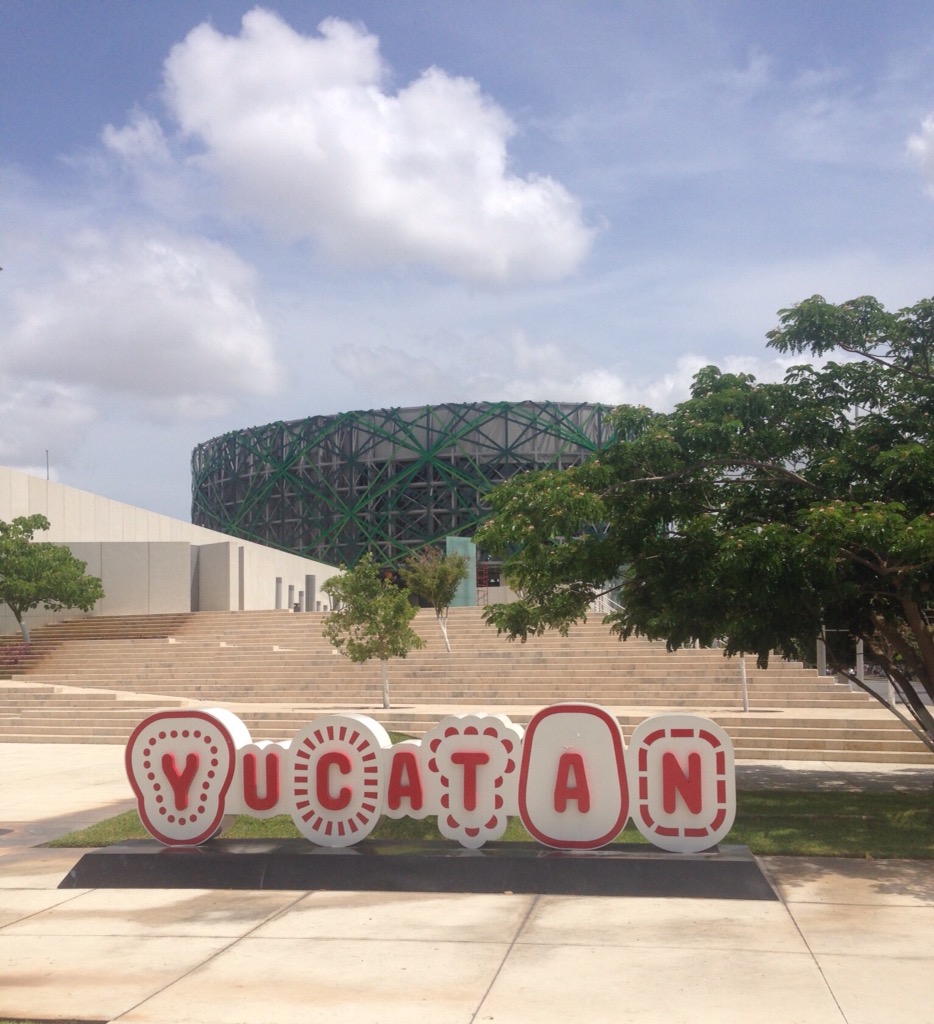
Our big trip to date was back into Merida to visit the Gran Museo del Mundo Maya. To get to Merida, we walked out of the house, down the driveway, and across the street to hail a colectivo to Progreso. Once there, we walked around the corner from the final stop in Progreso to catch a large bus into Merida. We were able to get off the bus right next to the museum which is on the outer edges of Merida. The entire trip (one-way) took a little over an hour and cost about $1.45. Not a bad deal!
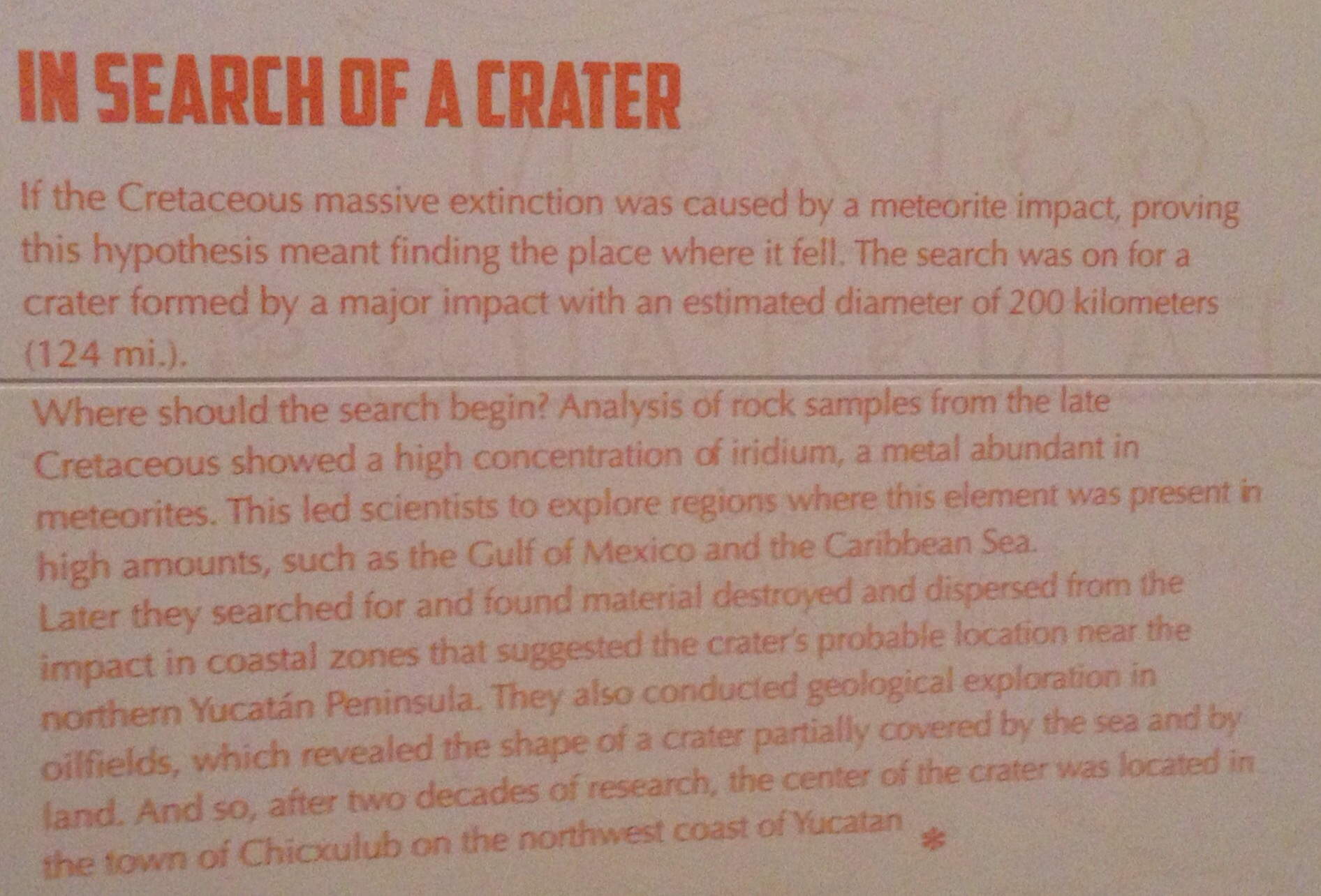
The Mayan Museum is beautiful and interesting. Most of the posted information is in both English and Spanish, with some in Mayan as well. There are films that are shown throughout the day but those are only in Spanish. The museum actually covers prehistoric times in general before focusing on the Mayan history and culture. I am fairly ignorant regarding ancient history, so a lot of the information was new to me including the news that a huge meteor/asteroid had crashed into Mexico, in the Yucatan, significantly changing the world, and its inhabitants, at that time.
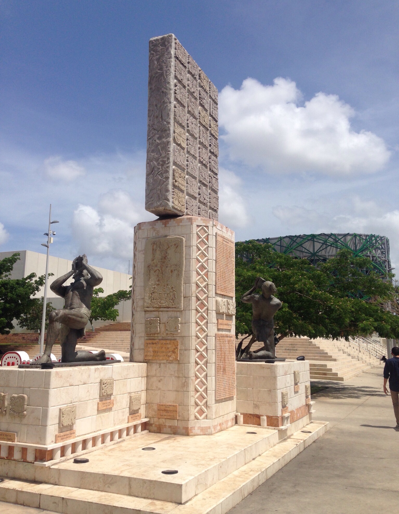
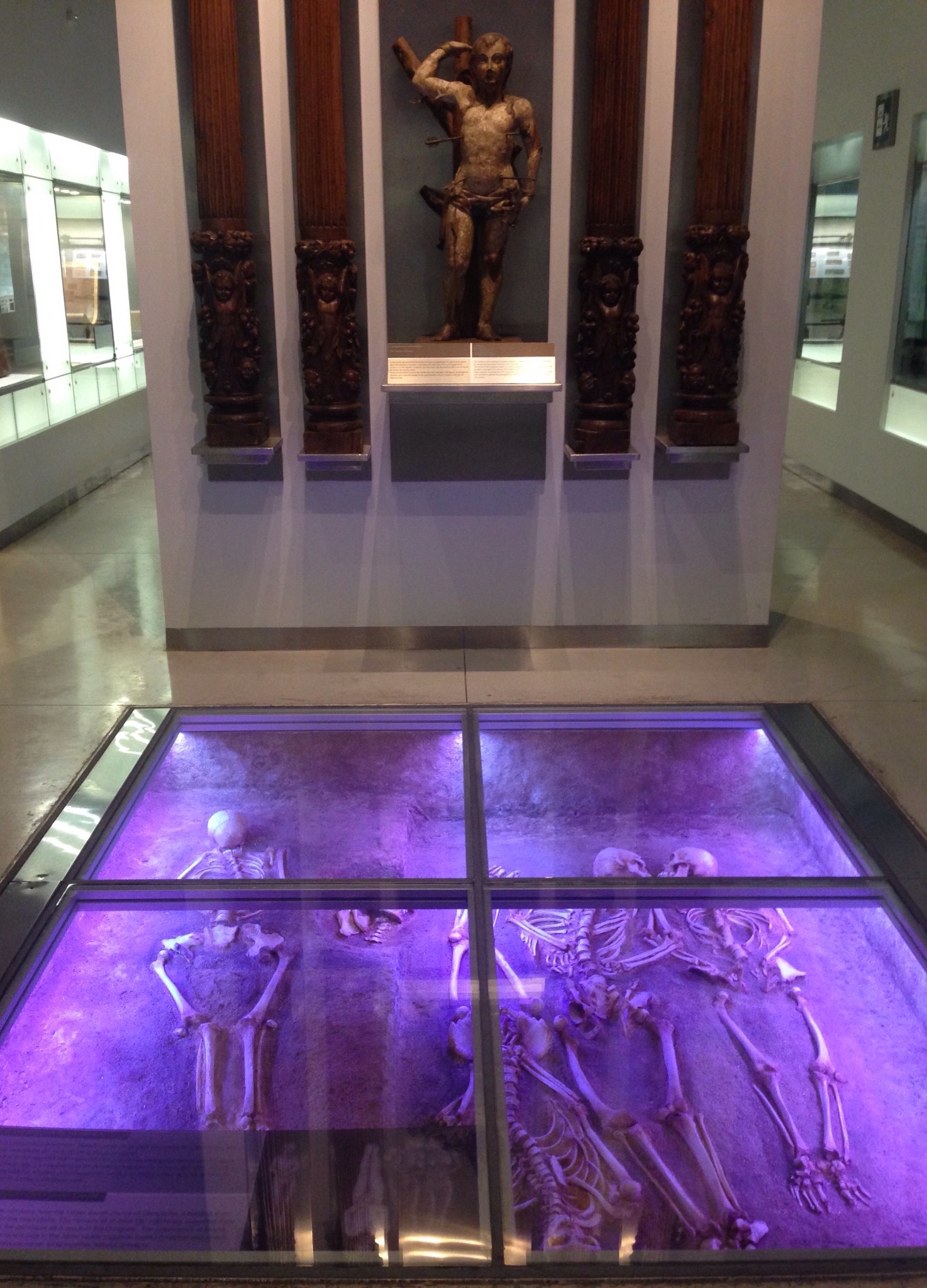
The very modern Mayan museum in MeridaAnother view of the museum and an impressive sculpture out frontInformation on the impact crater that was centered near the town of Chicxulub in the Yucatan. It landed about 66 million years ago and the accepted theory is that this was the cause of a climate disruption that killed off 75% of the earth’s plants and animals.We saw dead people — or at least an example of mass graves that have been found.While the main floor of the museum holds the educational exhibits, the middle floors of the museum have a cafe and a movie theater, and the top floor hosts art exhibitsDown the road from the museum is a large mall, we decided to stop in before heading back to Chelem. The ice rink looked refreshing in the Merida heat which lacks the benefit of the coastal breezes of Progreso or Chelem.
We are headed back to Merida on Saturday for a hair appointment for me. Bob will be doing some exploring while I’m getting worked on.
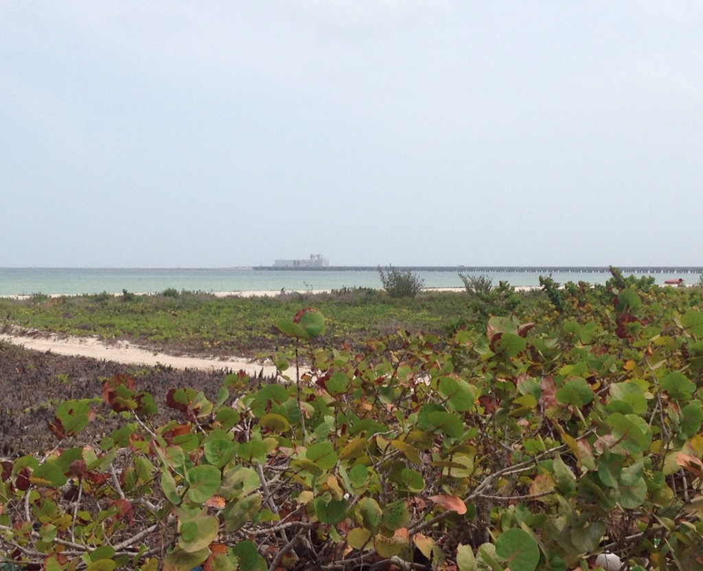
In Chelem, we have often been lazing the afternoons away either inside with the cats or outside by the pool. Bob has become proficient in pool care in terms of filtering, checking the chlorine, etc. He is also in the pool more often, as I have been focused on keeping my wound dry. He enjoys watching the birds dive for fish as well as the various boats go across the water. One day when there seemed to be an inordinate level of boat activity, we learned on the local website that it was likely due to the start of sea cucumber season.
We venture into town, about a 30 minute walk, to visit one of the produce stands, hit the pharmacy, or pop into one of the local restaurants. We have been to El Bullpen twice for their weekly art and wine flight event. Last night along with our $3.50 flights of white wine, we had dinner and I traded in my used English language books for some of theirs (with the approval of the owner). It was awesome! I scored 2 unused, New York Times crossword puzzle books (my favorites) plus a Nathianel Hawthorne novel and a Norman Mailor book. Give me some books and running shoes, and I’m a happy girl (okay middle-aged woman –but the point is I’m happy).
Last Sunday, we had tried to stop into a bar/restaurant called Lizard Joes. Our homeowner had told us about it. It is known for its live music, and is co-owned by Joe King Carrasco, who we have heard of from Austin. Lizard Joes is only open from Thursday through Monday. Unfortunately, they had a sign out on Sunday that they were closed, so we stopped at another restaurant that had been recommended by the homeowners –La Terracita.
We got to La Terracita just in time, as it rained pretty hard for a bit shortly after we got there.We just ordered drinks and were brought all of this. Crazy!
The grilled pineapple with tamarind was pretty good. Tamarind is spicy. It seems to be on everything here — savory or sweet.
As I said, we continue to get into Progreo, mostly in conjunction with doctor visits. the doctor who has treated my injury is Dr. Herrera at the Clinico Medico on the square in Progreso. He speaks English and has treated the wound, wrote the prescriptions for anti-biotics, and stitched up the hole when it wasn’t closing on its own. He sent me to the health center for the rabies shots. The health center is just across the bridge from Chelem (45-50 minutes by foot), so we generally walk to those appointments. We are charged for services at the clinic, but not for those at the health center.
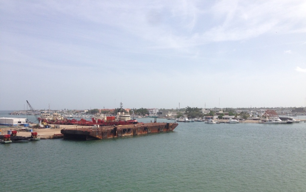
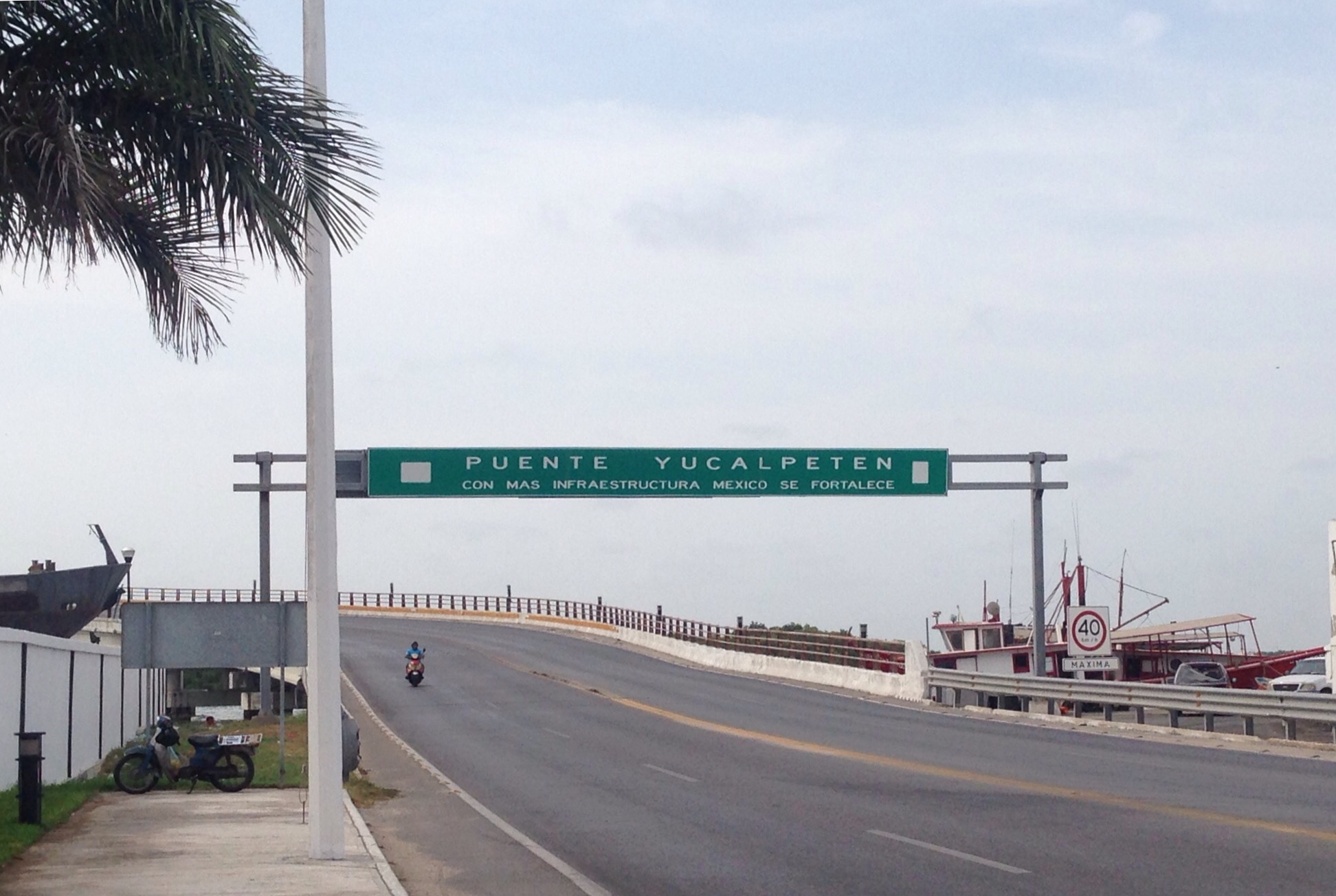
View of the Yucalpeten harbor as we cross the bridge from Chelem to ProgresoWarning: Nasty photos ahead. Turn back now if you aren’t a fan of gore!
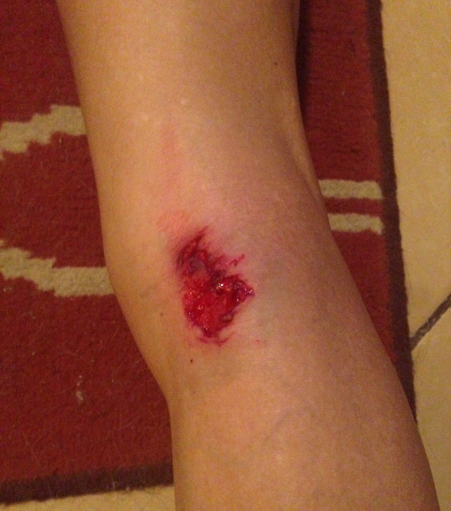
Original injury prior to any doctor visitAll stitched up — not sure which version looks worse/better– but I can clearly see that I have lost my biker calves from our trek across country!There is a lot to be said for dogs whose bark is worse than there bite, but it could have been worse. I could have been hit by an asteroid!
One fun fact that we have learned in our short time in the Yucatan is that the Mayan word for “dog” is “pek” pronounced like our last name. While we are currently cat-sitting, this information is somewhat relevant to our current stay, as I was bitten by one of the many street dogs in Chelem on my second morning out for a run here. While I have flesh to spare, I wasn’t really looking to off-load it from my right calf. I had run on the same road the prior day and had seen two locals running there as well. Apparently, I smelled worse on Sunday. Anyway, not to prolong the sad story too much, we are getting to know the local clinics (the staff of which have been very nice and from whom we learned the aforementioned fun fact), and I am getting to try out some antibiotics and rabies shots. During my initial visit to one of the clinics in Progreso, I was one of 4 dog bite cases that day, so there is a bit of an issue. I find out Monday if they think I need to have stitches. I’ll keep you posted.
As you’ll see below, Bob and I are still getting out and about (otherwise the dog would win!), but it has made it a tad more stressful. We generally make sure we have an umbrella or stick handy just in case.
We chose to go to Progreso for the doctor visits so have been there a few times now. We opted to walk back one day (about 6 miles), but generally we have taken a colectivo– white vans that run between Chelem and Progreso. You can flag them down from the main road at the end of our driveway, and they will drop you off anywhere in Chelem or Progreso along their route. It’s not luxurious (see below), but it is very convenient as they run pretty frequently for the better part of the day. It costs 9 pesos (roughly 50 cents) a person each way.
Looking at the passenger row ahead of us as well as the driver’s row. The van holds between 10-15 people.
More photos of Progreso —
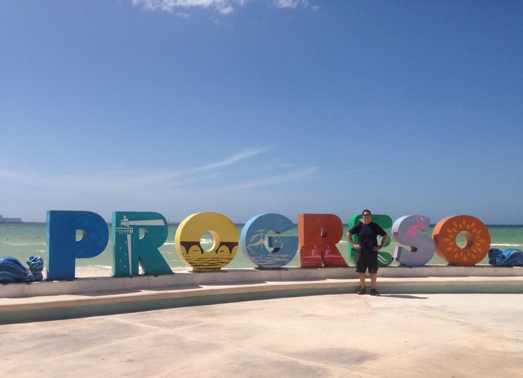
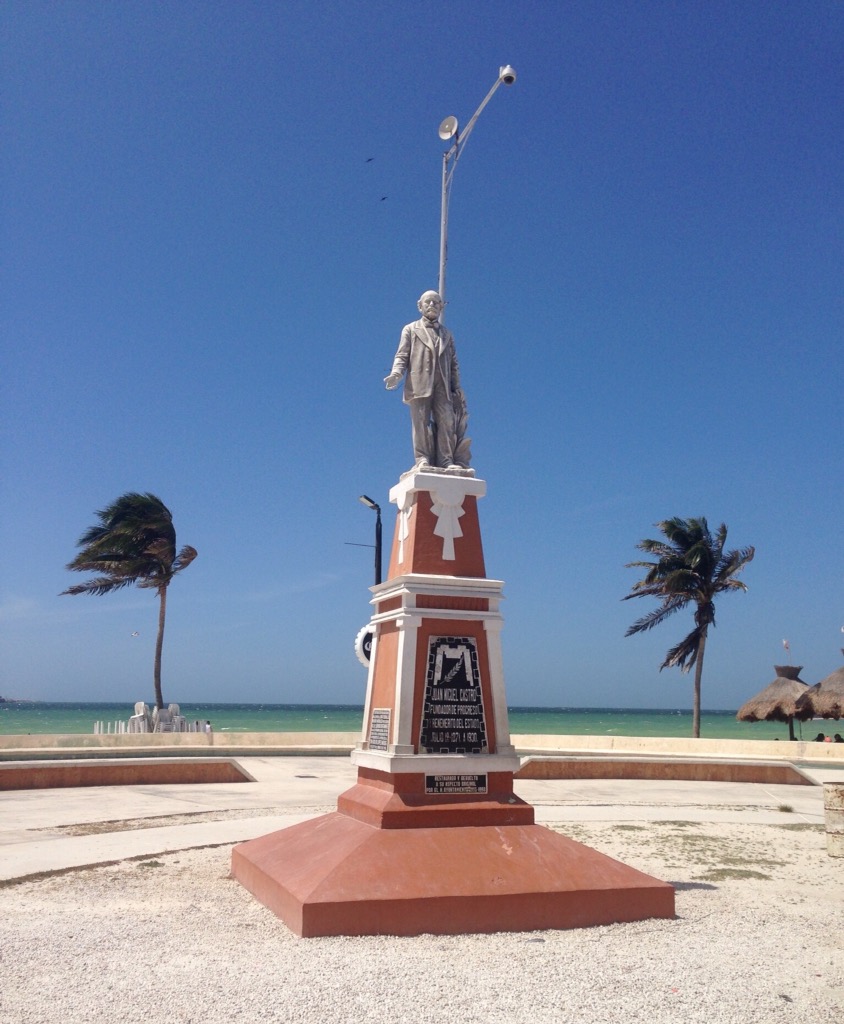
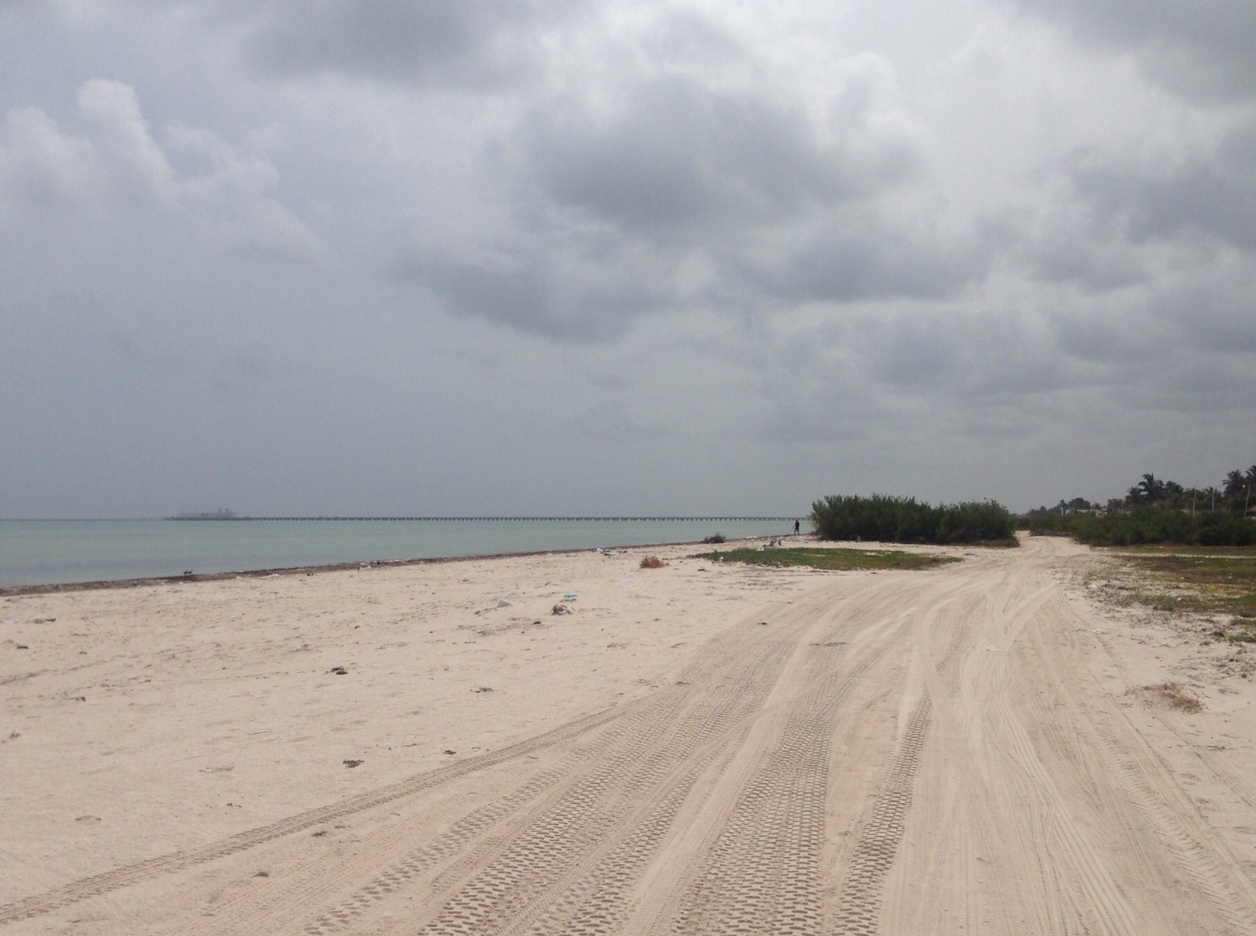
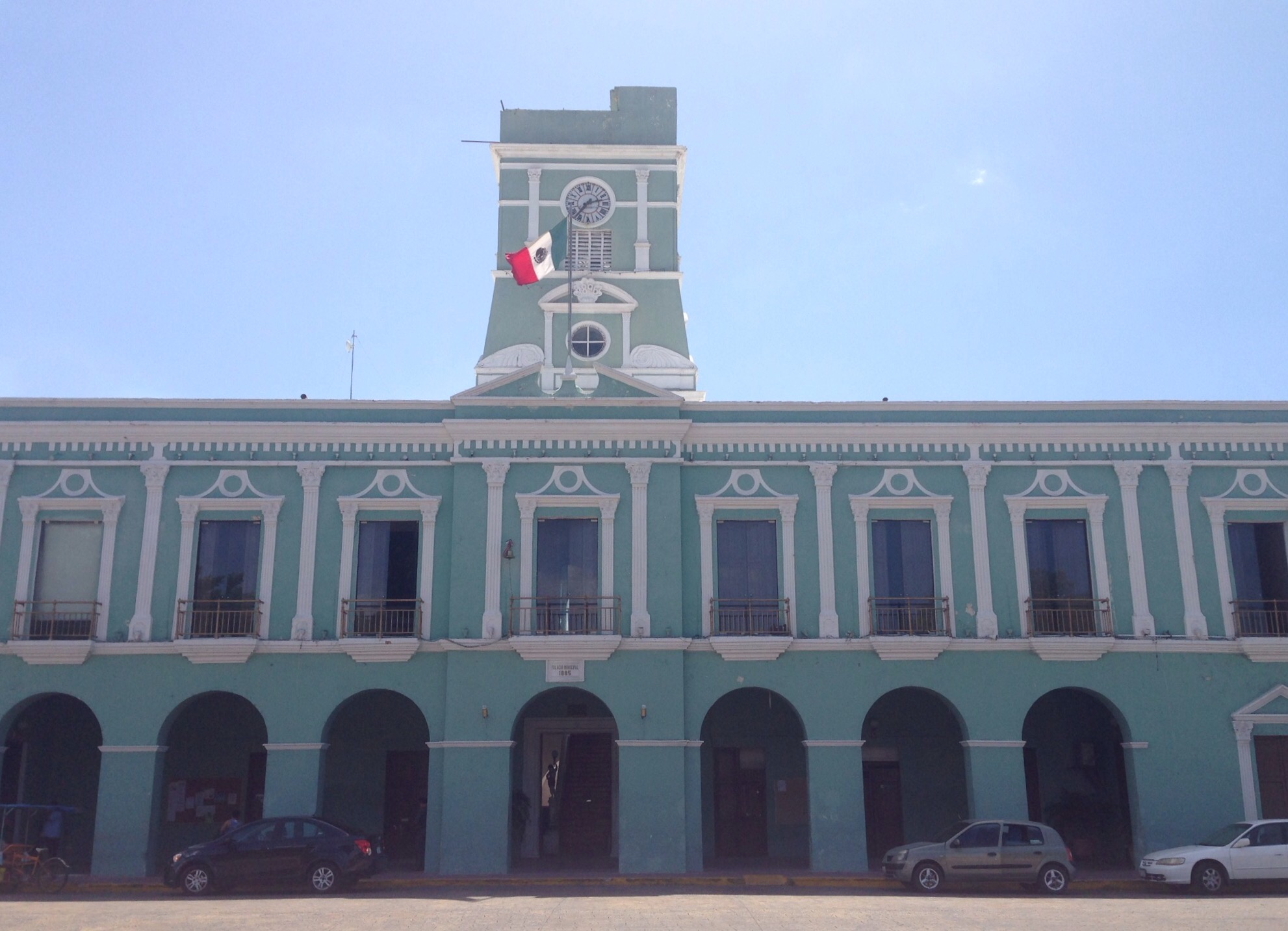
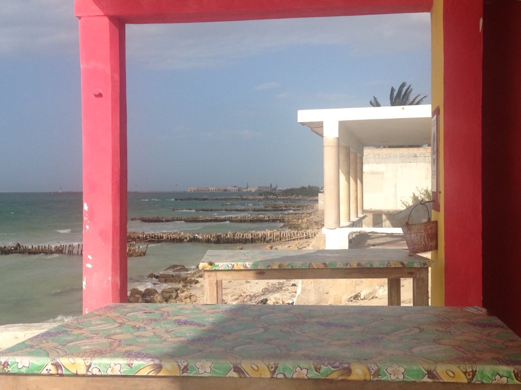
Bob in front of the Progreso sign at one end of their Boardwalk.A statue along the boardwalkLooking down the beach on the east side of the pier where many of the popular restaurants areThe Progreso beach on the west side of the pierA couple of nice properties along the west side beach Looking across the beach to the pierThe municipal building in front of the Plaza de Independencia in ProgresoStarting across the bridge on the day we walked back to ChelemLater on the day (yesterday) when we walked back to Chelem, we walked to a local restaurant that was having an art show and wine event. Over our $3.50 flights of white wine, we got to talking with the co-owner of the restaurant (a US native from South Dakota via Colorado). She noted that had seen us walking into Chelem earlier that day.
Photos of Chelem —
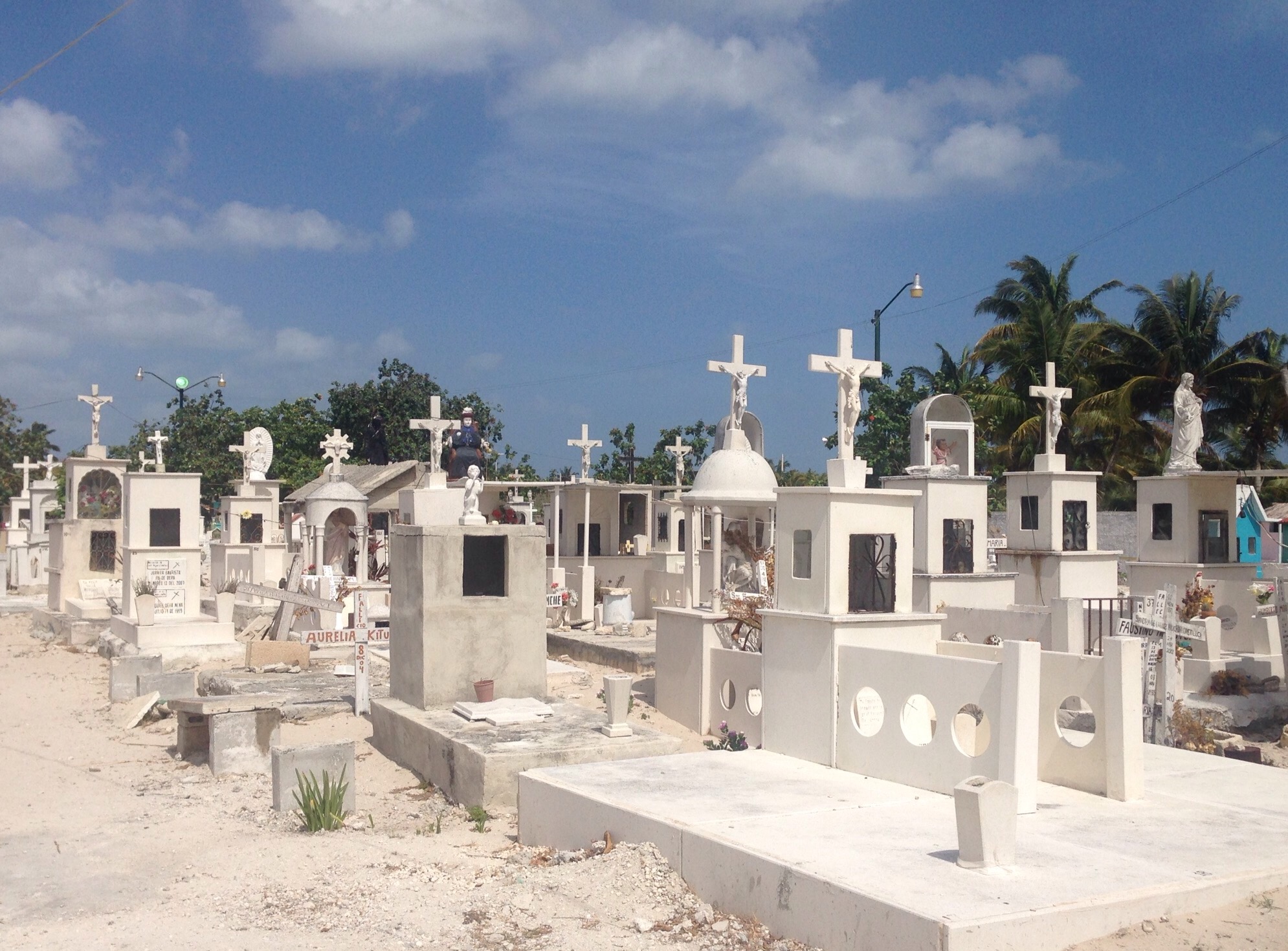
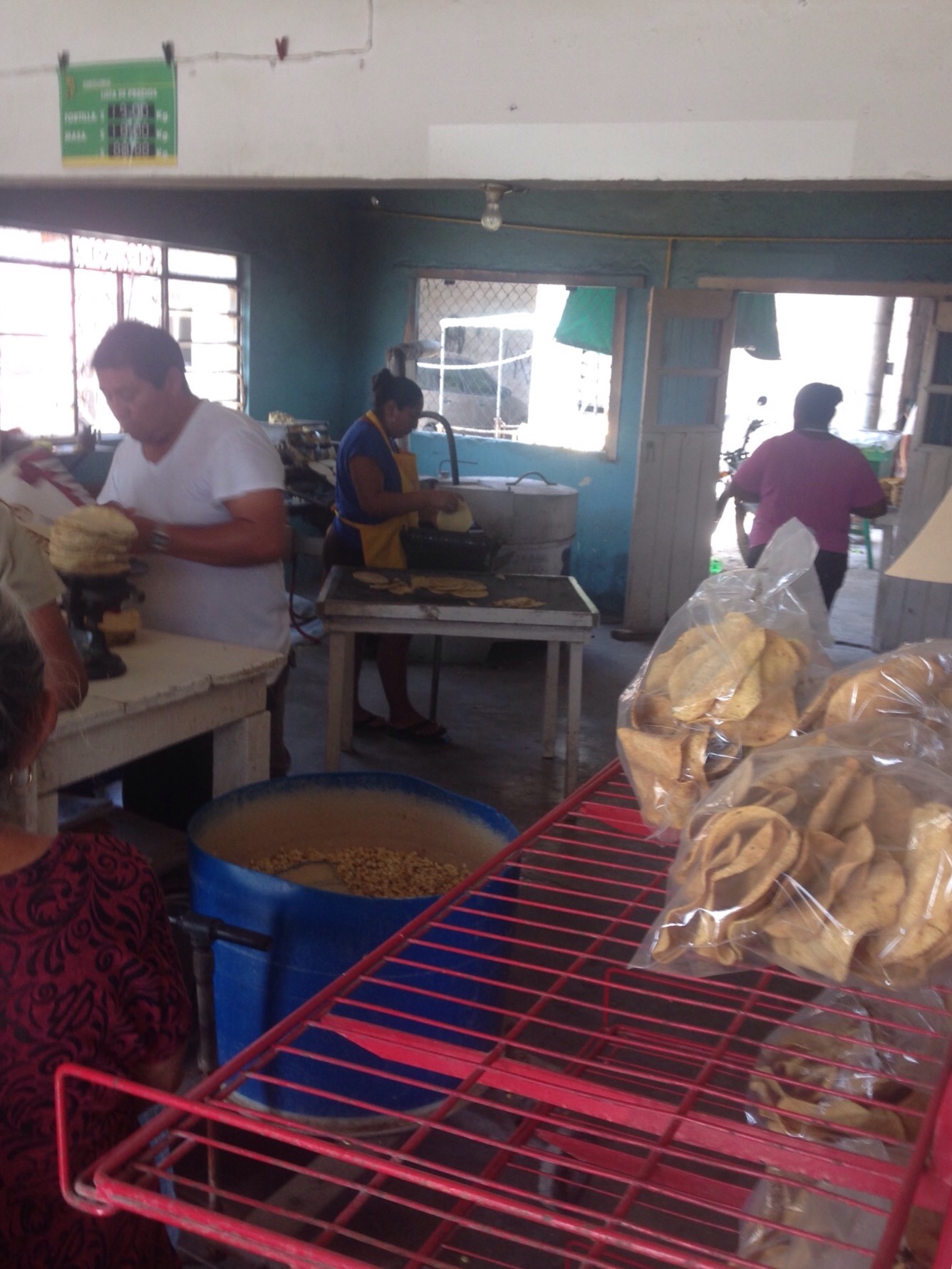
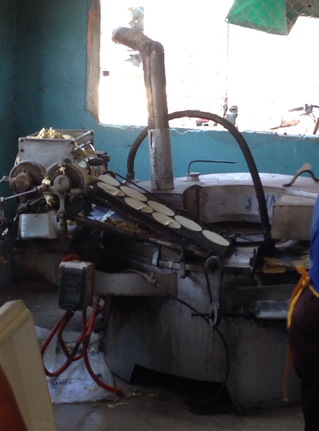
The Chelem beach/coastline as viewed from the patio of the La Playa bar/restaurant just up the street from usA sign outside the Sliders bar (that we haven’t been to yet), the advertised price comes out to about $1/beer.The cemetery in ChelemInside one of the local tortillerias, they were cranking them out as the electricity had been off throughout the area that day and had just come back on..Corn tortillas hot off the grill. we bought a 1/2 kilo of them ( a stack of maybe 25 or so) for about 50 cents.
A couple of the local “habitat” —
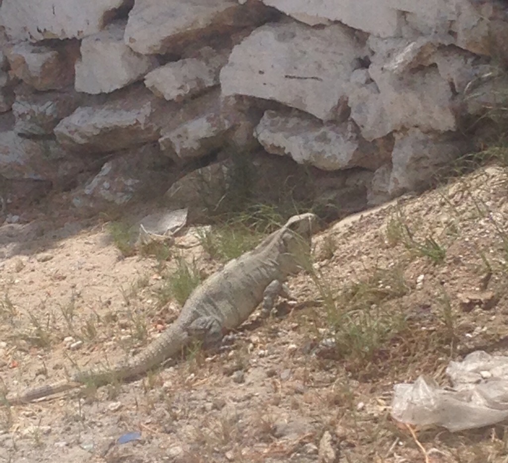
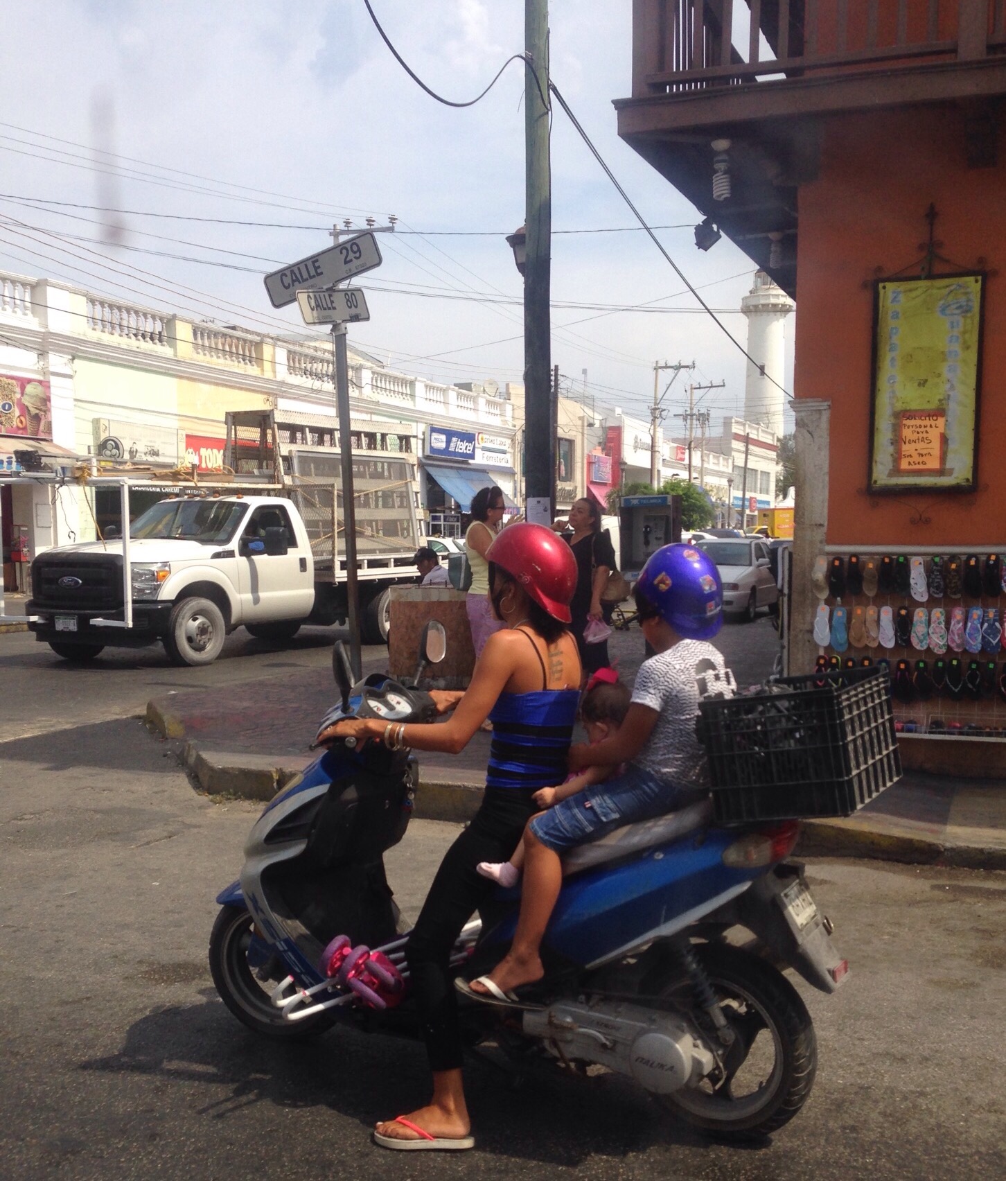
We are in lizard country. They try to hide with their well-camouflaged skin but there movement gives them away.While we like the smaller modes of transportation (bikes, bike carts, motors,etc), this takes some getting use to.


