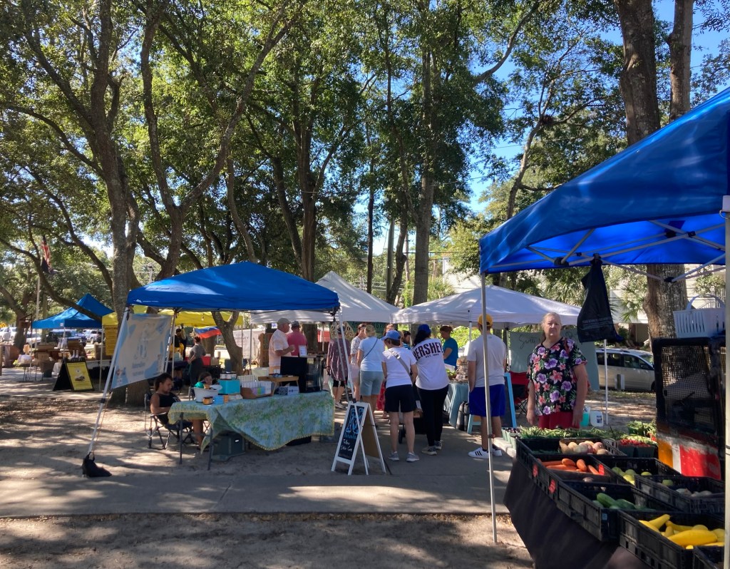
Bob and I had stopped at a Visitors Center on our way to our housesit and picked up some information on the area. Some of this included local events like farmers markets, art shows, etc. Today, we drove 6 miles to the community of Surfside Beach for their weekly Farmers Market.
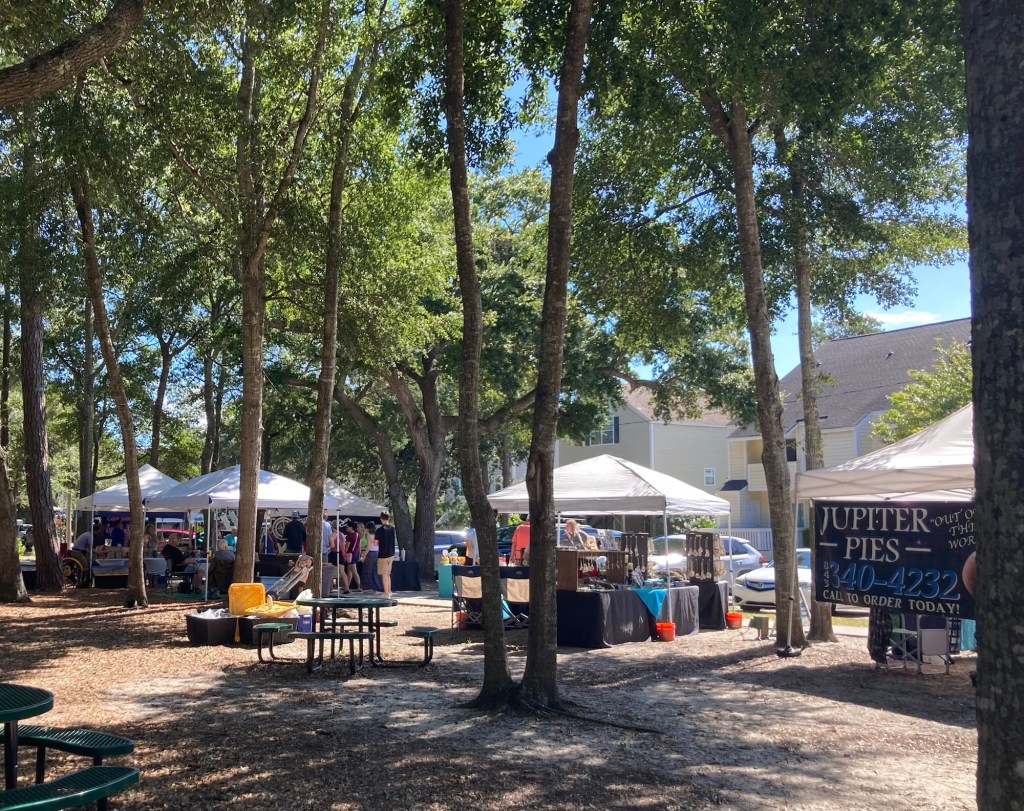
The Farmers Market was relatively small, maybe about 20 booths, but it offered a range of items from produce to baked goods, prepared food and coffee, as well as crafted decor and jewelry.
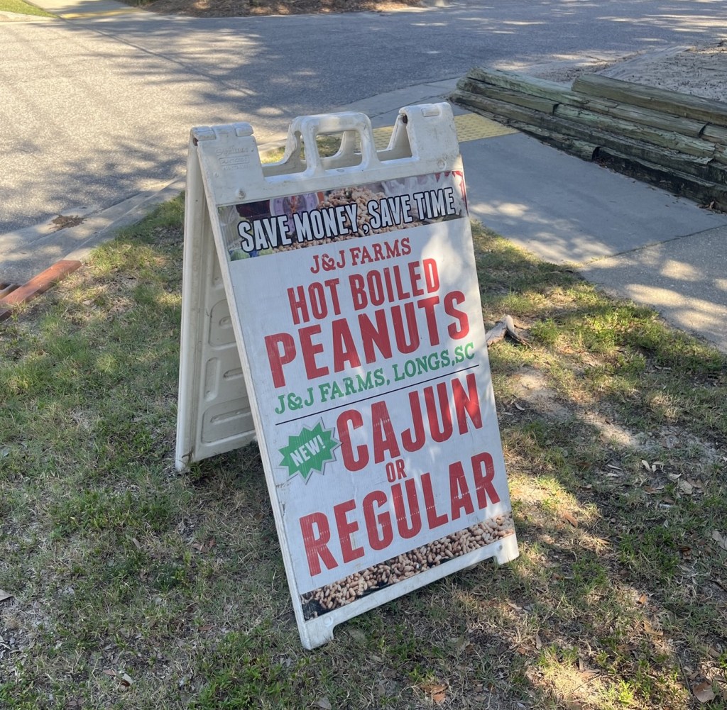
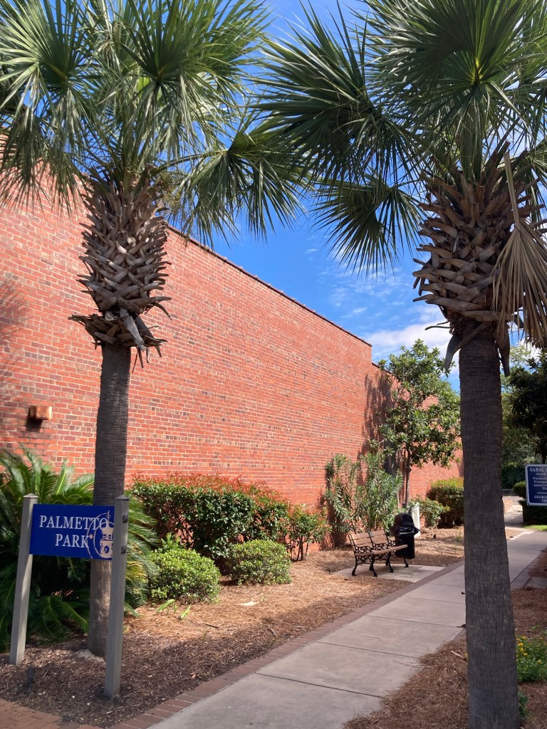
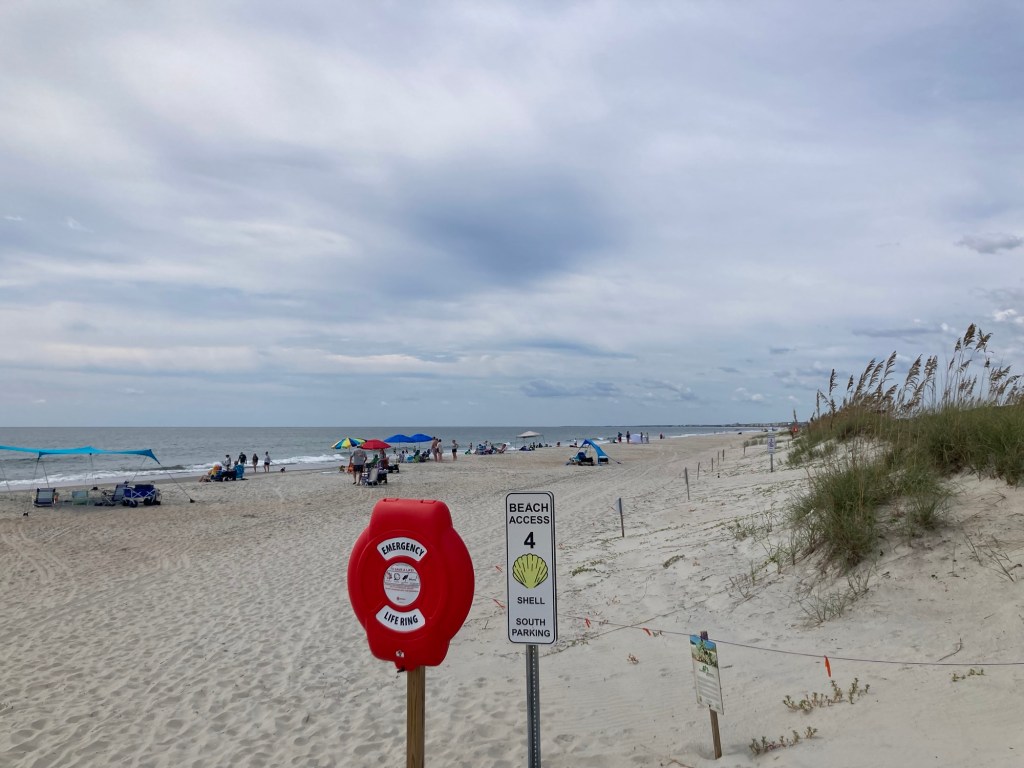
You don’t go anywhere here without seeing signs for boiled peanuts.The market is held in a park across from the library.
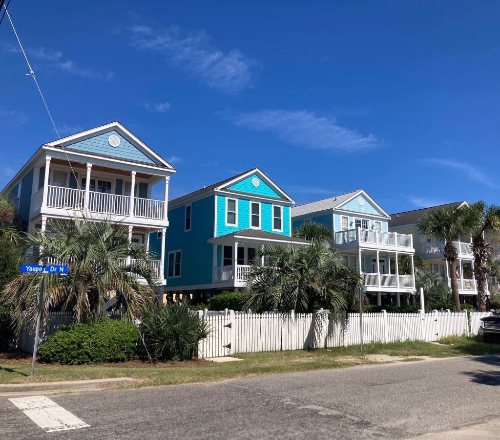
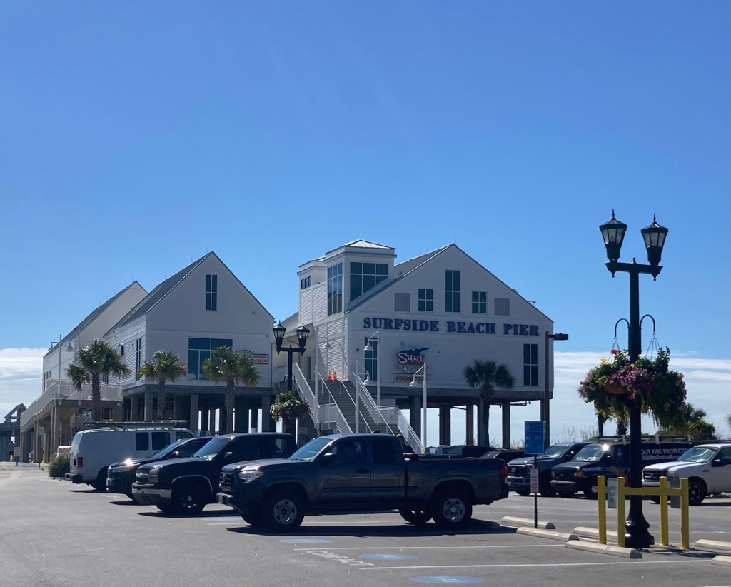
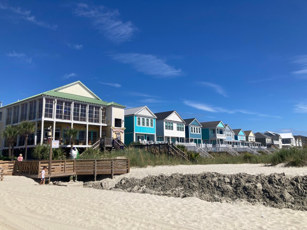
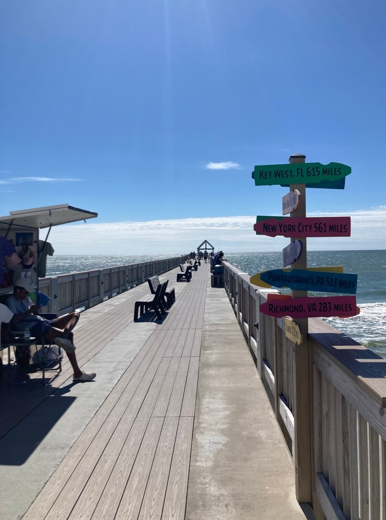
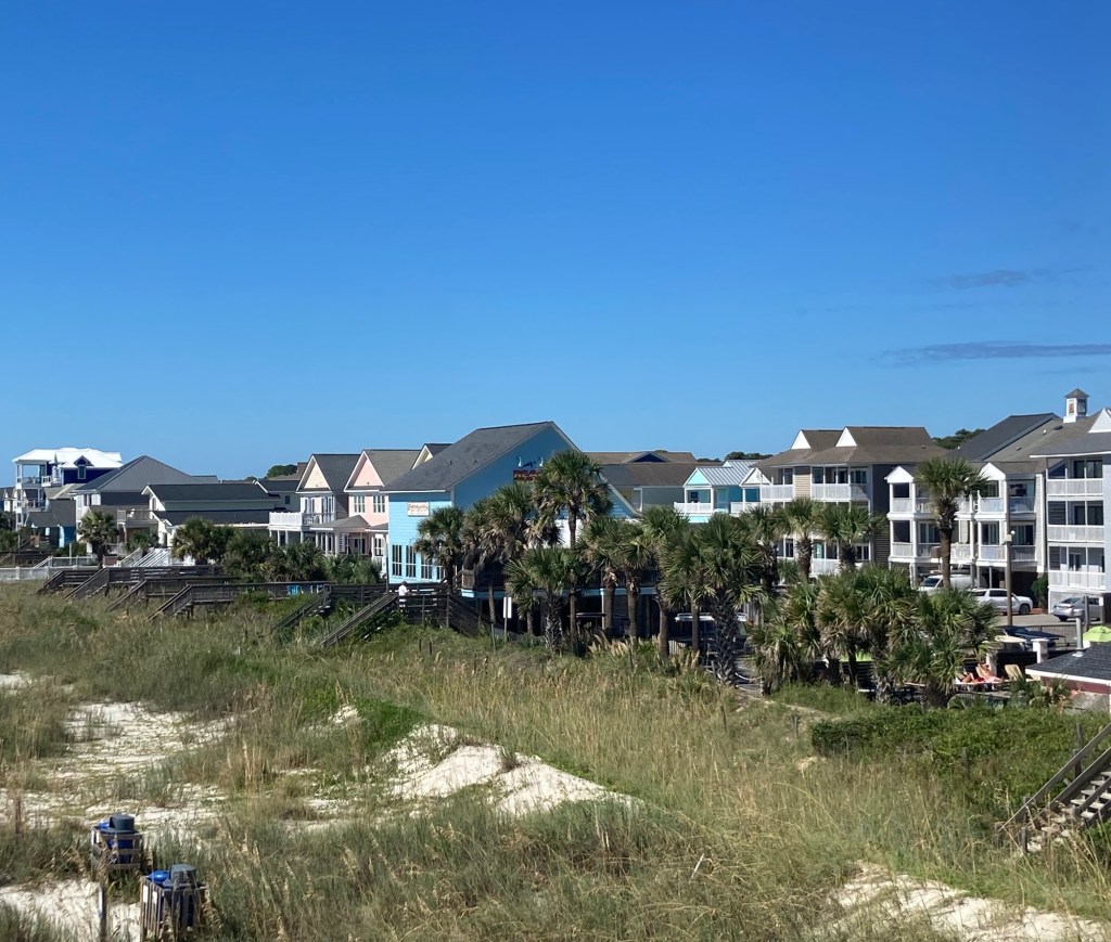
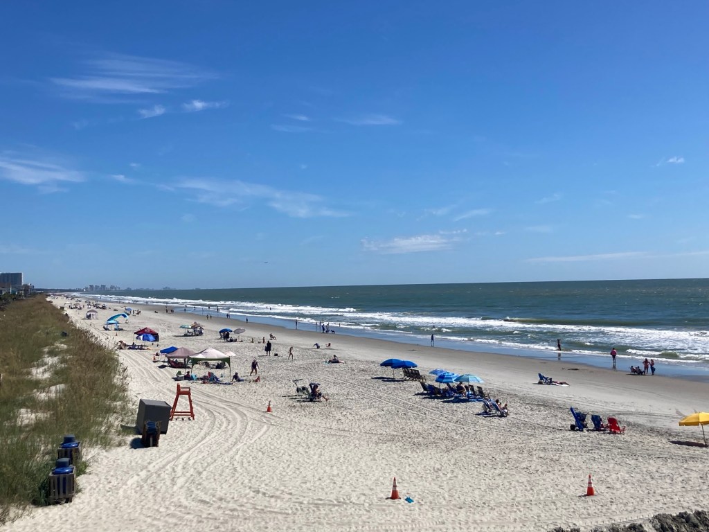
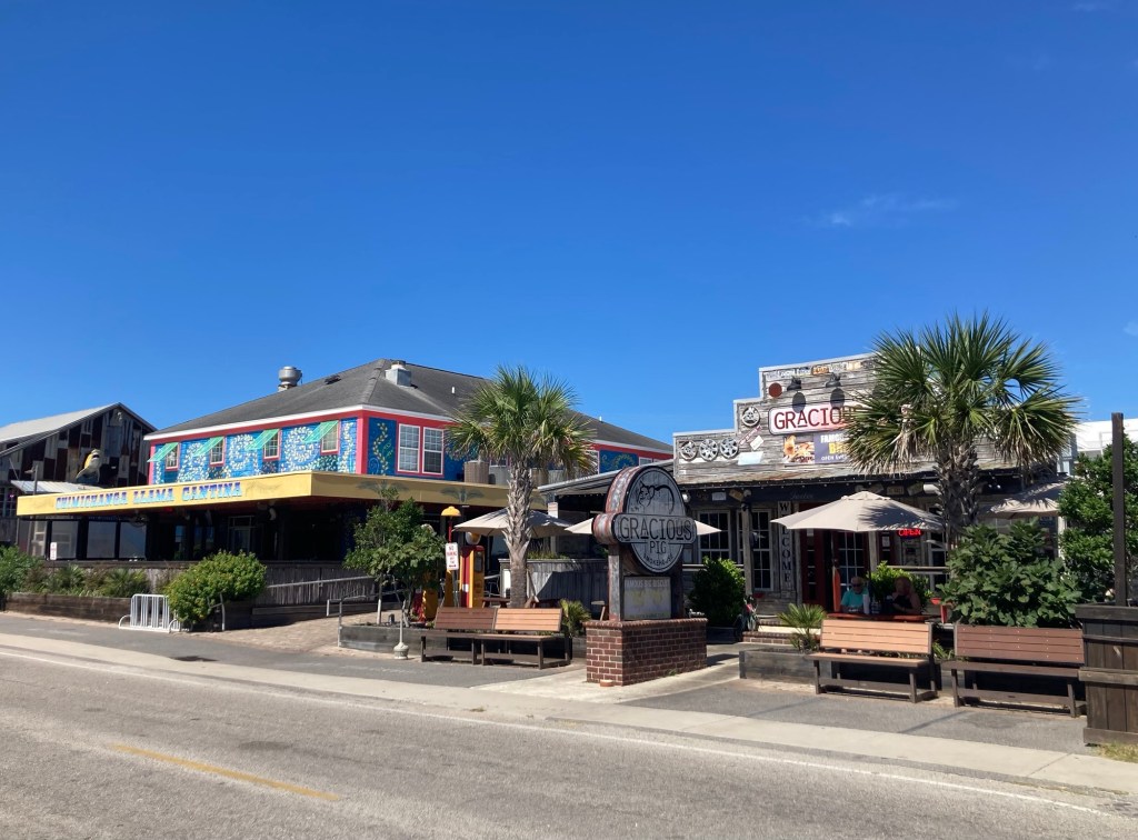
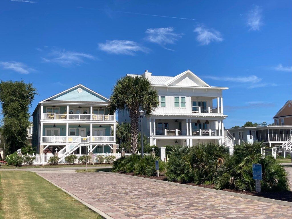
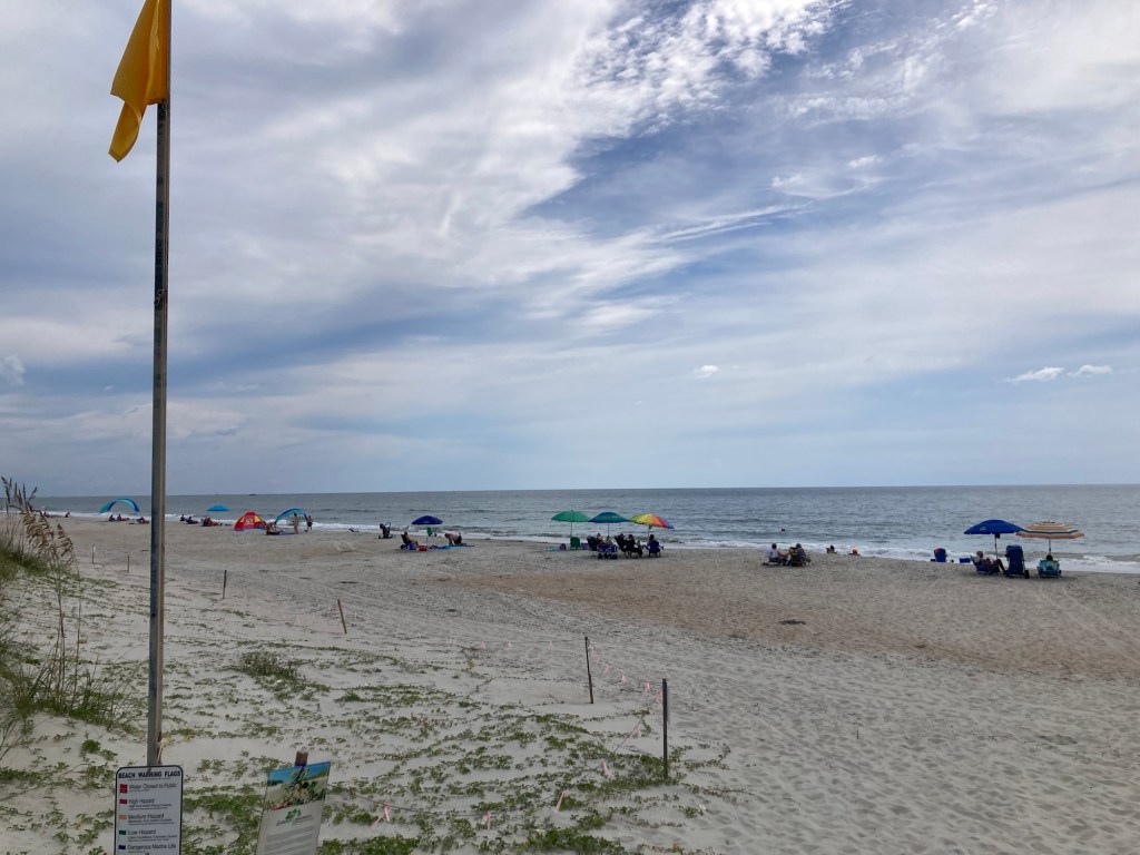
Surfside Beach is a town of about 4,000 northeast of Murrells Inlet. It is part of the Grand Strand, which is an arc of beach land on the Atlantic Ocean in South Carolina which extends for more than 60 miles. After we had looked around the market, we walked a few blocks to the beach. The houses (on stilts) were cute, it had a small restaurant area, and the beach was gorgeous. Lovely, high 70 degree F, low humidity day to be outside.
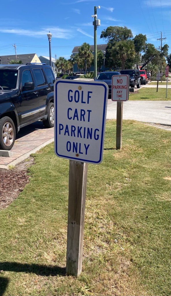
Some homes a block off of the beachThe elevated fishing pierA restaurant on the left and houses along the beachLooking out to the end of the pierLooking towards houses south of the pierOne view of the beachLooking northA Mexican restaurant on the left and a barbecue restaurant on the right More cute homesLots of people driving golf carts in this community
If you are somewhere where Labor Day is celebrated, happy Labor Day! It’s an early one this year, and already the beginning of another month.
When Bob and I were meeting our homeowners, they mentioned that they acted and stage managed at a theater in the nearby city of Georgetown, South Carolina. We looked up Georgetown and decided that perusing their Historic District and Harborwalk might be a good plan for today when the masses might be enjoying Labor Day at one of the beaches.
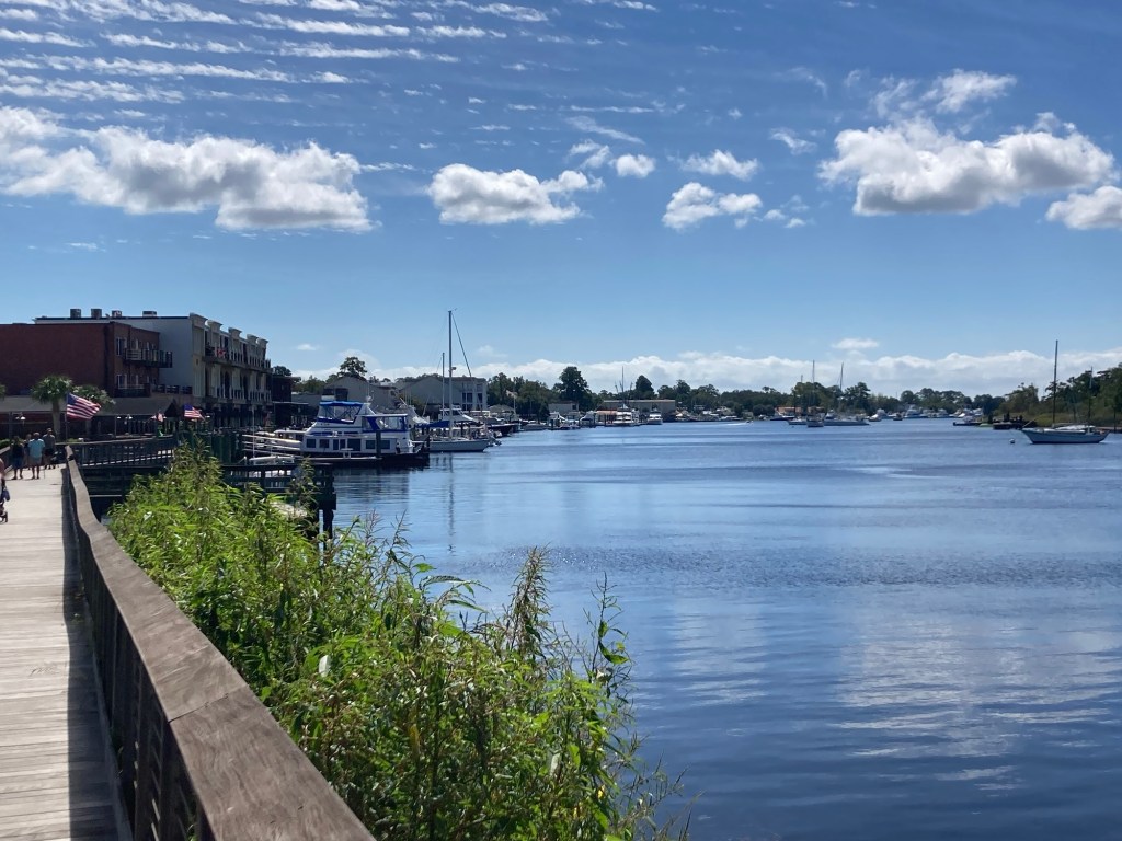
The city of Georgetown (population of about 9,000) is about 30 miles from the house.
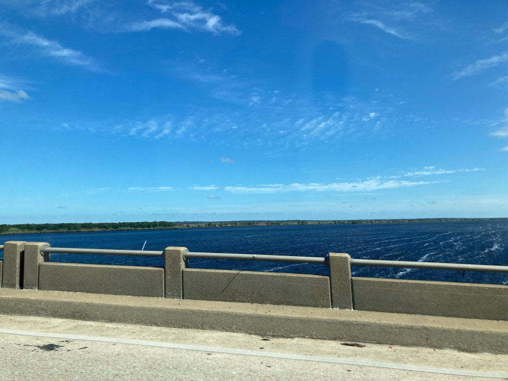
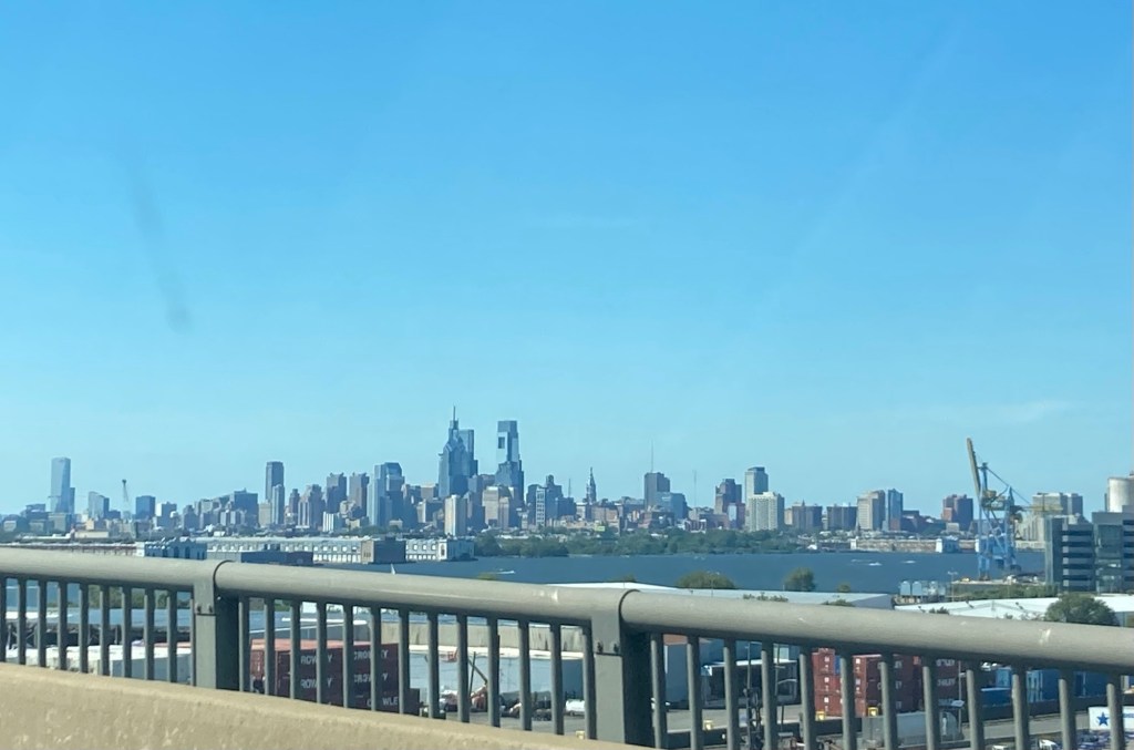
Crossing the Atlantic Intracoastal Waterway
During our walk we learned that Georgetown was formally founded in 1729, making it South Carolina’s 3rd oldest city after Charleston and Beaufort. Its economy was at one time heavily based on the labor intensive crop of rice, and the slave population was about 85% of the total population during the 1800s. The Civil War and social/political changes as well as a few hurricanes put an end to rice as a major agricultural product.
A map of the small historic district along Front Street, which parallels the Sampit River
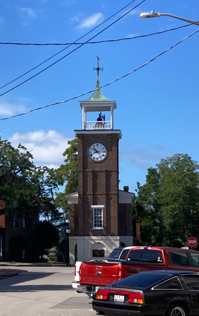
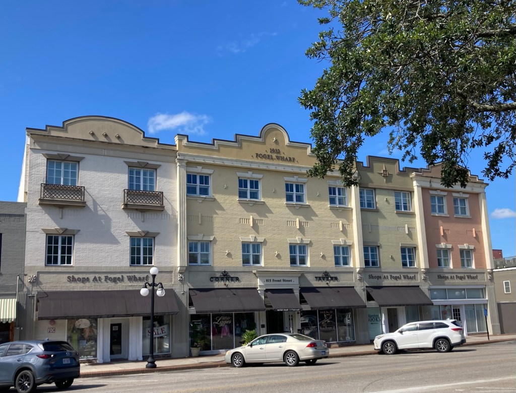
One of the first structures we saw was a clock tower. It is located atop a Greek Revival market and town hall built in 1842 after a fire destroyed most of the buildings on Front Street. An open air market was on the 1st floor and the town hall was on the 2nd. The clock tower and belfry were added in 1845.
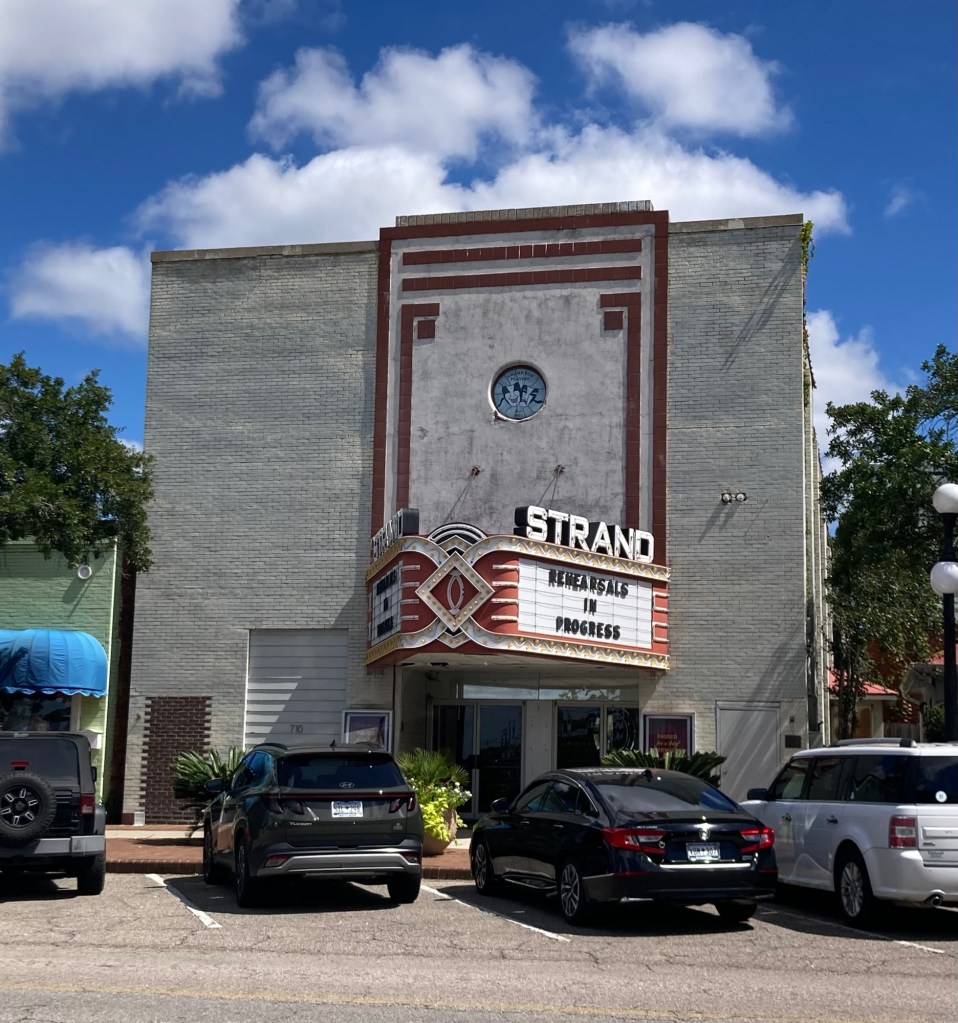
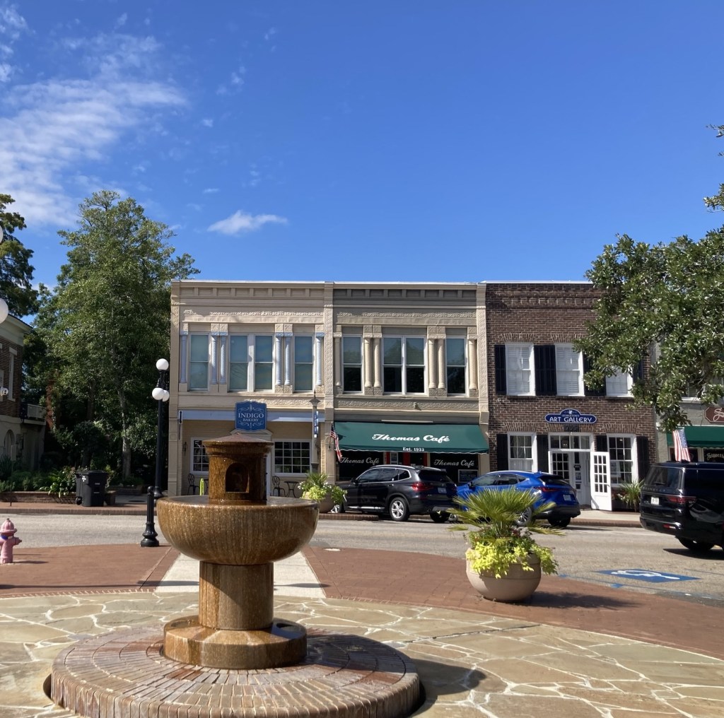
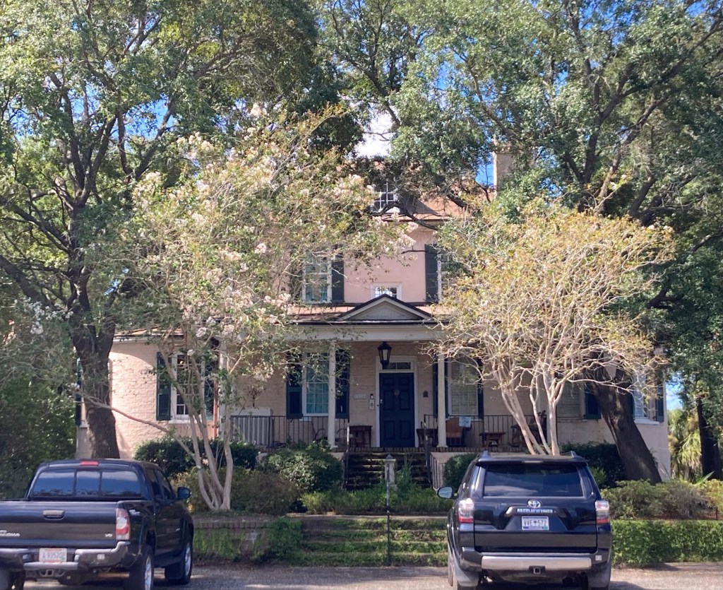
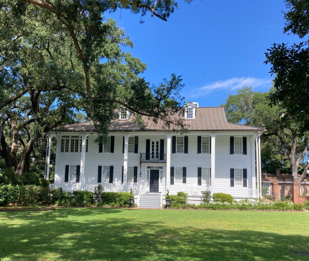
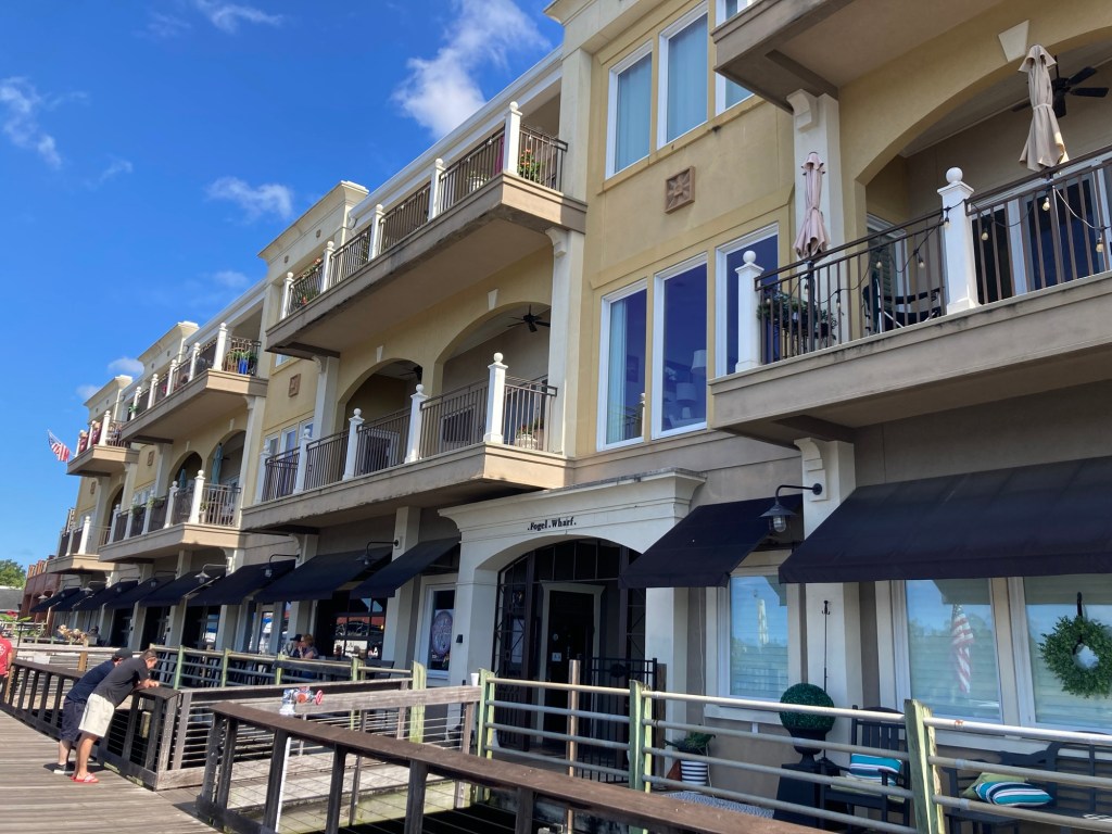
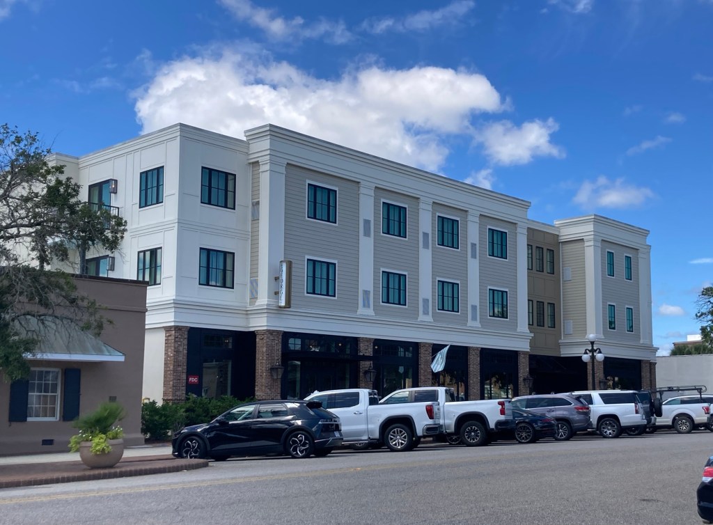
The clock towerThe Strand Theater which keeps our homeowners busyA fountain and some shops at the start of our walkA pocket park between storesSome fun art along one building More of the buildings on Front Street. The backs of them also face the River, so we saw them on our Harborwalk as well.The Robert Stewart House, built between 1740 and 1770. President Washington spent the night in this house on his southern tour in 1791.The Kaminski House, built sometime between 1750 and 1800. It was home for many years for Harold Kaminski (and his family), who was a local County Commissioner, Mayor, and US Navy Officer.
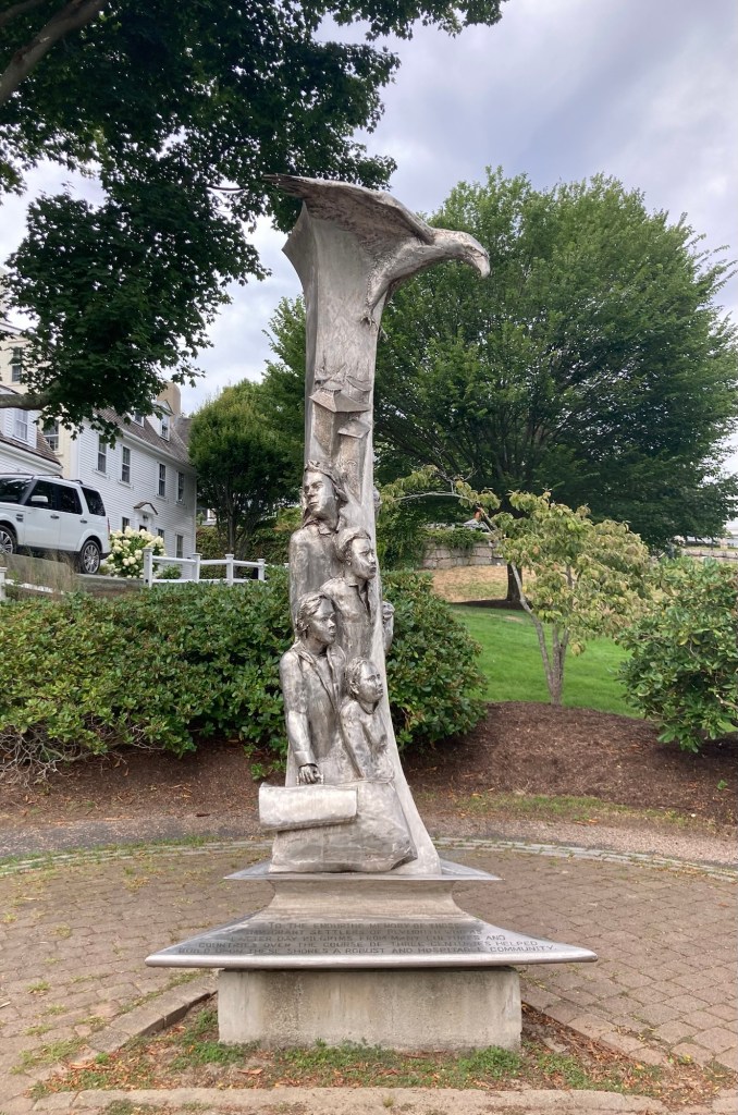
A park connecting Front Street to one end of the Harborwalk displayed a few items of local and national history.
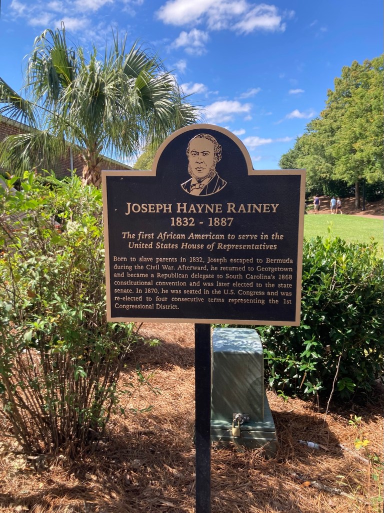
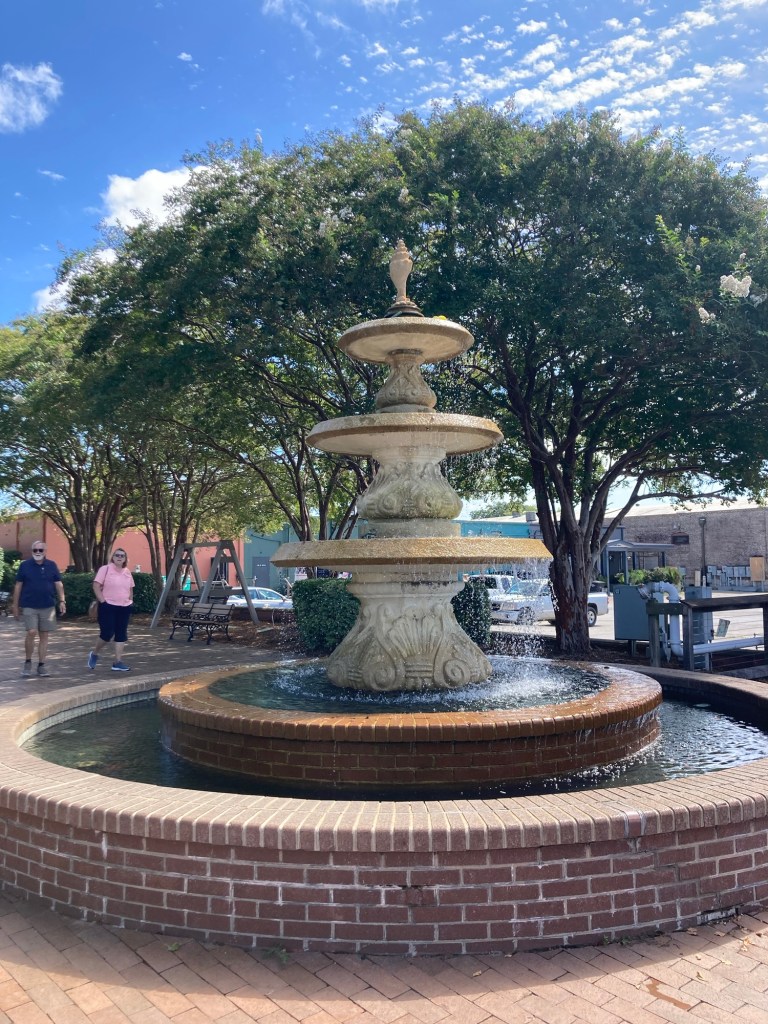
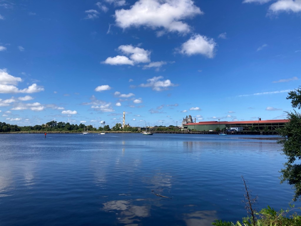
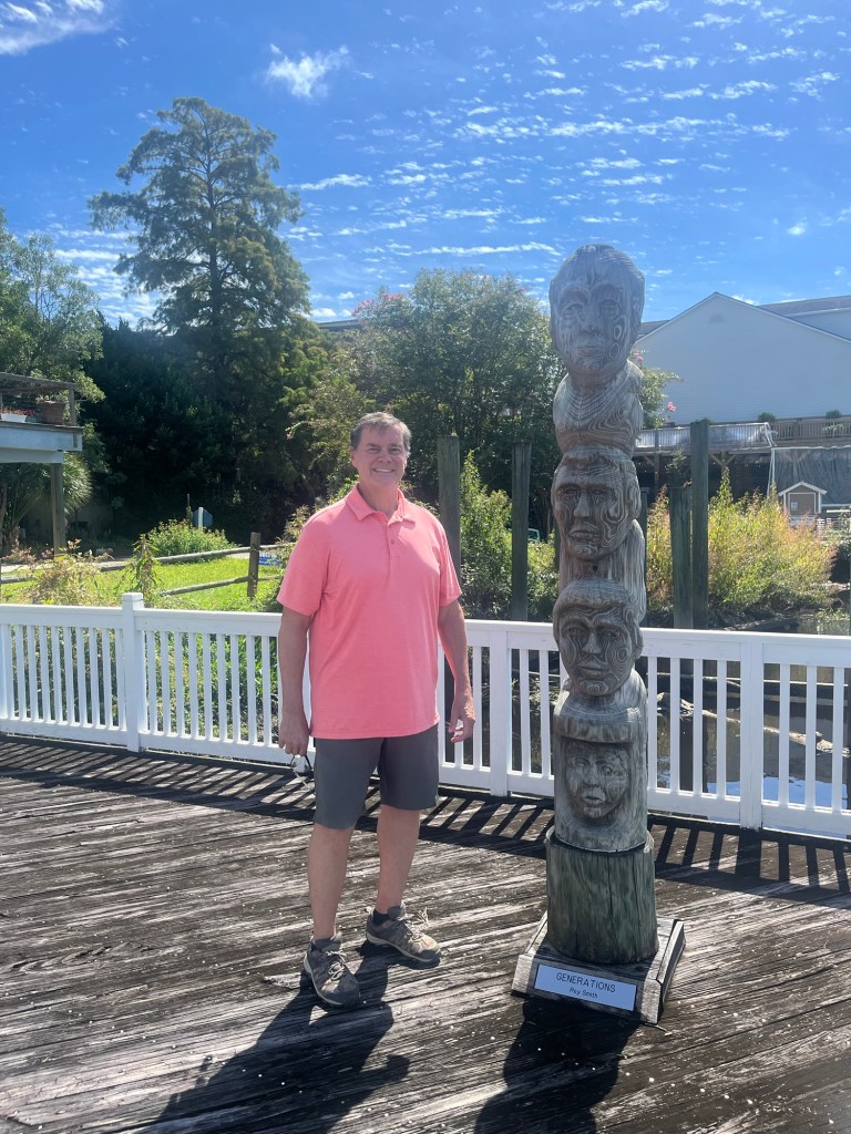
A memorial for the 1st African American to serve in the US House of Representatives, beginning in 1870.These brick display cases show copies of the three Charters of Freedom — The Declaration of Independence, The Constitution, and the Bill of Rights.A fountain at the end of the small parkLooking down the Sampit RiverLooking the other direction towards the shops, restaurants, and marinaSome of the restaurants and housing facing the riverFinding a tower of heads along the Harborwalk. This is “Generations” by Roy Smith.A small, independent hotel called The George back on Front Street.Peeking into its restaurant
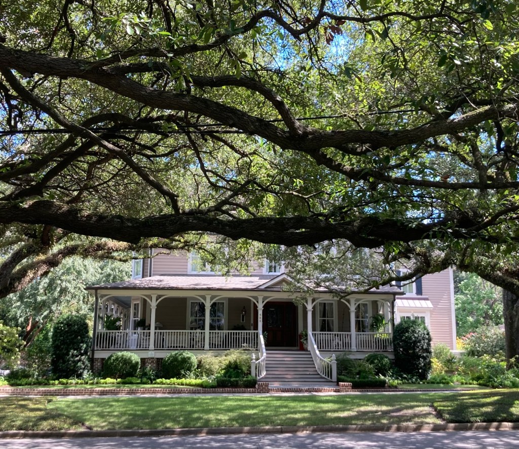
We walked a little bit into a local neighborhood, which unsurprisingly, was very Carolina-esque — lots of big homes with porches. We also loved the big trees that provided a nice amount of shade.
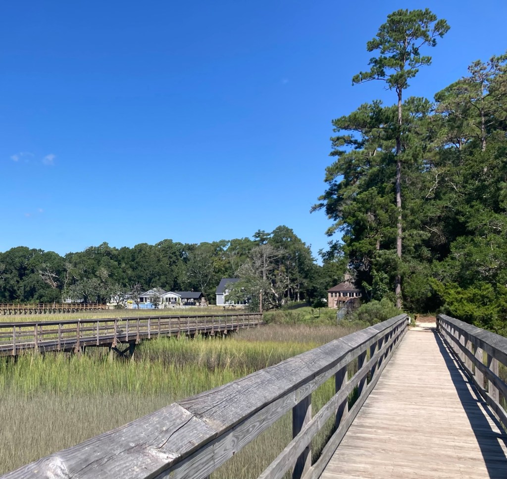
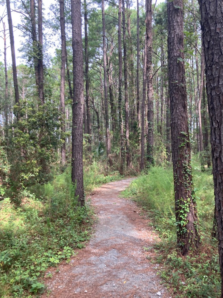
As we are at the start of the very busy Labor Day Weekend, Bob and I chose a local park to explore today that we didn’t think would be a hotspot for weekend tourists. We drove about 39 miles northeast of Murrells Inlet to the community of Little River, South Carolina, to explore the Vereen Memorial Historical Gardens.
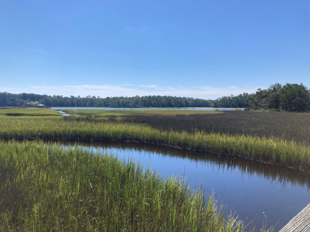
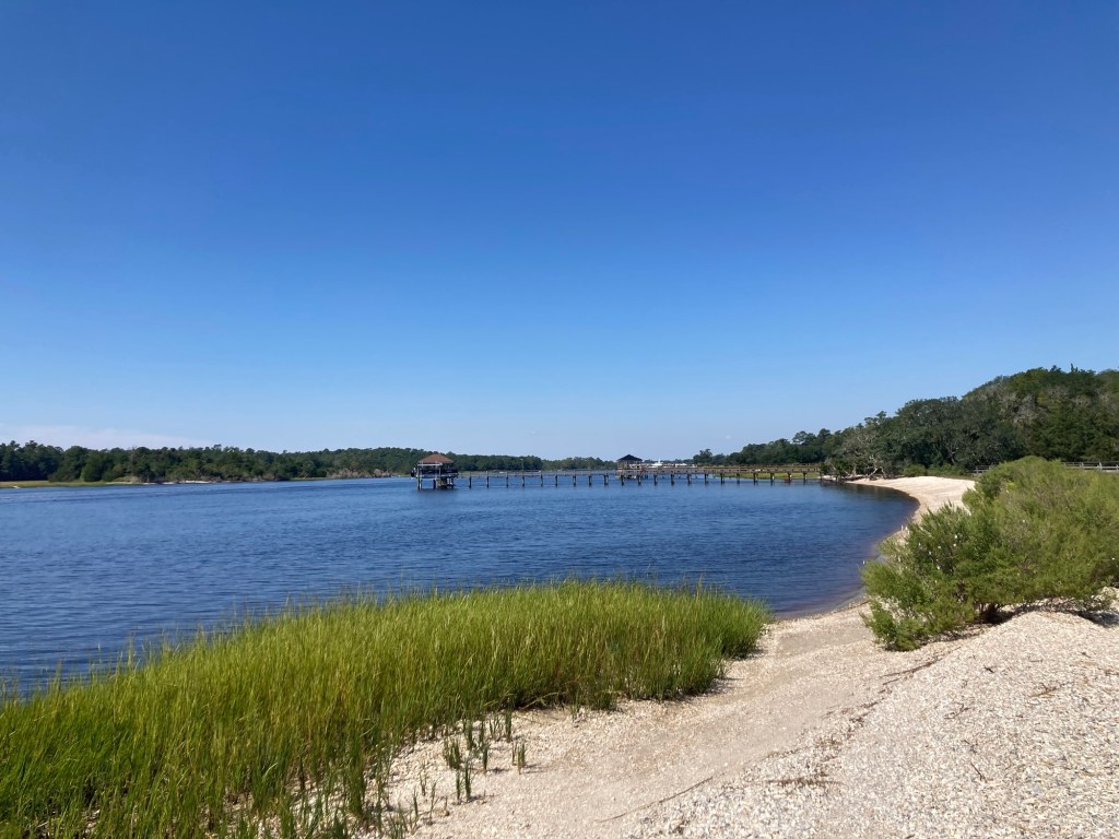
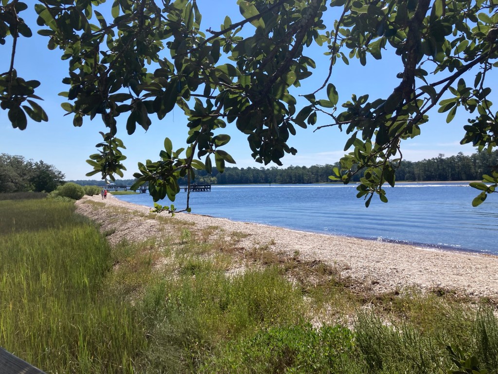
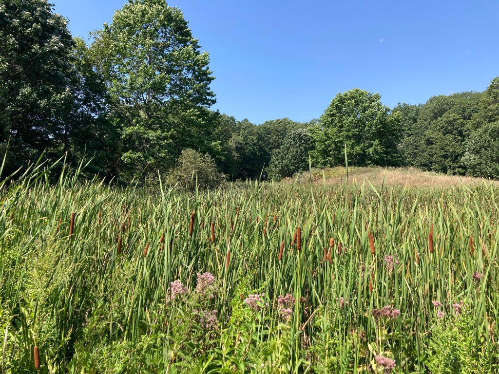
They did not disappoint, although they are not a flower-based garden. Instead, this pretty 115 acre park has trails through forests and over salt marshes and also overlooks the Intracoastal Waterway. It is free to the public and close to neighborhoods. We saw a number of other walkers while we were there.
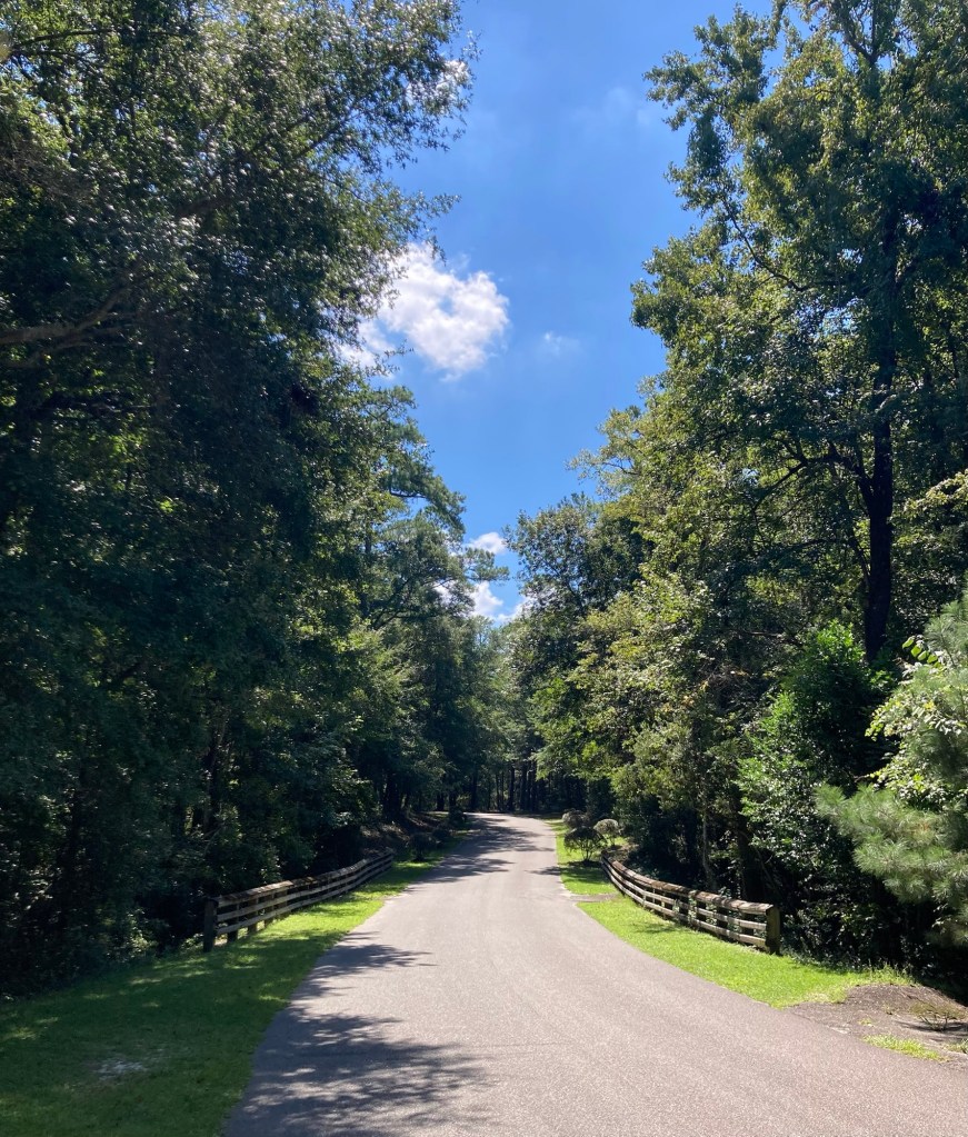
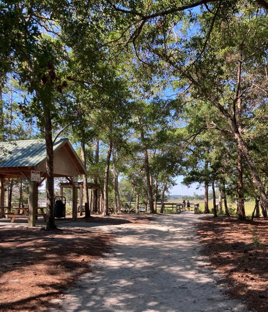
The gate at the park entrance The tree-lined drive into the park.We started our walk on a boardwalk near a picnic pavilion.
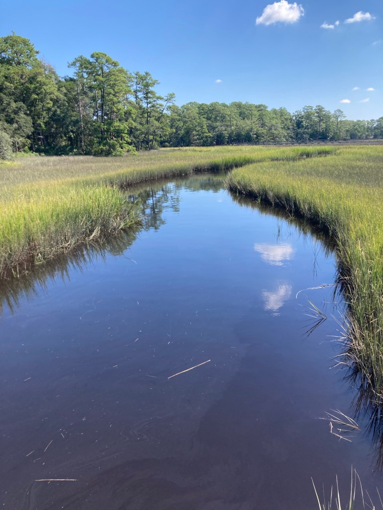
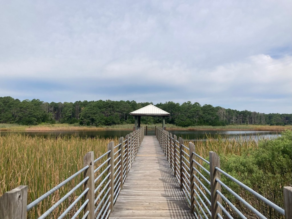
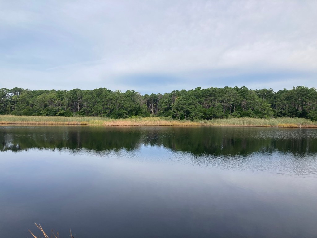
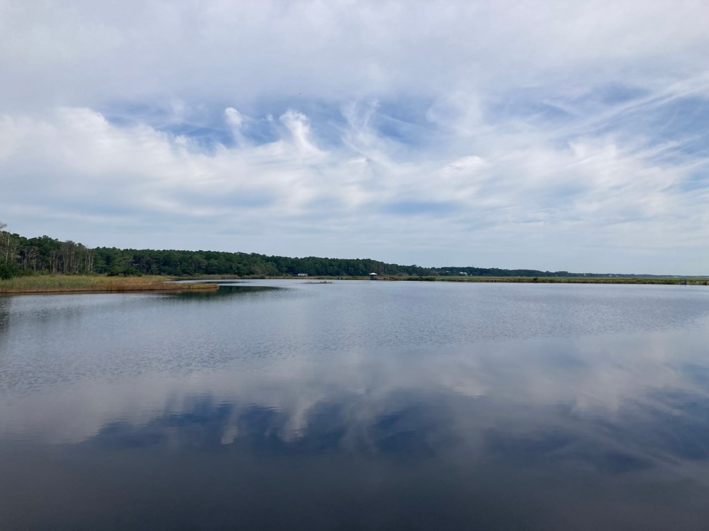
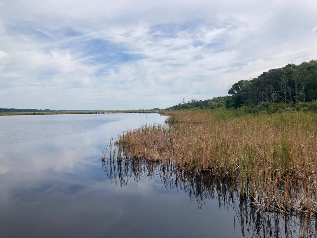
The boardwalks go over salt marshes, and an information sign noted that salt marshes are the most productive natural habitats on earth. They provide areas for animals and other organisms to feed and breed and also offer protection against predators. This one is also quite visually attractive.
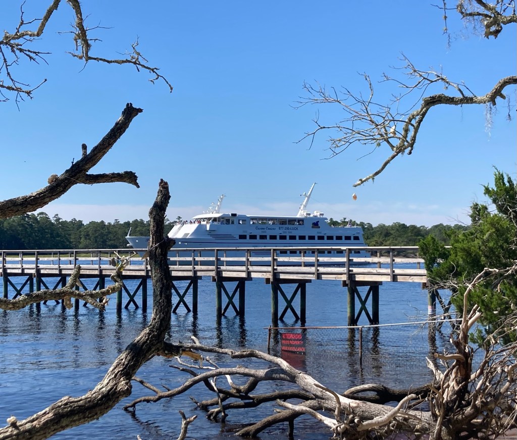
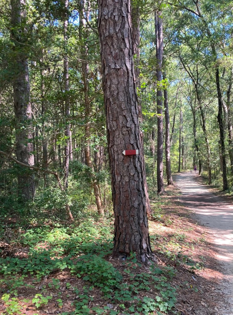
Crossing the salt marshLooking out on the Intracoastal WaterwayAnother view of the small beach and Intracoastal Waterway A casino cruise ship sailed pastOne of the wishing trees along the shore, where people hang oyster shells and make a wishWalking back towards the mainlandAlways on the lookout for gators in the marshThe trail markings for the first trail that we hikedA house with easy access to the park
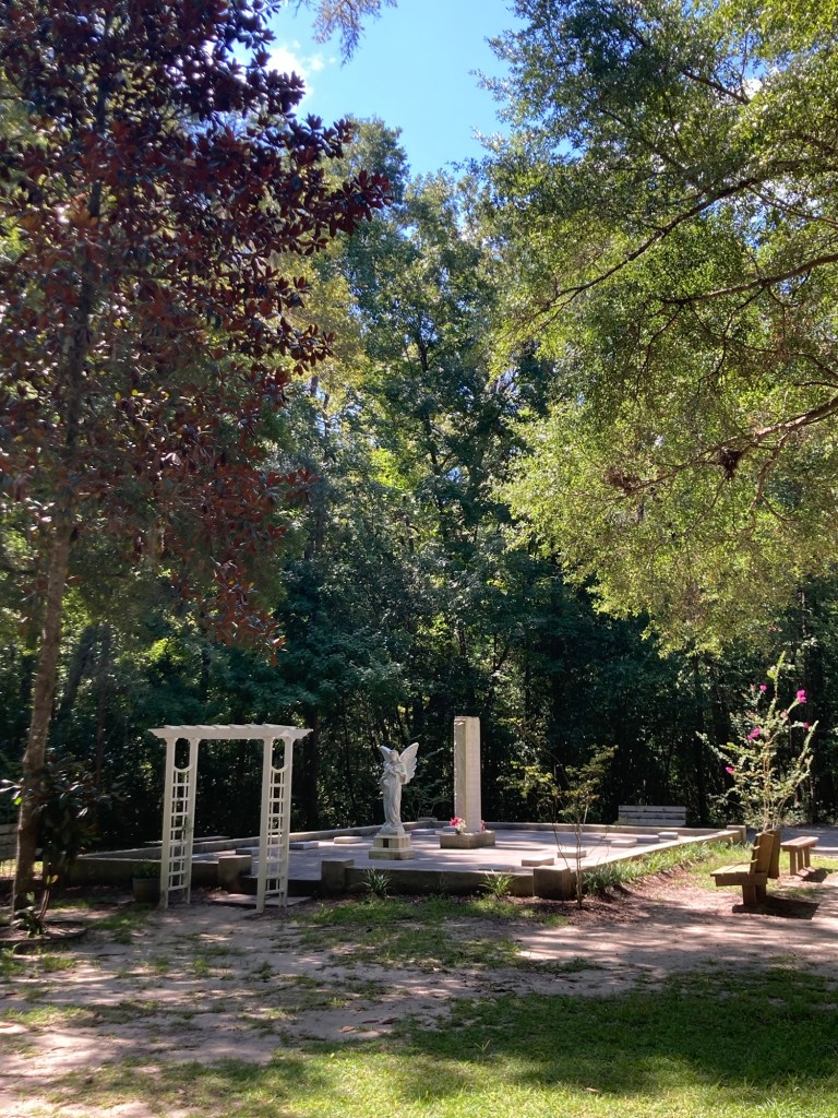
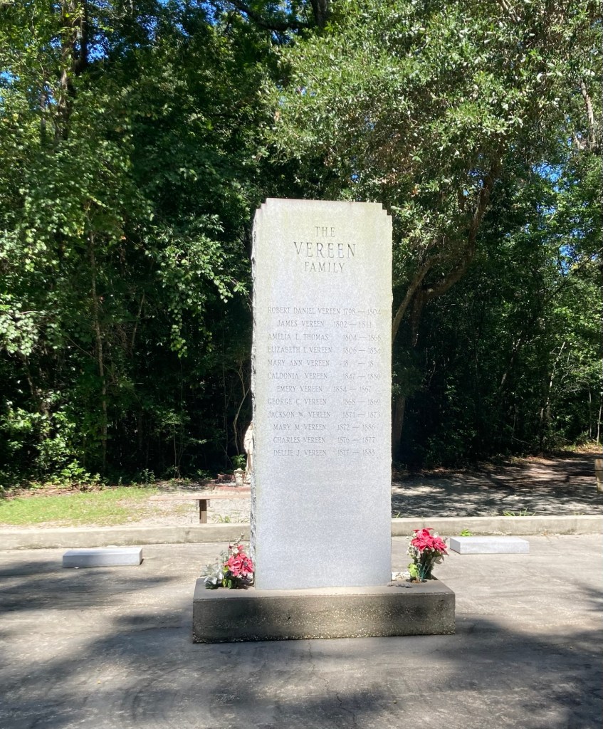
The park is located on land that was once part of Big Landing Plantation, which was acquired by Jeremiah Vereen, Jr. in 1797. The Vereen family played a significant role in the area’s history, and a descendant of the Vereen family donated this land to the county Historical Preservation Commission in 1971 to create the park.
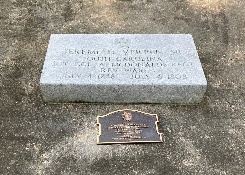
The Vereen Family Cemetery within the parkThe names of the 12 individuals who are buried hereThe patriarch, who apparently fought in the Revolutionary War
Tomorrow we will likely spend much of the day watching two college (American) football games, as the 2025 season is kicking off.
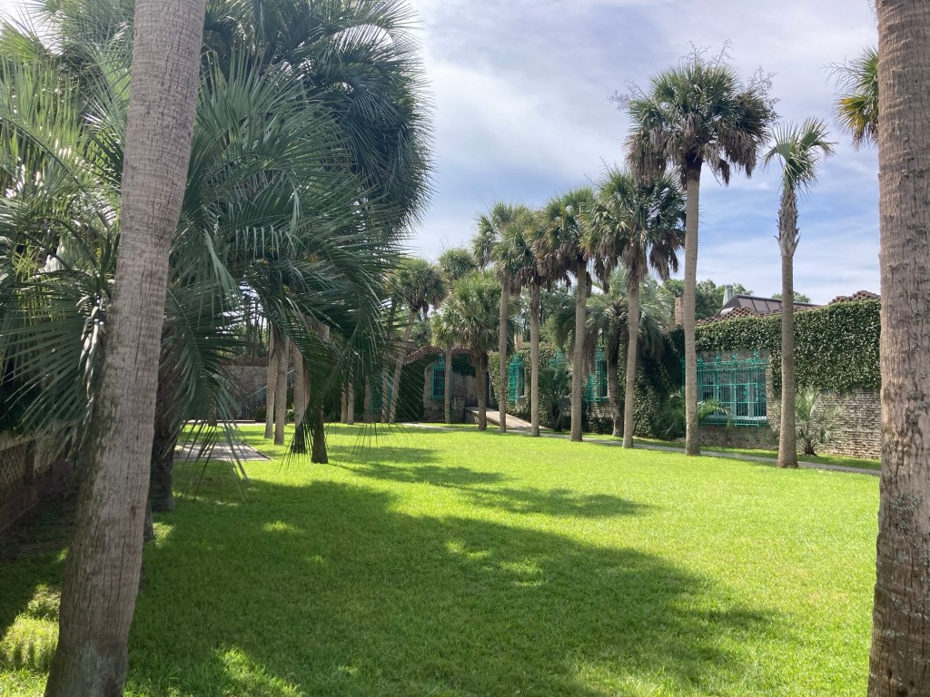
What do you get when you cross a natural wetlands, a bit of forest, paved and unpaved trails, an old Moorish estate, and access to a beautiful white sand beach on the Atlantic Ocean? Huntington Beach State Park, a 2500 acre state park located in Murrells Inlet about a 25 minute drive from the house.
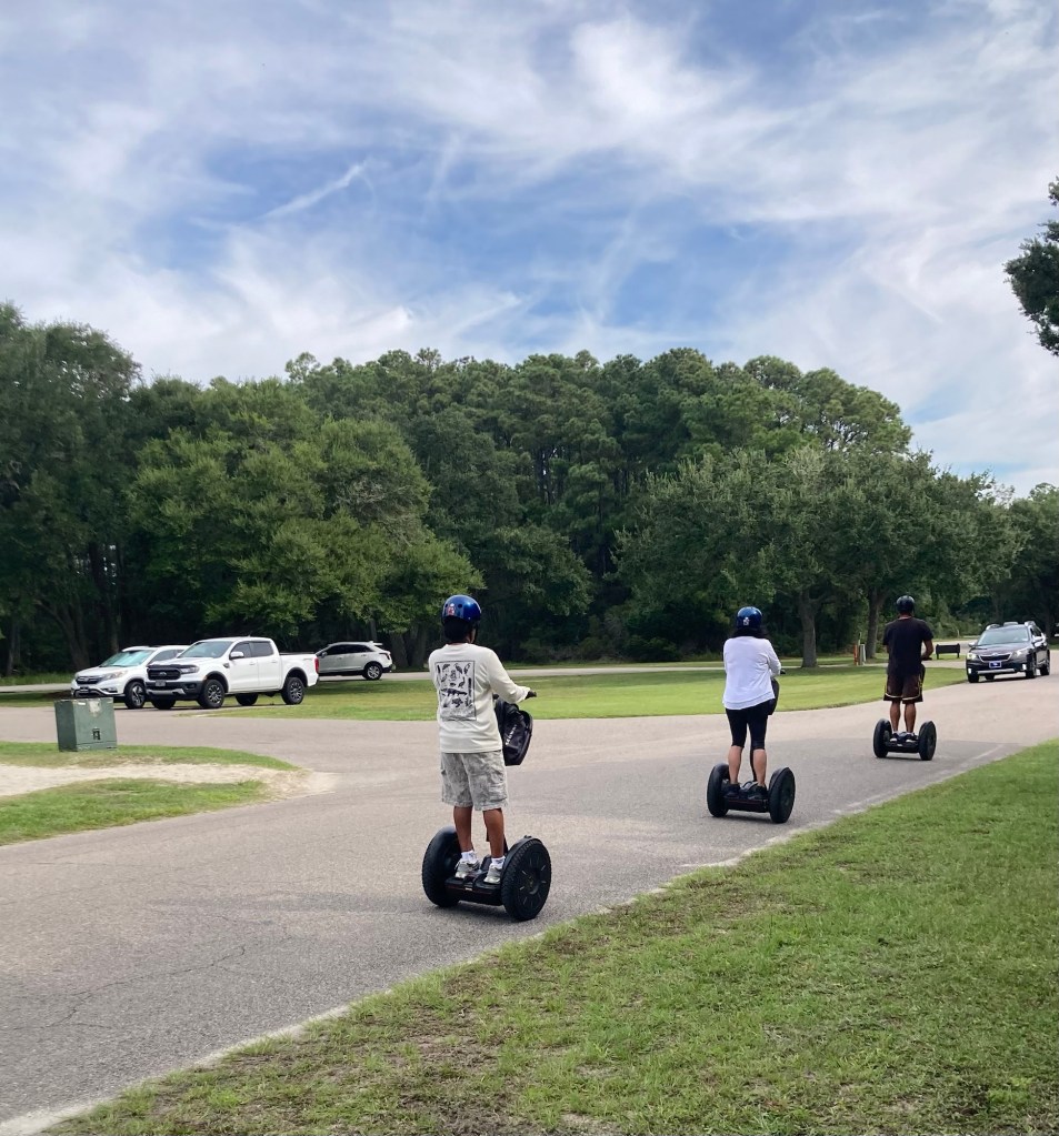
It was an active day at the park at not quite the start of the Labor Day Weekend, and the first thing we saw on the way to the Visitors Center to pick up a map of the park was a tour group on Segway scooters.
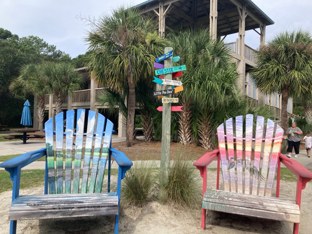
The guy in black was the guide, and there were 3 or 4 others that were behind. Not a typical activity in a state park.Some fun big chairs and signage to SC sites in front of the Visitors Center.We started our visit on the short Kerrigan Nature Trail that led to Mullet Pond.The boardwalk over part of the pond.
A few pics from the overlook.
Some colorful flowers on a tree.
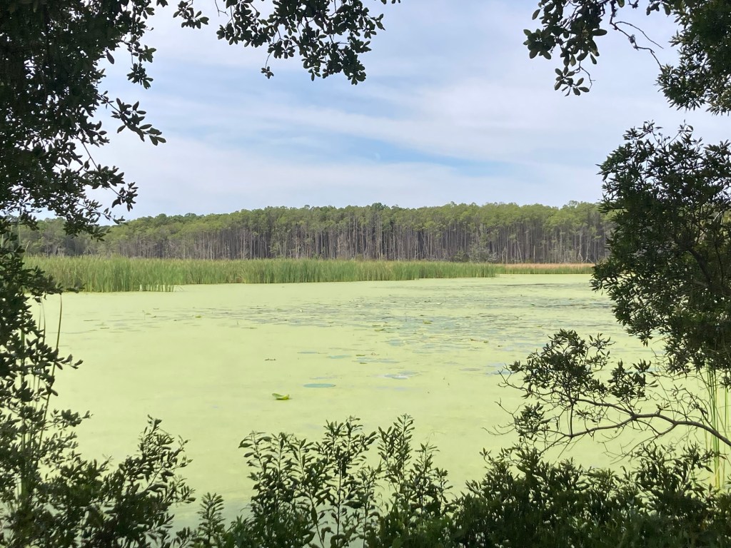
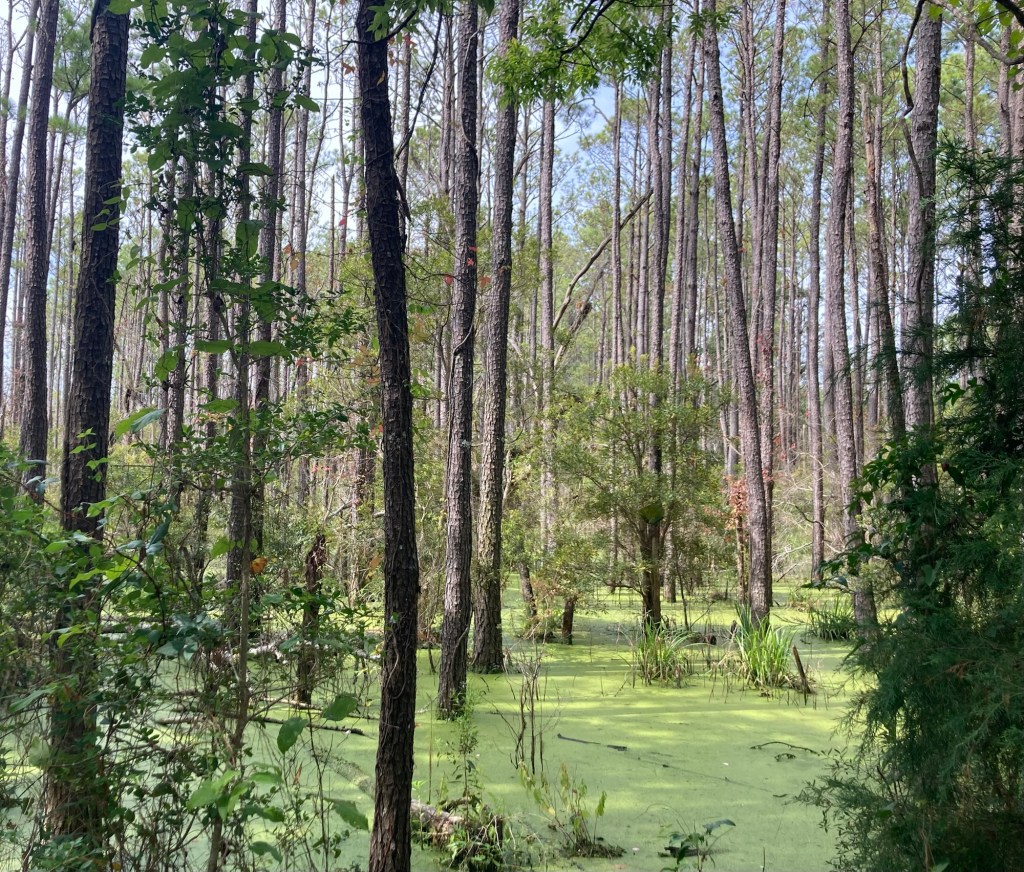
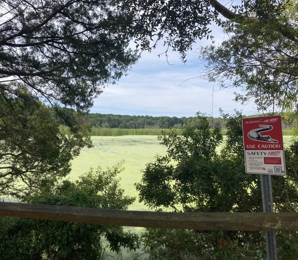
From the Kerrigan Trail, we walked the paved Atalaya Trail between Mullet Pond and Mallard Pond. There were a number of safety signs about what to do if you see an alligator, but sadly (sort of), we didn’t see any.
The following pics are of the much larger and greener Mallard Pond.
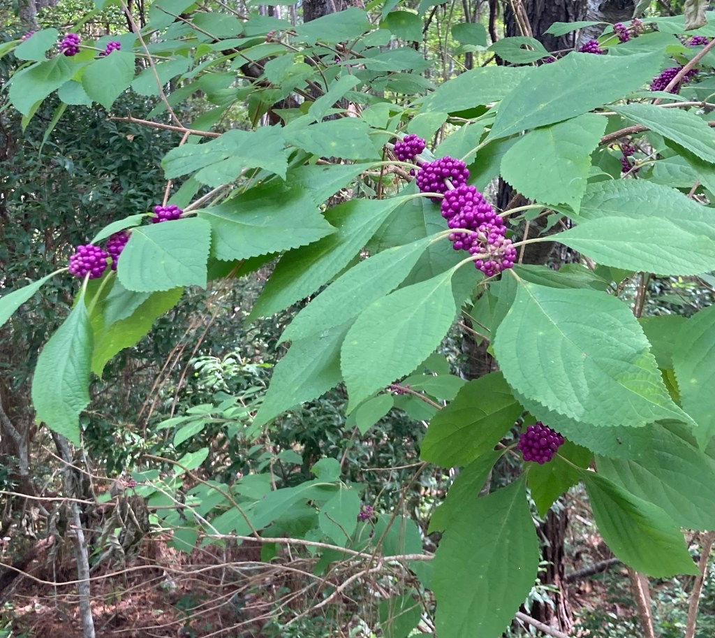
Some colorful berries
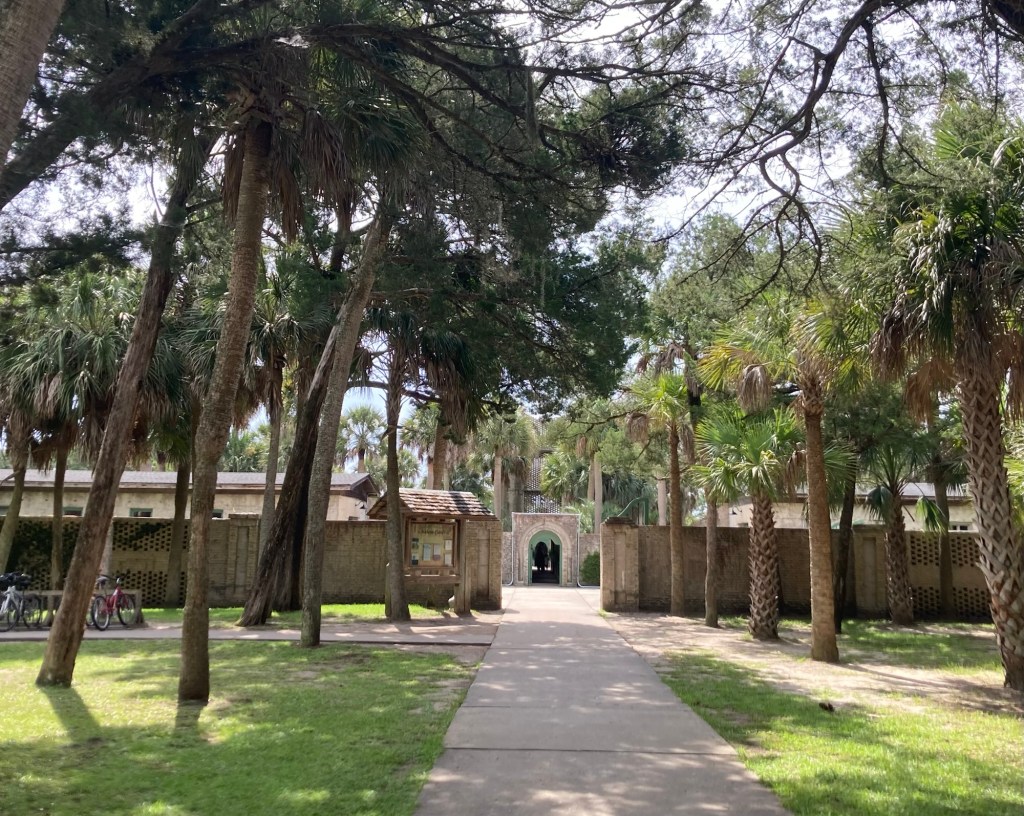
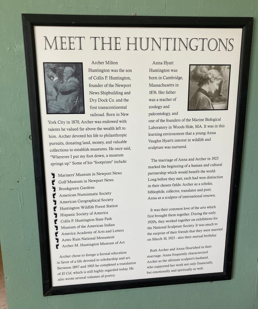
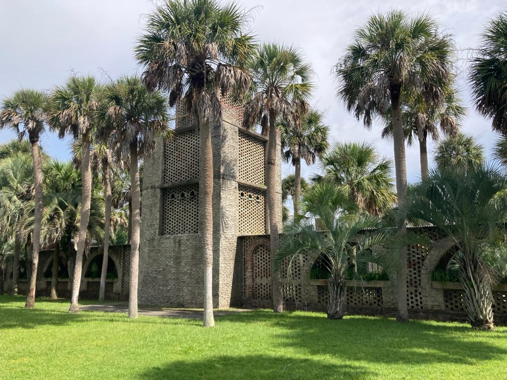
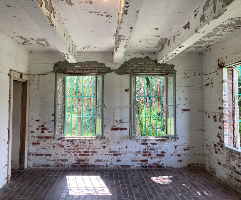
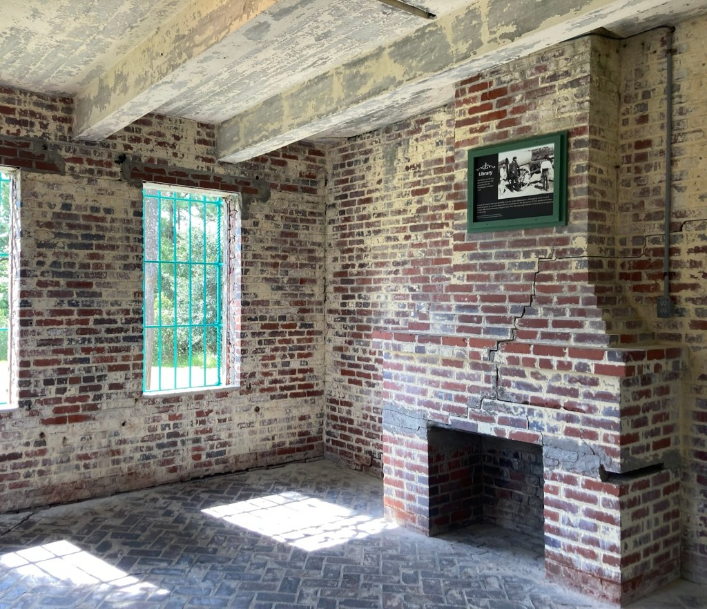
Heading all the way back on the trail, we came to the entrance to Atalaya Castle, the winter home of Archer Milton Huntington and his wife, Anna Hyatt Huntington. There are no longer any furnishings in the house, and it has not been completely maintained, but you still get a sense the the Moorish style home.
The outer walls form a square, with the east side facing the ocean. Within the walled structure, there are two grassy inner courtyards with a covered walkway and tower in the center. The one-story living quarters consist of 30 rooms around 3 sides of the perimeter.
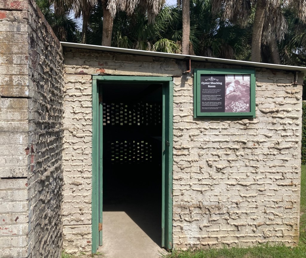
Entering the outer walls to the homeThese were impressive individuals, who we will learn more of, as we plan to go to the Brookgreen gardens, which Archer created and which displays a number of Anna’s sculptures.Right inside the walled entrance was this structure where oysters were shelled.One side of the inner courtyardThe walkway and tower which divide the courtyardThe master bedroom facing east, towards the oceanThe library, almost all of the rooms in the living quarters had fireplaces
Finally, we walked the short path from Atalaya to the beach. There were a number of people out enjoying being near the ocean.
Last Saturday, Bob and I left Needham, Massachusetts, to start our journey to Murrells Inlet, South Carolina, for our next housesit. We didn’t need to meet up with our new homeowners until Monday afternoon, so we spent a couple of nights on the road and even stopped in Alexandria, Virginia, on Sunday to have a quick breakfast with Bob’s brother and girlfriend.
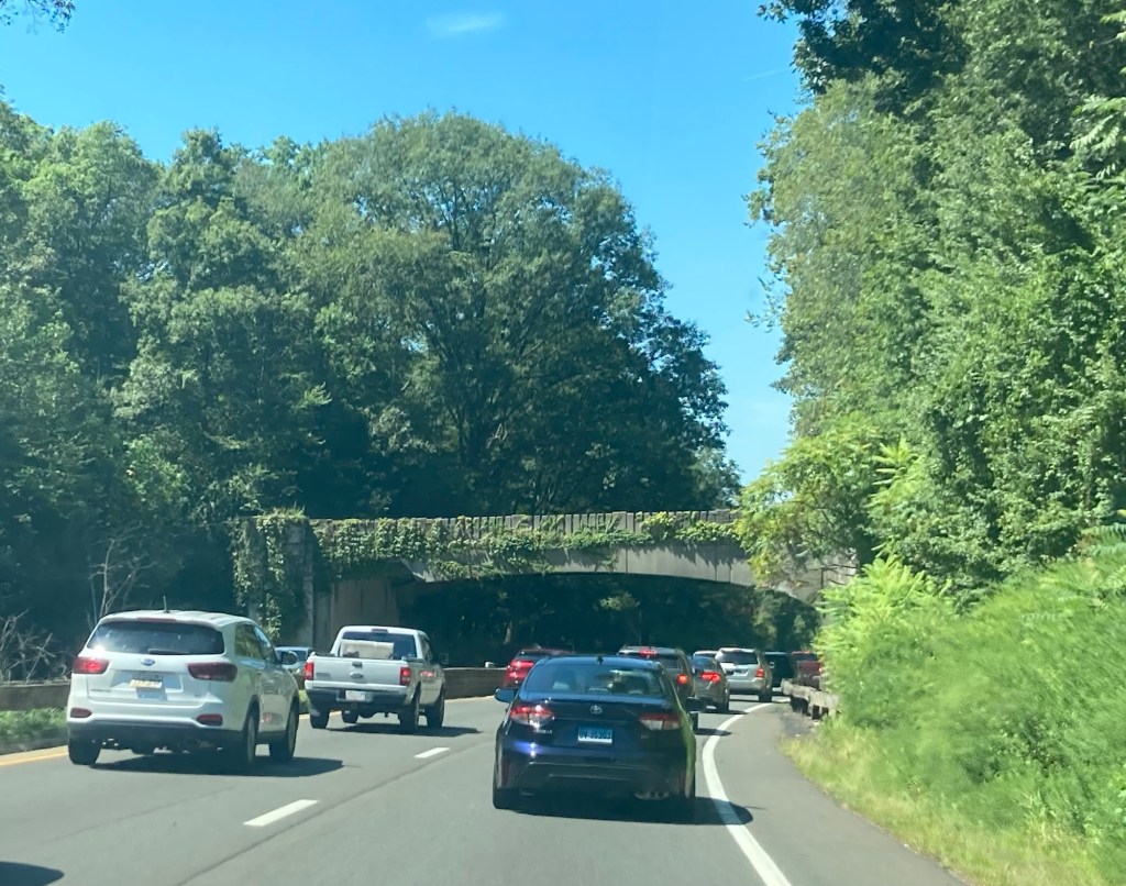
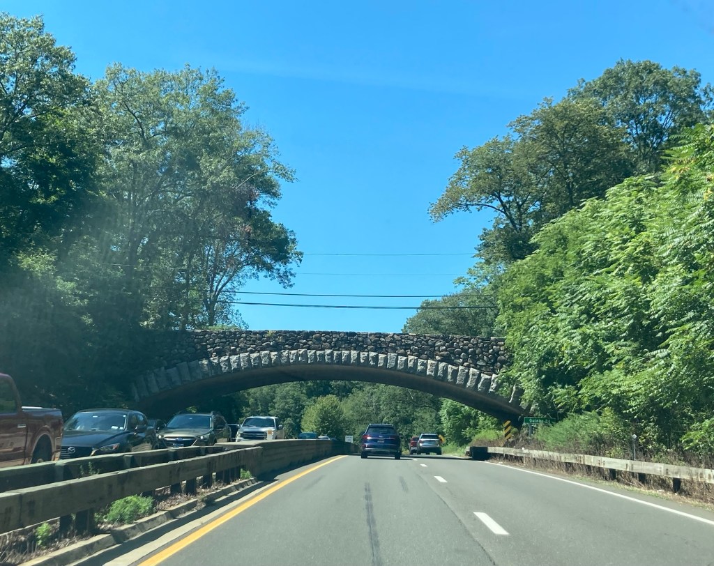
Both days were a little over 6 hours of often stressful East Coast driving. There were a lot of people in lots of cars traveling during the end of summer/back to school weekend. Saturday’s trek took us through parts of Massachusetts, Connecticut, Delaware, New York, and New Jersey before we landed at a Marriott brand hotel near the Philadelphia airport. Google Maps gave us wrong directions in New York City, so we spent more time there than we would have liked but otherwise no other real issues on the drives.
One of many bridges on a scenic parkway in Connecticut Another bridge on the same parkwayCrossing over a bridge into New York City, where we were to almost immediately cross a 2nd bridge into New Jersey. Didn’t happen immediately, but Bob can now say he has driven in NYC.
We spent Sunday night in Rocky Mount, North Carolina, before driving about 3.5 hours into Murrells Inlet for our transition with the new homeowners. We had a great meet up with the homeowners Monday late afternoon, and they fixed us dinner.
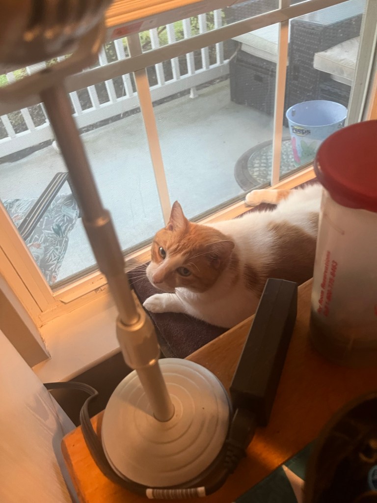
They are both native New Yorkers, who moved permanently to South Carolina about 5 years ago. They are both active in a local community theater (He acts, and she stage manages). They are off on a cross country trip to see family in New York and then drive west to explore more of Utah and Nevada. They live in a lovely, quiet neighborhood in Murrells Inlet, which is just south of Myrtle Beach, with Squeegee, their 9 year old male rescue cat.
Squeegee likes to keep an eye on what’s going on in the ‘hood from the front door or the window in the study. He’s very quiet. He apparently only has something to “say” if the neighbor’s cat gets too close to the house.
The homeowners left about mid-afternoon yesterday after a doctor’s appointment. Before they left, they took us to a local place for breakfast (We treated since they had fixed us dinner.) and then showed us the location of a Marsh Walk. We went back there today after a walk this morning around a nearby subdivision.
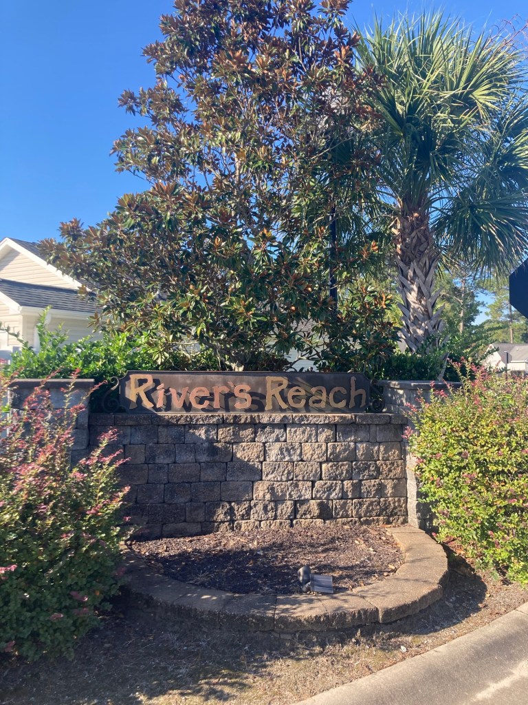
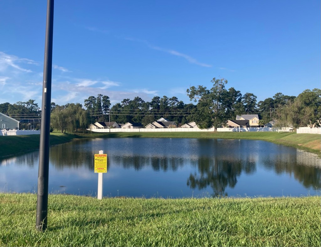
One of 2 entrances to the small subdivision in which we are stayingA couple of little people in the nearby development watching our walk.The yellow sign warns of alligators in the retention pond. This is a marshy area. We feel like we’re likely to see an alligator before the end of the sit.
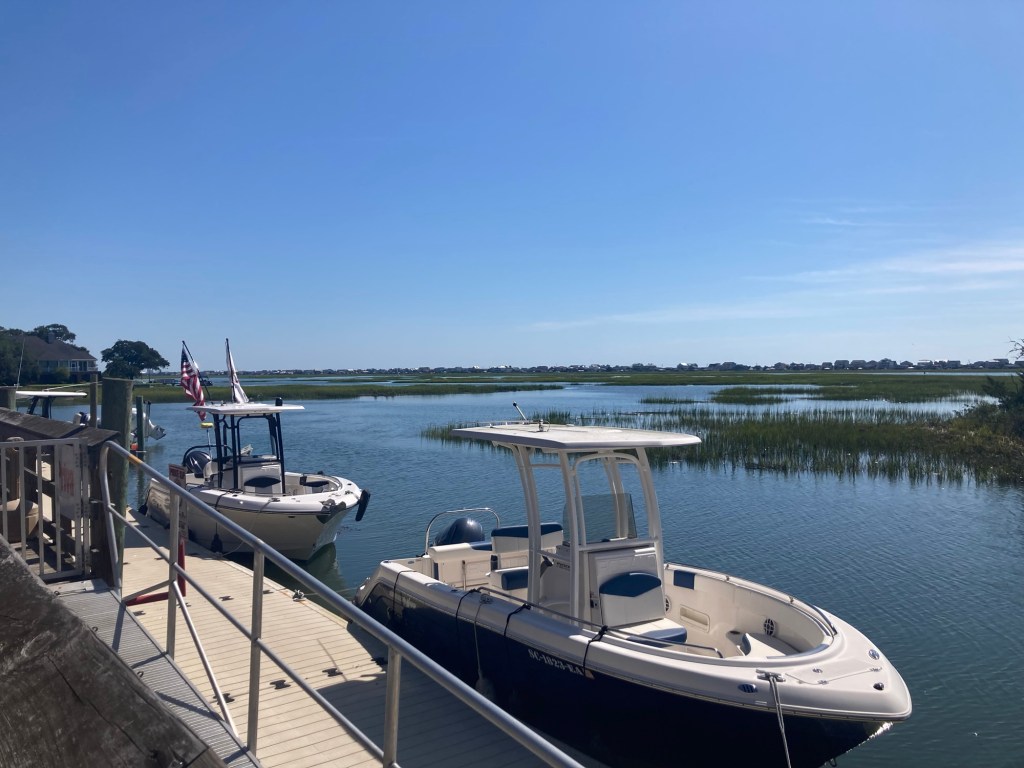
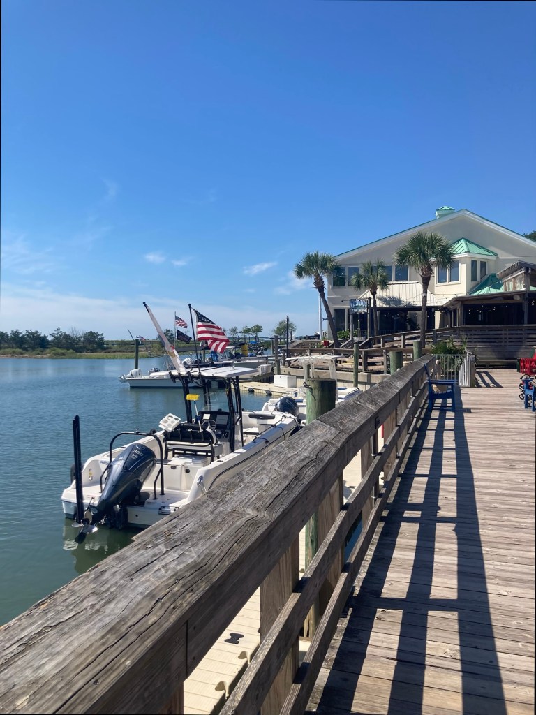
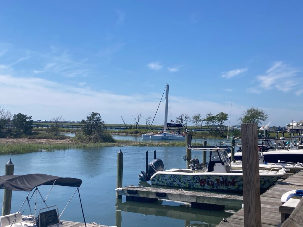
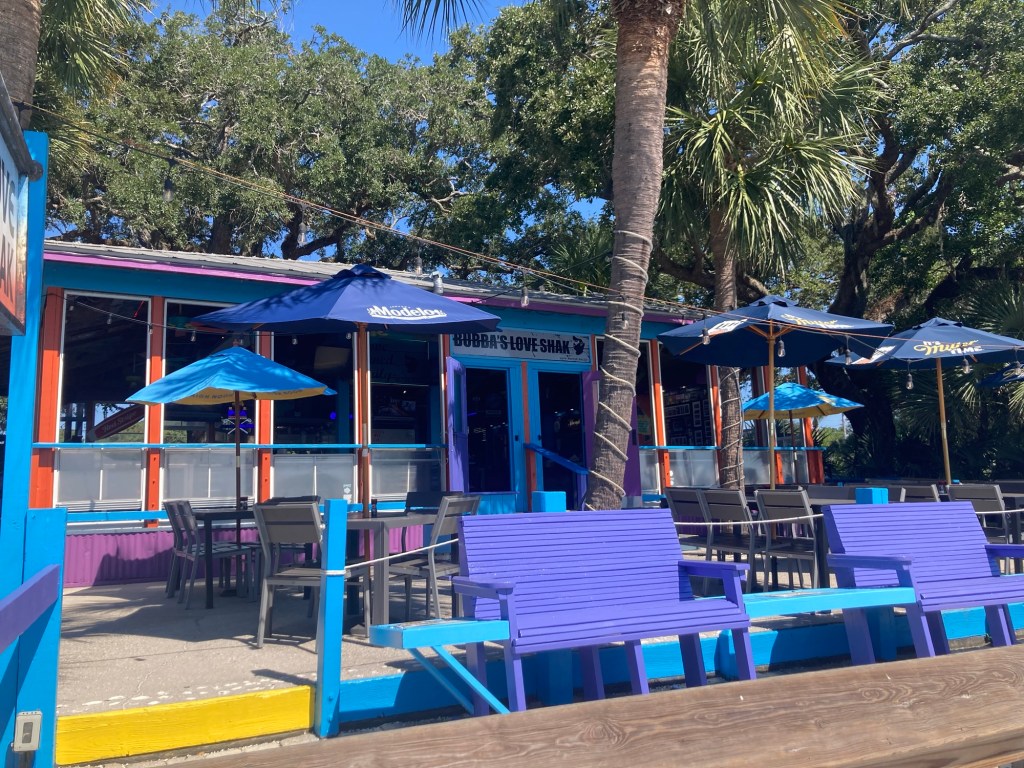
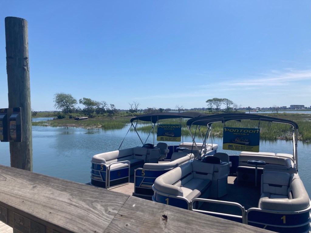
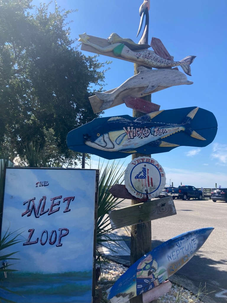
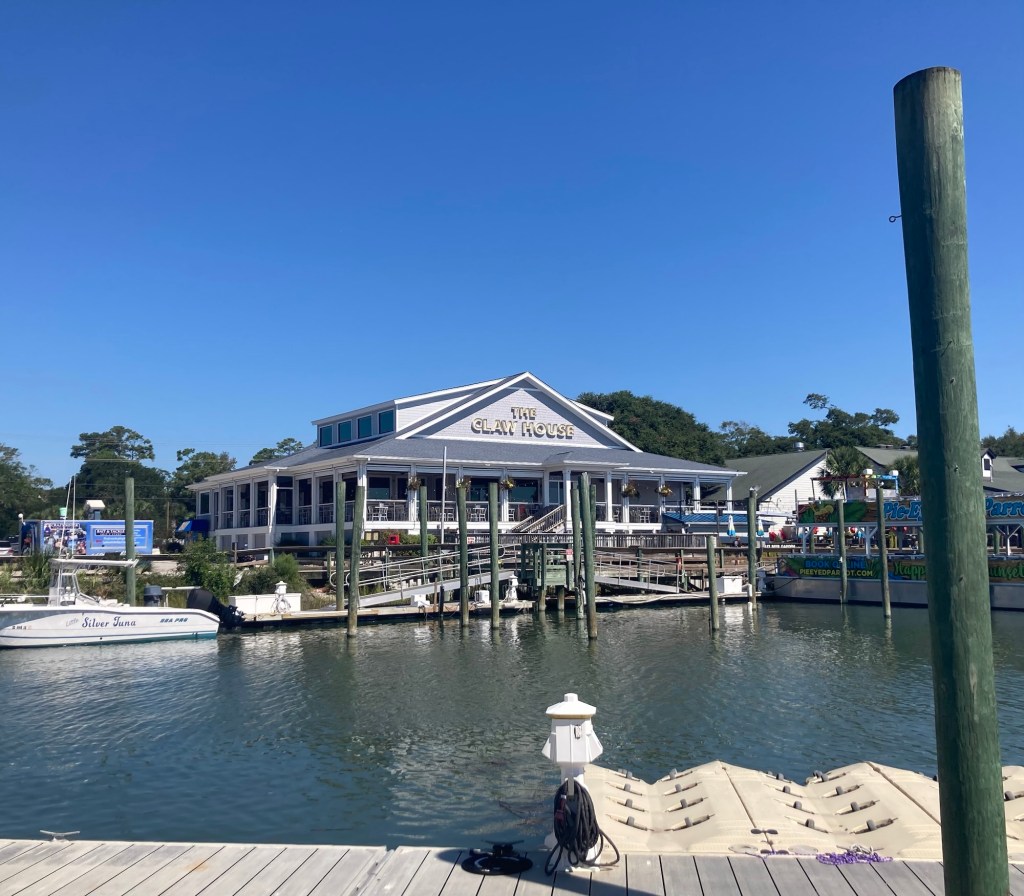
The following are photos from the Marsh Walk, a boardwalk behind a number of restaurants and from which you can go on a number of different types of boat rides. A shop that we stopped into sold shirts that said, “Murrells Inlet, a quaint little drinking village with a fishing problem.” You definitely have a number of opportunities to drink and fish along the Marsh Walk.
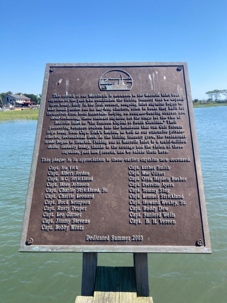
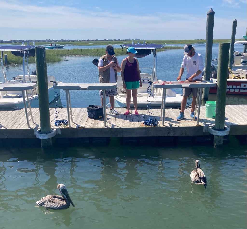
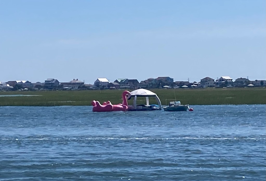
Looking across the inlet to Myrtle BeachPart of the boardwalk Another section A boat coming back inA colorful bar/restaurant along the boardwalk Some pontoon boats for rentSignage for the part of the boardwalk that juts out into the bayLooking back towards the restaurantsA tribute to Murrells Inlet boat captains, who helped establish the fishing industry that the town depends onA couple having the fish they caught on their charter filleted for them. The pelicans were awaiting the cast off parts.A zoomed in view of a moored boat and floaters looking towards Myrtle Beach
On this rainy Wednesday, Bob and I had a look around the nearby Needham Center and Museum and learned a bit more about the local history.
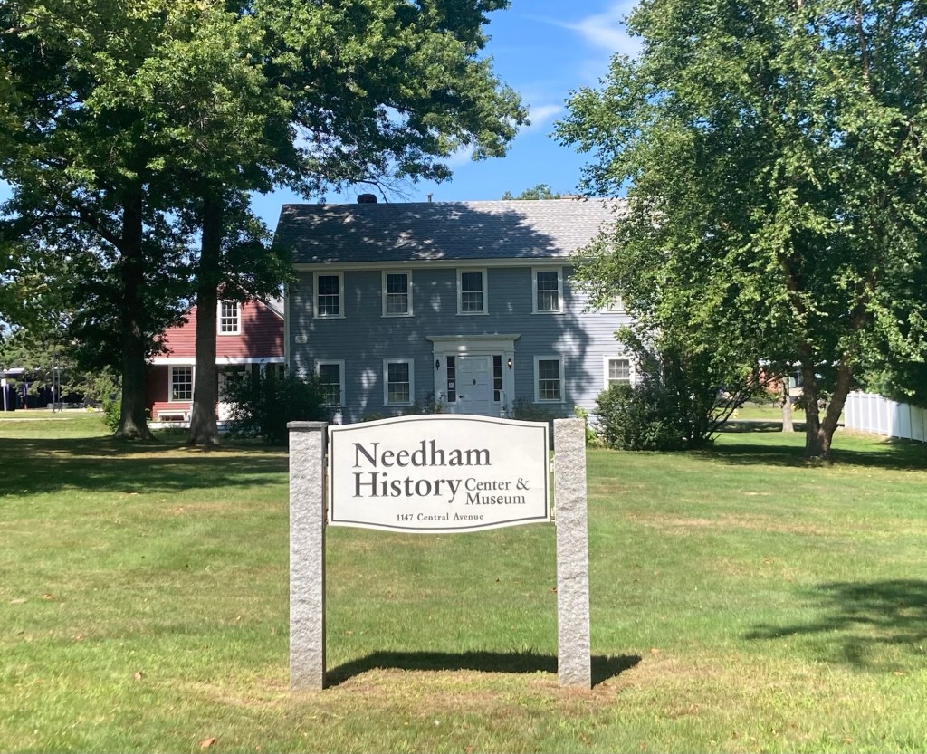
The exterior of the museum. It is only about .5 miles from the house and shares a property with an elementary school.
As we have found in other local history museums, it had an eclectic mix of artifacts from Needham’s older and more recent history. The following are some of the things that caught our attention.
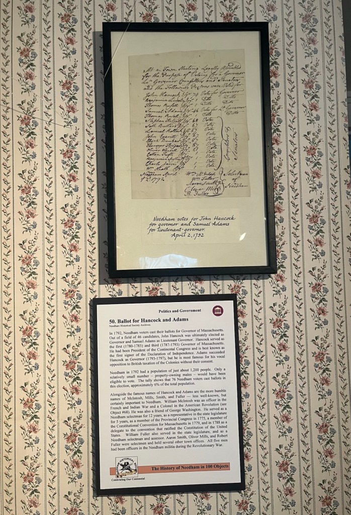
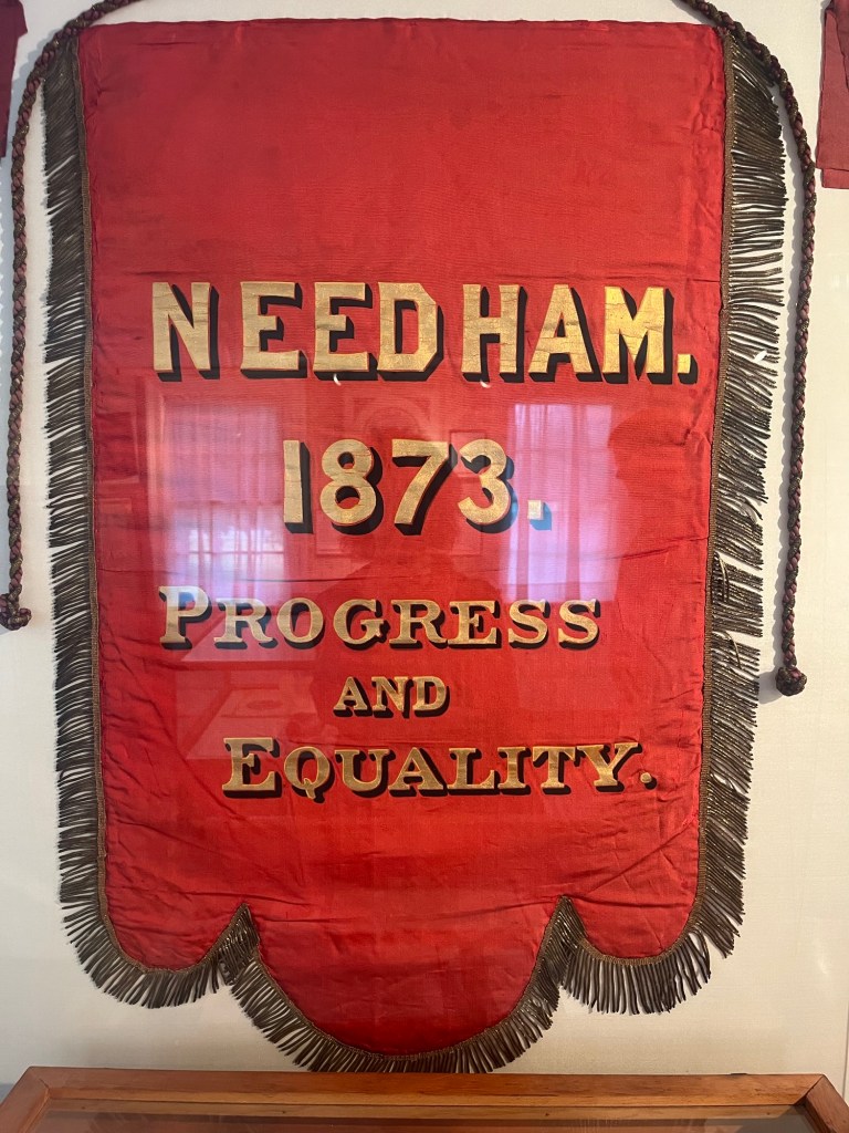
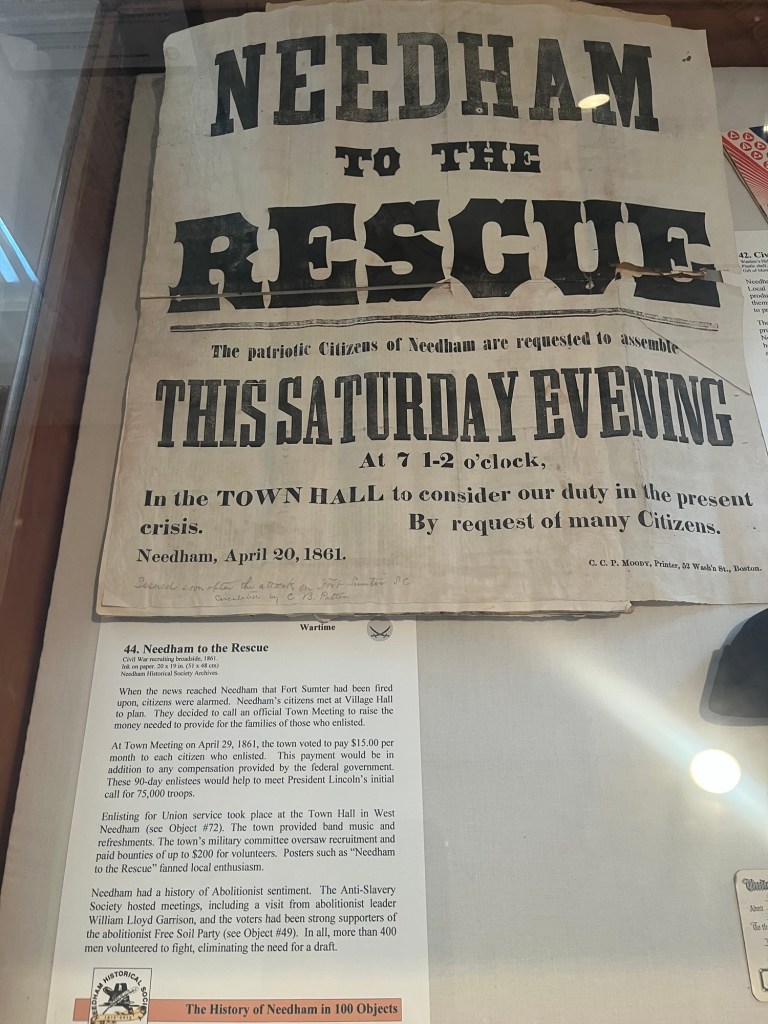
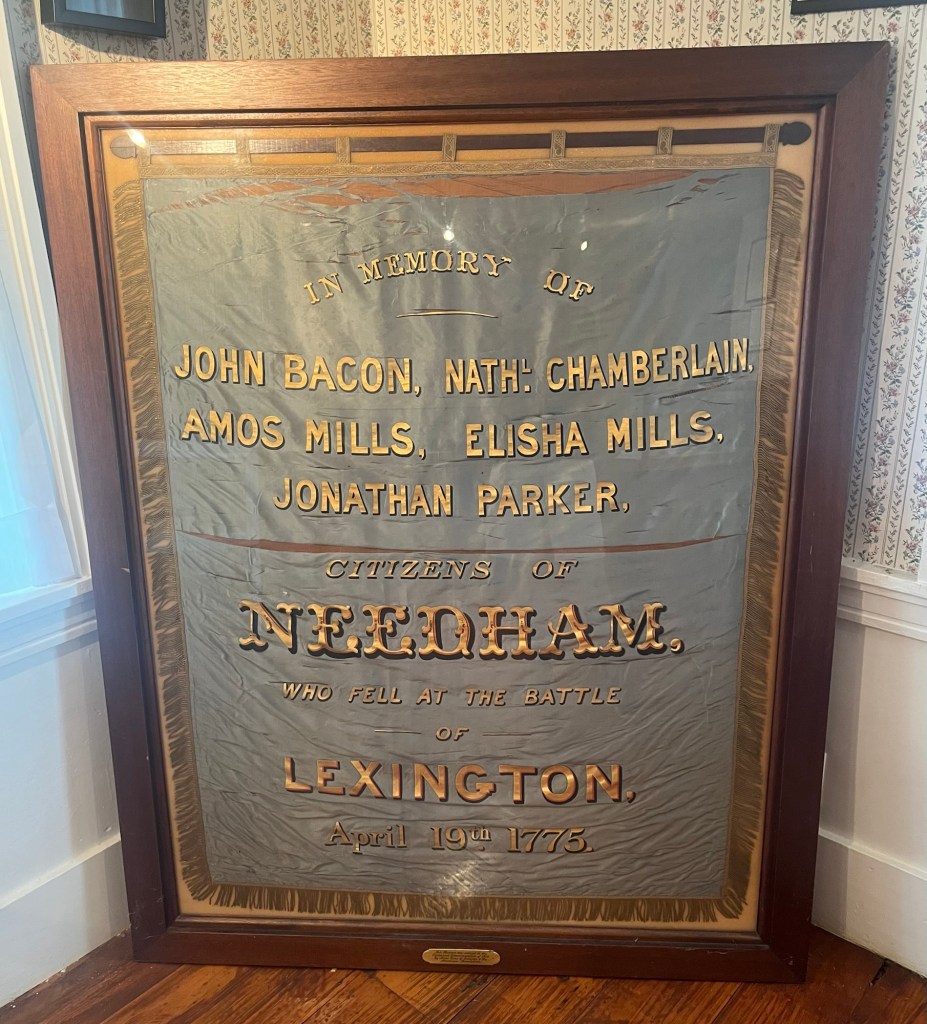
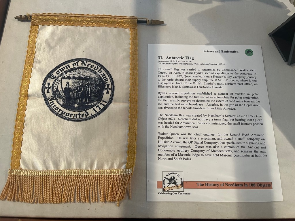
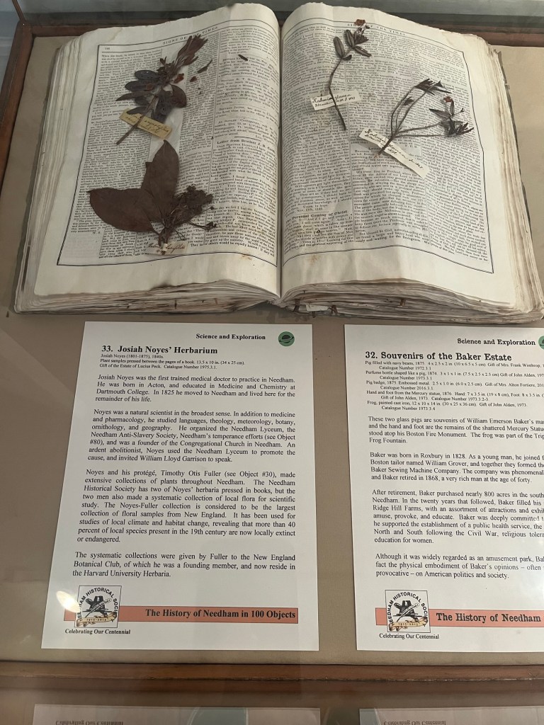
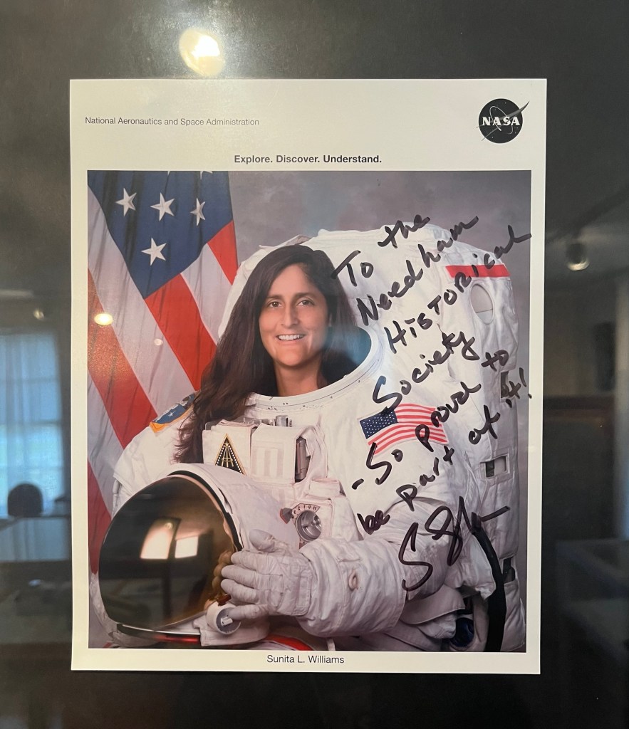
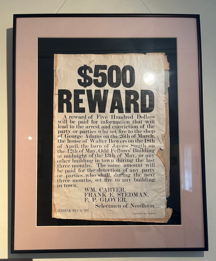
Some information on the Needham vote in 1792, when John Hancock was on the ballot for Governor and Samuel Adams for Lieutenant Governor. About 6% of those eligible to vote voted.A banner supporting women’s right to voteA meeting called to address the start of the Civil War. Needham voted to pay $15/month to each male who enlisted for the Union.This Lexington Banner was made by the town for the 1875 Centennial of the battles that began the American Revolution on April 19, 1775A Needham flag ended up at the South Pole! It was carried by Commander Walter Kerr Queen of Needham on Byrd’s 2nd expedition to Antarctica.Flora collected by Josiah Noyes, the first trained medical doctor in Needham. Sunita Williams was born in Ohio but grew up in Needham. She has completed 2 missions on the International Space Station, logging 322 days, including 7 spacewalks (a record for a woman).Aly Raisman, a two-time captain of the gold-medal winning US Olympic gymnastic teams, was born in NeedhamApparently, there was an arson problem in Needham in 1887.A quaint promotional banner from the 1920s to try to encourage people to settle in NeedhamSome dishwater and utensils from the McIntosh Tavern that was once located down the street from the house.A very impressively bunted Needham Town Hall.
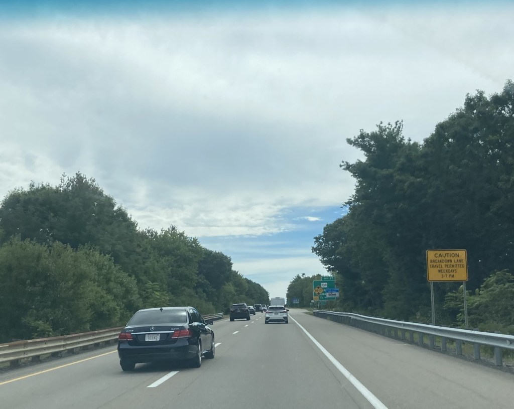
Bob and I decided to go a bit further afield today and drive about an hour southeast of Needham to visit Plymouth, Massachusetts, home of the first Pilgrim settlement. Part of our journey to Plymouth took us on state highway 3, where we were surprised to see signage indicating that driving in the breakdown lane is permitted during certain times of the day, morning rush hour times going towards Boston and evening rush hour times coming out of the city.
Note the yellow sign indicating the hours for permitted driving in breakdown lane, the “lane” on the far right which is generally only used by vehicles that have pulled over due to a mechanical issue or because they’ve been stopped by police.
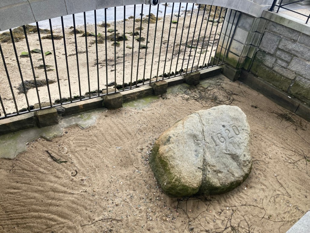
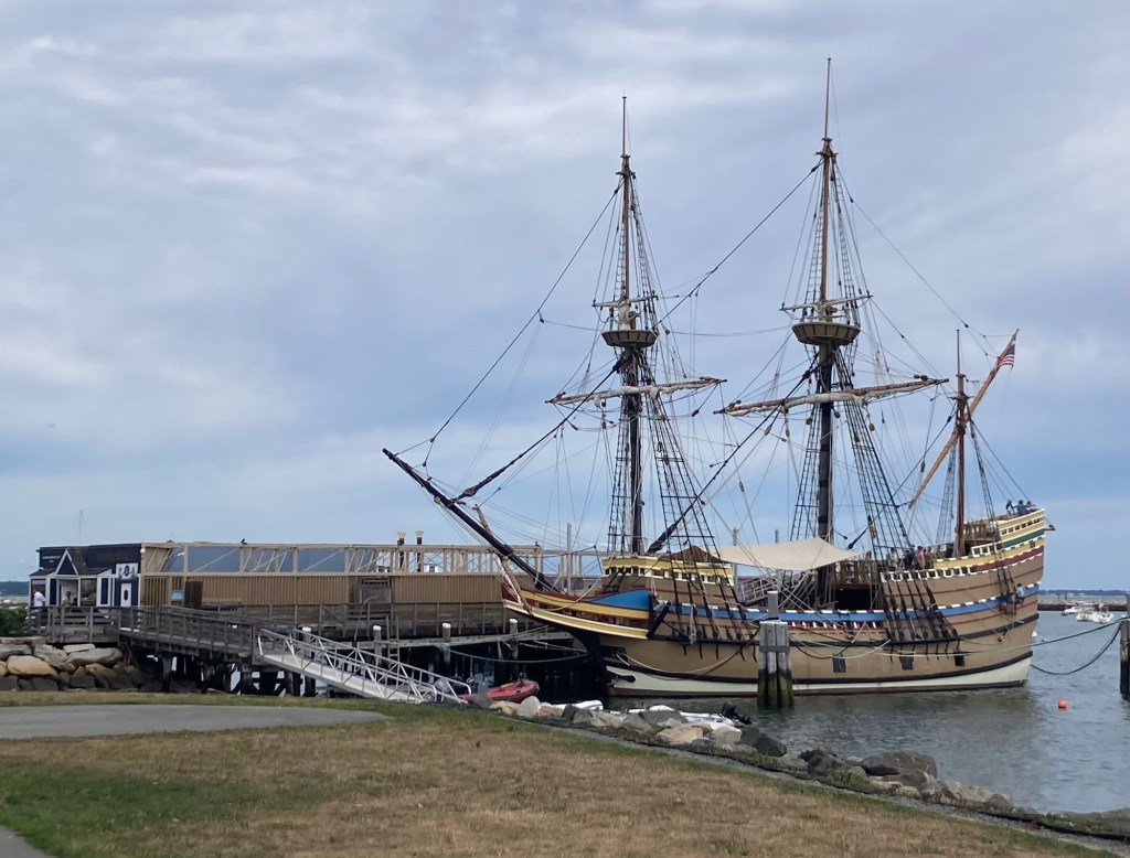
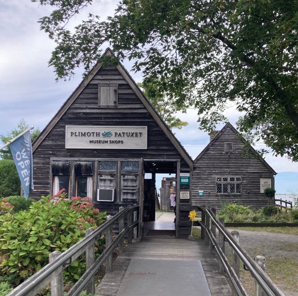
But onto Plymouth. Plymouth was the site of the colony formed in 1620 by the Pilgrims, English settlers who came to the US on the Mayflower. The community was named Plymouth by John Smith after a city in Southwest England. Among other things, Plymouth was the site of the first Thanksgiving feast. It is currently the county seat of Plymouth County, Massachusetts, and has a current population of about 61,000. The US town was historically spelled Plimouth, and there were a number of businesses that we saw that used that spelling.
We found free 2-hour parking on Main Street and walked from there down to the harbor before coming back up to explore Main Street.
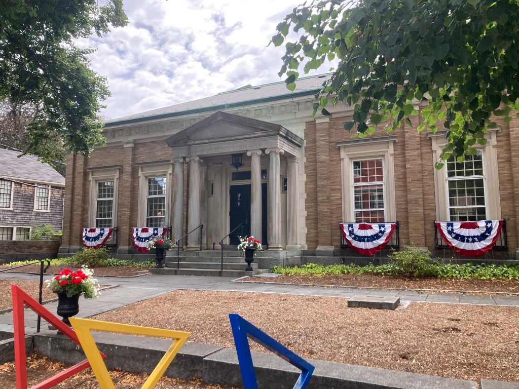
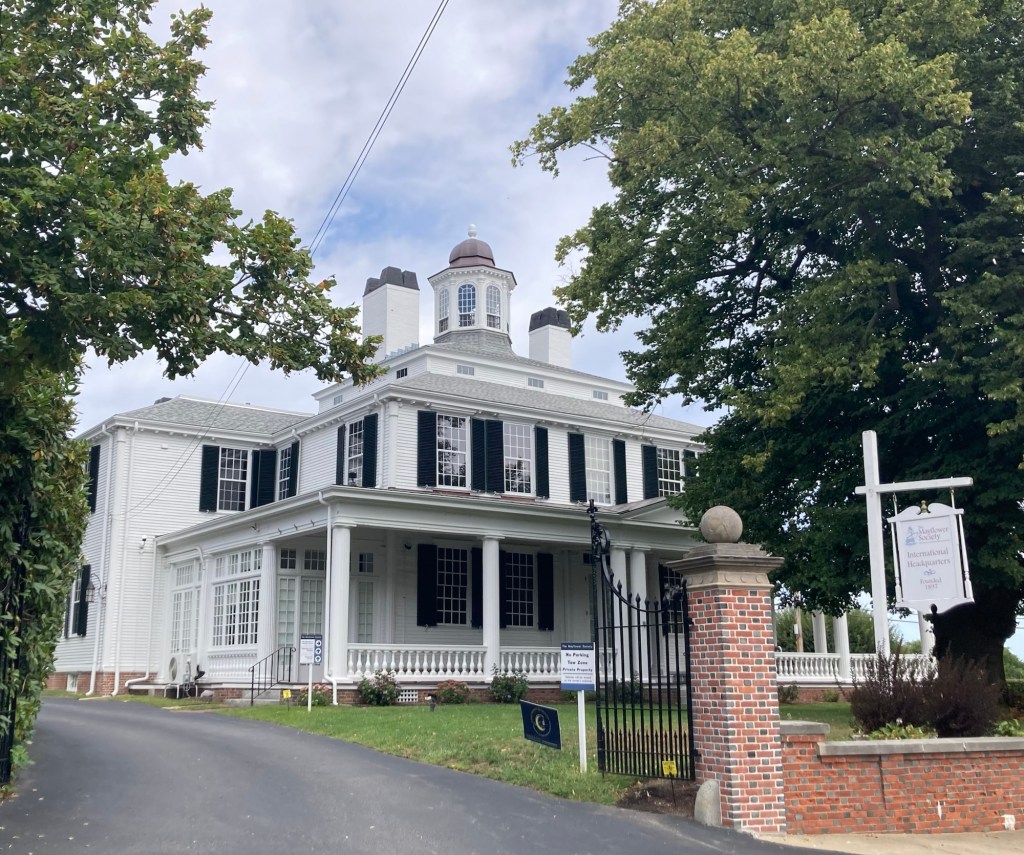
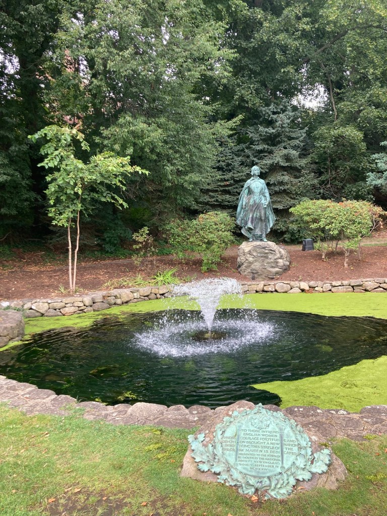
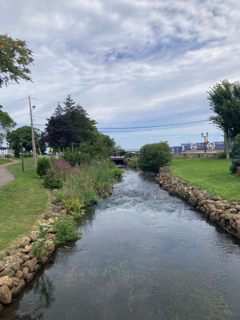
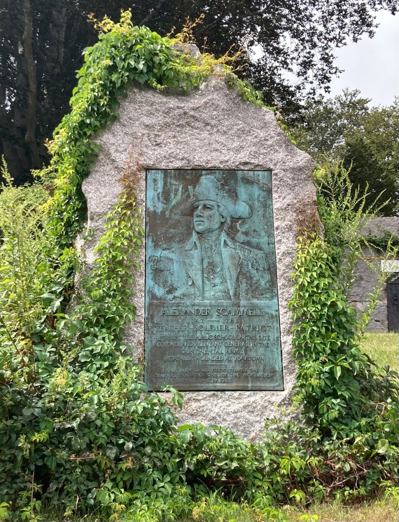
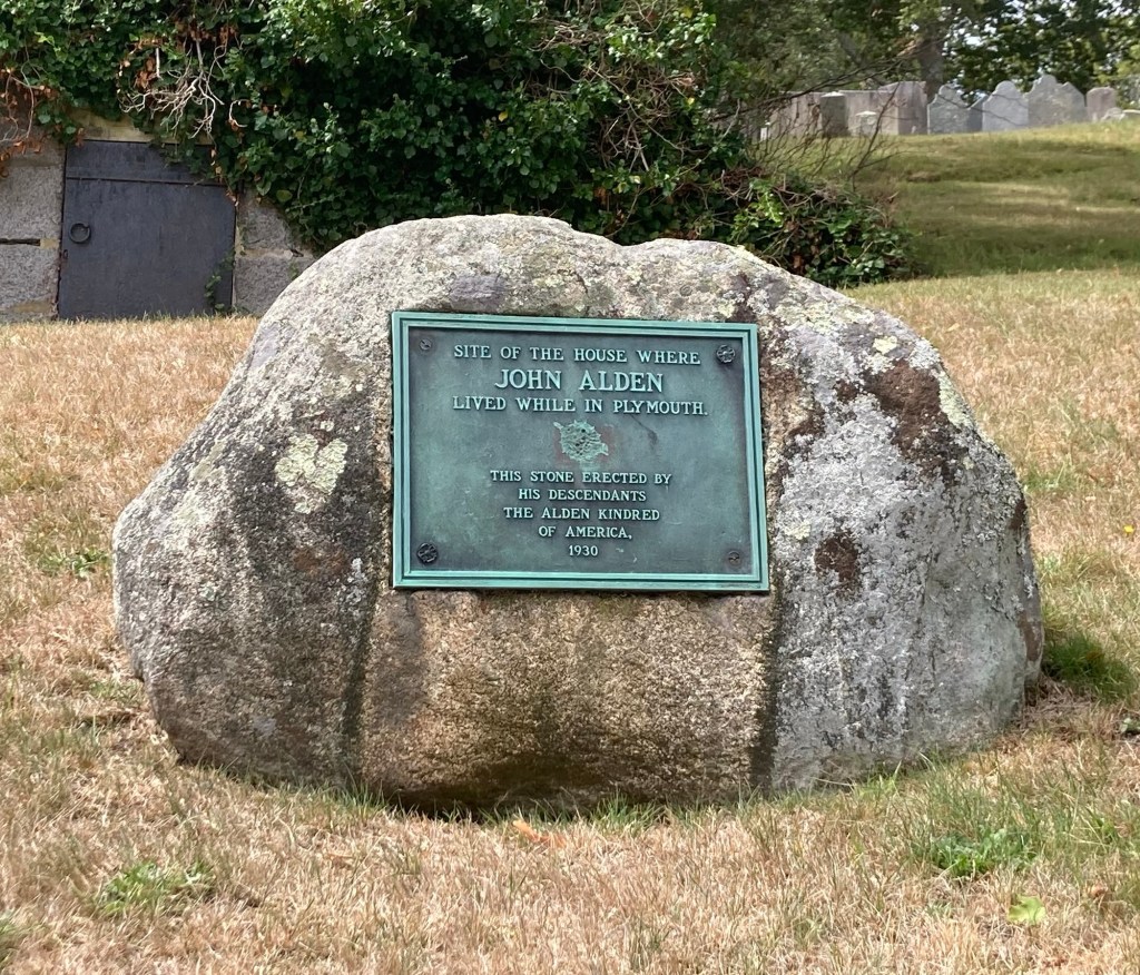
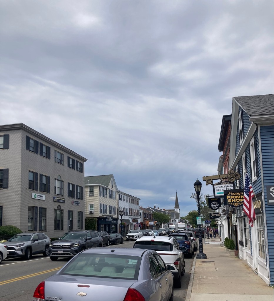
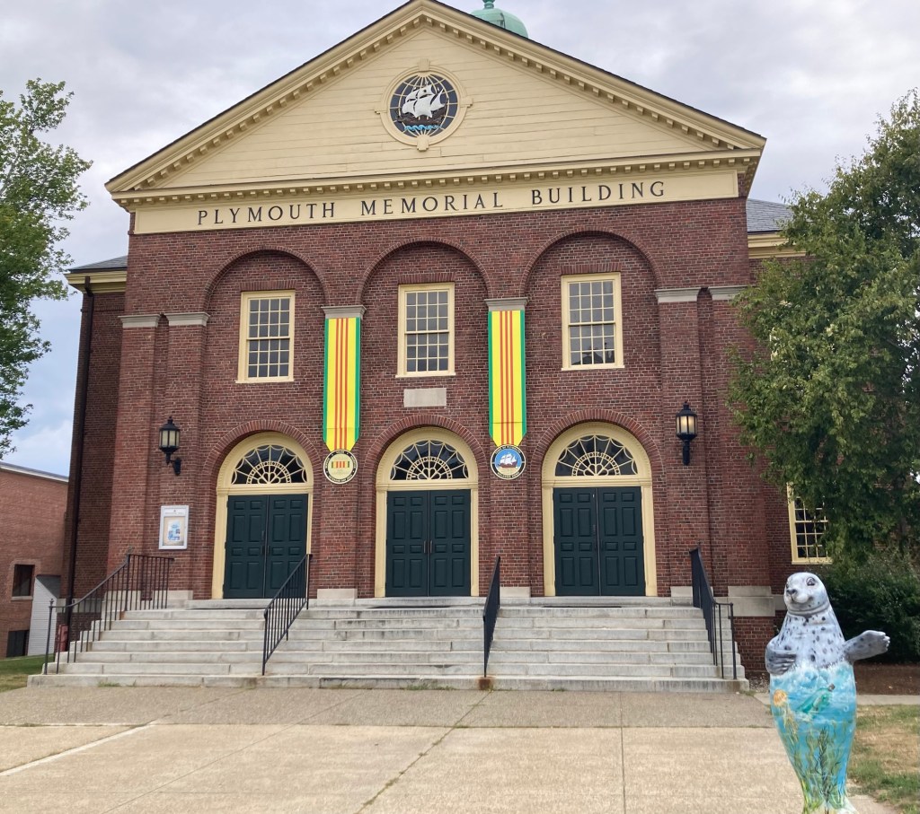
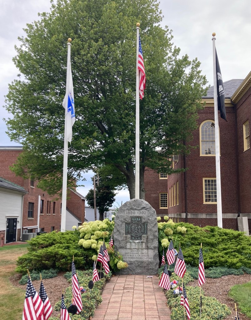
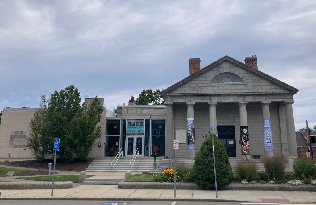
The Russell Library with colorful bike racks out front.Home of the Mayflower Society, formed in 1897 to promote the education on the Mayflower Pilgrims and research to establish their lineal descendants.Plymouth HarborPlymouth Rock, recognized as the landing site of the Pilgrims. It is housed under a covered but open air structure in Pilgrim Memorial State Park, which runs along Plymouth Harbor.The Mayflower II, a full-scale reproduction of the original MayflowerA couple of museum shops in the state park near the Mayflower IIThe shoreline and buildings in the opposite direction from the ship and rockAn important person in Plymouth history Walking into Brewster Gardens, which lies between the harbor and Main StreetA statue by Barney Zeitz in 2001, celebrating the immigrant settlers of Plymouth, “from many cultures and countries over the course of three centuries helped build upon these shores a robust and hospitable community.” A statue to the fortitude and resilience of pilgrim womenTown Creek, running through Brewster Park to the harborThis is the 5th building on the site of the first church in Plymouth Behind the church is Burial Hill, a large cemetery that was used from 1600s-1957. This impressive marker, from 1923, was close to the church.Another nearby marker indicated where John Alden lived while in Plymouth. He was a crew member (cooper) on the Mayflower, who ended up staying in Plymouth and was one of the signers of the Mayflower Compact (first governing document of Plymouth Colony).The old post office on Main Street, which also now houses retail shops as wellLooking down Main Street in Plymouth Plymouth Town HallCurrently a 1,500 seat event venueA veterans memorial marker next to Memorial Hall for the Spanish War, 1898-1902Pilgrim Hall MuseumThe building on the right, which appears to be a former church, is now the Spire Center, a performing art center
Yesterday, Bob and I were reunited in Needham, Massachusetts, just in time for dinner after Bob flew from Cedar Rapids, Iowa, to Chicago and then onto Boston Logan Airport. His plane in was a bit late, so he caught an Uber for the approximately 40 minute ride from the airport, as he would have had to have waited about an hour to catch the next train from the South Station.
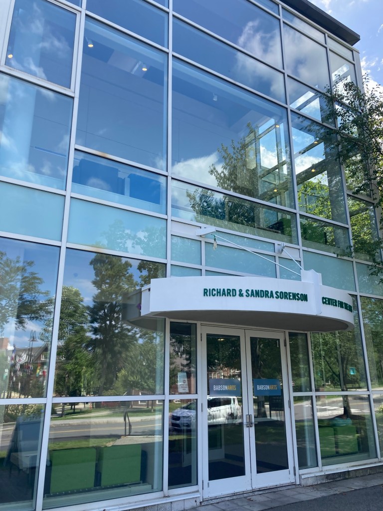
Prior to his arrival yesterday early evening, I walked onto the nearby Babson College to watch a kid’s performance of the musical “Beetlejuice.” I had seen signs up in the neighborhood and thought it would be a good thing to support. I think it was the culmination of a summer camp. It was cute. The sound wasn’t great, and I’m not sure I saw any future Meryl Streeps or Robert De Niros, but it was an entertaining 75 minutes, and we clapped for every song.
The small performing art center at Babson
Today, we did a shop at Trader Joe’s, as Bob is cooking tonight (an onion and kale pizza with mozzarella and anchovies!). Yesterday, he had to settle for me warming up a Spanish omelette with some Spanish cheeses and bread.
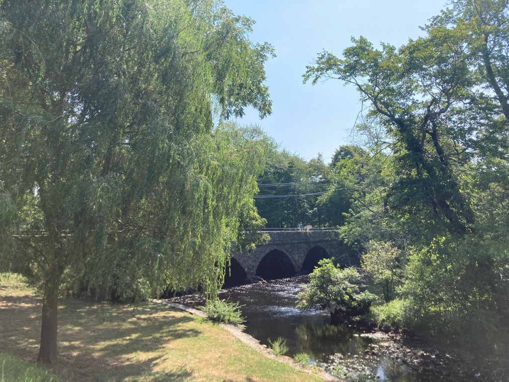
Then, we drove about 10 minutes to the community of South Natick for a short walkabout.
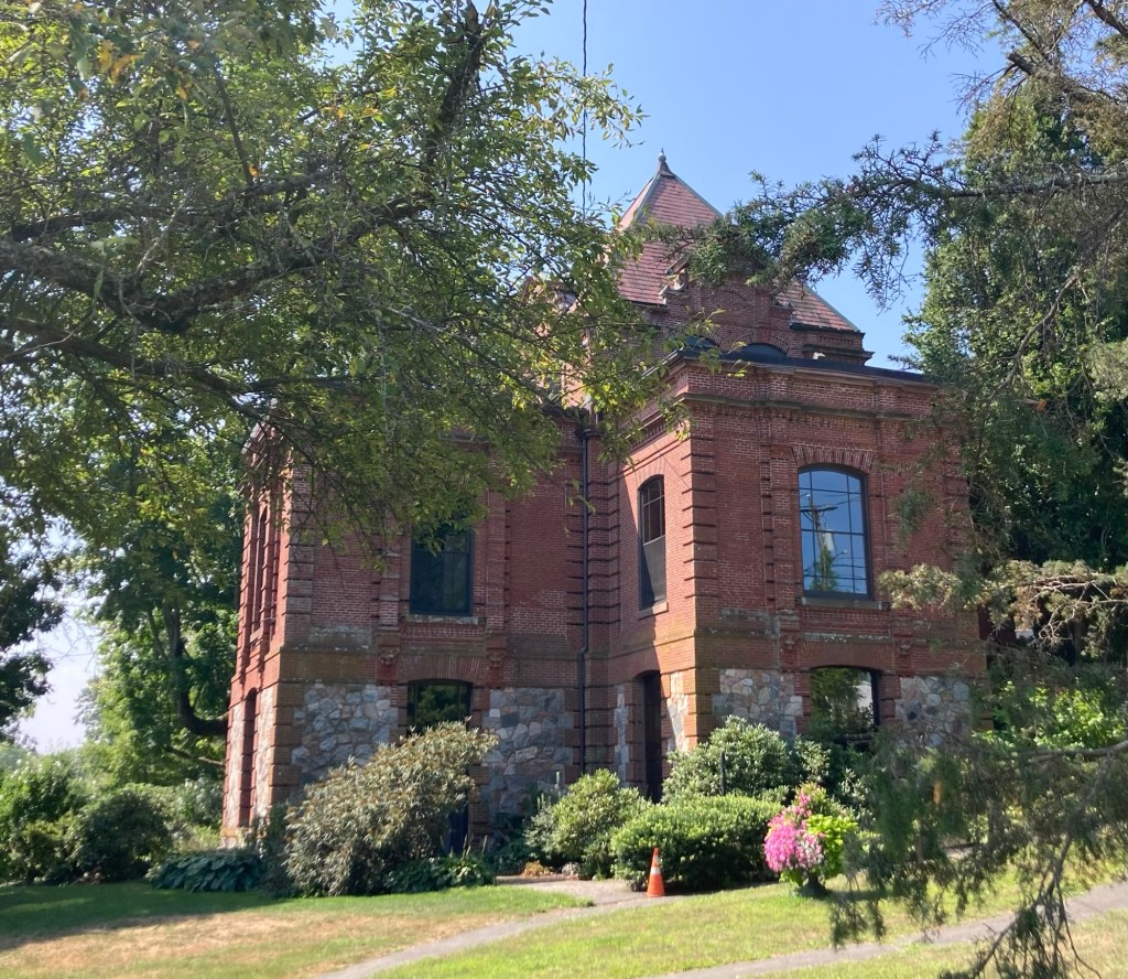
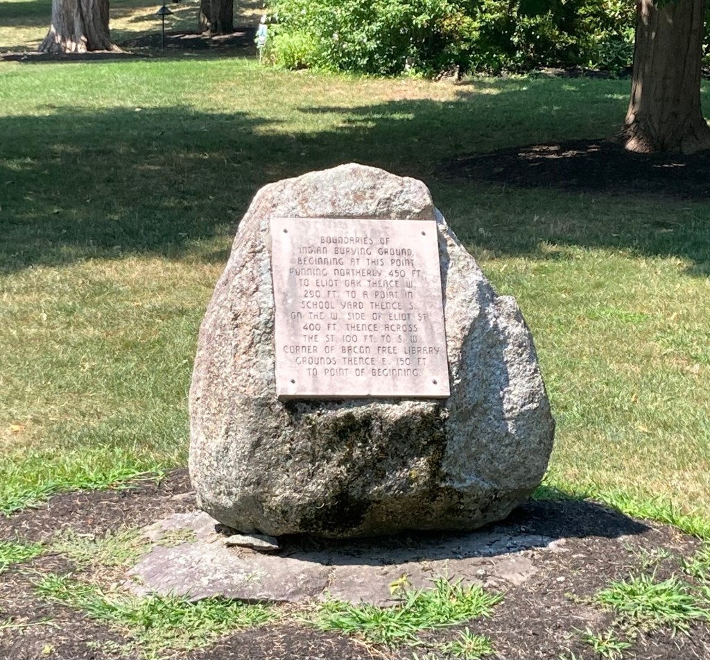
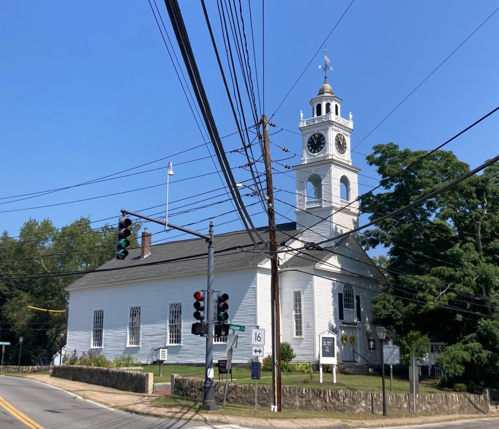
The South Natick Dam. A sign near the dam noted that fish between here and some dam in Boston are contaminated with PCBs.A bridge over the Charles River near the damThe former Bacon Free Library, which is now the Natick History MuseumA stone on the grounds of the history museum, noting the boundaries on Indian burying grounds Eliot Church, named for John Eliot, the founder of Natick. The sign in front of the church noted that there are no Sunday services until fall.
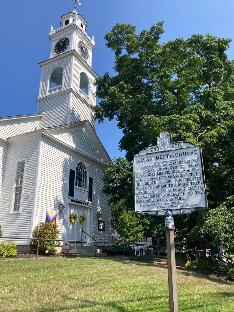
In reading about the history of Natick, Wikipedia states that it was founded in 1651 by John Eliot, a Puritan missionary born in England, who received a commission and funds from England’s Long Parliament (from 1640-1660) to settle Massachusetts Indians, called Praying Indians, on land deeded from the settlement at Dedham (another nearby community).
Natick was the first of Eliot’s network of praying towns, which were self-governing under Indians but combined both Indian and Puritan culture and practices. These communities were created by the colonial government in a ring around Boston as a defensive strategy.
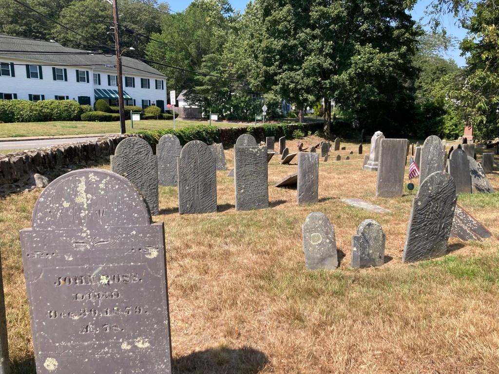
A sign in front of the church noting Eliot’s work with the Indians on this site.An old cemetery behind the church.
The degradation of the stones make them difficult to read.
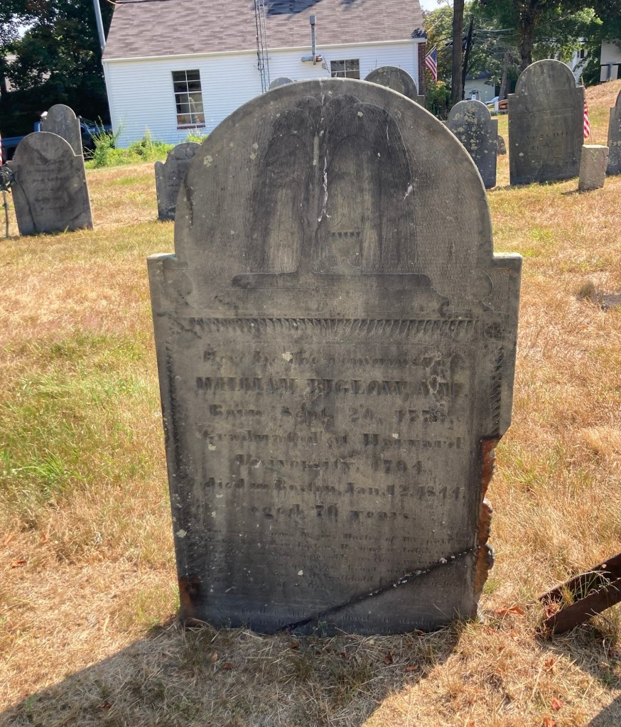
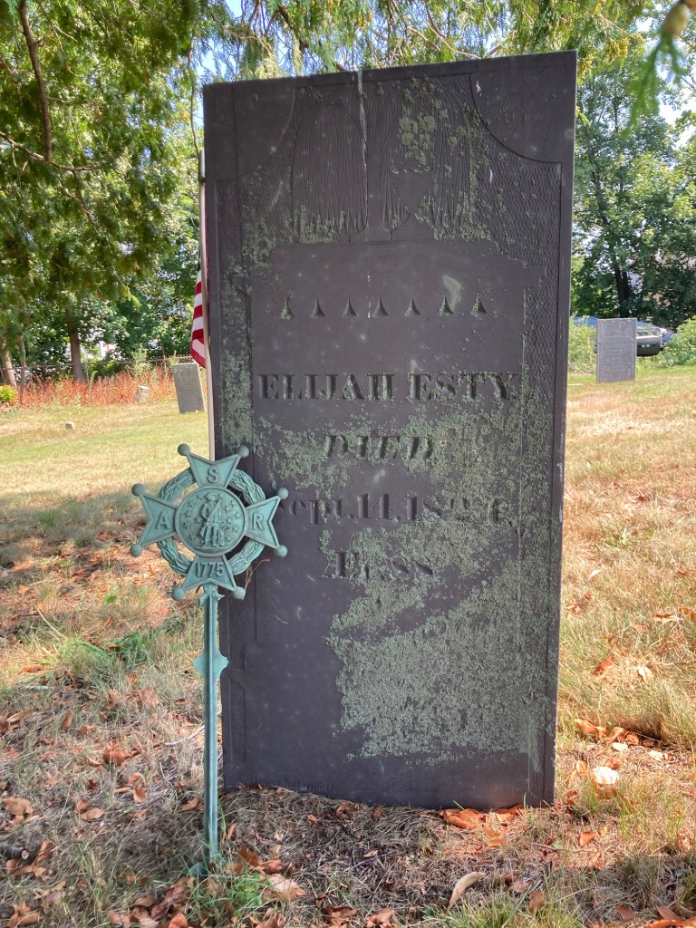
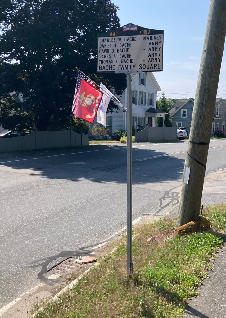
This cemetery marker from the Sons of the American Revolution, seems to indicate that Elijah Esty fought in that war.A small park on the main street (Eliot Street) through the small town center of South NatickThis unusual (to us) memorial marker for a family of men who served in WWII and Korean Wars was located in a residential area along Eliot Street.
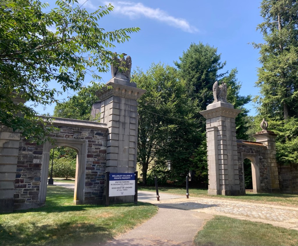
The homeowners had the cleaning service coming today, so I decided to let them clean in peace and take myself out of the house for a few hours. I opted to walk to Wellesley College to see a bit of the campus.
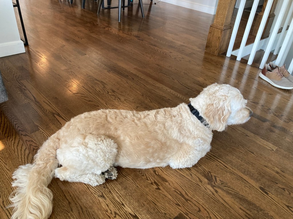
Zeus stayed home and monitored the cleaning efforts (spoiler— they did good work!), but earlier today he assumed what appeared to me to be a cat-like pose.
I have yet to see another dog lay with his front paws tucked underneath them.
Wellesley College is a private women’s liberal arts college in nearby Wellesley. It was founded in 1870 as a female seminary. It is a member of the Seven Sisters Colleges, an unofficial grouping of current and former women’s colleges in the northeastern United States. It offers 60 majors spanning the liberal arts. I first became aware of it when I ran the Boston Marathon, as they always have a vocal group of supporters along the route.
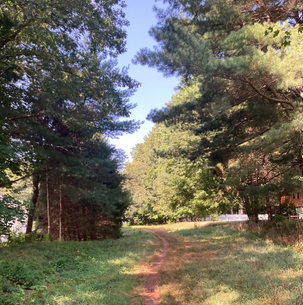
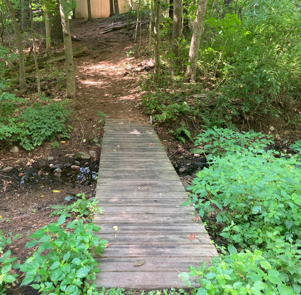
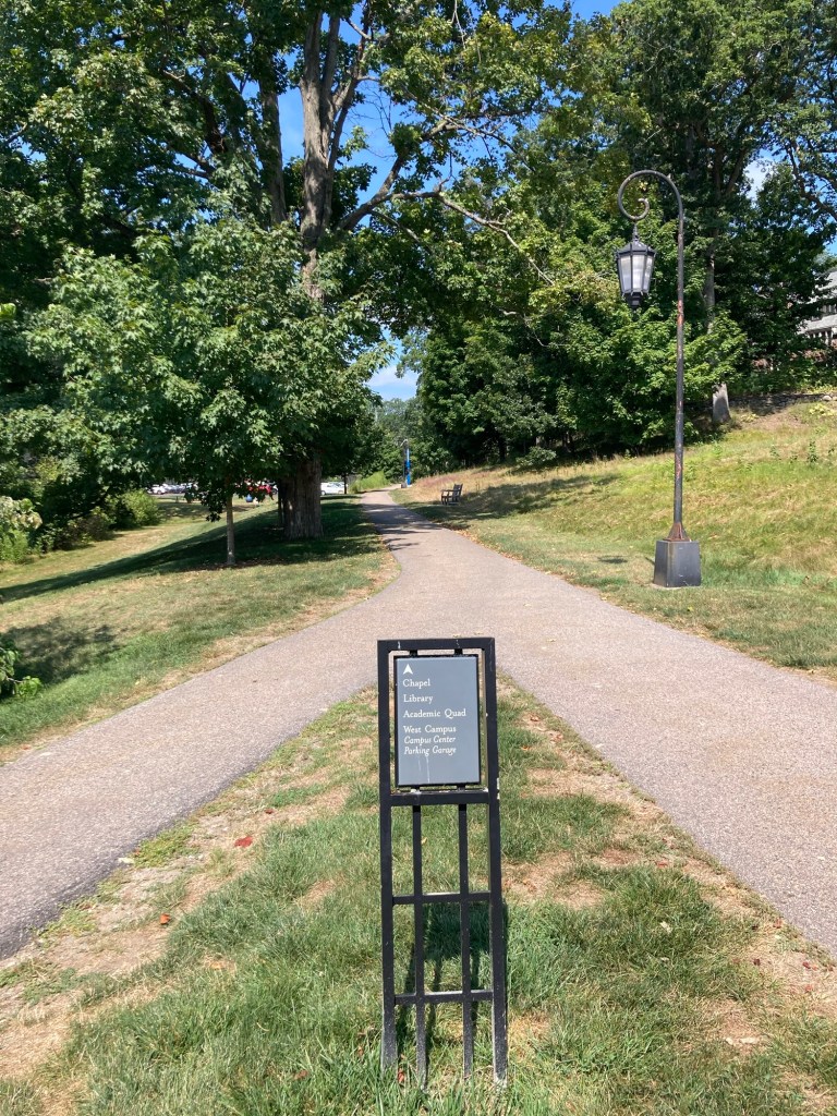
It was a 2.3 mile walk onto campus from the house. I was able to take the same off-road path that I did the last time I walked to Wellesley (town), but I got to stay on it for longer.
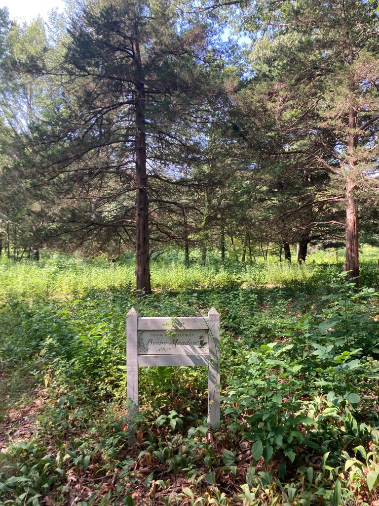
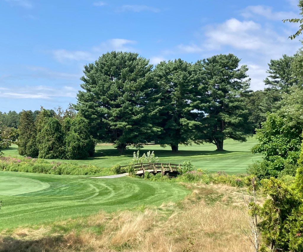
Starting a new (to me) section of the trailWalking by some homesA boardwalk across a little streamMore of the pathBeebe Meadow, which I had seen signage for by a road I have run on. It is a lovely neighborhood meadow with some mown paths.Coming off the path, I walked a couple of blocks and was on Dover Road, with a private golf course
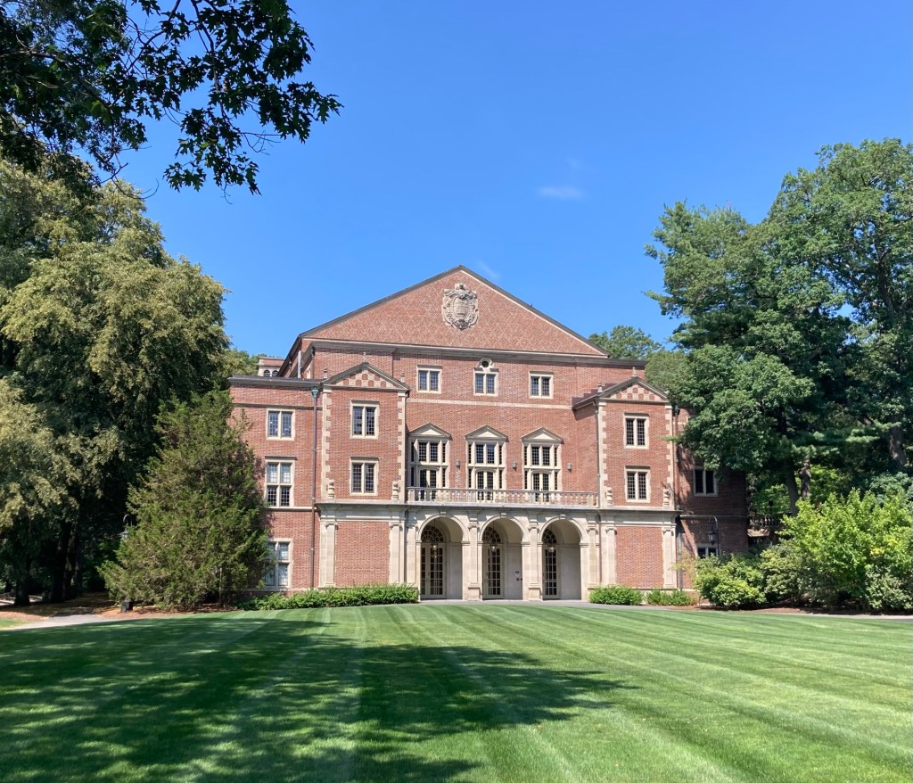
I didn’t know anything about the campus, but it struck me as a very peaceful setting. It is protective of its staff, faculty, and students, with buildings requiring that you scan your ID for entry.
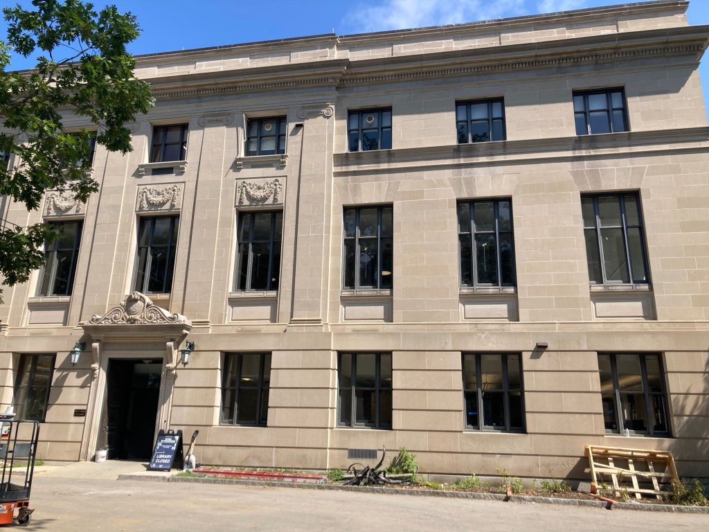
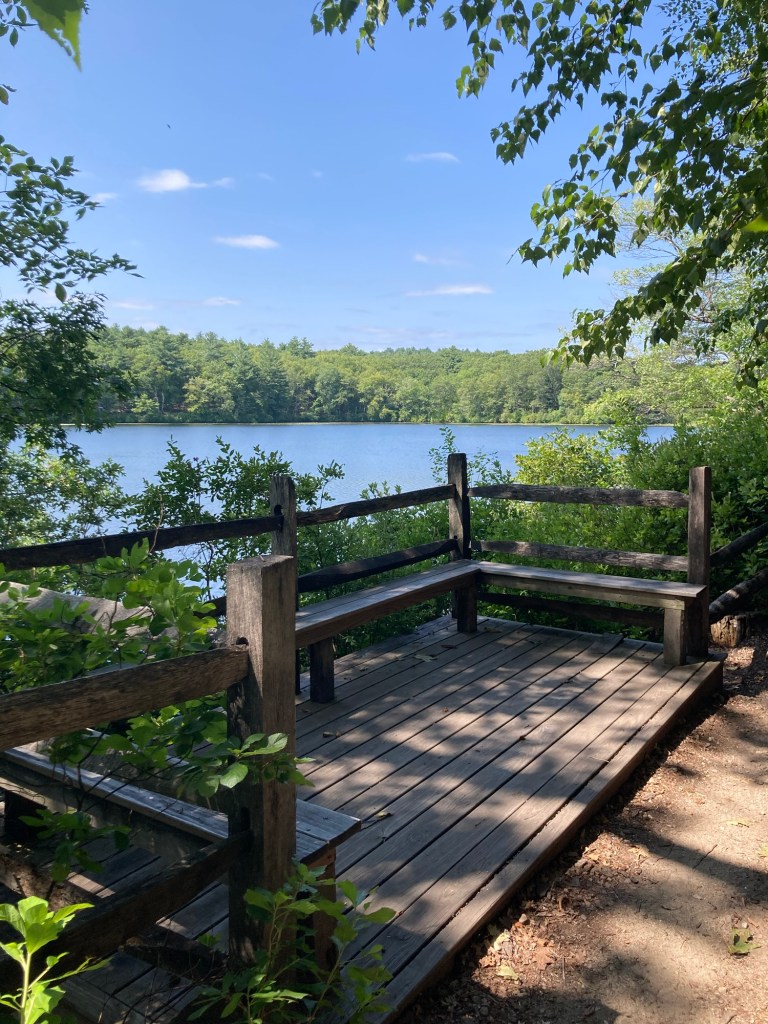
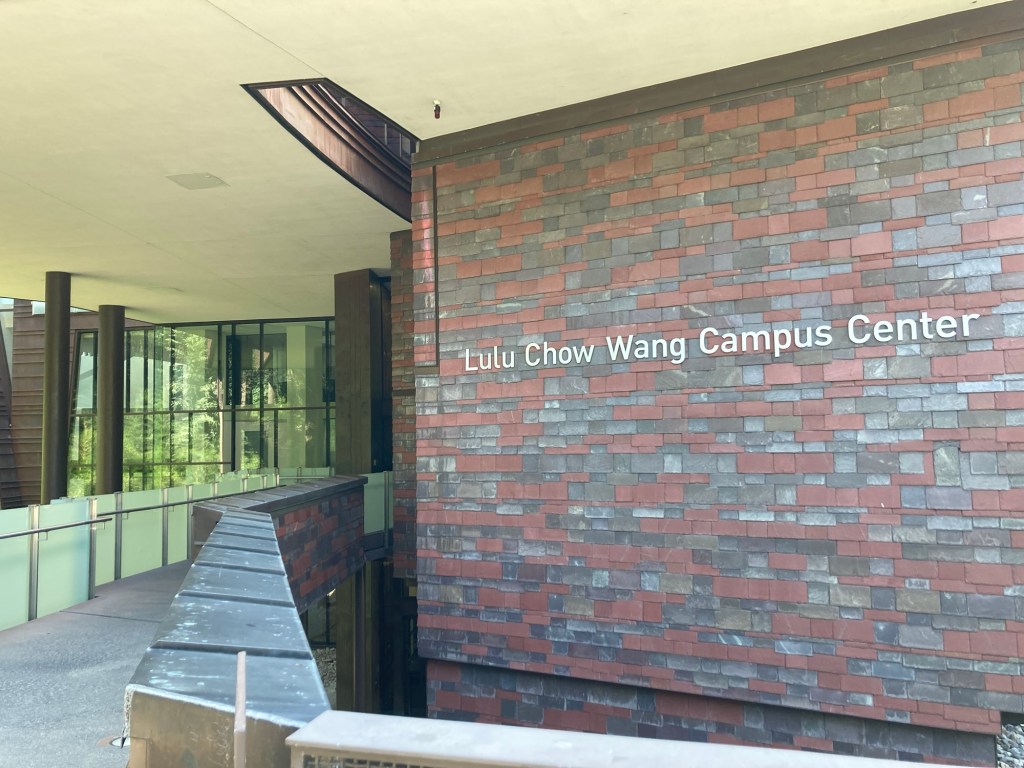
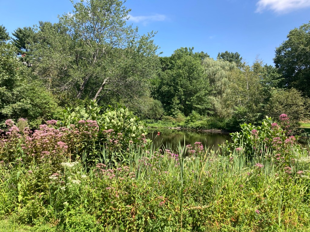
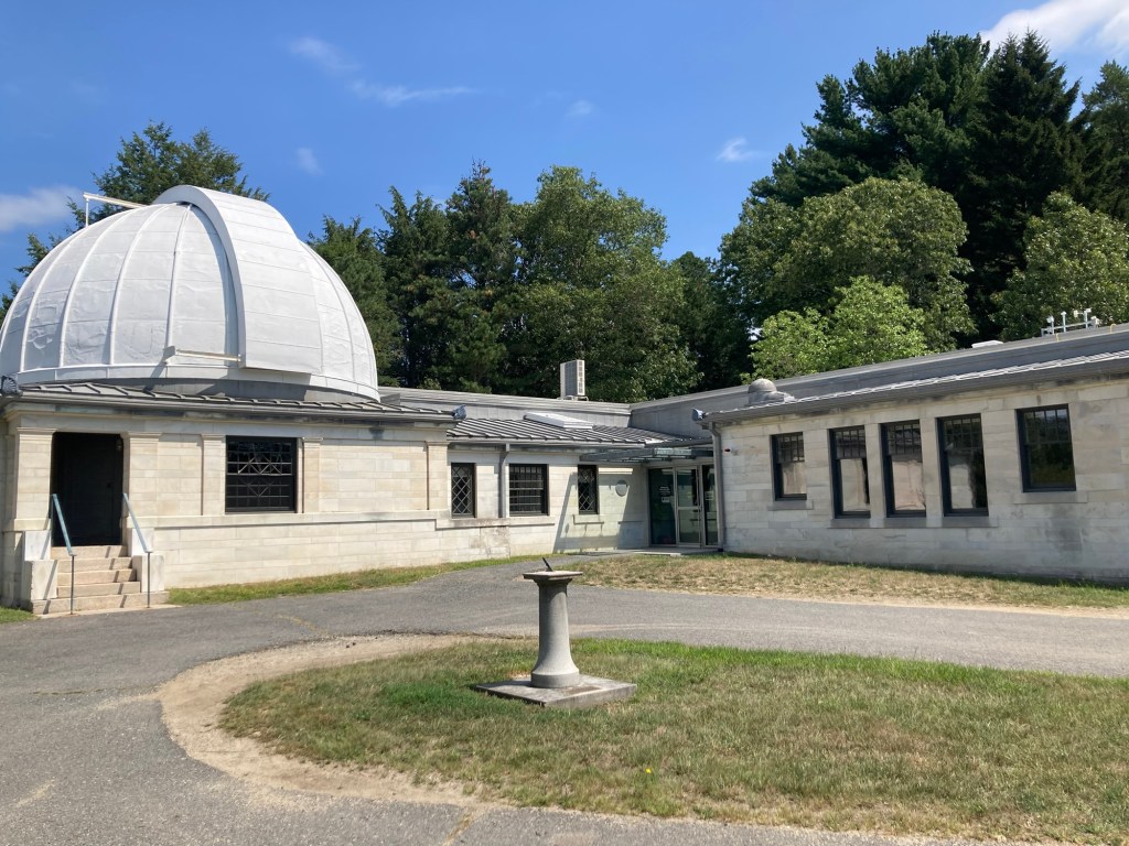
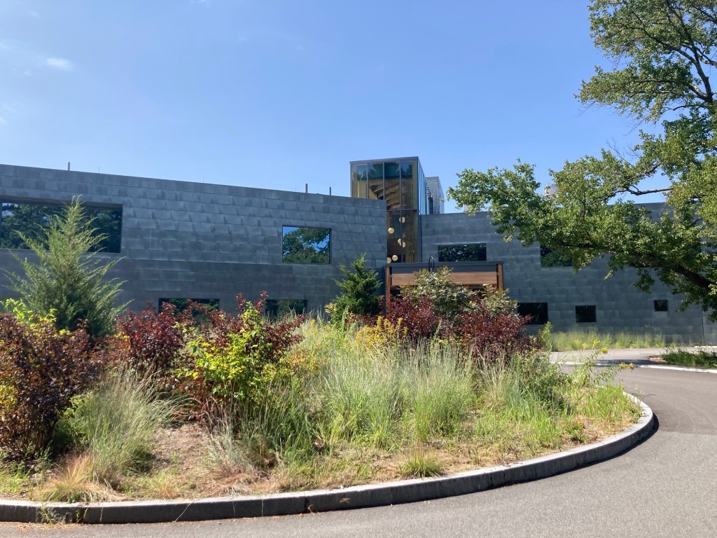
I actually entered at the east entrance, but this one is more impressive.Signage on campusLooking up at the Stone-Davis building from the walking pathThe college chapel The Clapp Library, which is undergoing some renovationsLake Waban, a lovely surprise. There is a 2.5 mile trail around the lake. The portion on campus is open to the public. The neighborhood owned portion is not.A viewing deckOverlooking a meadow towards the eye-catching Wang Campus CenterLooking back over the meadowWalsh Alumnae Hall across from the Wang Campus CenterA close-up view of the entry (for those with ID) to the campus center The entrance to the botanical gardens on campusThe observatory in the gardensThe Science ComplexThe Global Flora and Visitor Center next to the Science Complex
After my walk around campus, I walked down Central Avenue in Wellesley to the library, where I finished reading “The Boston Globe” that I had purchased this morning (my treat on non-running days). On the way back to the house, I exchanged books at a free little library. When I returned to the house, it was spic and span and the lawn people had been here as well.
Today was a Plan B day. I thought I was going to see some gardens in Wellesley, but they were having a sunflower event, where for $22 you could see their field of sunflowers (which I did on the drive in) and also be able to pick some. I decided maybe I’d wait to visit until after the event. Another item on my to do list was Houghton’s Pond Recreation Area, so I headed there instead.
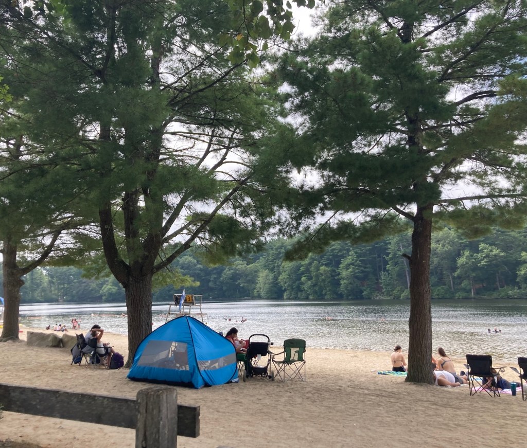
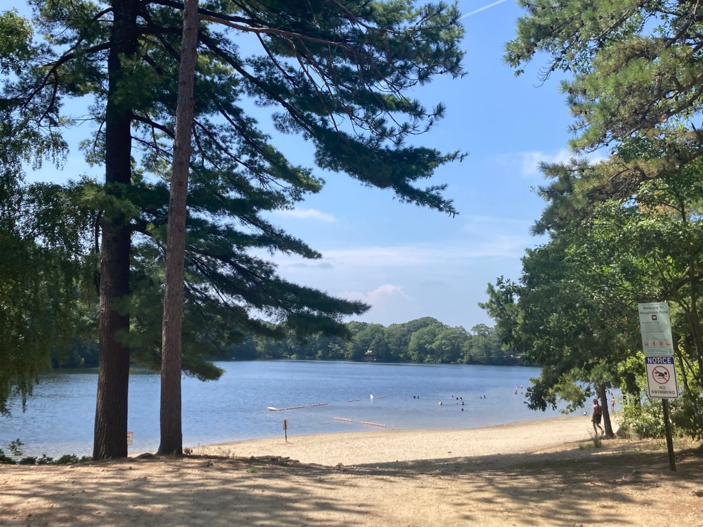
Houghton’s Pond is located on the outskirts of Milton, MA, which is southeast of Needham and almost directly south of Boston. It is an awesome park for swimming, canoeing, hiking, mountain biking, and horse back riding. There were lots of folks out enjoying the park — mostly near the water.
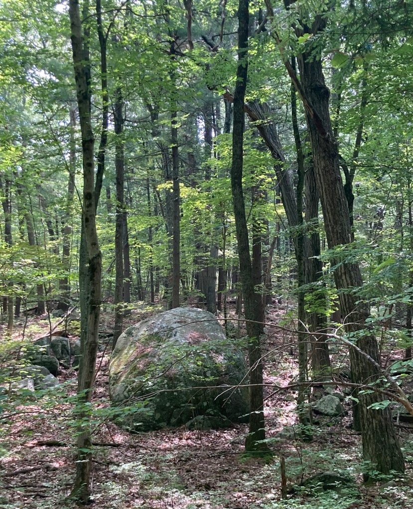
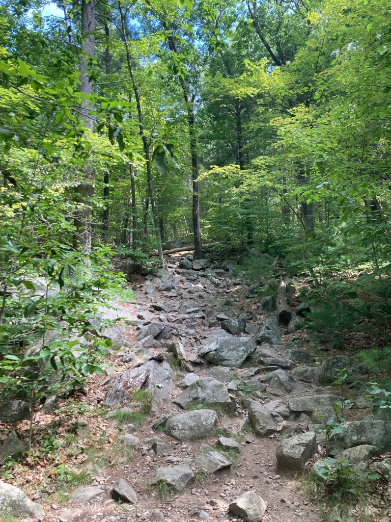
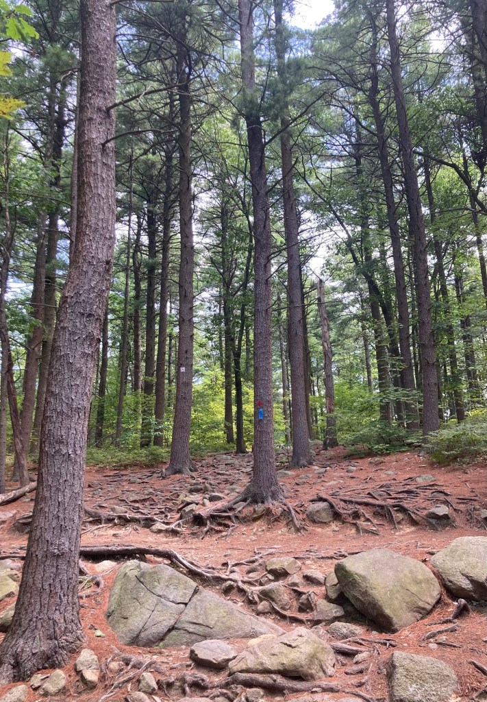
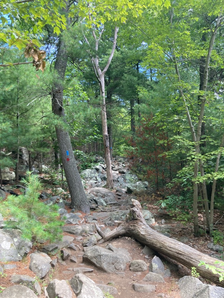
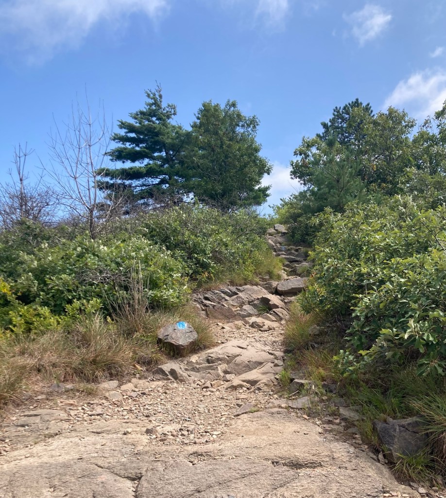
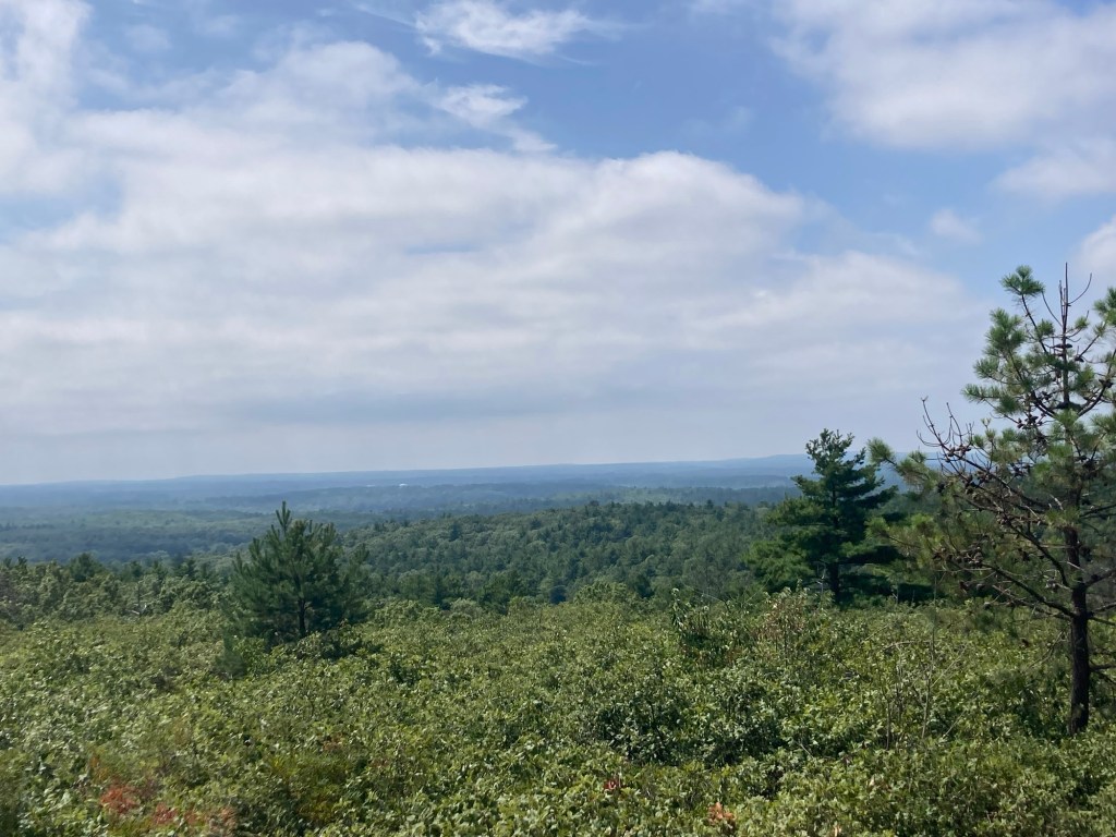
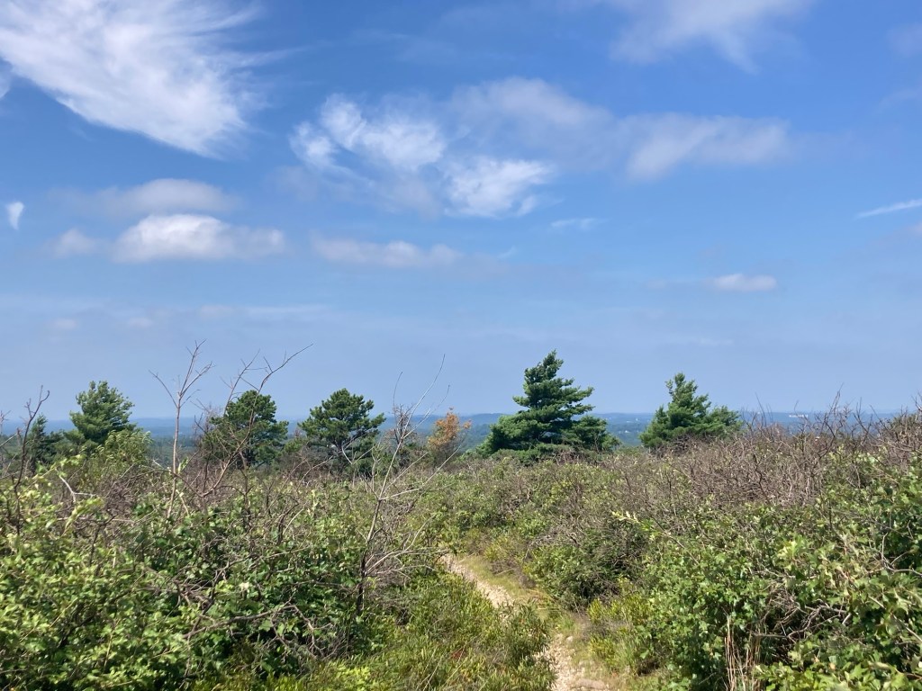
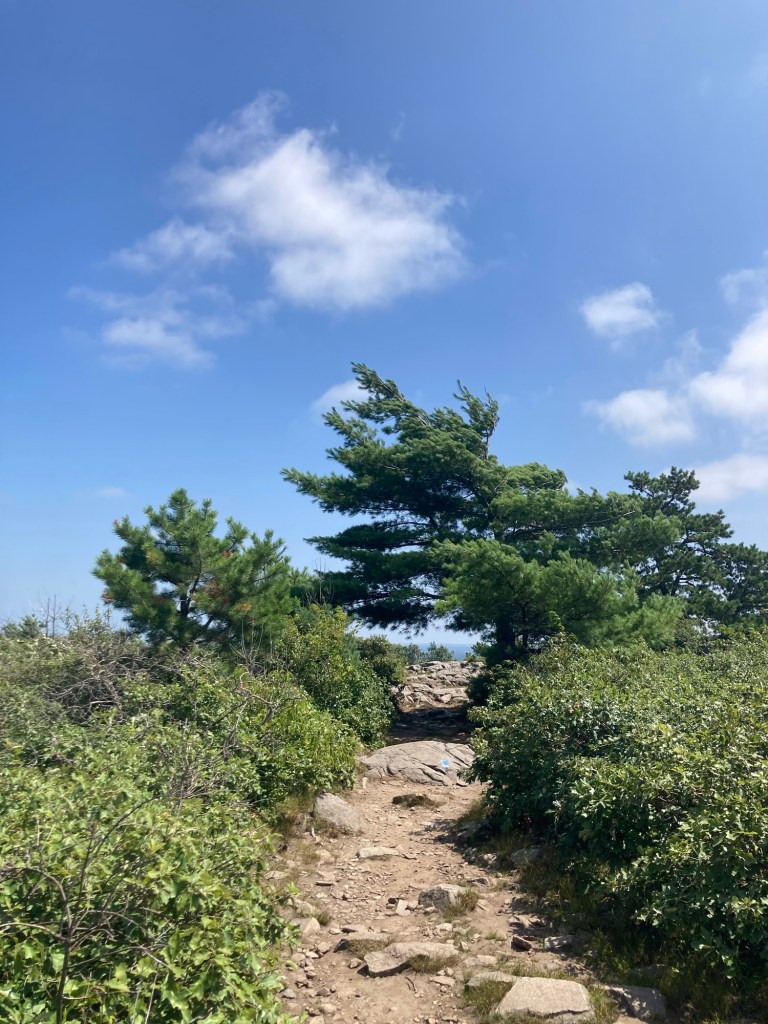
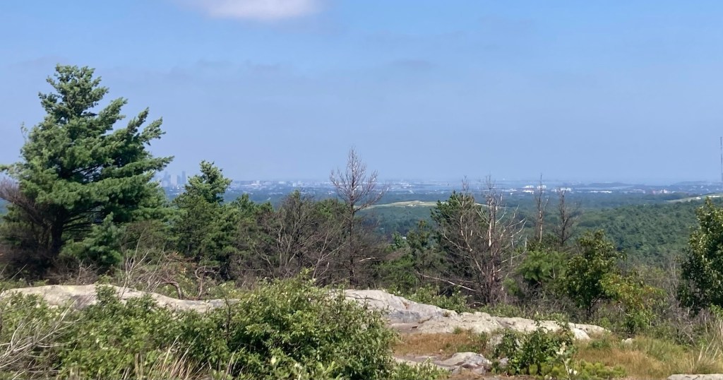
I had a good, if rock abundant, 1.5 hour hike, mostly shaded. I have to say that if I were to be here longer and do more hiking, I might invest in a bug hat that I have seen a few people with. It has netting over your face to keep the bugs out. There just always seems to be a couple of midges or some tiny type of gnat type bug that follow you through your hike.
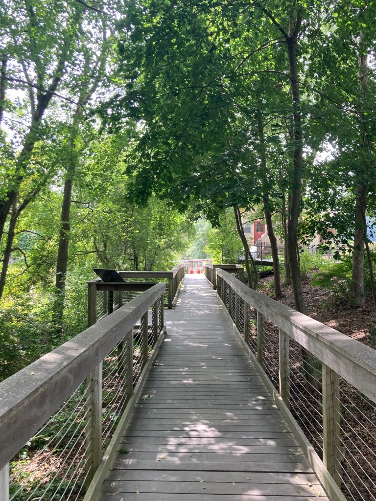
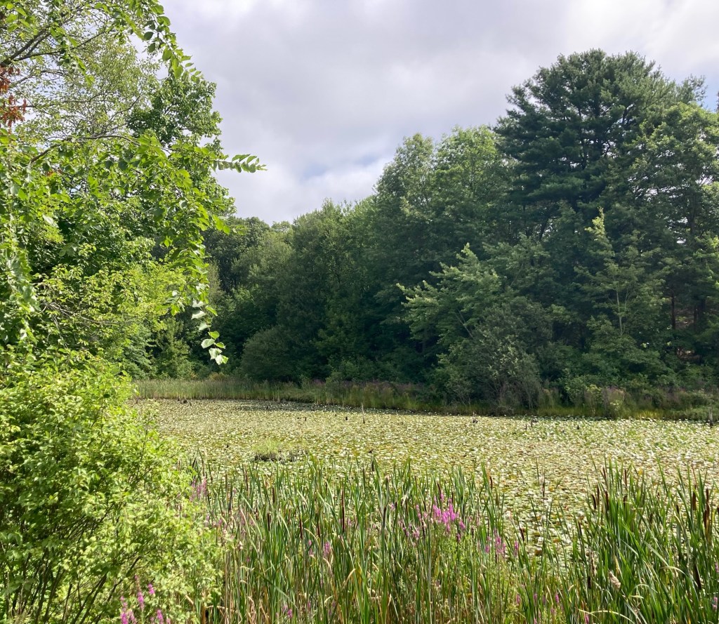
A boardwalk right off the parking lotThe marshy area by the boardwalkThe beach by Houghton’s PondOne of 3 hiking maps I saw at the park. I did all of the green route and an out and back on the red and blue route to go to the summit.Starting out before the green and red routes split.Rocks beside the trailA boardwalk in the woodsMore rocks by the trailDittoAnd then the rocks were the trailFollowing the ruttier, rockier blue/red trailDittoGetting above the tree lineViews of the surrounding areaDittoDittoThe last bit to the topMaybe Boston? Not sure what direction that was.A number on the tree that corresponds to the map — very helpfulAnother view of Houghton’s PondThe attractive concession stand