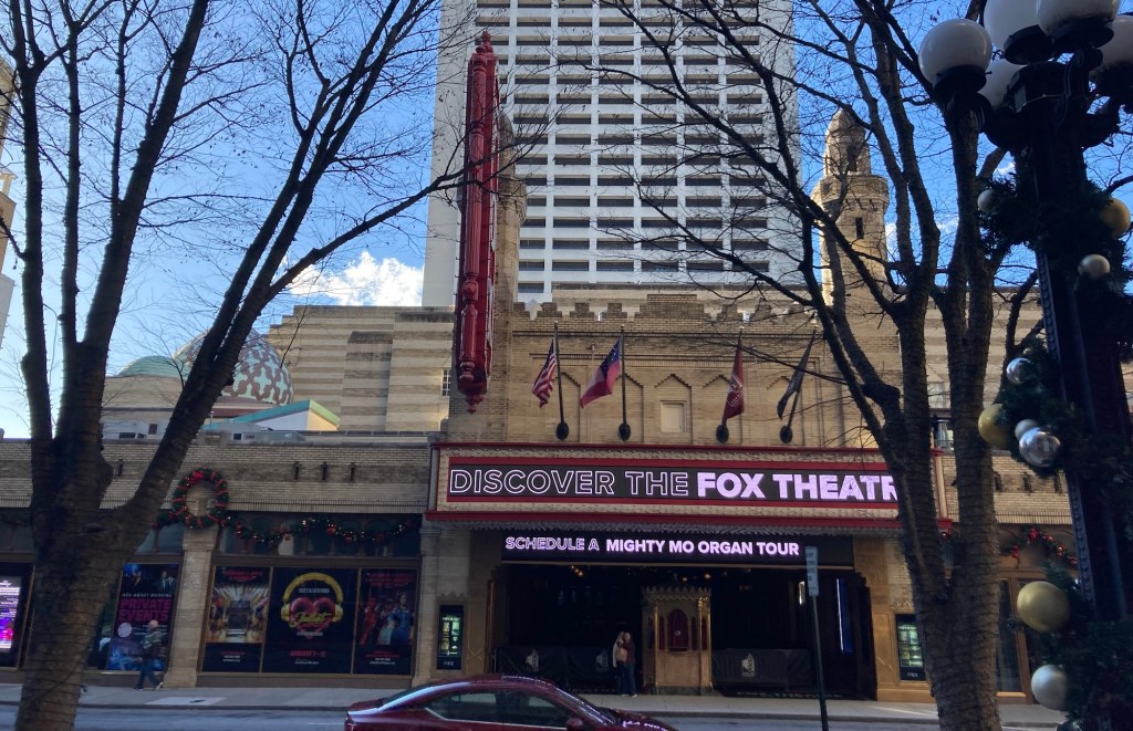
Bob and I spent a lovely few hours this afternoon walking to and then having a tour of Atlanta’s historic Fox Theatre. This on a day that almost hit a heat record at a high of 72 degrees Fahrenheit. A cool front comes in tonight and temps will soon be more seasonal.
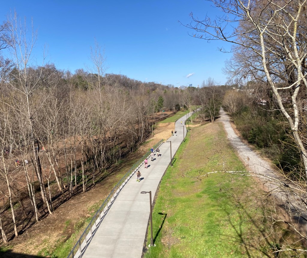
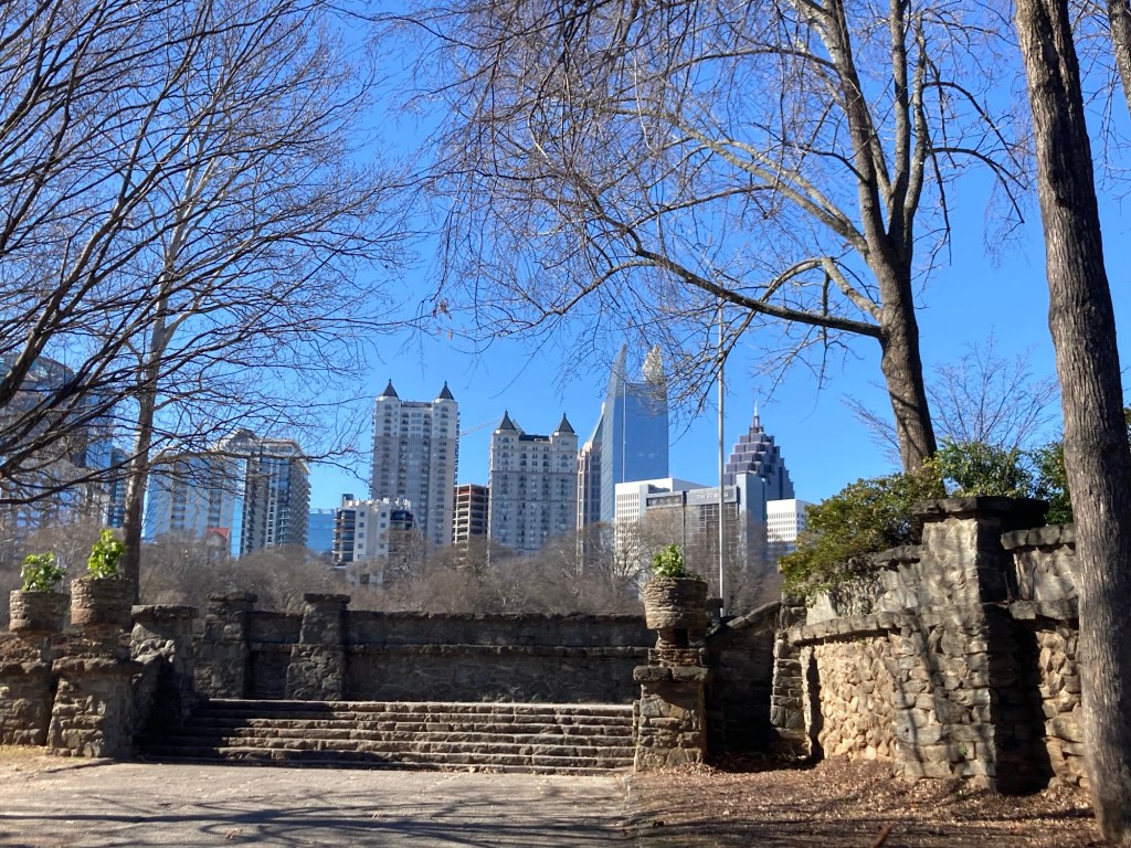
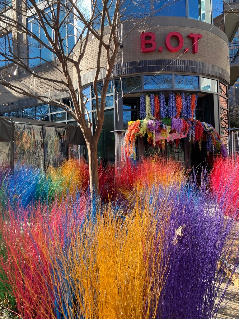
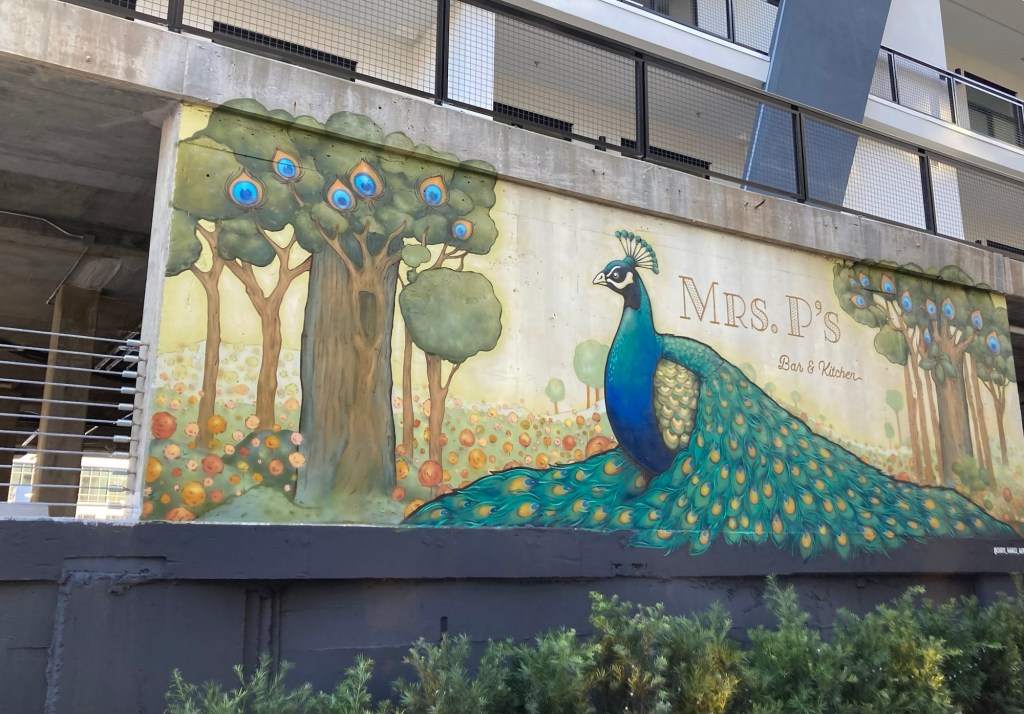
Walking on a bridge over the Beltline trail to Piedmont ParkLooking across Piedmont Park towards downtown A colorful entrance to a Thai restaurant A residential building near the theater
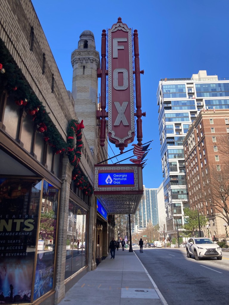
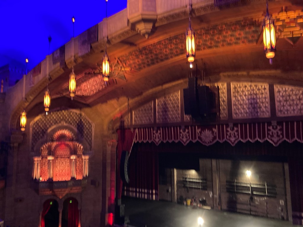
The Fox Theatre was begun in 1928, originally conceived as a home for the Atlanta’s Shriners organization. They were focused on creating a structure that honored the great mosques/structures of the Far East. However, they soon ran out of money and ended up partnering with William Fox, a movie mogul wanting to create a large movie venue in Atlanta.
The now Fox Theatre opened on Christmas Day 1926 with a 4600 seat theatre for Fox and a couple of ballrooms and offices for the Shriners.
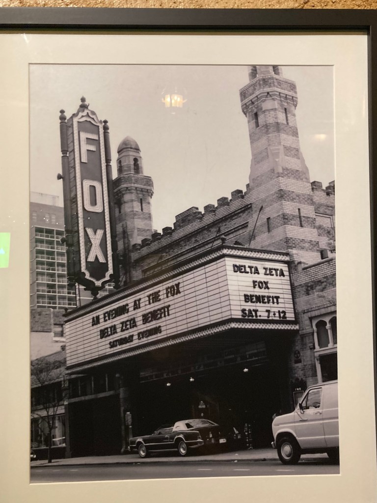
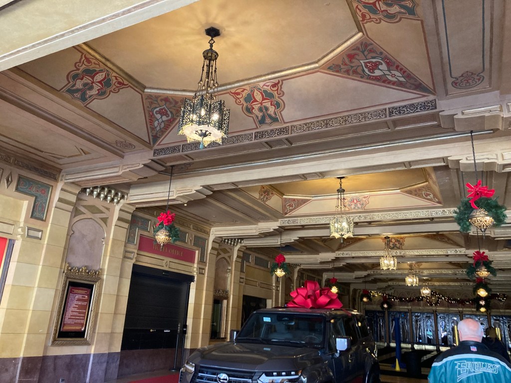
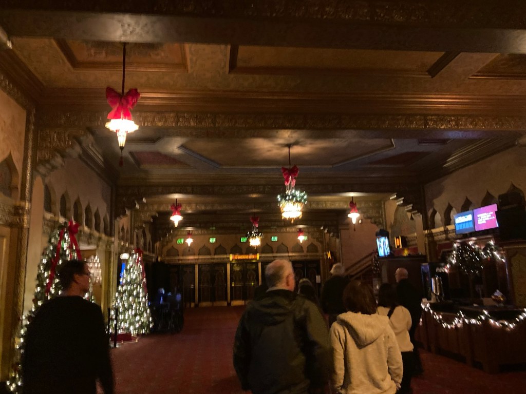
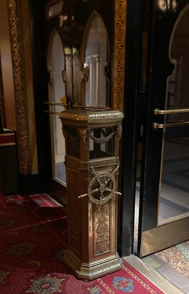
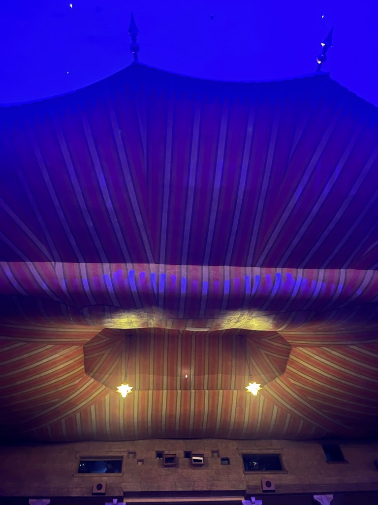
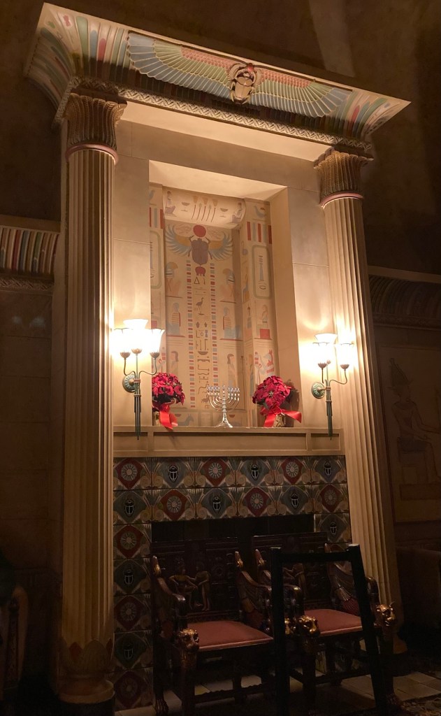
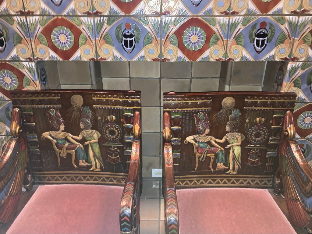
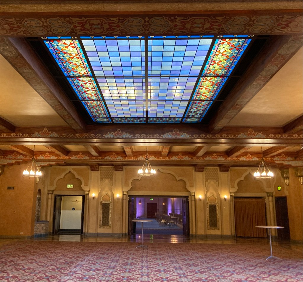
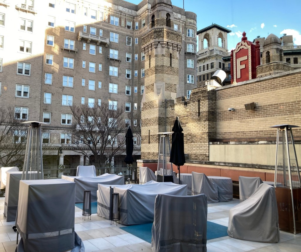
A photo of the Fox in the 1960s when they were having a benefit to keep the theater from being razed to make a parking lot for Southern Bell Telephone.The Fox Theatre todayThe external lobby for the theaterA sign in the external lobby that shows the location of the theater at Peachtree St and Ponce de Leon AveThe lobby of the theater The old ticket box where the staff would collect the tickets at the doorThe stage in the auditorium. The highlighted Parton the left is not boxed seats but covering for the pipes for the Mighty Mo organ.The large canopy over the back of the auditorium The auditorium carpet, the Jewish star for William Fox and the moon and star for the Shriners.A decorative wall in the the women’s loungeA close up of the mantel tiles and the King Tut chairsOne of the upstairs ballroomsThe Egyptian Ballroom, where they currently host proms and weddingsLooking onto the patio of their member’s club A look at the theater from across the street
On the way back, Bob and I walked a different route back which took us by the current Shriners Temple.
On the way back, Bob and I stopped at a bar in a boutique hotel for a cocktail before heading back.
Signage for the bar
Just for giggles, Bob and I counted the number of different places we rested our head in 2024 and came up with 72. We still find that pretty exciting.
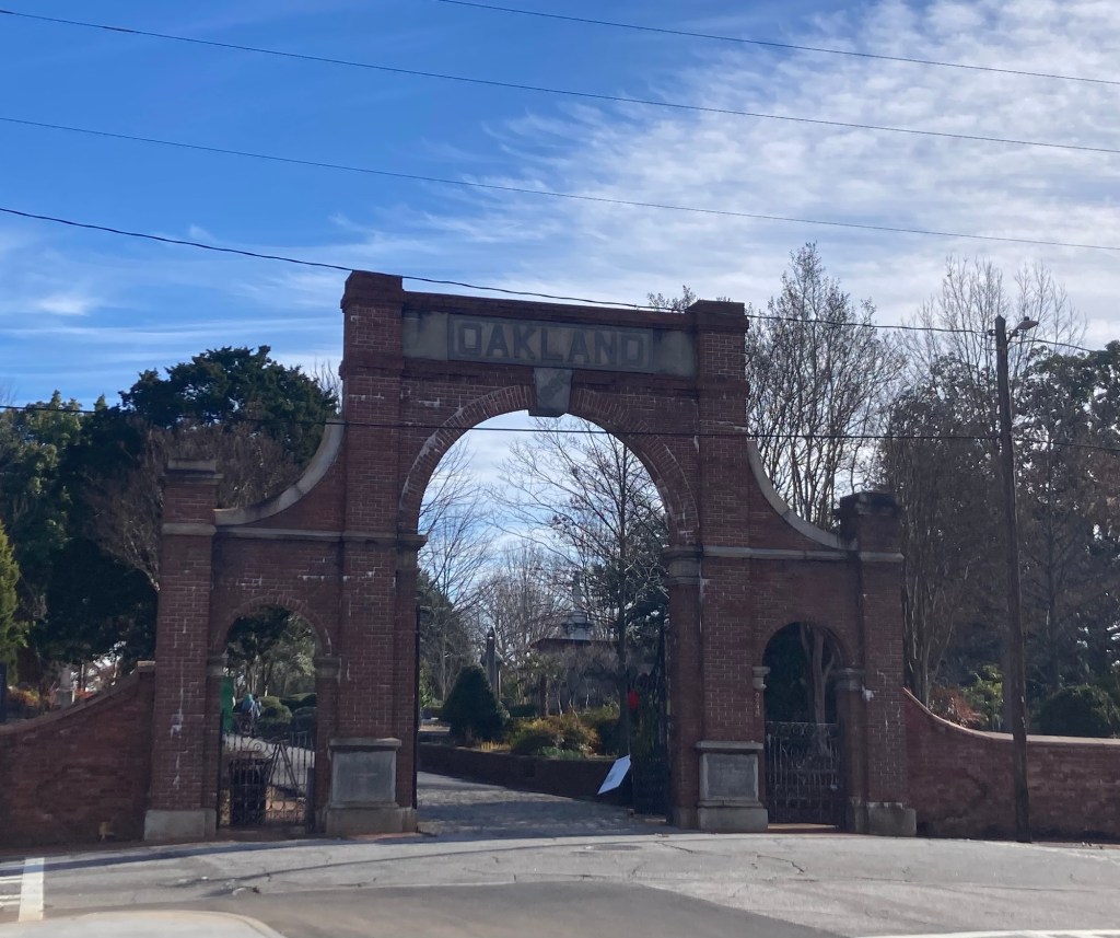
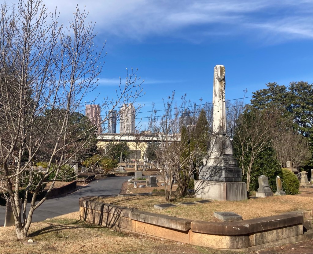
One of the attractions that came up in Googling what to do in Atlanta (that we hadn’t already done) was the Oakland Cemetery. Although some may find it morbid, I find cemeteries to be good places for quiet walks and sometimes architecturally interesting and always good for a bit of local history.
The Oakland Cemetery was established in 1850 when the city of Atlanta purchased 6 acres of plantation farmland on the edge of town for a municipal cemetery. By 1867, the 6 acres had grown to 48 acres. Today, it is the permanent home to more than 70,000 people of all distinctions.
The cemetery is located near the Martin Luther King, Jr. Historic District and about 2.9 miles from where we are staying. It was about a 90 minute walk to the cemetery through a few new areas of town and on a lovely 60+ degree day.
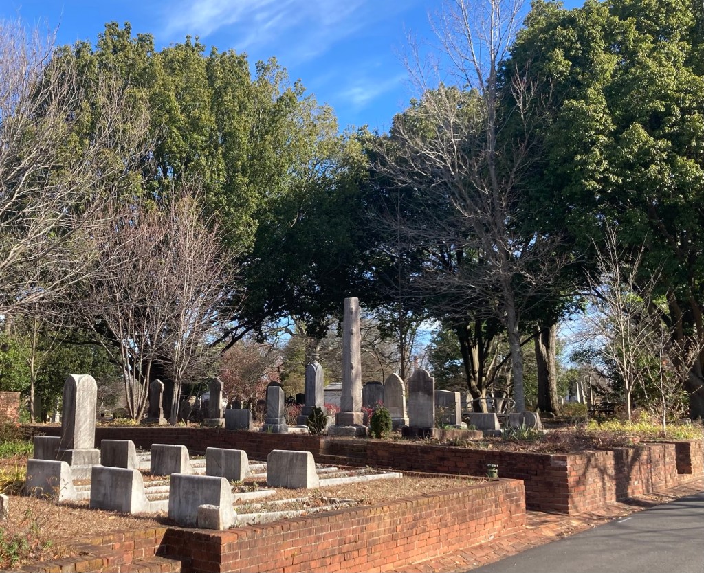
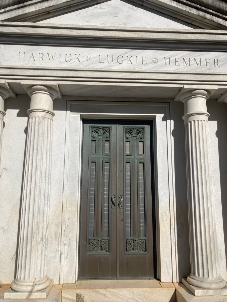
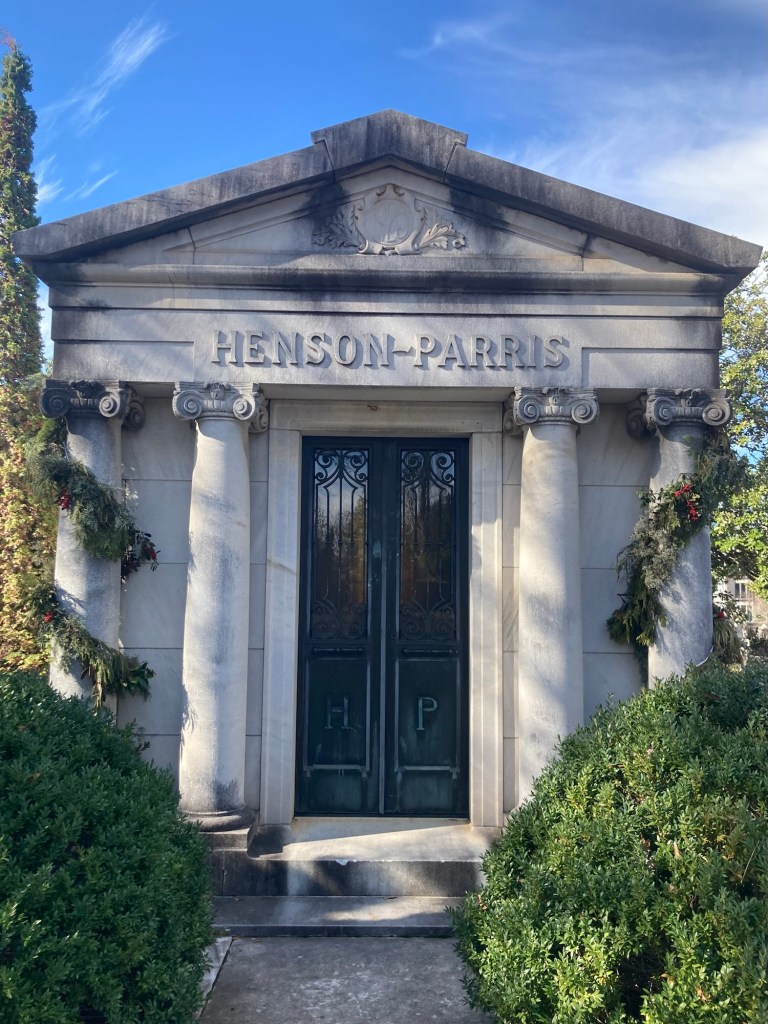
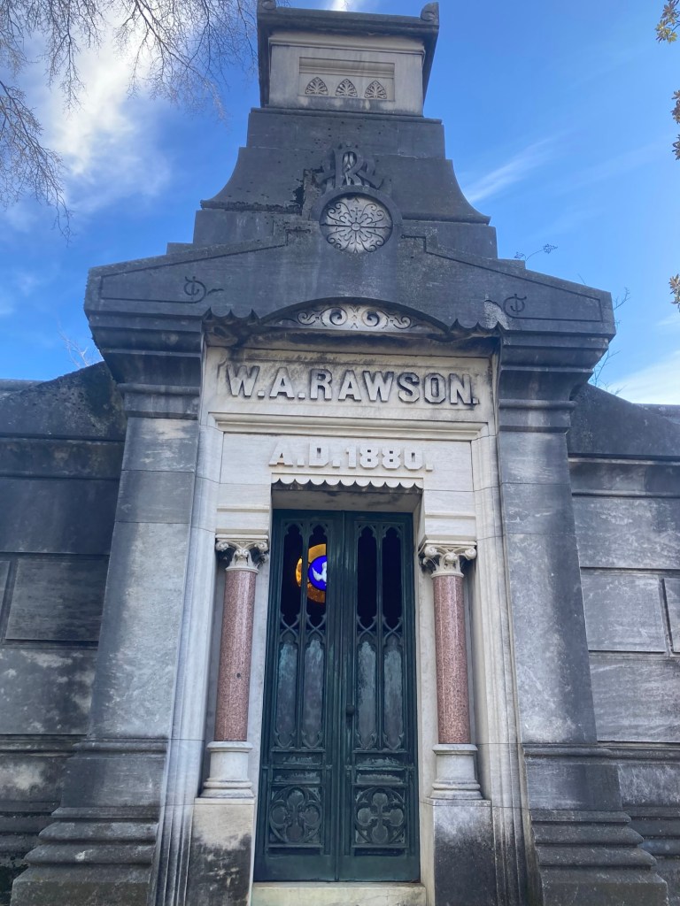
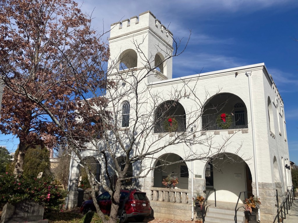
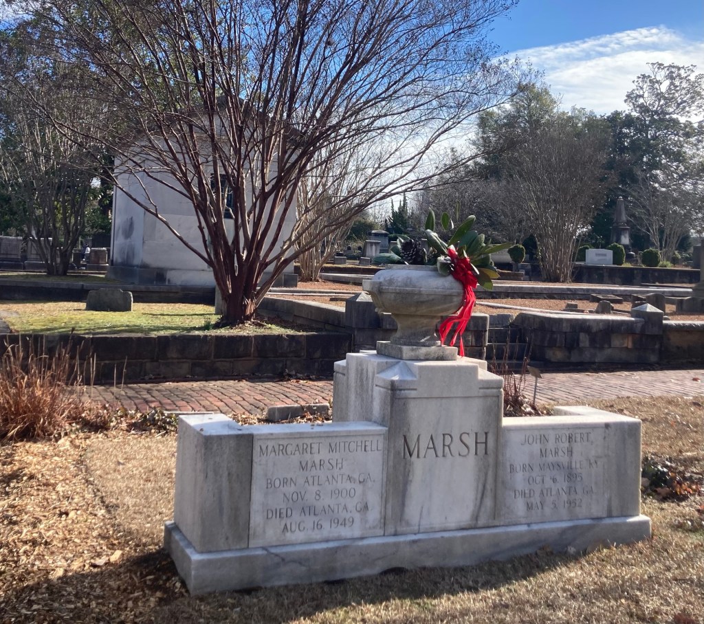
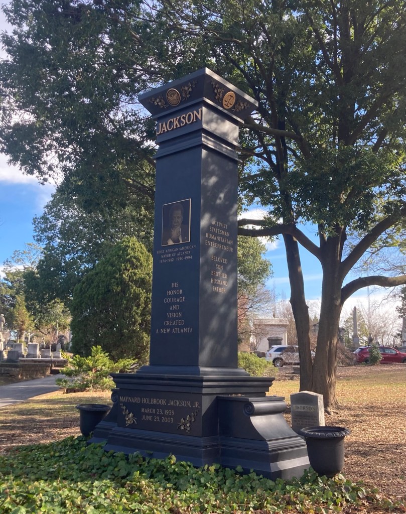
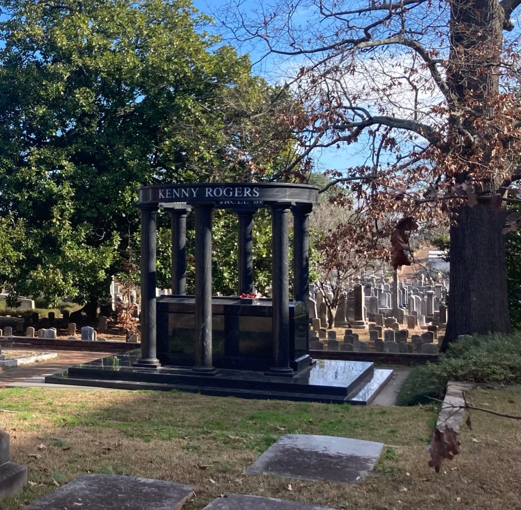
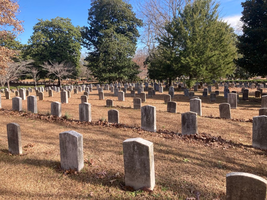
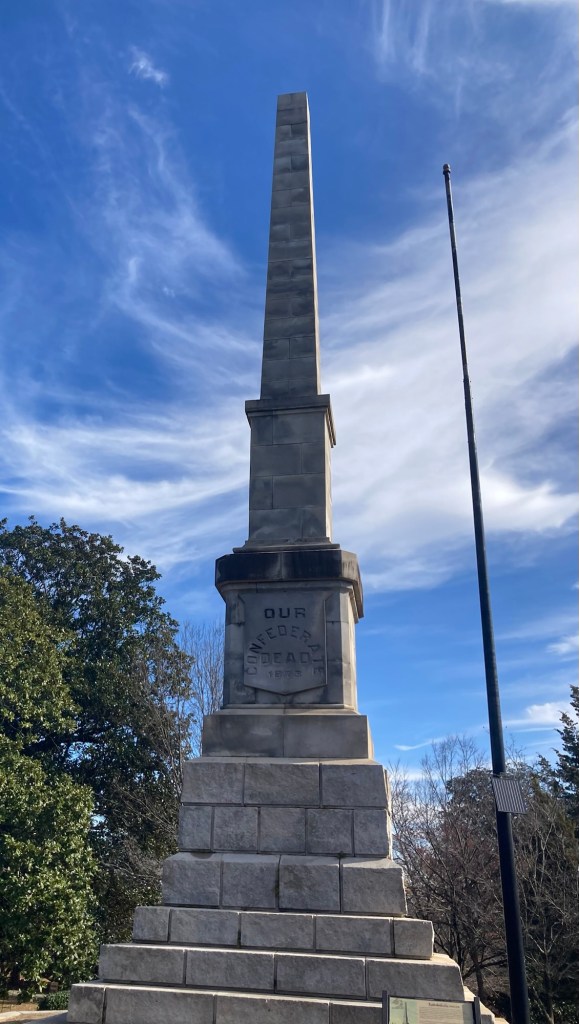
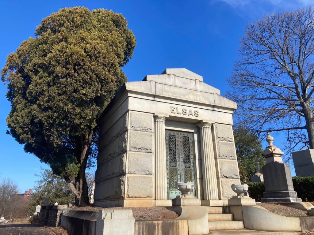
Walking on an overpass with a good view towards downtownThe MLK Branch Library with one of his quotesThe front gate of the cemeterySome of the headstones at the entrance to the cemetery An impressive looking mausoleum DittoLooking across the cemetery towards downtown This mausoleum houses Atlanta Mayor Charles Collier (1848-1900), his daughter, Julia, and her husband Julian Harris, who was the son of “Uncle Remus” author Joel Chandler Harris. Julia and Julian also owned the Columbus Enquirer-Sun that won the 1926 Pulitzer Prize for journalism.The bell tower, which originally housed a receiving vault for caskets and an office for the Sexton, who oversaw the cemetery. It currently houses the Visitors Center.The burial spot of Margaret Mitchell (1900-1949), author of Gone with the Wind, and her husband John Robert Marsh.The black granite monument for Mayor Maynard Holbrook Jackson (1938-2003), Atlanta’s first African American mayor. He served 3 terms and was instrumental in bringing the 1996 Olympics to Atlanta and expanding the airport, which now bears his name.The grave of Bobby Jones (1902-1971), considered the greatest amateur golfer of all time. In 1930, after winning golf’s Grand Slam, he retired. He co-designed Augusta National golf course.The monument for Kenny Rogers, one of the bestselling musicians of all time. He had 24 number 1 hits and 3 Grammy awards.Part of the confederate burial grounds in the cemetery The obelisk to the confederate deadThis mausoleum is home to Jacob Elsas (1842-1932), whose family owned the Fulton Bag and Cotton Mills until the 1960s. The former mill is now a residential community in Cabbagetown (see below).
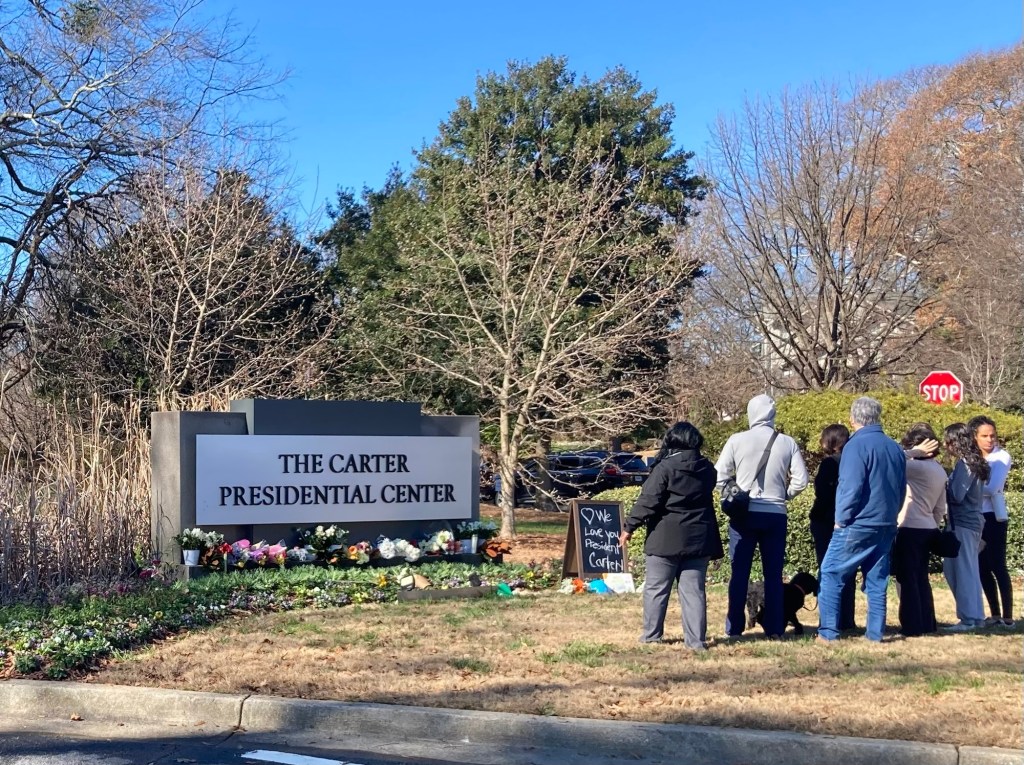
Last night, we learned that former President Jimmy Carter, from Plains, Georgia, had passed away at age 100. The last time we housesat in Atlanta, we visited the Carter Center and Presidential Museum here in Atlanta. I thought I would walk by there on my way back to the house.
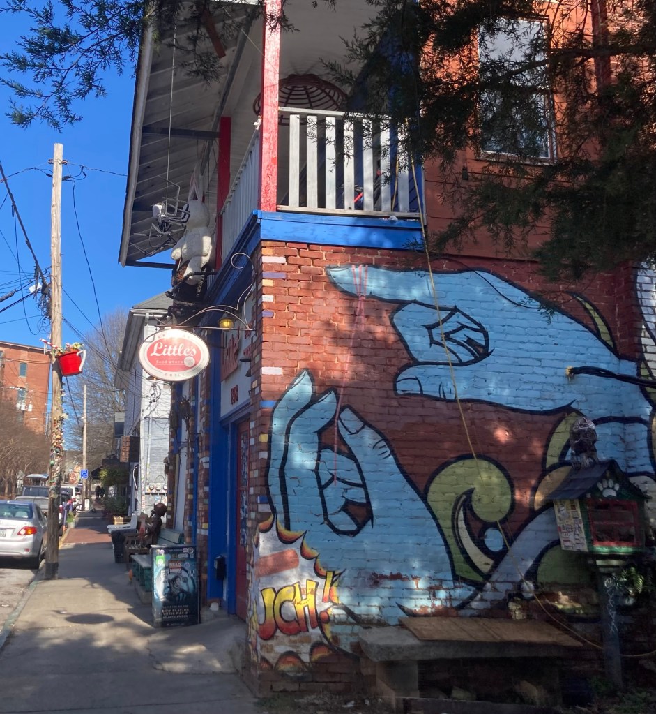
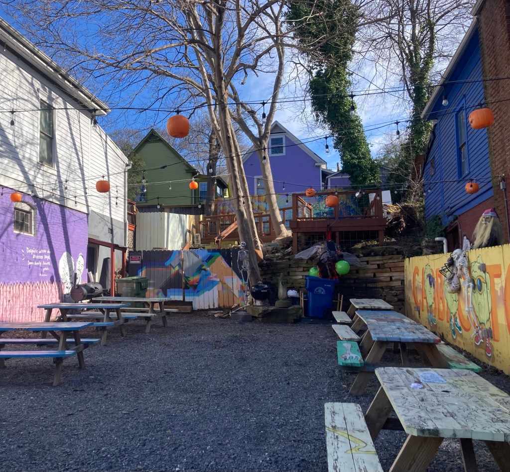
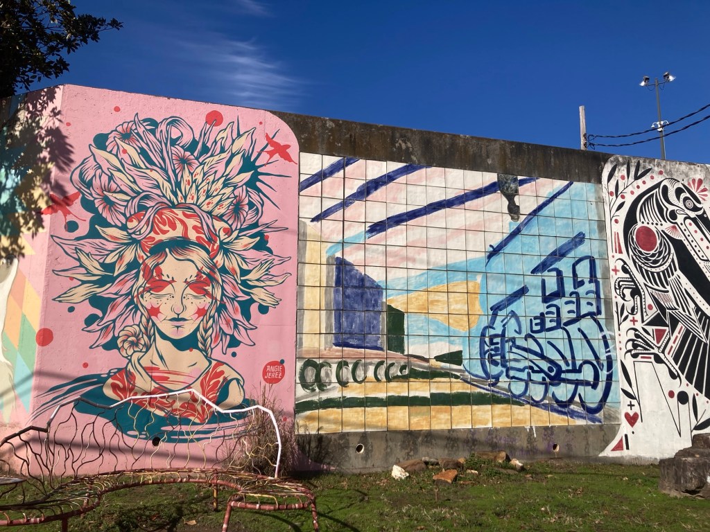
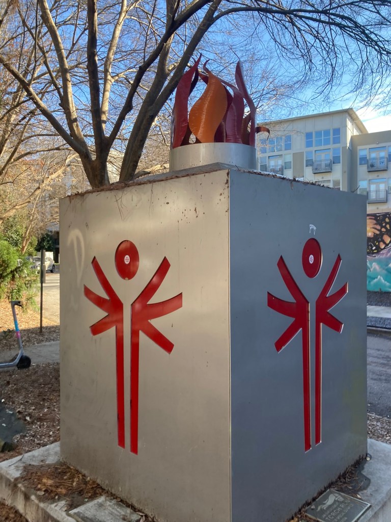
I first walked through the very funky Cabbagetown after leaving the cemetery.Another eclectic neighborhood dining spotMurals on a wallBefore I got to the Carter Center, I walked along the Beltline Trail. This is a monument to the Law Enforcement Torch Run for Special Olympics.Some of the people and offerings left in tribute to our 39th President, who was an honorable President and even better man and humanitarian.
This is our 4th repeat housesit of 2024. The other three were in Canada. This is the 3rd time Bob has sat at this house and my second. It is a lovely home in the Midtown area of Atlanta, and we are completely taken with the cat, home, and the neighborhood.
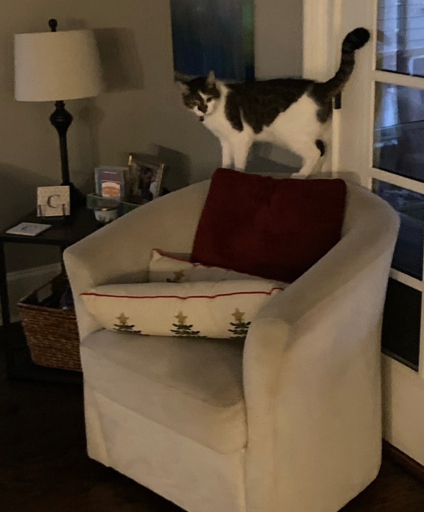
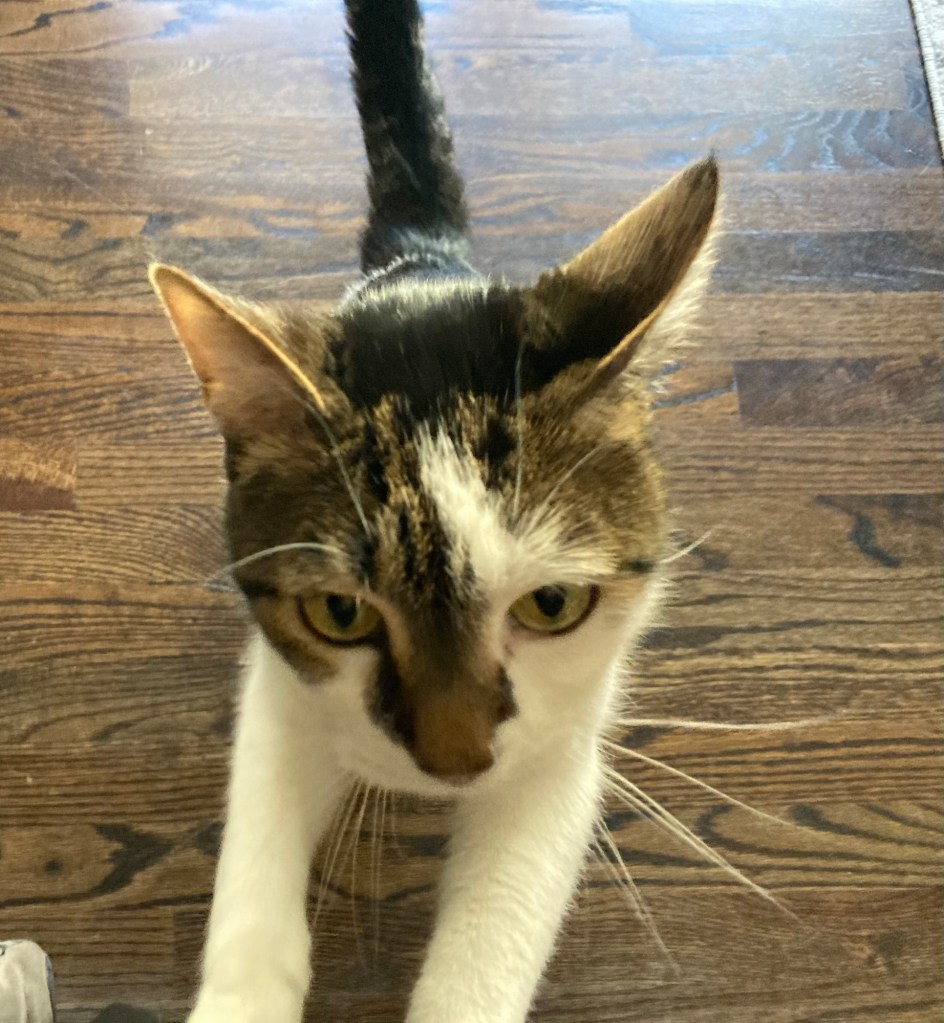
Jax we enjoy because of his fun personality and occasional lap/leg sitting.
Jax on chairJax on legs on chair. Usually, he prefers Bob’s legs.
The home is super comfy with all the kitchen utensils you could want, and the neighborhood may be the best ever in terms of walkability. There are so many stores, grocery stores, and restaurants within a 5 to 30 minute walk. It is definitely something that we would love to have whenever we land again. Then, there is the nearby Beltline Trail for running, biking, etc., and the city is sufficiently sidewalked to make longer walks possible.
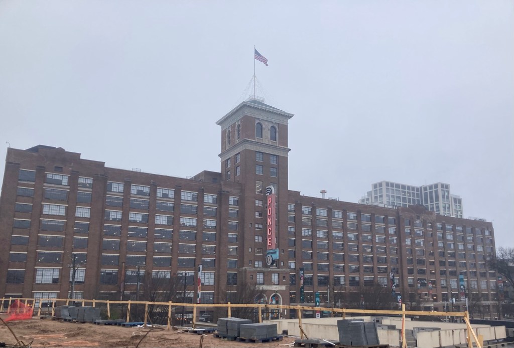
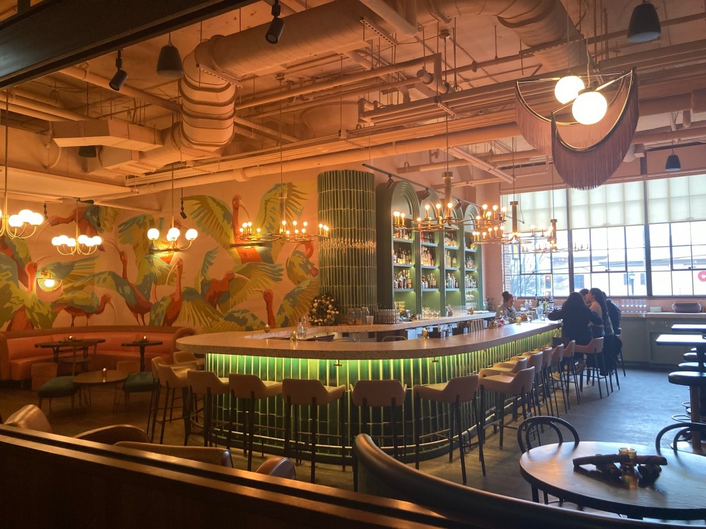
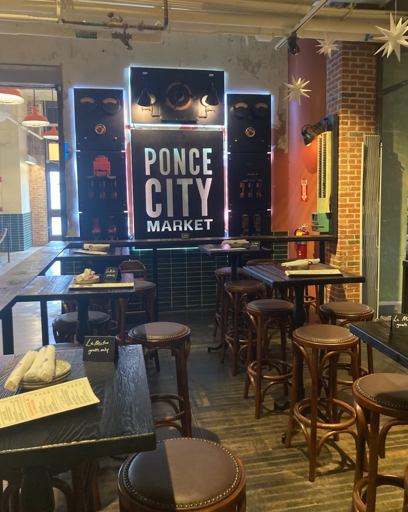
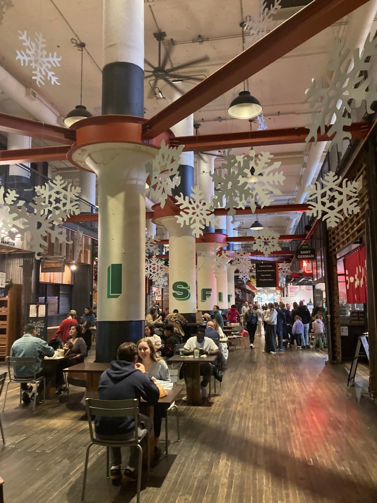
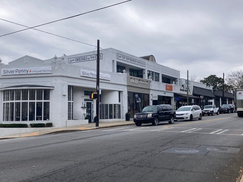
We have explored two neighborhood retail/restaurant areas, and today, we went back to checkout the vibrant Ponce Market, about 15 minutes from the house.
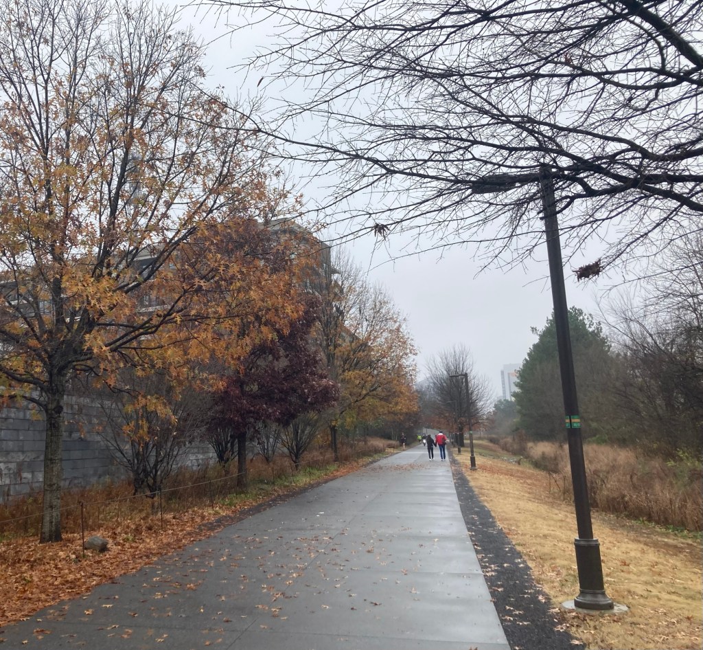
Heading down the 22 mile loop Beltline Trail to the Ponce Market on a cloudy/misty day.Some bike decor along the trail with the Ponce Market in the background
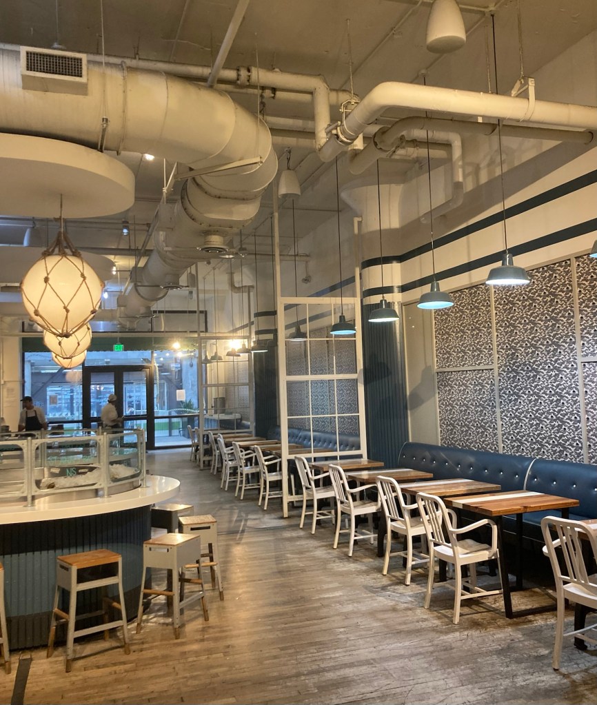
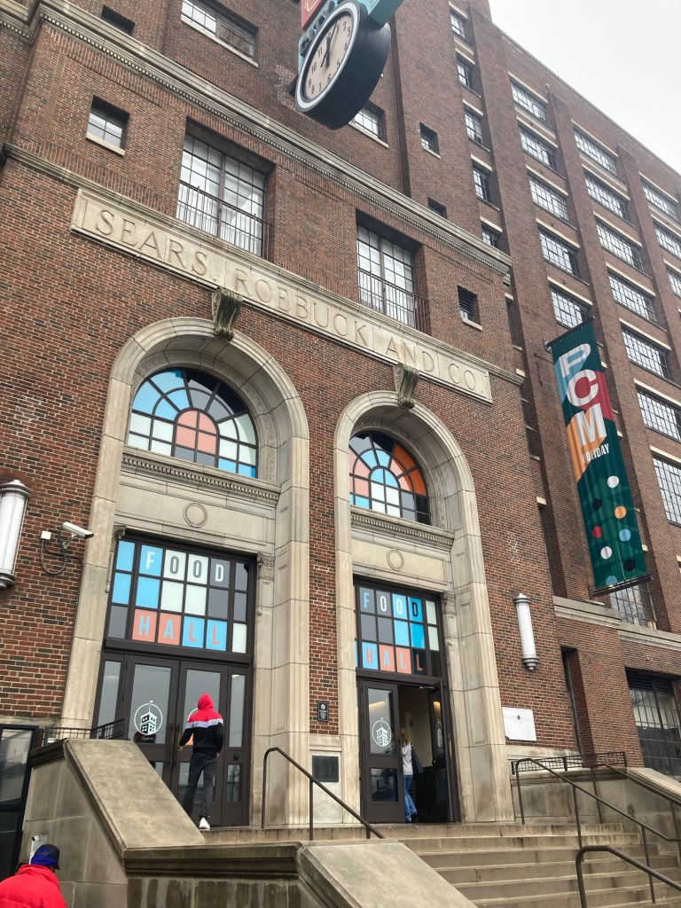
The building that now contains the Ponce City Market was built in 1926 as a retail store, warehouse, and regional offices for Sears, Roebuck, and Company. It was renovated in 2011 as a space for retail, restaurants, and pop-up shops as well as a rooftop deck with a mini golf course, carnival games, food and drinks. Due to the weather, we stayed inside today. There is also apartments and workspace in the building.
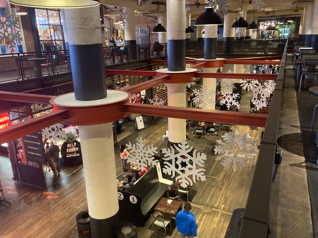
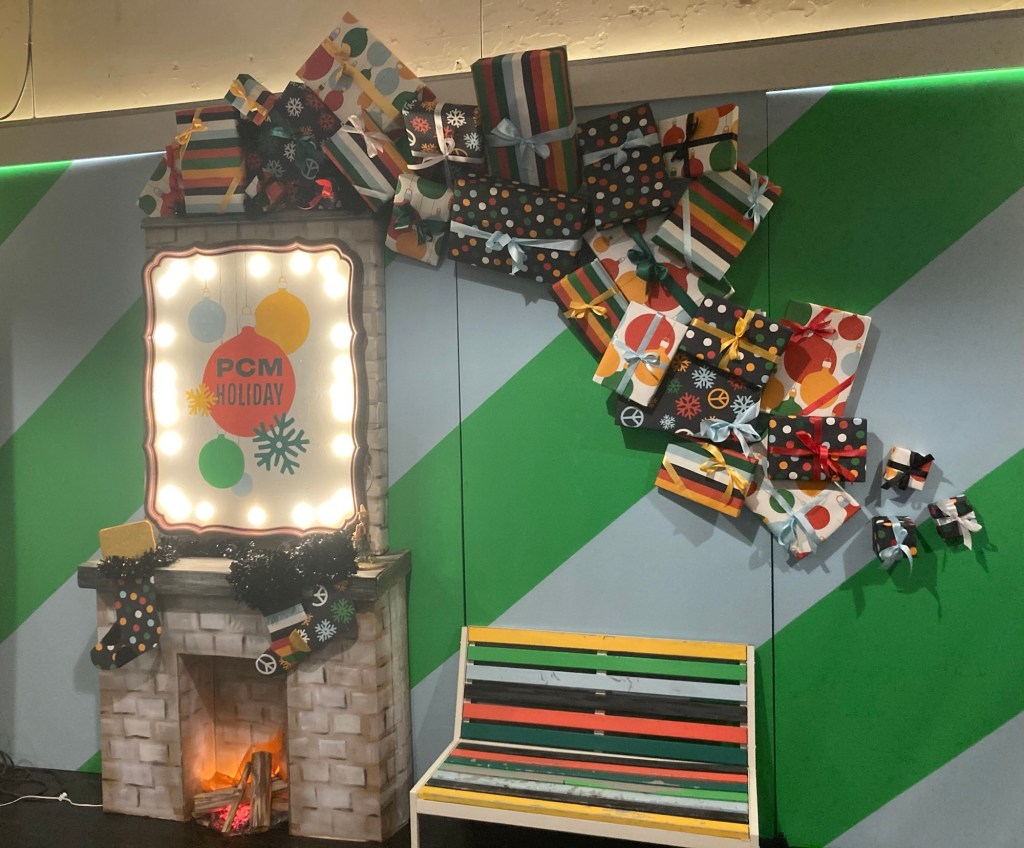
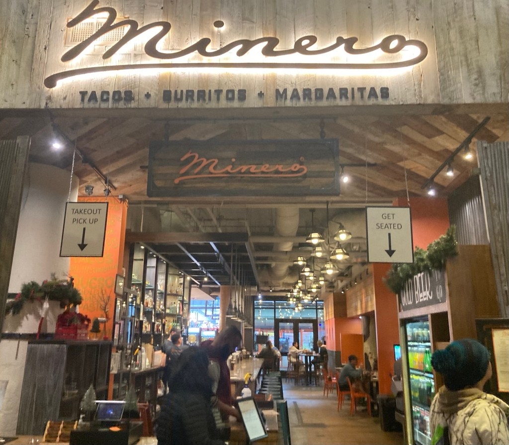
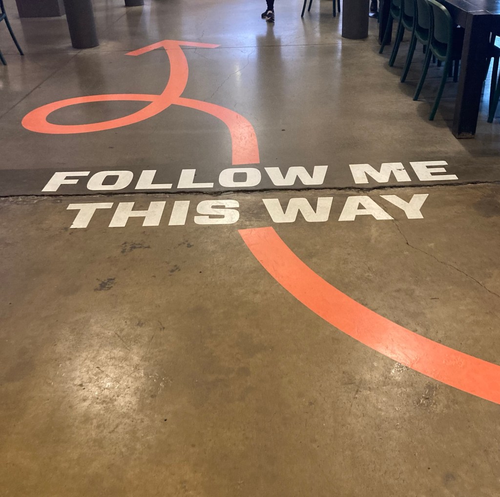
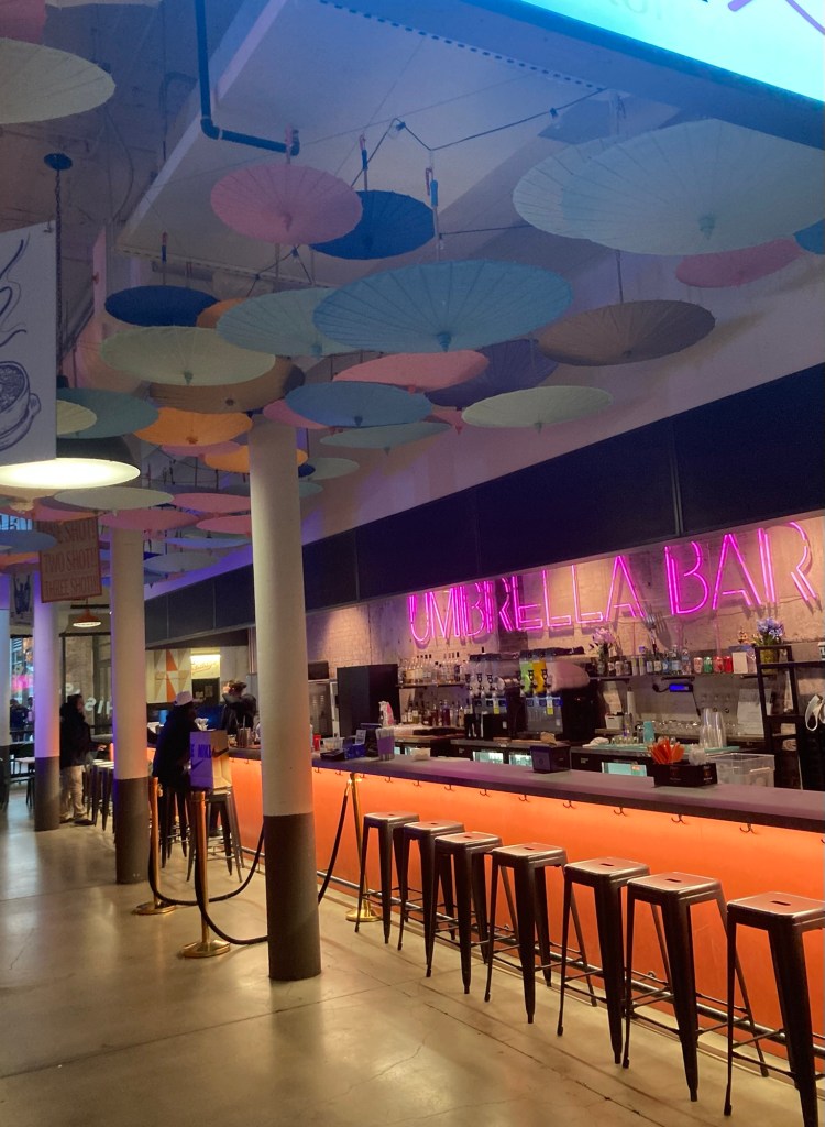
The market as viewed from the Beltline TrailMost of the retail and restaurants are on two floors. Looking down on the lower floor from above.A holiday selfie spotW.H. Stiles Fish Camp restaurant A spiral staircase up advertising some of the stores aboveAnother restaurant, we were there between 11 am and noon, so things were just starting to pick upFun signageOne of the establishments you could frequent if you followed the sign aboveThe very cute Atrium restaurant Fun historical decorThe seating area for La Metro, a Spanish tapas restaurant we hope to visit before we leaveThe lower floor of the market A closer view of one of the entrances
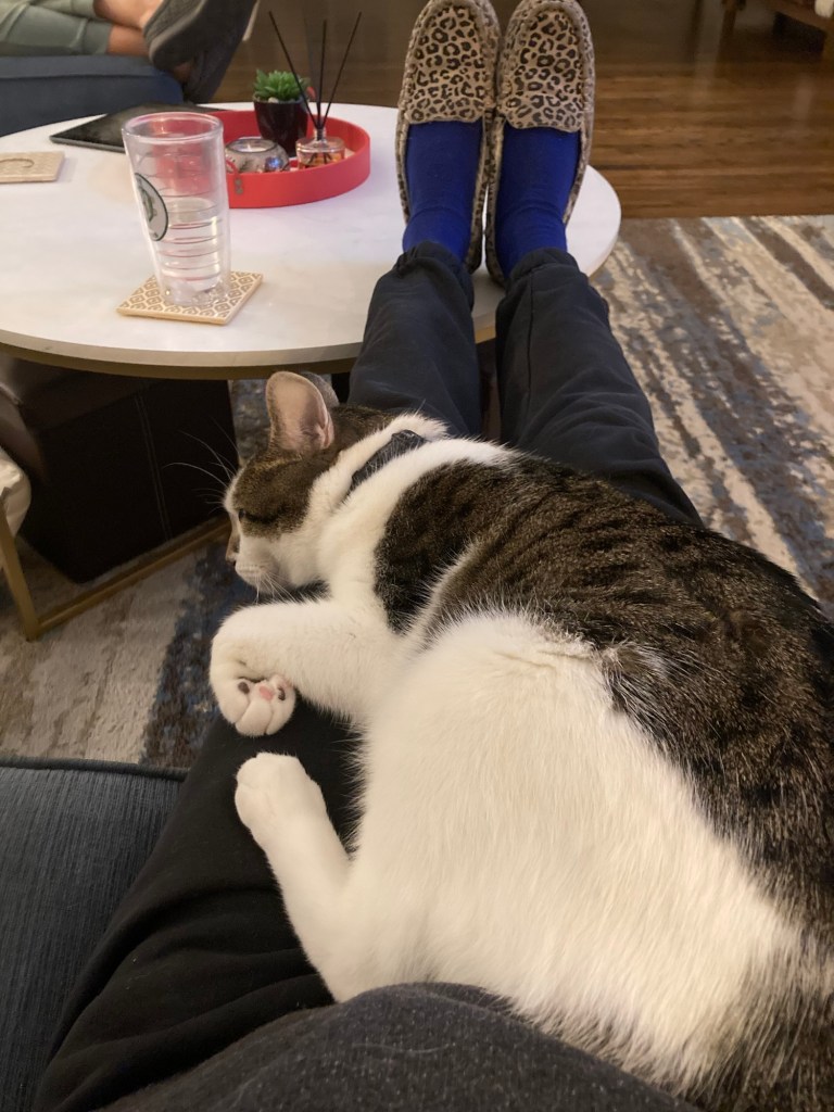
First, Jax the cat has finally shown himself and can be quite the talker. He typically stays on the upper level (family bedrooms), but does come down to the main level when he hears us go into the room where his food is kept and/or if he’s in the mood for some petting or a short lap sit. He’s a cutie.
Jax reaching up to the chair I was sitting on for a pet and a head rub
After a chill couple of days for Christmas, Bob and I headed out today to visit the Centers for Disease Control (CDC) Museum on its main campus on Emory University. It was about an hour walk from the house. A couple of highlights from the walk.
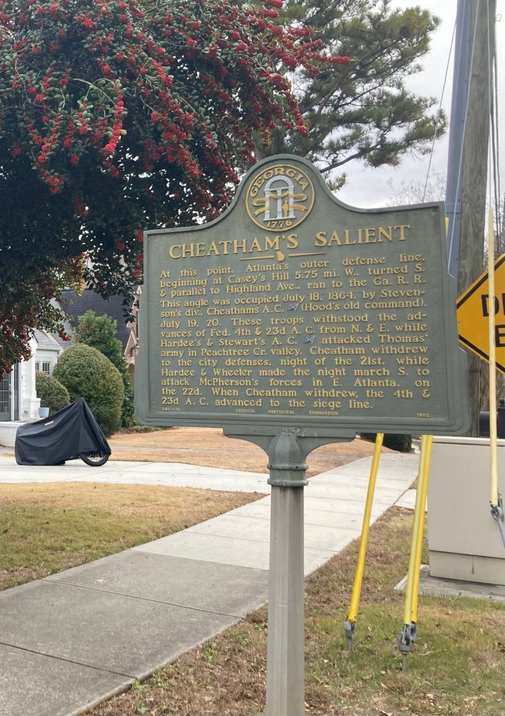
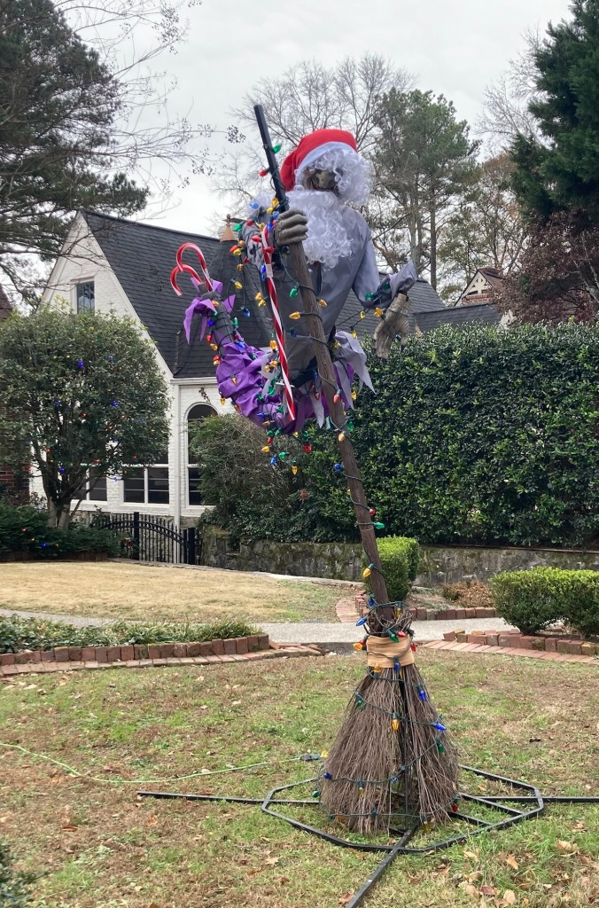
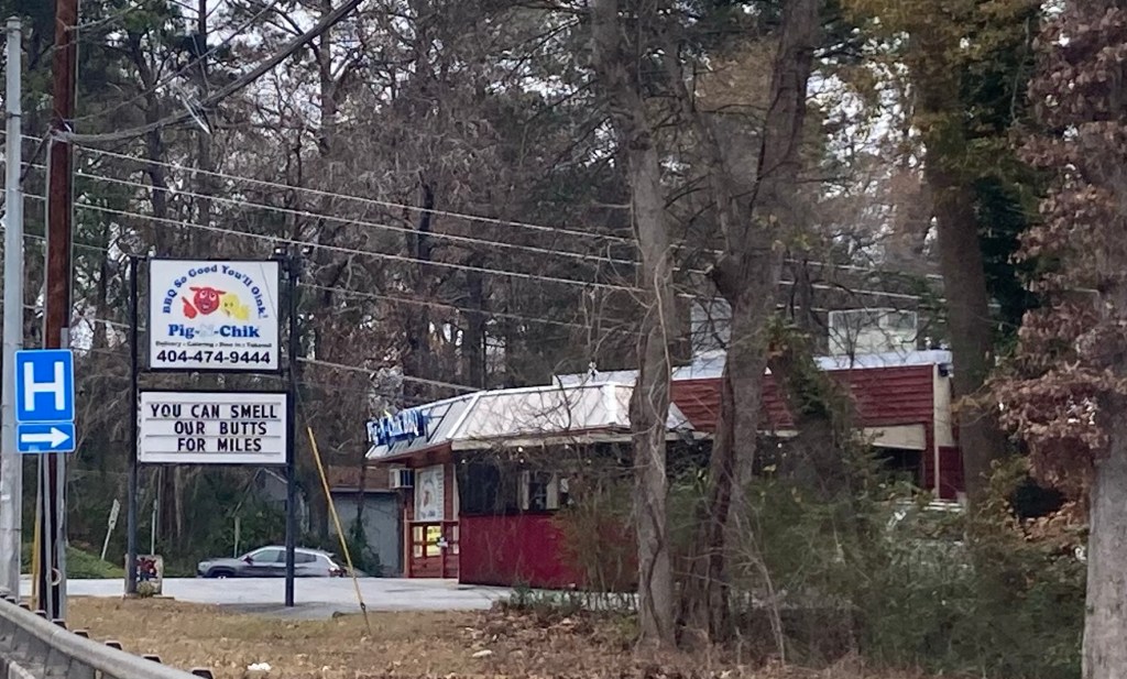
One of the small, neighborhood shopping areas near where we’re staying. A marker to a Civil War battle One of the more unique Christmas yard decorations in the lovely neighborhoods we walked throughAnd then a restaurant advertisement that caught our eye
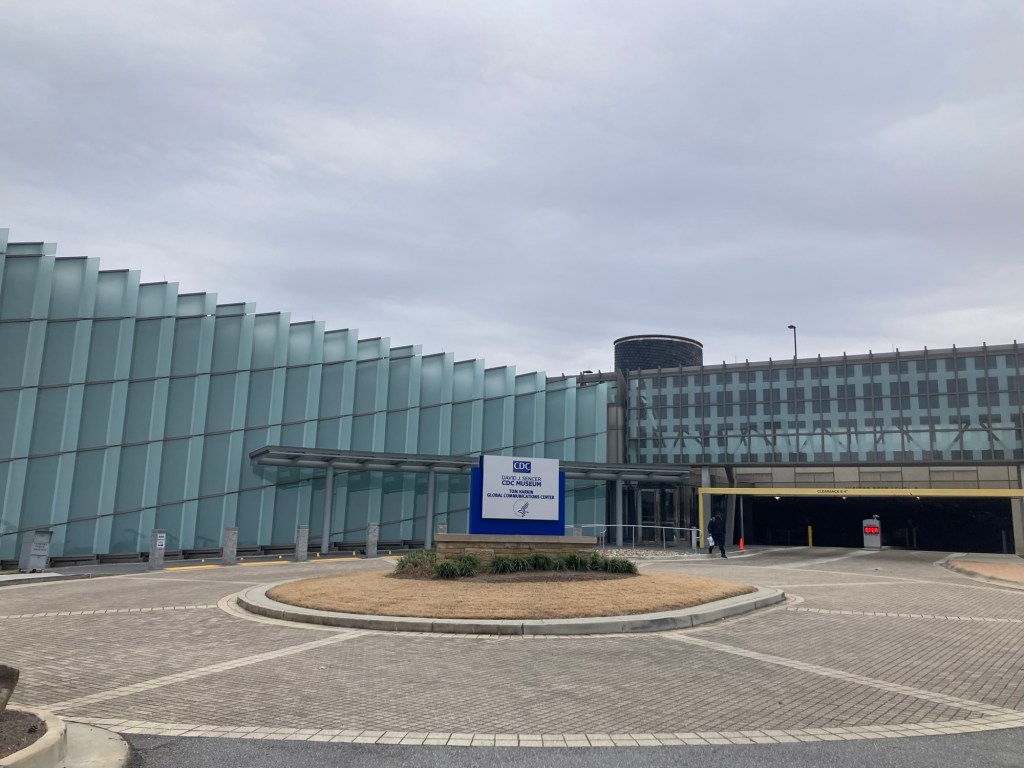
The CDC Museum is free and open to the public, although you must show a government-issued ID or a passport, if you are not from the US. You also go through security.
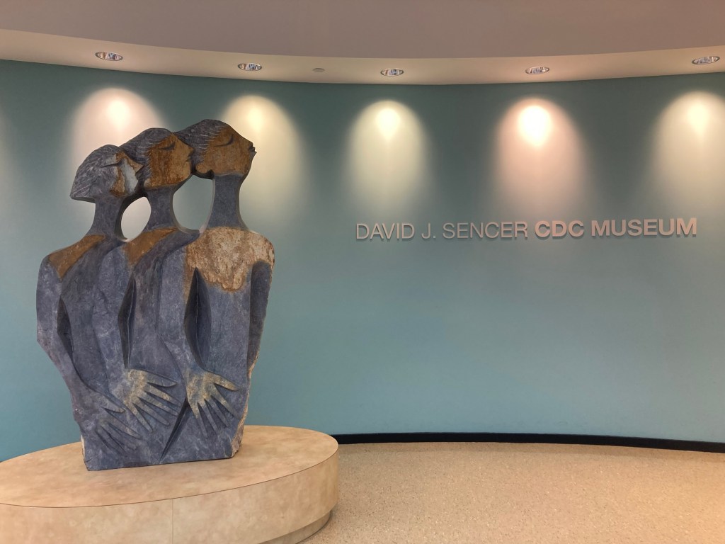
The museum building The lobby. The sculpture is “The Messengers” by Lameck Bonjisi.
The museum has permanent exhibits on the history of the CDC, the different types of work it undertakes, and then a rotating exhibit. The current rotating exhibit was on Health as a Human Right and Health Disparities. The exhibits are on three levels.
The introduction to the exhibit space with rotating information displayed on the monitors
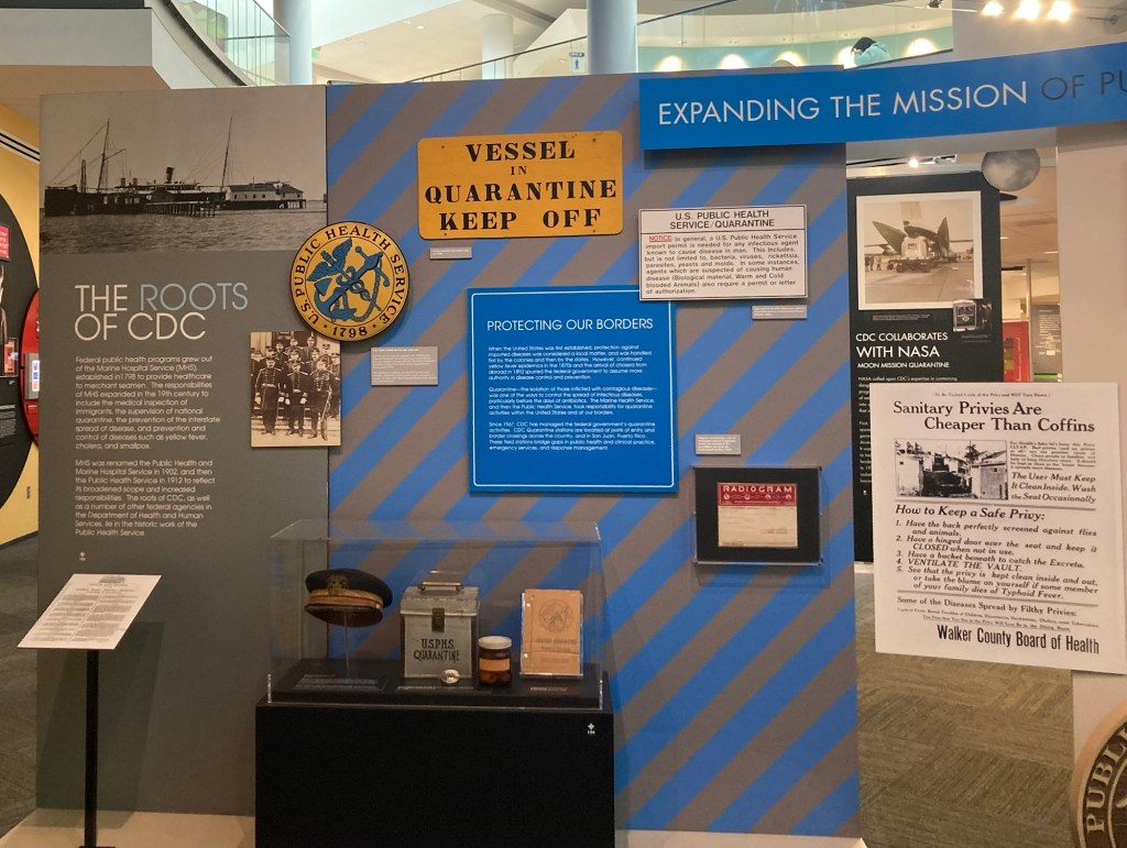
According to the exhibits, federal public health programs in the US grew out of the Marine Hospital Service established in 1798 to provide healthcare to merchant seamen. The MHS responsibilities expanded in the 19th century to include the medical inspection of immigrants, the prevention of the interstate spread of disease, and prevention and control of diseases. It was renamed the Public Health Service in 1912.
The CDC itself was established after WWII and opened on July 1, 1946. It is currently on a 45 acre campus of Emory University and is one of 13 major operating components of the Department of Health and Human Services. It is one of the few government agencies with headquarters outside of Washington, DC. Besides this main campus, it has 10 other major locations in the US and Puerto Rico, and its over 15,000 employees work in over 50 countries around the world. We generally hear about the agency during pandemics (Covid, AIDS, Ebola), but they do a lot to assess and improve the physical and environmental health of people around the world.
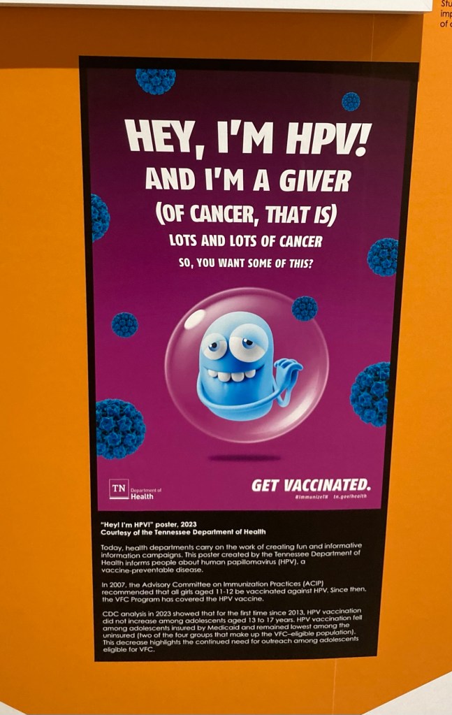
Below are some samples from the various exhibits.
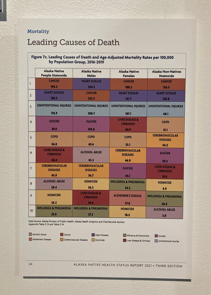
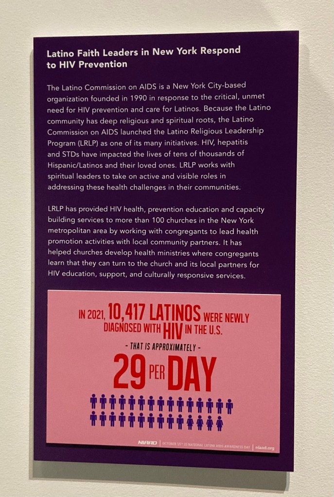
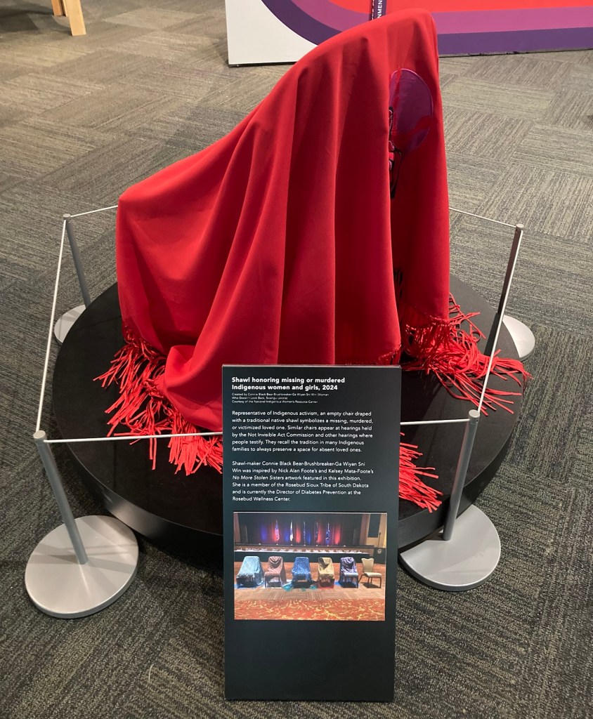
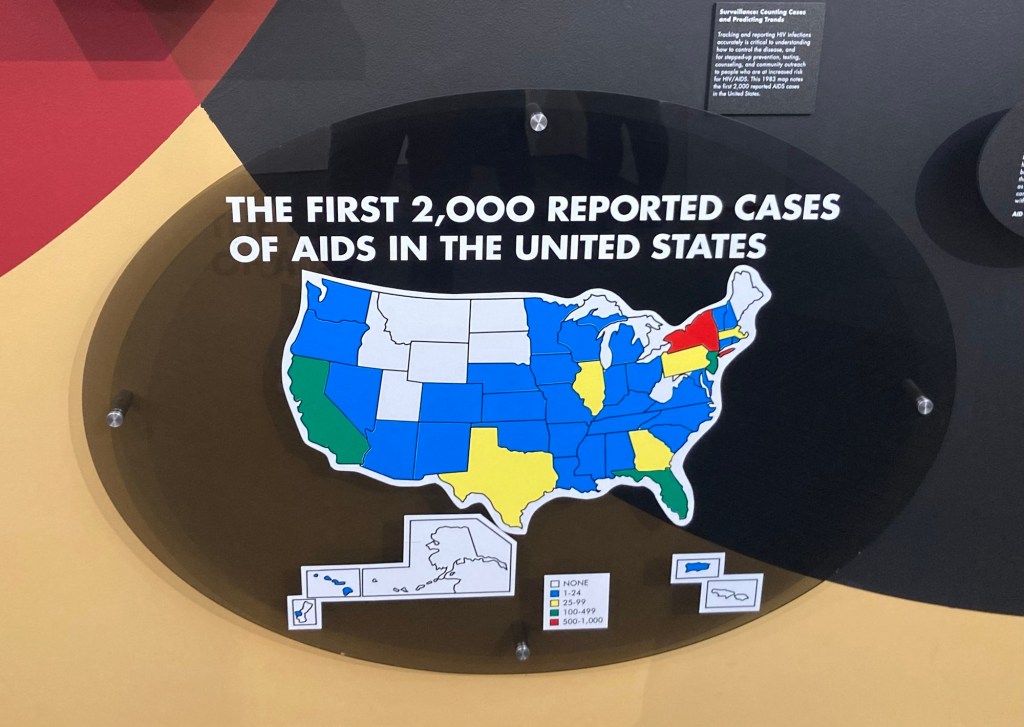
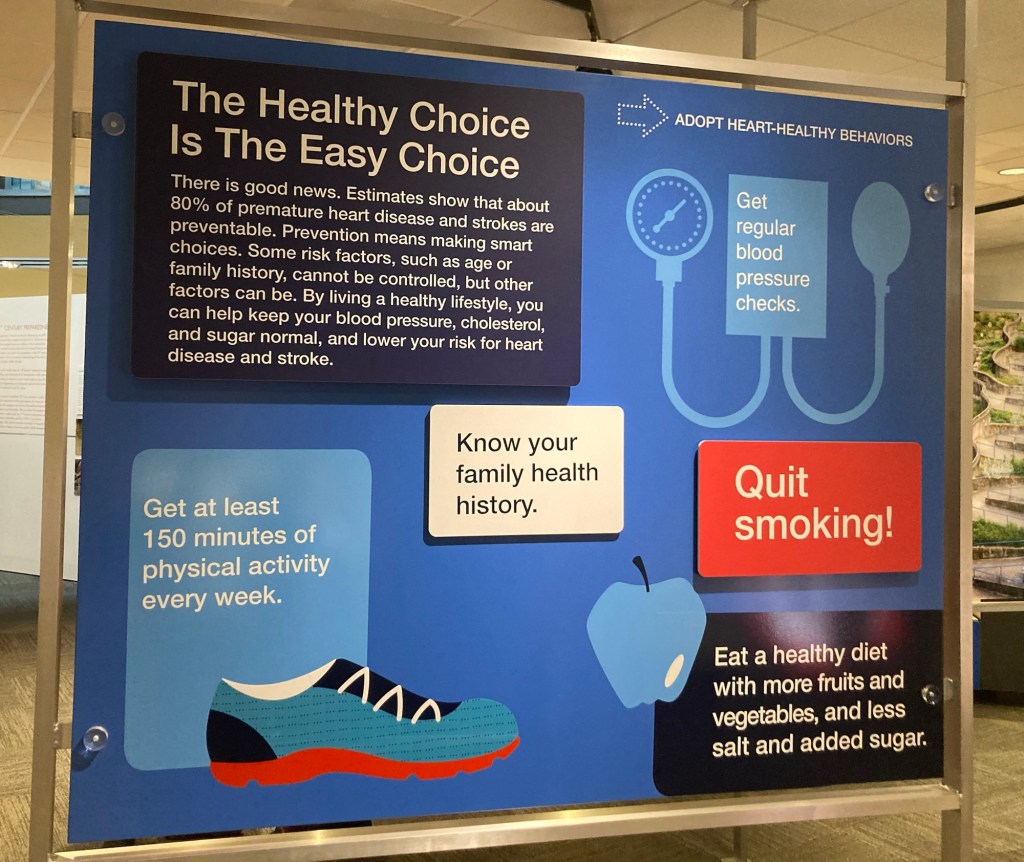
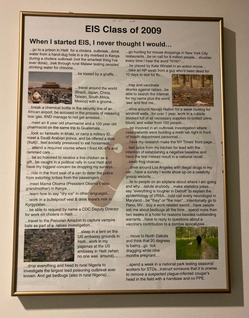
A sample poster to help increase vaccinations This was from the health inequality exhibit comparing disease rates between native and non-native populations in AlaskaA call to actionThis was sadly impactful— shawls covering empty chairs to indicate missing or murdered Indigenous women and girls Some of the historical information Part of the AIDS exhibit Good health remindersThis was part of an interesting exhibit on projects created by the different classes of the Epidemic Intelligence Service. The footprint is used to convey the amount of walking required in field investigations of diseases.
It was really impressive to see the variety of work that they do, and the number of emerging diseases and terrorism events they have had to respond to even since 1946 (polio, Zika, anthrax scares, 9/11, AIDS, Ebola, TB, etc.). They do not get nearly the recognition they deserve for helping address public health needs on an ongoing basis as well as these more major events.
The big assignment for the day was to drive from Greensboro, North Carolina, to Atlanta, Georgia, to start our new housesit. Mission accomplished. We had our relatively quick walk-through, as this is a repeat. We will be caring for a cat, Jax, who has not yet made his appearance, and a lovely home in midtown Atlanta. More to come on the new sit.
On the way, we stopped in Boiling Springs, North Carolina, to visit a former homeowner, neighbor/friend of home owner, and the adorable dog, Cooper. They all hold a special place in our hearts, and we had a great visit over some homemade goodies.
The seriously cute Cooper. Us with Cooper and Linda, his humanLinda and her neighbor/friend Maria
We also learned on the drive that our nephew and his wife will be having a daughter this June to make our great nephew a big brother.
After a couple of longish drives in a good amount of traffic, it feels great to have landed for a two week sit.
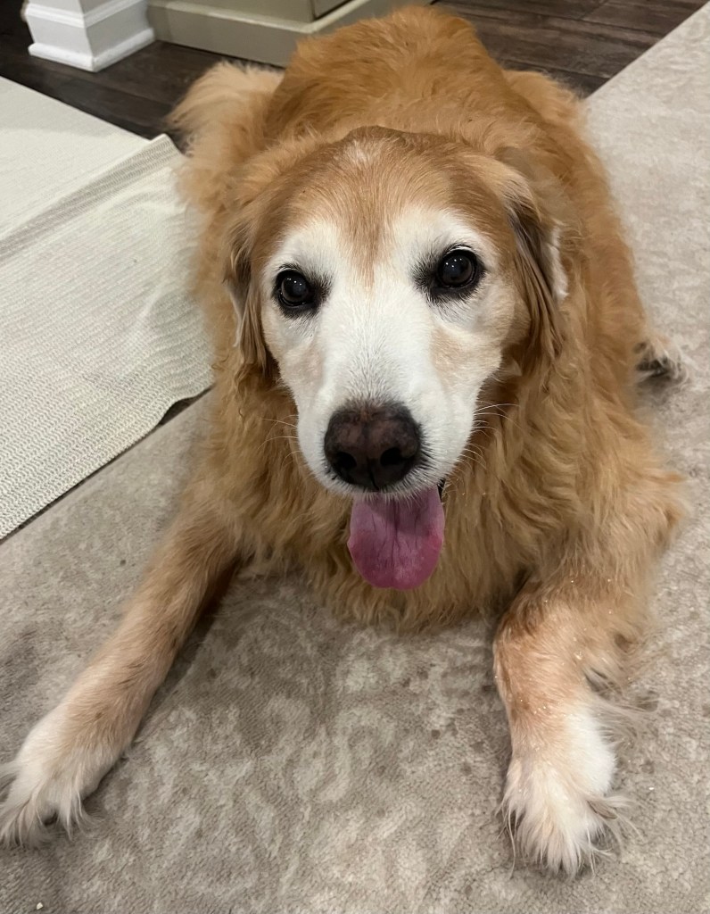
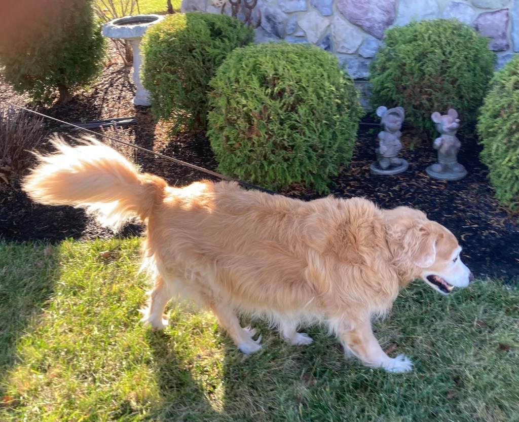
So our Delaware sit went a little differently than planned. Last Friday night, Cassie, the sweet 13 year old Golden Retriever that we were caring for, started really struggling to get herself up and get herself in a comfy position when she was lying down. Her back legs didn’t seem to have any strength.
Saturday morning, she wasn’t better, so we reached out to the homeowners. They felt that she had probably hurt herself getting on and off a bed or on their wood floors and thought it might resolve itself. By Sunday night, all were in agreement that she needed to see the vet. We got a 4 pm appointment on Monday, and they prescribed some anti inflammatory pills.
The sweet, resilient Cassie
We were skeptical. At this point, Cassie’s back legs were not working, and we were having to lift her to get her to get up and change positions, go outside,or get up to eat. We had put extra floor coverings down in the house because she couldn’t get any traction on the wood flooring. The happy news is the pills worked. Starting some time Wednesday, she started getting stronger. Today, when we left her, she was back to “normal” except that she wasn’t hopping upon furniture, which is probably a good thing. Bob and I made sure one of us was always with her, so we became quite attached. She is a sweetie.
Back on her feet
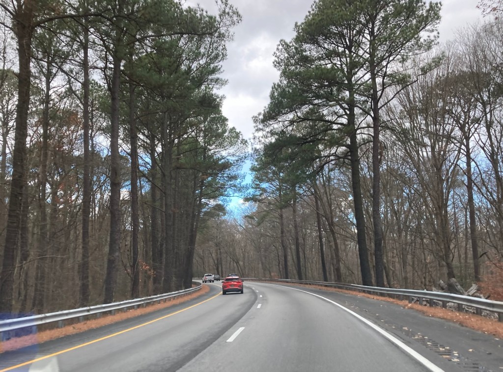
Today we left Cassie to drive what we thought would be a maybe 6.5 hour drive to Greensboro, NC. Holiday car travel made it over an hour longer. We drove through Delaware, Maryland, District of Columbia, and Virginia before stopping for the night.
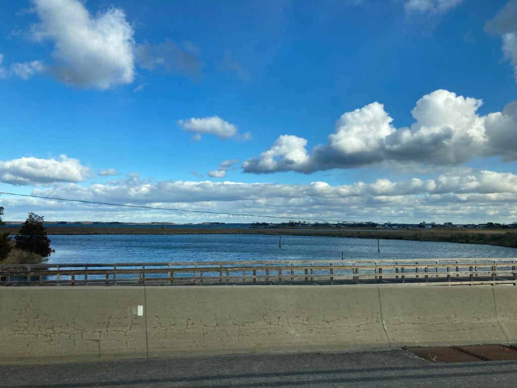
The pics below are mostly from our drive through Maryland before everything slowed way down going around DC and then through Virginia.
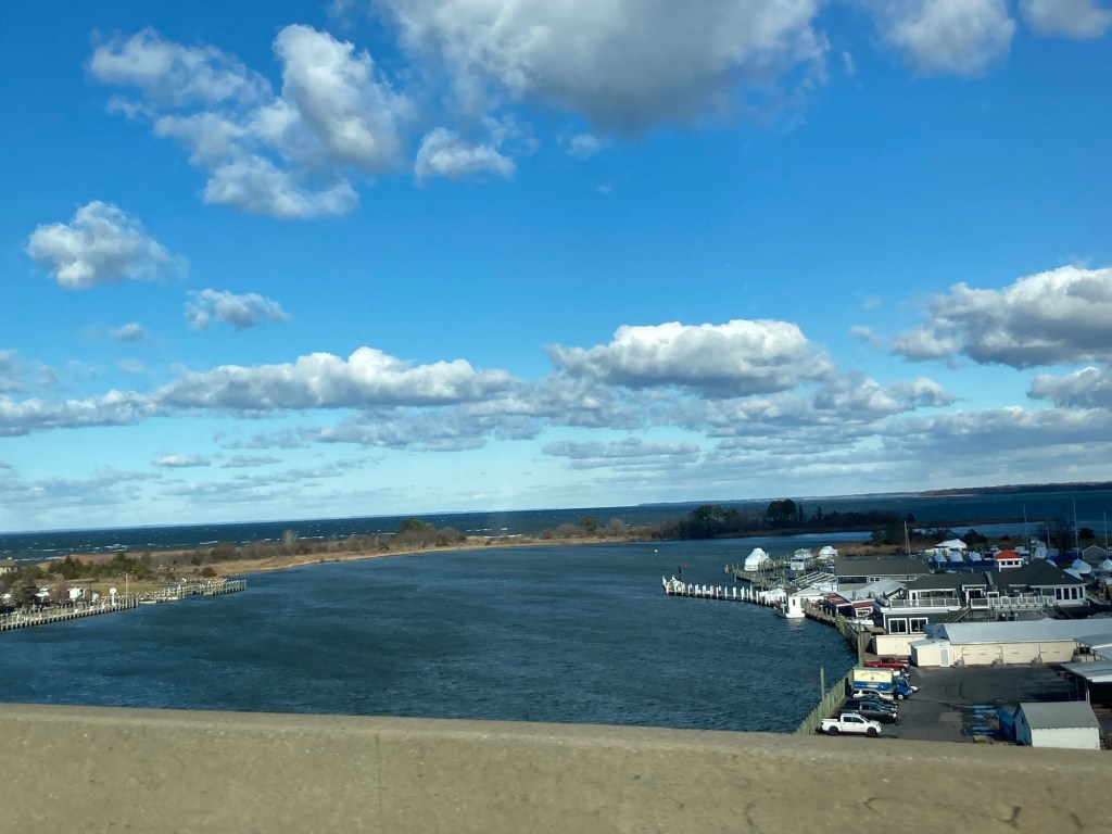
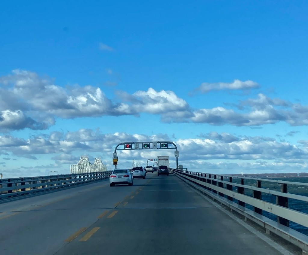
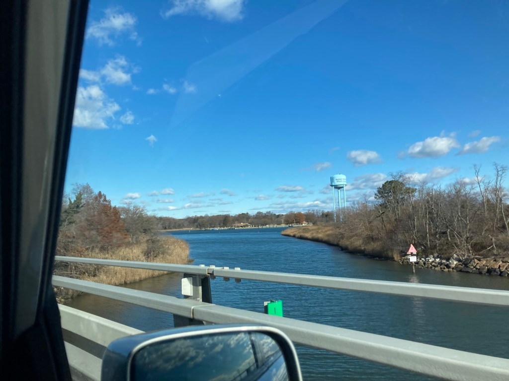
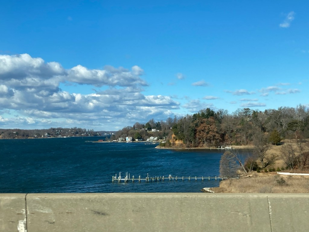
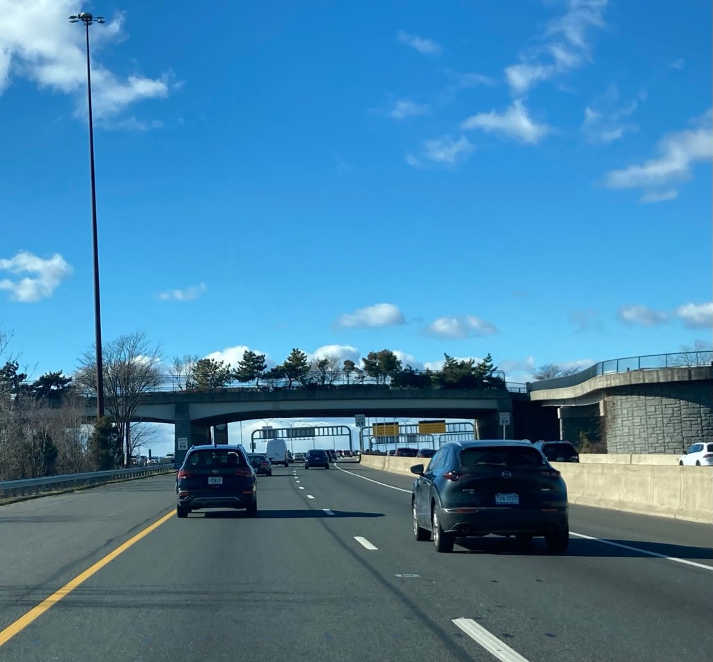
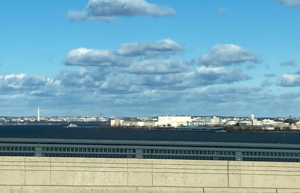
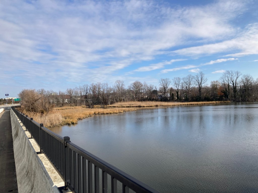
Heading over the 4 mile Bay Bridge over the Chesapeake BayContinuing over the bridgeDittoA tree lined overpassBefore the swamp becomes real, the Washington Monument on the left and the capitol on the rightA glimpse of some of the traffic
Tomorrow, we are going to stop in Boiling Springs, NC, to visit a former home owner and neighbor that we got to know over a 4 month housesit early in 2023, before we head to a repeat housesit in Atlanta, Georgia.
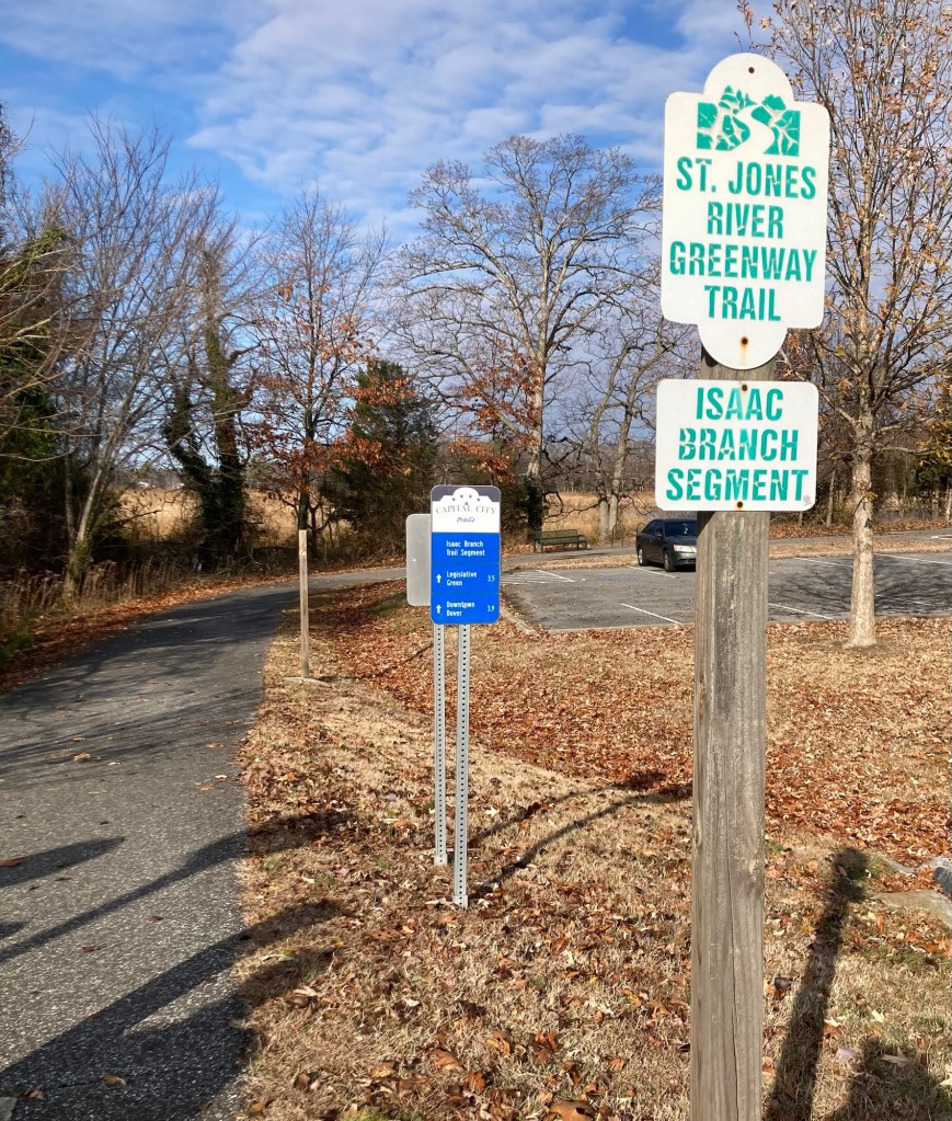
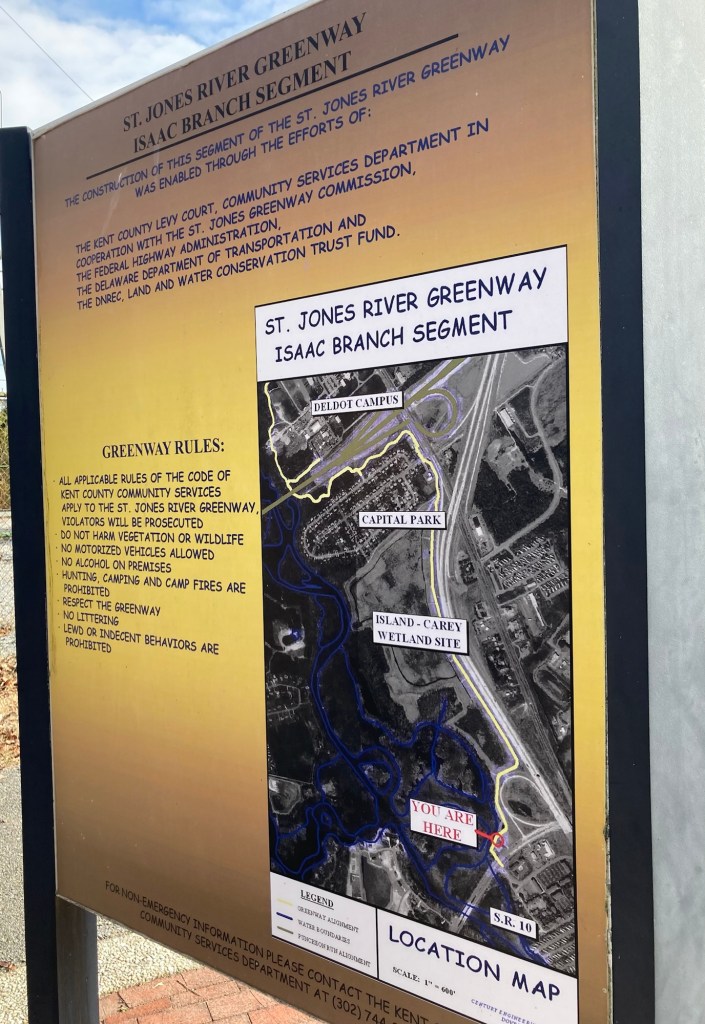
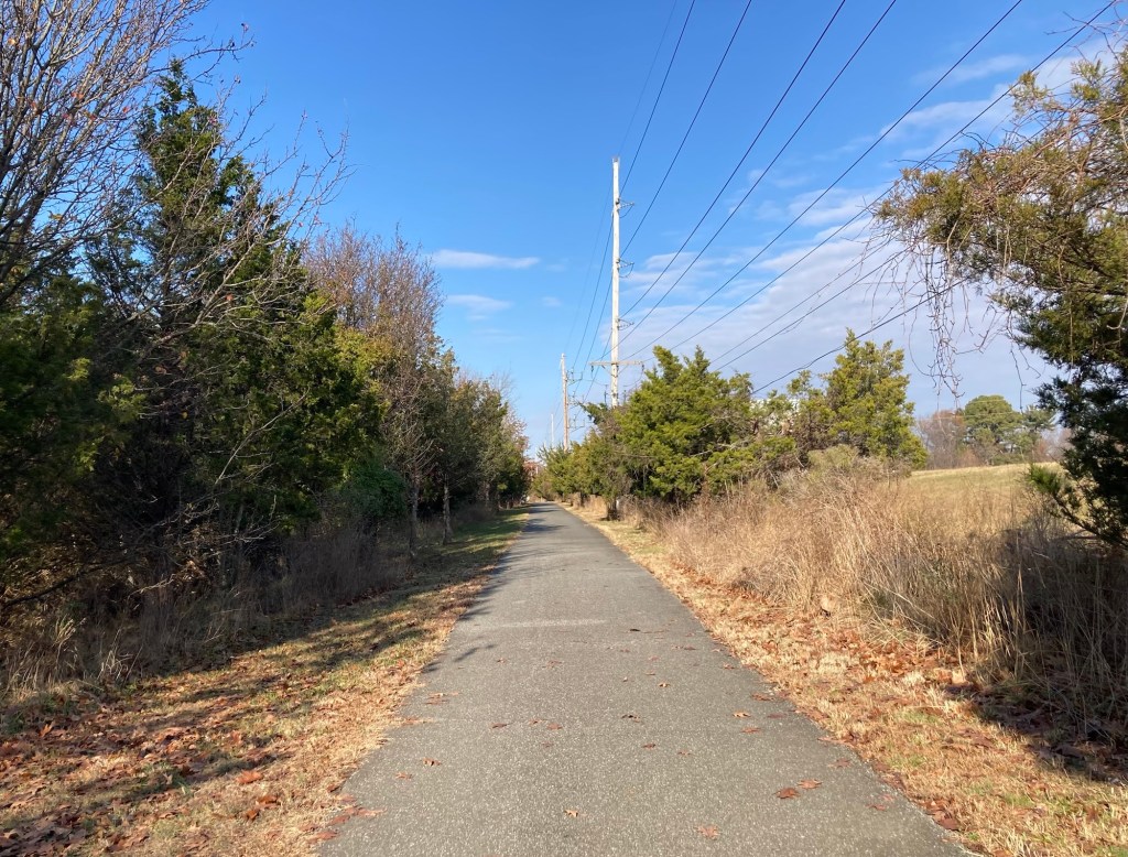
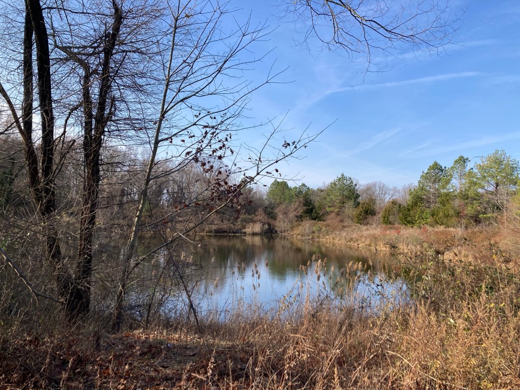
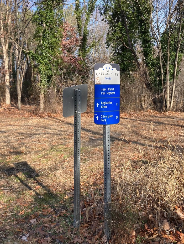
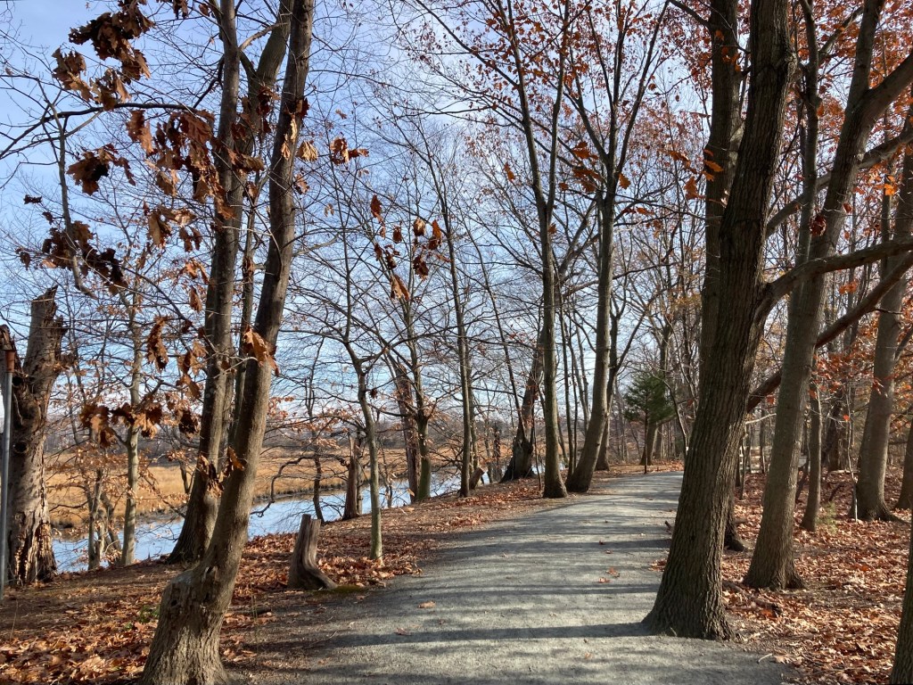
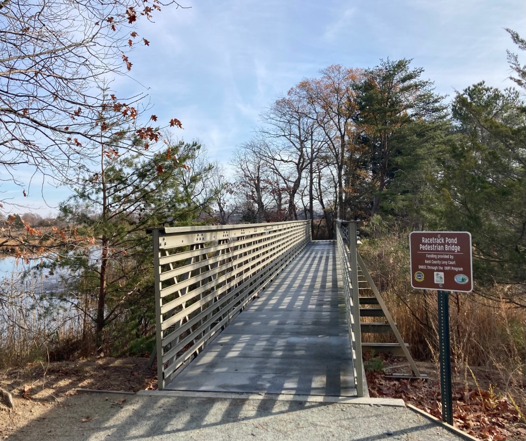
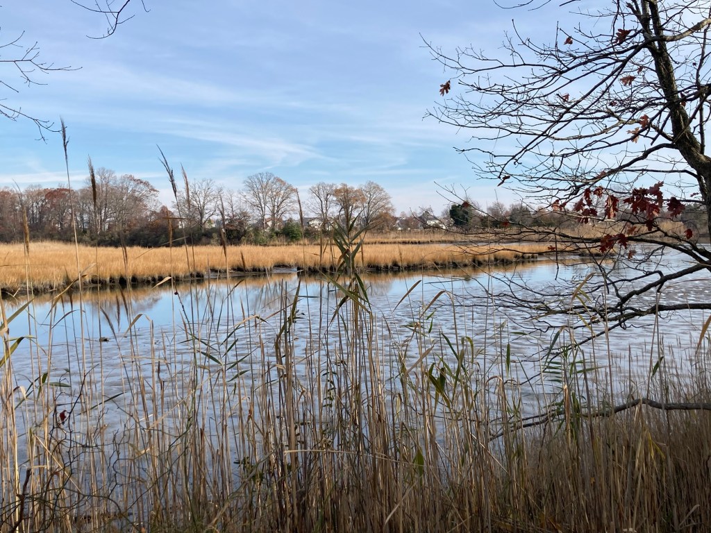
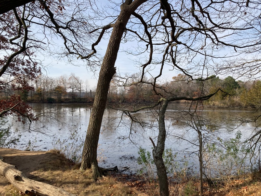
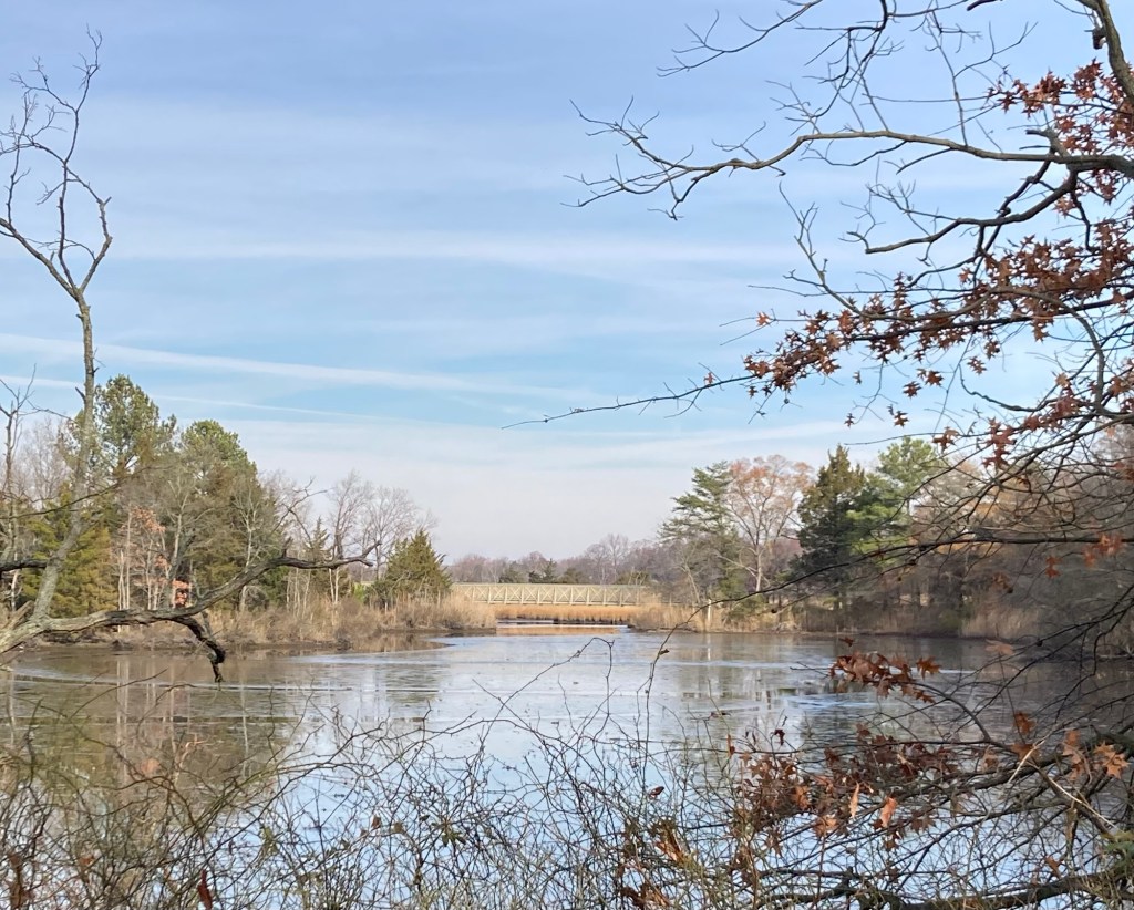
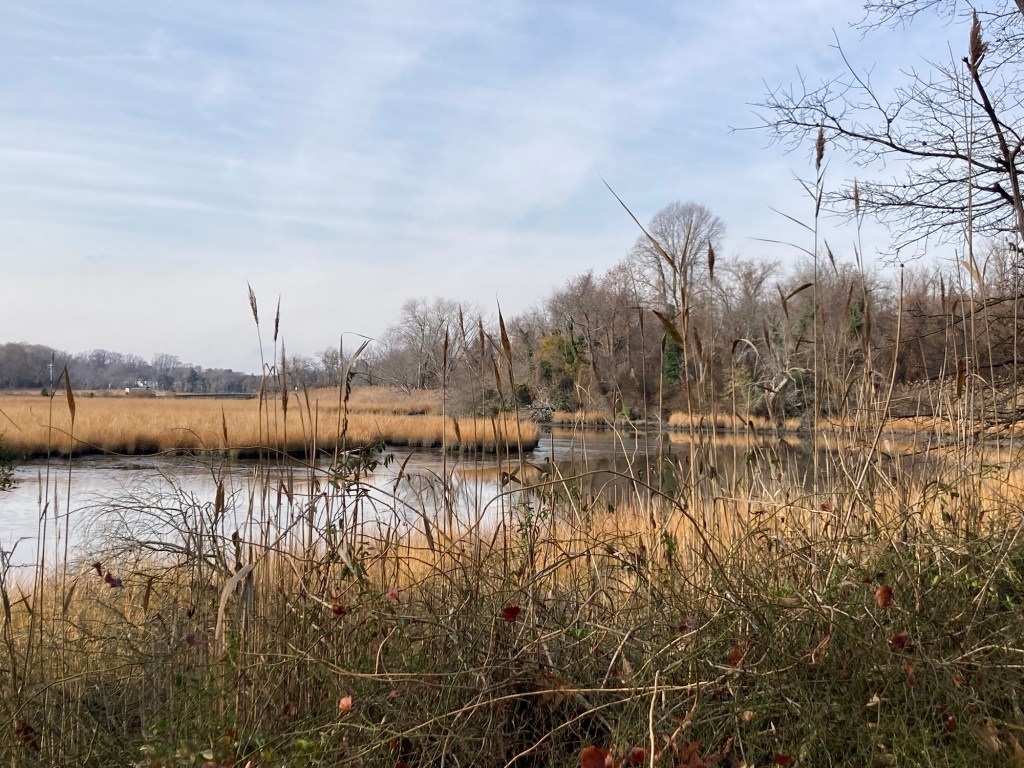
Just a quick blog today (photos mostly) from our near freezing walk along the Isaac Branch Trail segment of the St. Jones River. It is a well maintained asphalt pathway which runs alongside the St. Jones River, and is part of the Capital City Trails Network.
This portion of the trail is 2.6 miles long. We walked 2 miles before turning around. Had we known the total length ahead of time, we would have likely went until the end. The signs along the route show greater distances, so it must connect to other trails.
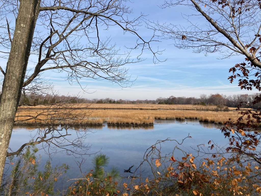
Here’s the pics. It was a lovely walk. We saw one other walker and one well bundled up cyclist. We continue to be surprised by how marshy this area is, but we are less than 10 miles from the coast.
Note about St. Jones. The internet tells me that a John Jones (1530-1598) was a Franciscan monk, born in Wales, and executed in England. He is one of the 40 martyrs of England and Wales, lay and religious Catholics men and women who were executed between 1535 and 1679 for offenses under various laws enacted by Parliament during the English Reformation.
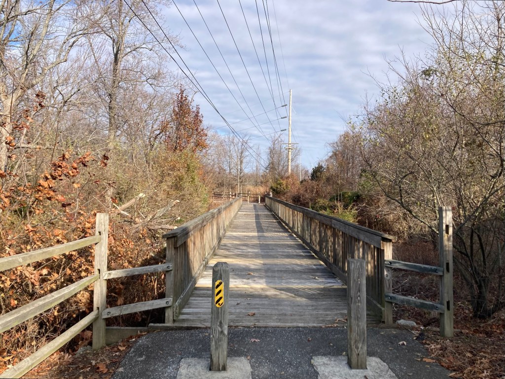
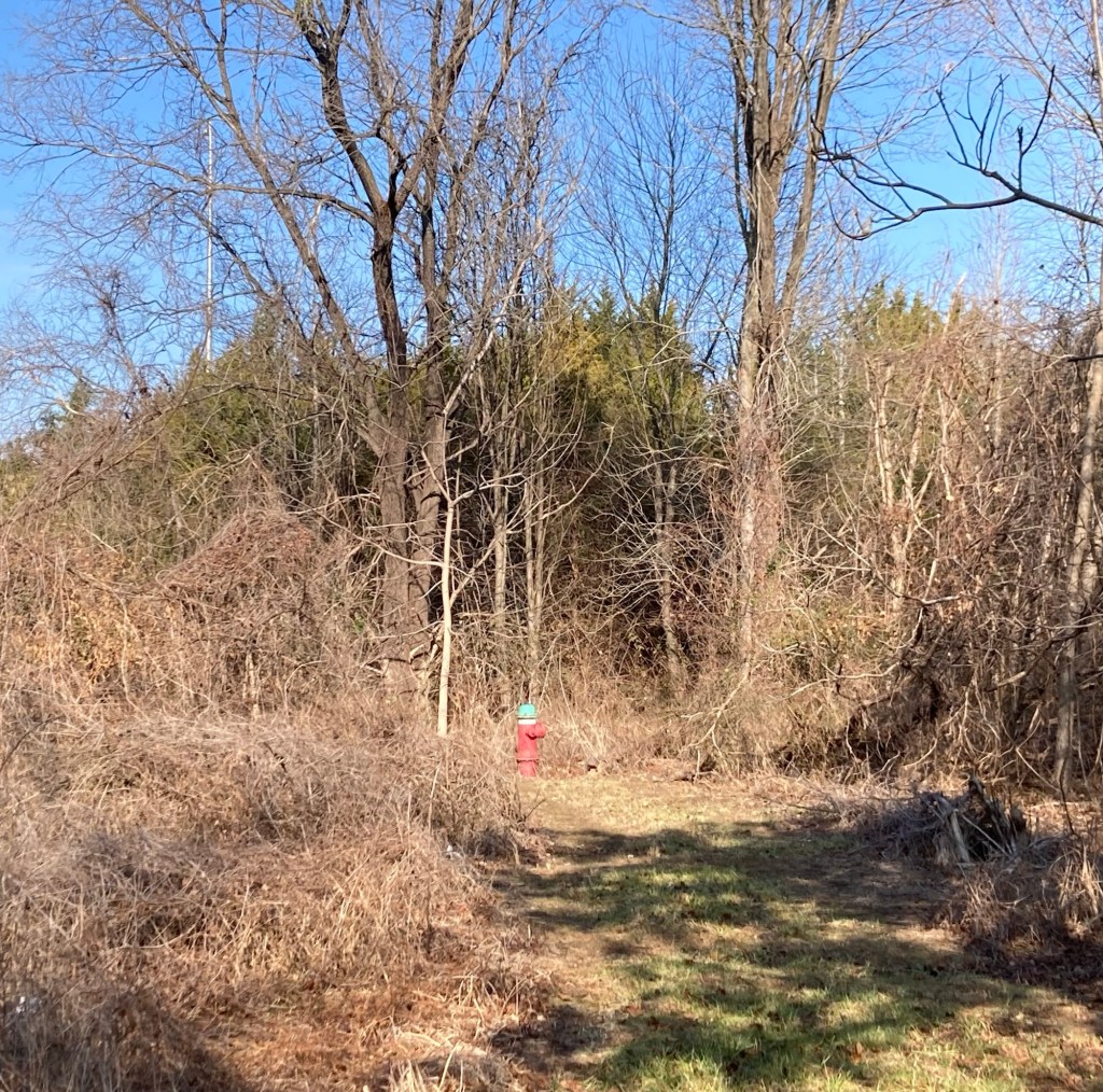
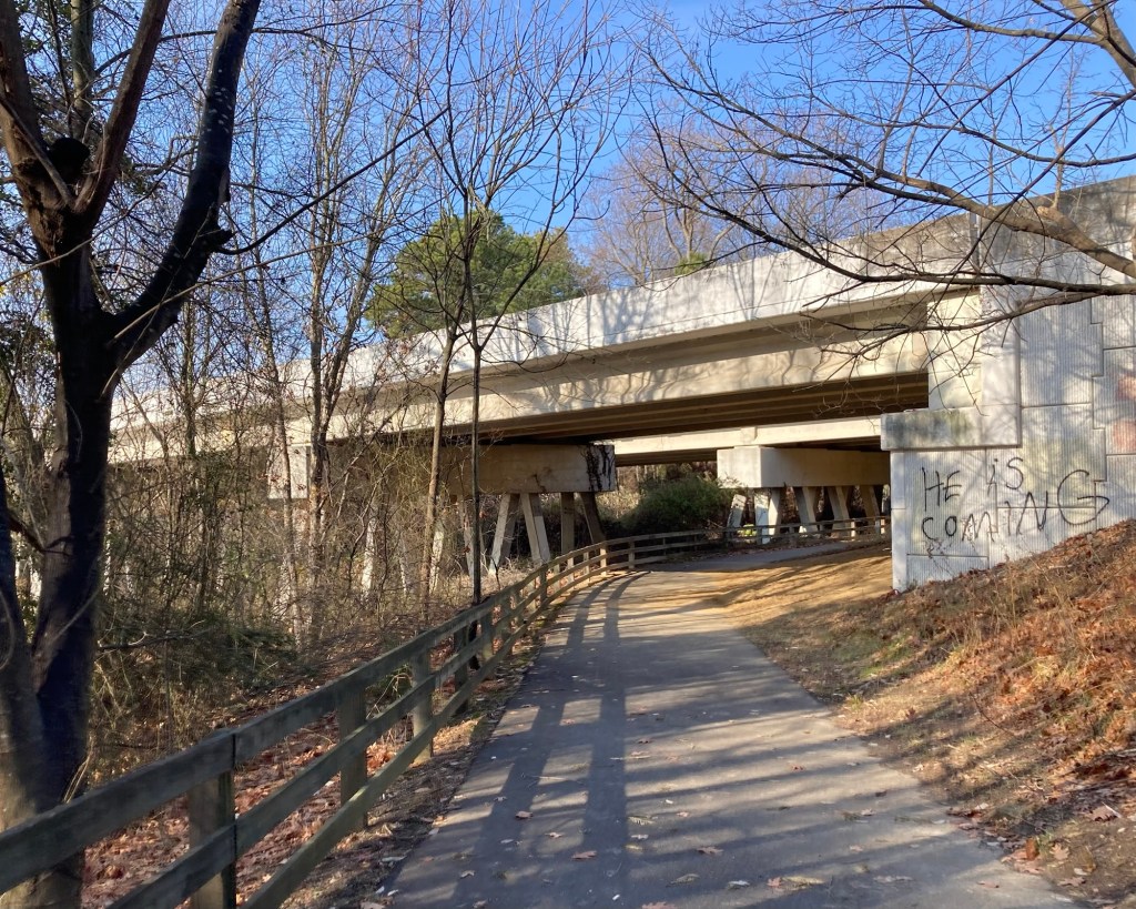
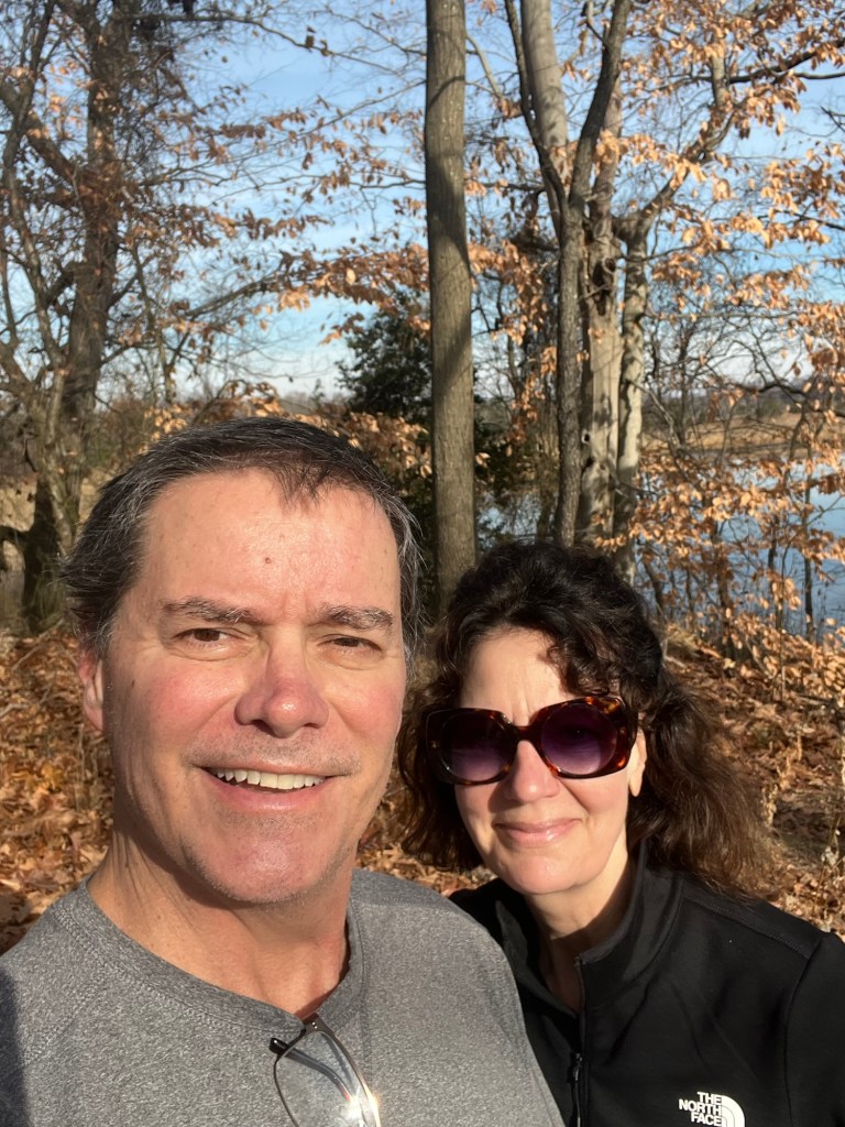
Crossing the St. Jones River on the way to the trailheadThe trailhead One view of the Isaac Branch of the RiverWe were there.A bridge (not) too farThere were distance markers every .1 mileAn unexpected place for a fire hydrantA heads up notice on the bridge. I hope he brings gifts.The last sign destination marker we passed before turning around
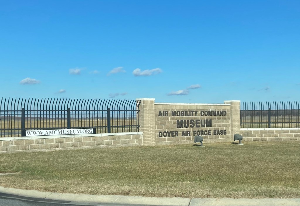
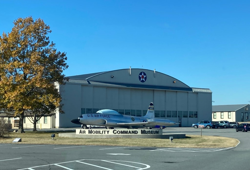
After a very rainy Wednesday, Bob and I headed to the Air Mobility Command Museum on a much cooler (high of 44 F but feels like temp 10 degrees cooler) but drier day. The museum is located South of Dover Air Force Base in and around an old WWII hangar. It’s free to the public, and is the only museum in the United States dedicated to the history of airlifts and air refueling. We learned a bit about that, but mostly, we ogled old and some current (in the sky) military planes.
Signage at road entrance Museum building
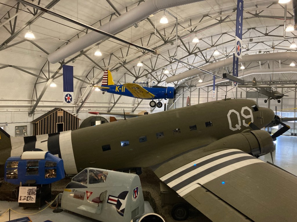
Upon entering, there is a small theater that continuously runs 4 different films — one about the Air Force and 3 about different types of planes. We saw all of 2 films about the C-5 (biggest plane at the museum) and the KC-10, which does mid-air refueling. Crazy to watch and cannot imagine trying to make that happen. We then explored the inside of the museum and an old control tower before heading out to see the planes and other outdoor exhibits.
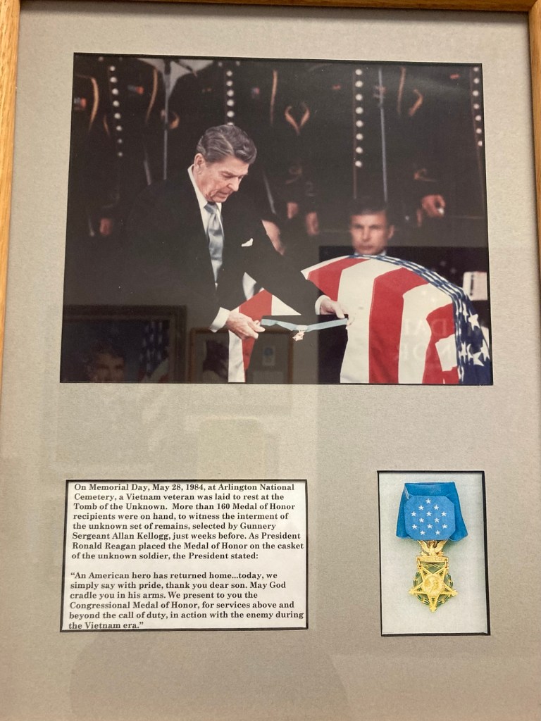
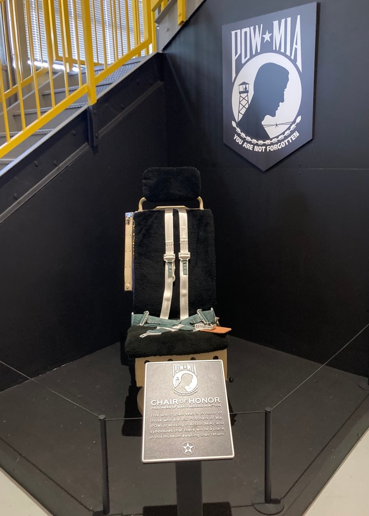
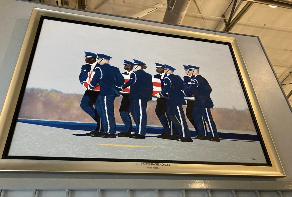
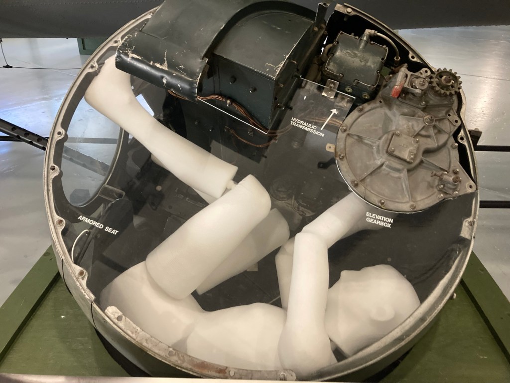
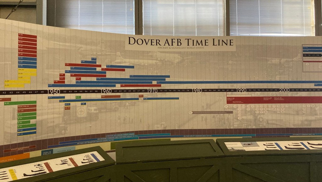
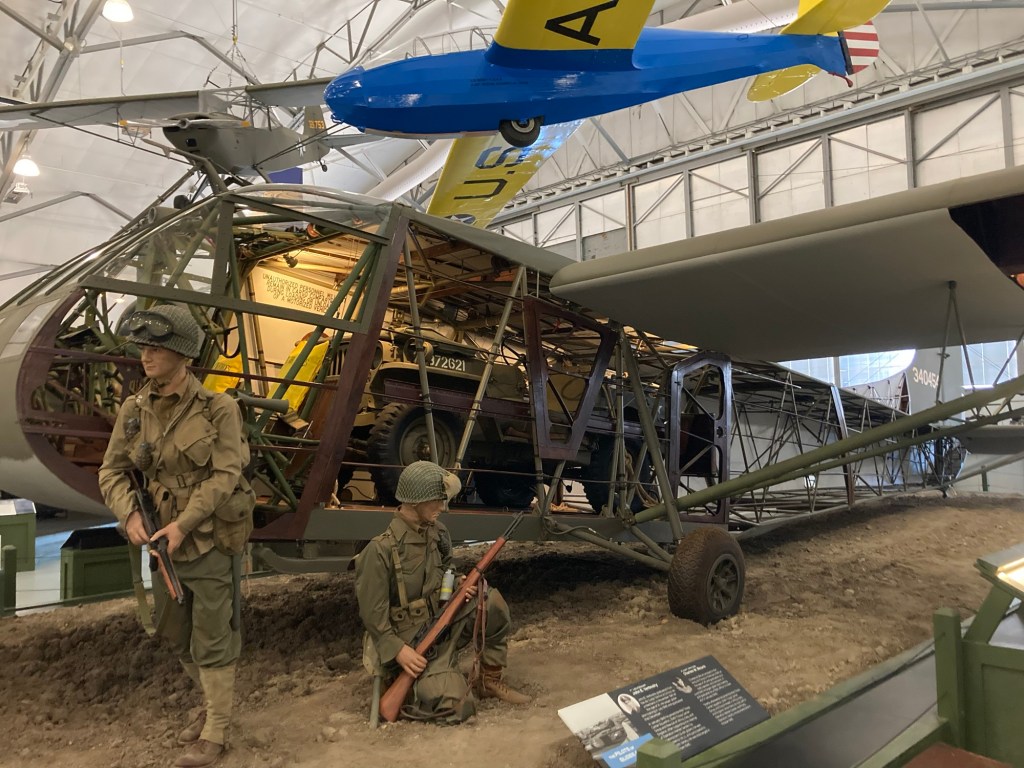
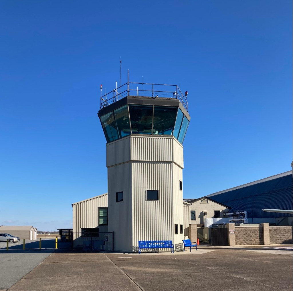
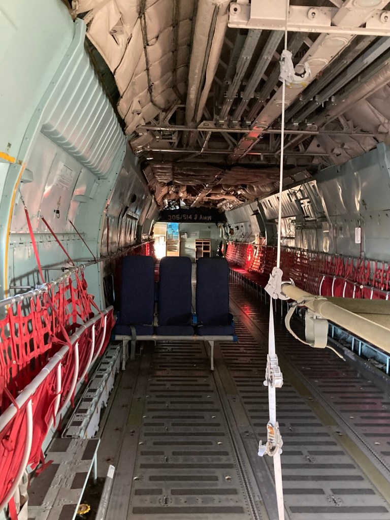
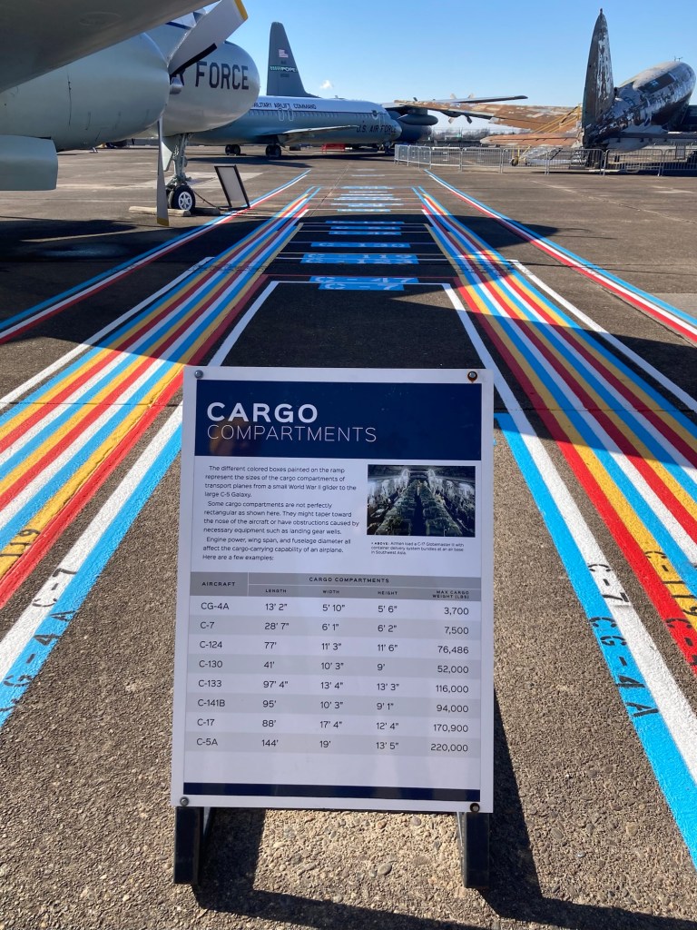
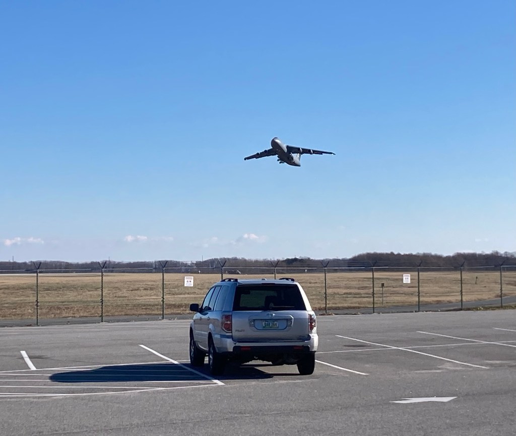
One of a number of photos from the Medal of Honor corridorOne view of some of the exhibits in the hangar portion of the museum A tribute to prisoners of war and those missing in actionSadly, this is how I am most familiar with Dover Air Force BaseA flying boom, developed by Boeing, as an improvement over the former hose method of midair refueling An exhibit of a ball gun turret. Dear God.A timeline to show the different types of aircraft that have flown out of Dover — fighter or pursuit (maroon), cargo (blue), attack aircraft (yellow), and bombers (green), since it was established in 1940.An inside look at the CG-4A Glider. As the name indicates, it had a quiet engine to help with the safe delivery of men, equipment, vehicles, etc to the front lines during WWII.The control tower used at Dover AFB from 1956 – 2009. We were able to go up for a better view of the planes and yard as well as to watch some C-5s and C-17s doing touch and go maneuvers.A 9/11 Memorial on the grounds. It is a pentagon shaped low wall with artifacts from all 3 locations struck on 9/11 (the steel beams, limestone block, and rock)The KC-10 refuelerThe massive C-5 and Bob. The C-5 has a maximum cargo capacity of 220,000 pounds, so Bob could bring a bunch of his friends.The C-141B Starlifter. We were able to go in this one.The cargo hold. It has a maximum capacity of 94,000 pounds. Bob would have to cut his guest list.The capacity comparisons. Also, the width and length differences are illustrated by the different colors on the ground.Watching a C-5 come in but not land
Bob and I had to get out and enjoy the unusually warm December weather today (high of 59 F!), so we headed out to a local park for a hike through the woods.
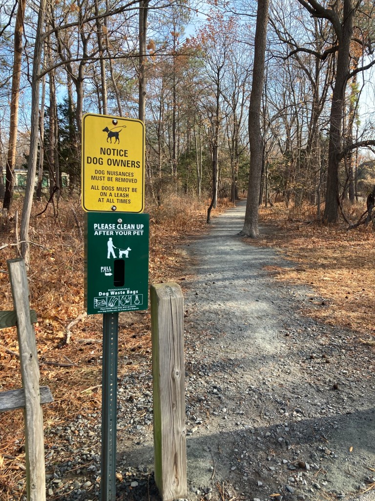
While we found the park online, it was not marked when we got to the site, so we think this is where we hiked but we’re not sure. If it was Hunn (and we think it was), it has 173 acres and contains a couple of tidal basins. There was also no trail signage except for the one below. Still, a pretty walk on a lovely day.
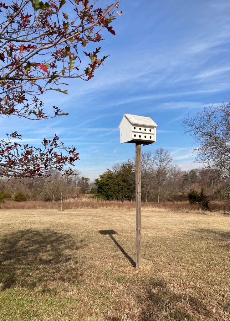
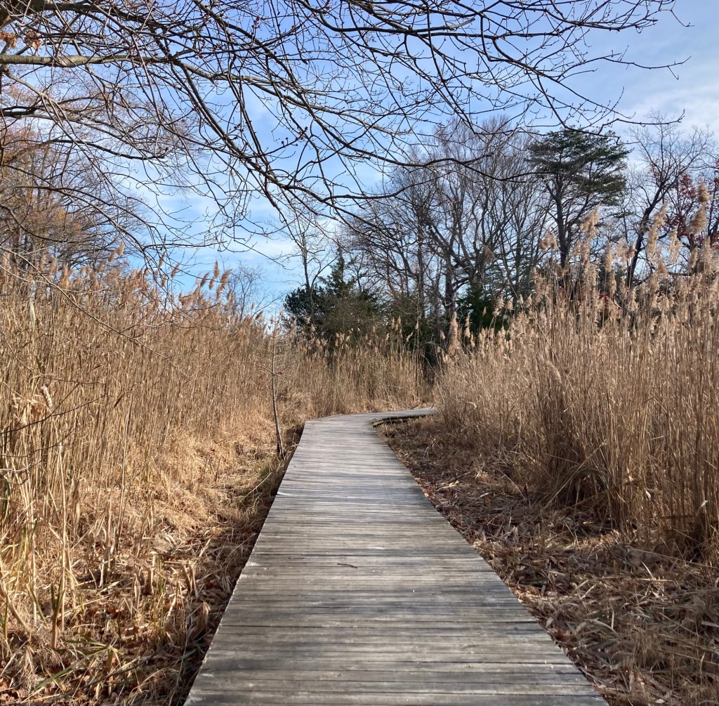
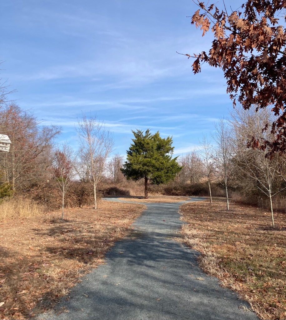
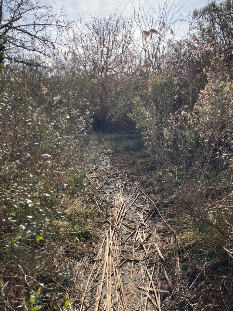
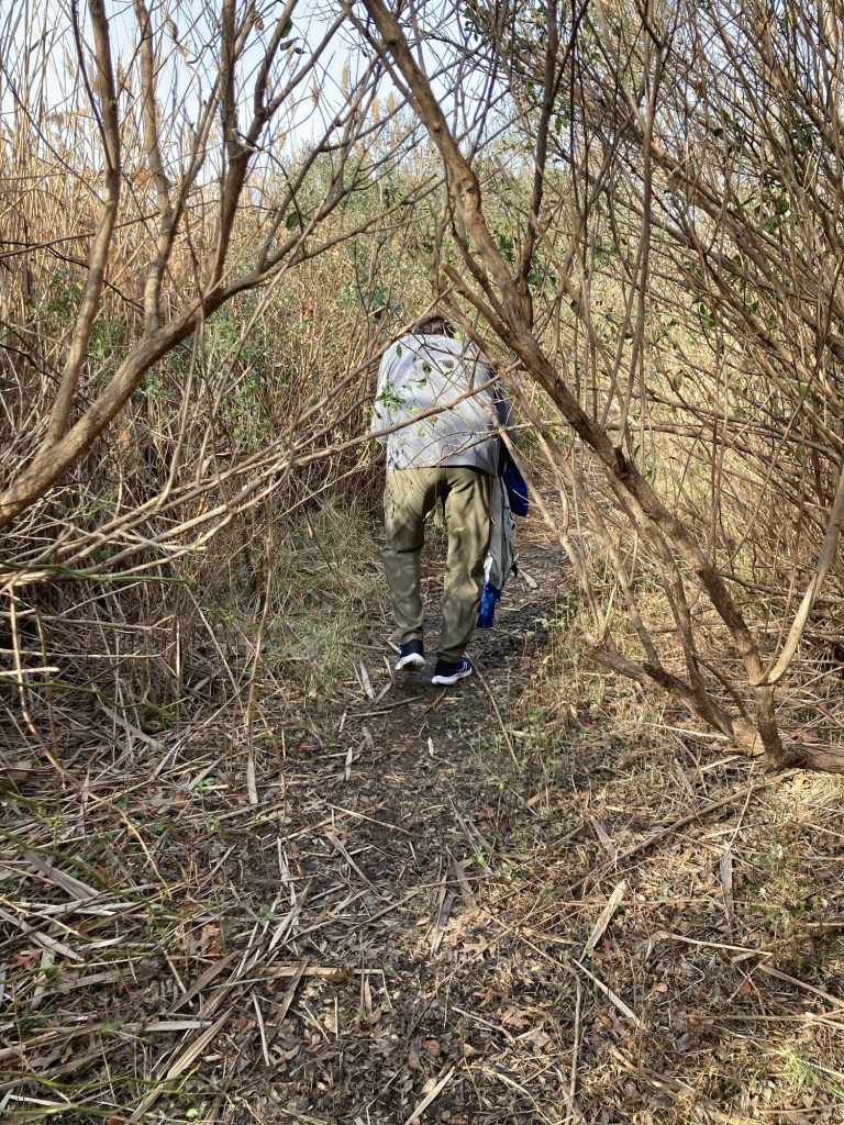
1st time we’d seen the term “dog nuisances”This path just went around the green tree with its leaves.Although, we did see this as well, but weren’t sure we were looking at a camera, bird house/feeder, or something else.Another path went into brush that we followed for awhileUntil we decided we’d rather walk standing upLoving the weather!
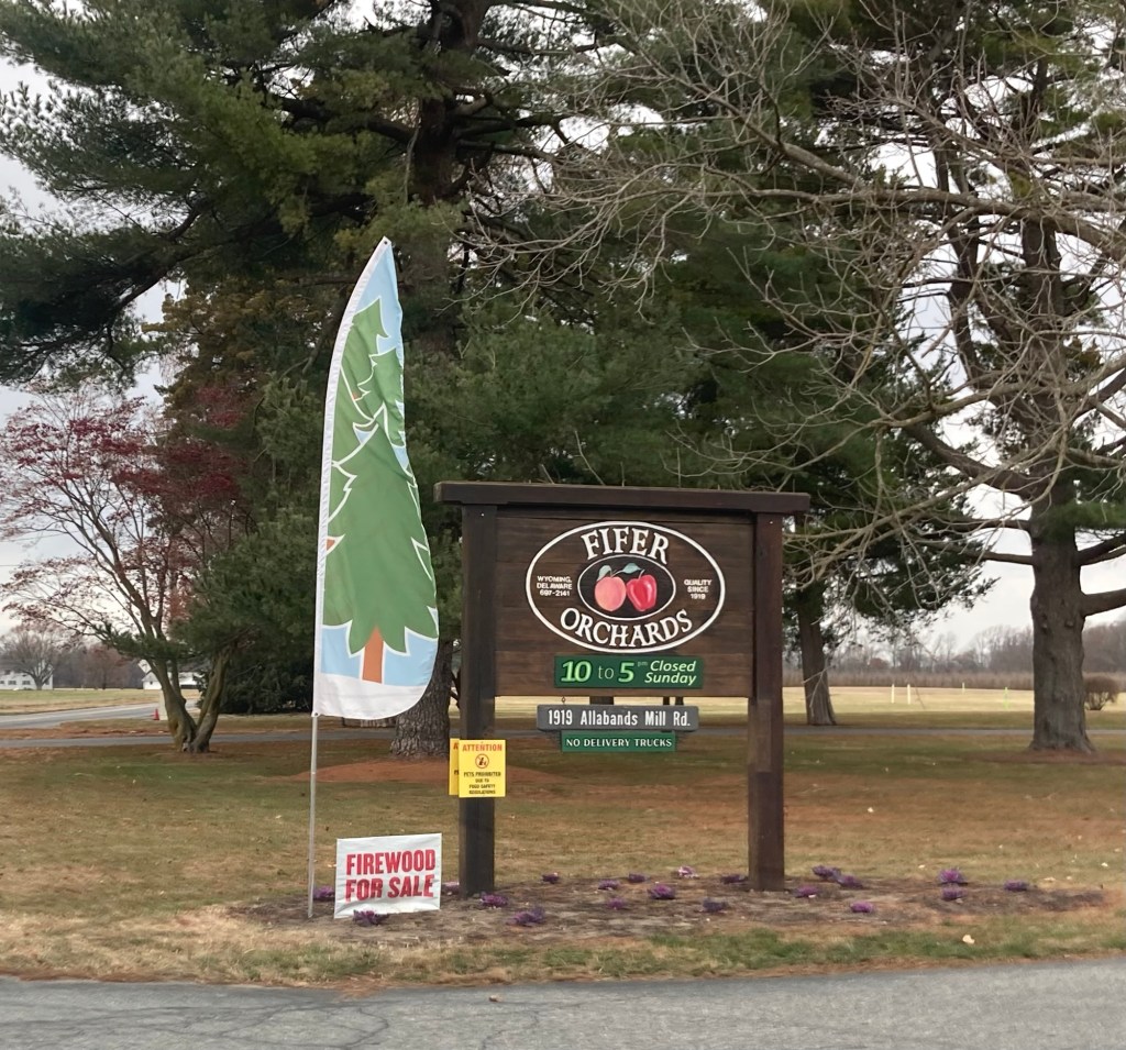
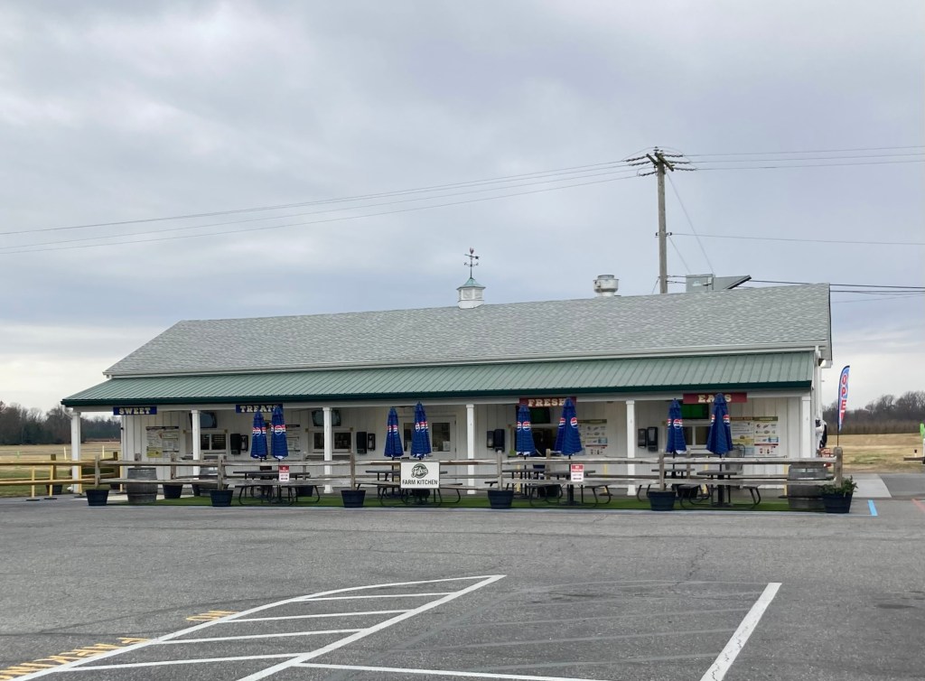
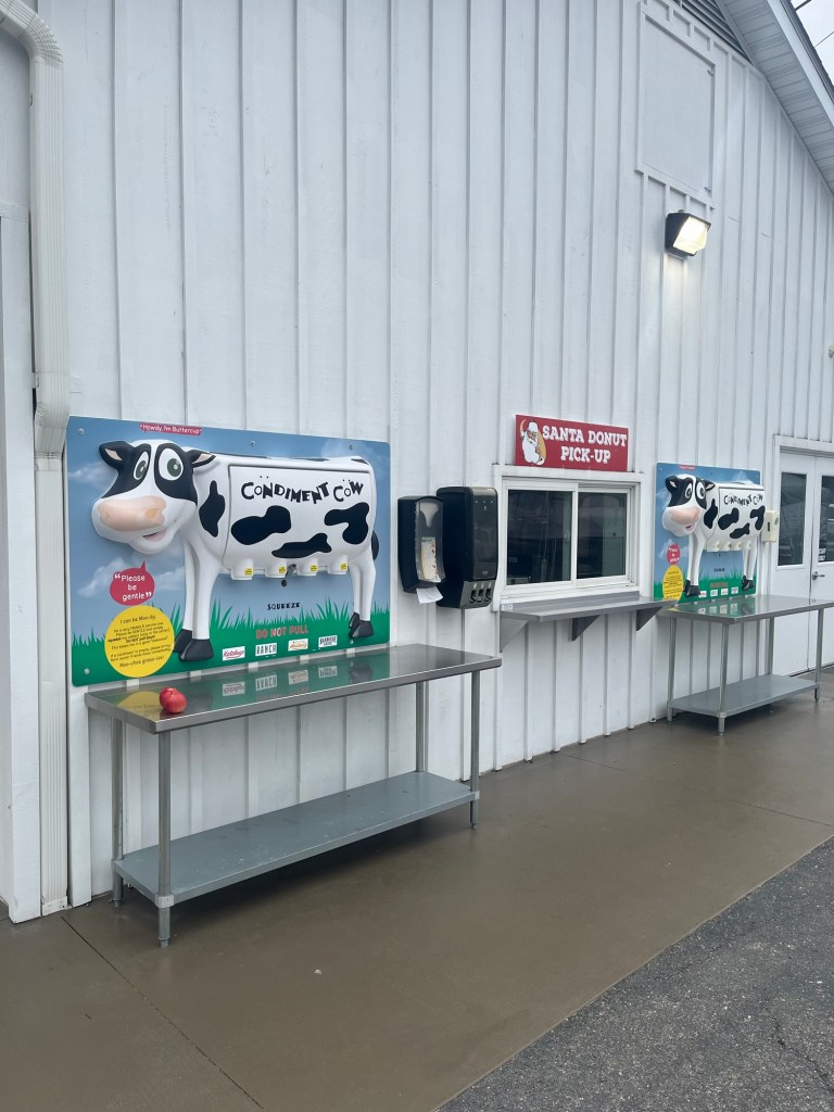
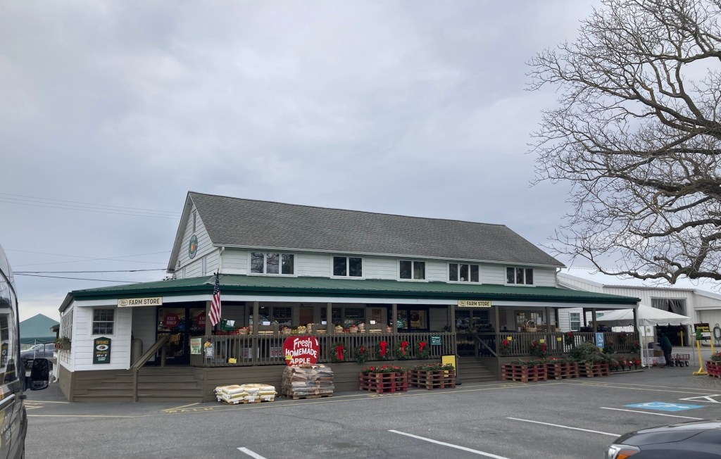
Bob and I headed out today to see some of the local sites. First, we headed to Fifer Orchards to peruse their farm market. Fifer Orchards is located in the nearby community of Wyoming, Delaware, about a 15 minute drive from the house. It has a population of about 1,700 and was named after the Wyoming Valley in Pennsylvania.
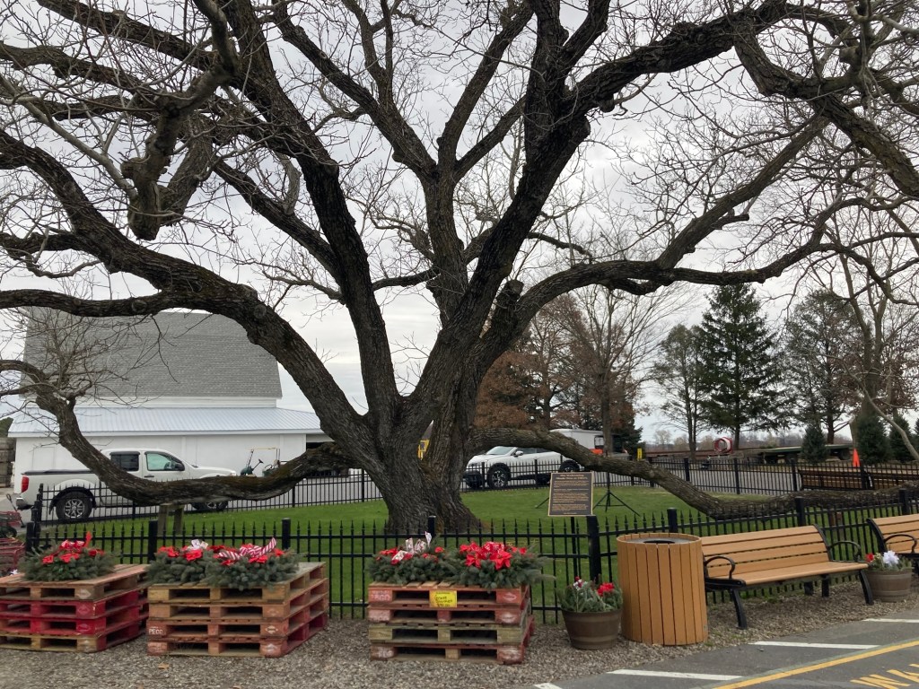
Signage at the road entrance The kitchen, which sells food (burgers,etc) and ice cream, with a separate line for each.A donut pickup window and cute condiment dispensers on the side of the kitchenThe farm store, which sells the farm produce, homemade baked goods, and locally made food products An English Walnut Tree, planted in the 1930s, by the Fifers. On 2/21/19, it measured 56’ in height, a trunk width of 167”, and a crown spread of 99’. It will be listed in the state’s 5th edition of “Big Trees of Delaware” as the second largest English Walnut in the state.
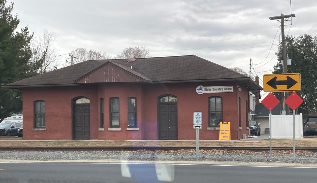
On the way back from the orchard, we stopped at a couple of other places in Wyoming as well. First, was the Rider Country Store in an old rail depot building.
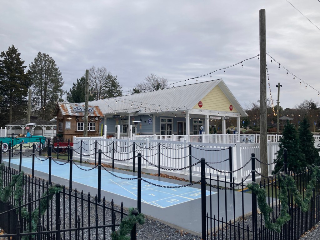
The Rider Country Store sold gear for the local high school team, The Riders, so we had a short visit.Across the street, they had set up a holiday park for ice skating on designated nights.
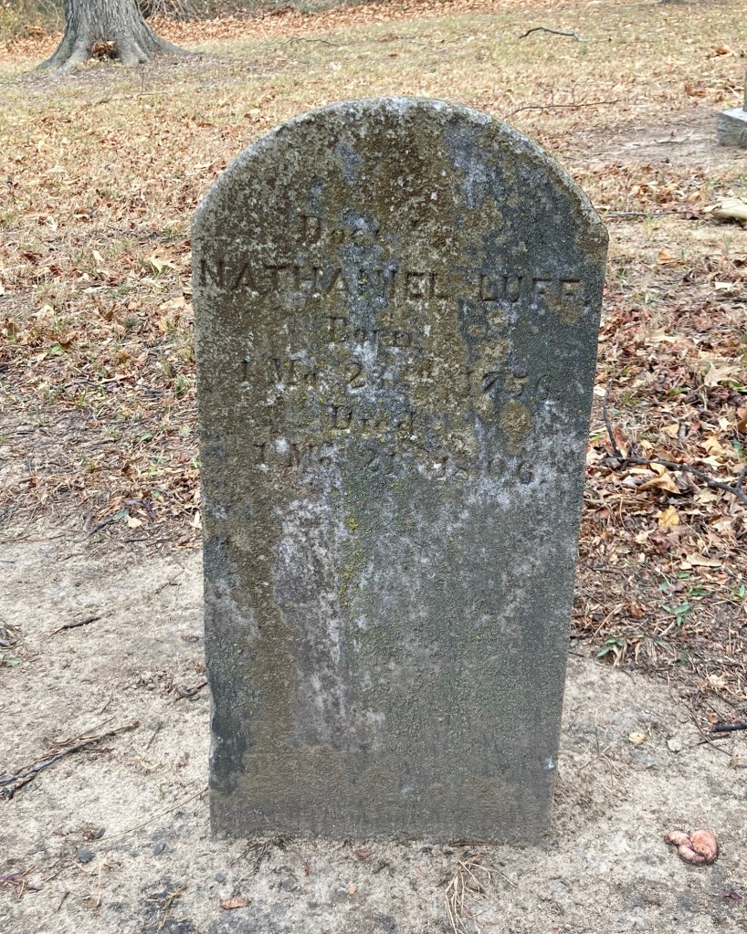
Finally, we wanted to get some photos of a couple of historical landmarks in Magnolia that we had read about.
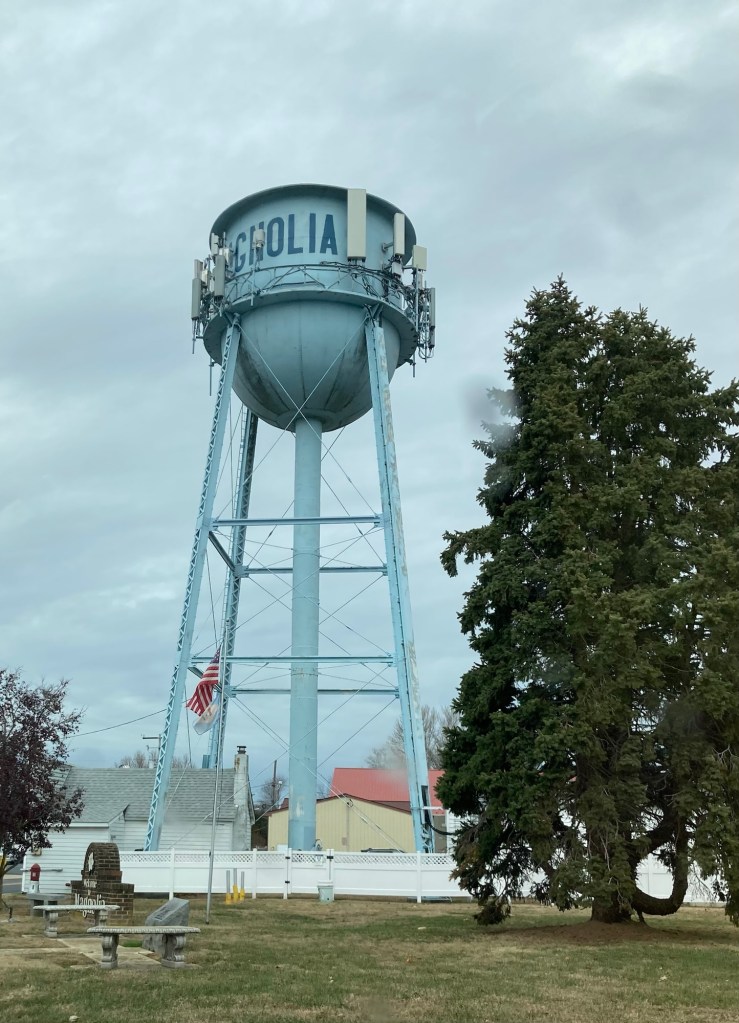
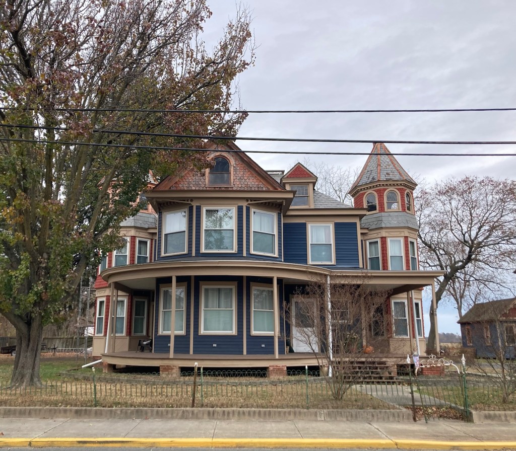
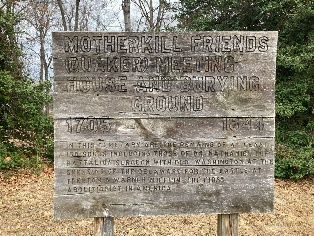
Not one of the historical markers, just thought I’d photo the water tower today since it said Magnolia.The former home of John B. Lindale, one of the last great peach “barons” and an example of high Victorian architecture. It is currently privately owned.A lovely roadside entrance to an old cemetery. The markers tell the history of Warner Mifflin (1745-1798), an abolitionist, and the importance of this site as the location of a Quaker meeting house.Walking up the stairs, you see this marker that also talks about it being a cemetery for Quakers as well.There are only a few of the 150 headstones left.This one is for Dr. Nathaniel Luff (died 1806), battalion surgeon with George Washington at the crossing of the Delaware for the battle of Trenton.